STS081-742-25
| NASA Photo ID | STS081-742-25 |
| Focal Length | 250mm |
| Date taken | 1997.01.20 |
| Time taken | 16:25:45 GMT |
Resolutions offered for this image:
4006 x 4006 pixels 639 x 639 pixels 5700 x 5900 pixels 483 x 500 pixels 433 x 502 pixels
4006 x 4006 pixels 639 x 639 pixels 5700 x 5900 pixels 483 x 500 pixels 433 x 502 pixels

Cloud masks available for this image:
Spacecraft nadir point: 9.5° N, 86.5° W
Photo center point: 11.0° N, 86.0° W
Photo center point by machine learning:
Photo center point: 11.0° N, 86.0° W
Photo center point by machine learning:
Nadir to Photo Center: North
Spacecraft Altitude: 193 nautical miles (357km)
Country or Geographic Name: | NICARAGUA |
Features: | LAKE NICARAGUA |
| Features Found Using Machine Learning: | |
Cloud Cover Percentage: | 5 (1-10)% |
Sun Elevation Angle: | 53° |
Sun Azimuth: | 143° |
Camera: | Hasselblad |
Focal Length: | 250mm |
Camera Tilt: | 26 degrees |
Format: | 2443: Kodak Aerochrome 2443, color IR, thin base, EA-5 process thru June 1999, E-6 process afterward |
Film Exposure: | Normal |
| Additional Information | |
| Width | Height | Annotated | Cropped | Purpose | Links |
|---|---|---|---|---|---|
| 4006 pixels | 4006 pixels | No | No | Earth From Space collection | Download Image |
| 639 pixels | 639 pixels | No | No | Earth From Space collection | Download Image |
| 5700 pixels | 5900 pixels | No | No | Download Image | |
| 483 pixels | 500 pixels | No | No | Download Image | |
| 433 pixels | 502 pixels | No | No | Download Image |
Download Packaged File
Download a Google Earth KML for this Image
View photo footprint information
Download a GeoTIFF for this photo
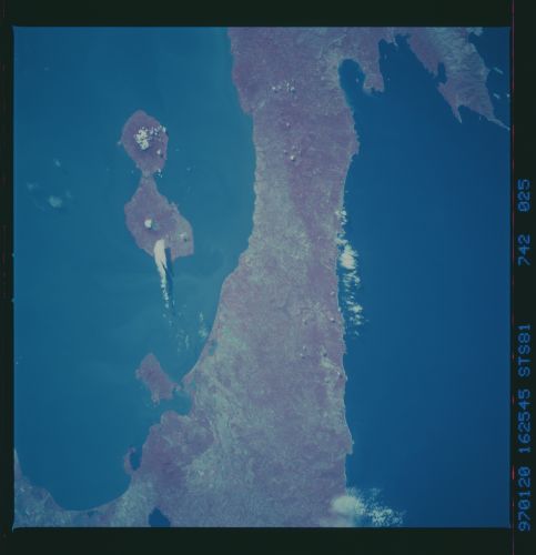
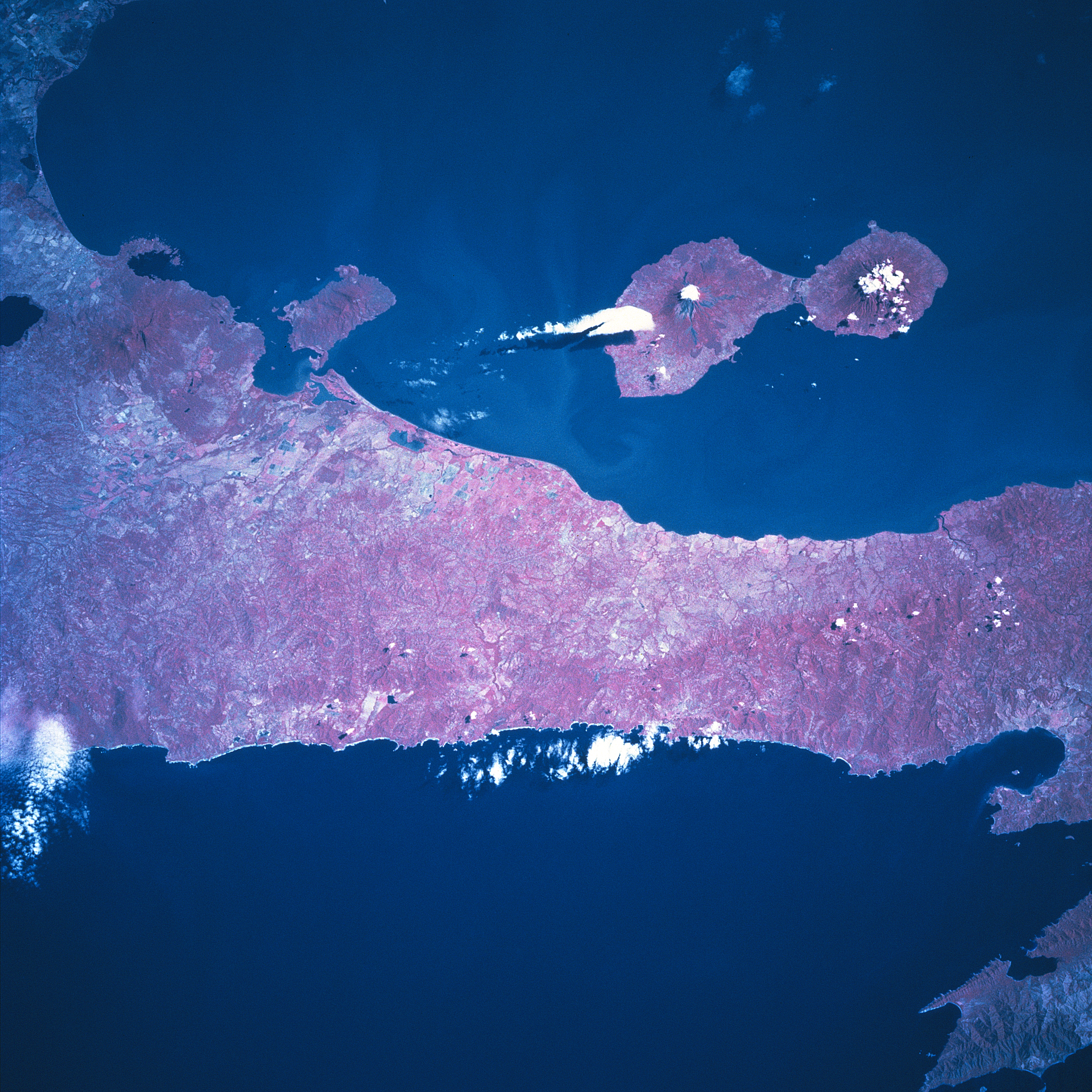
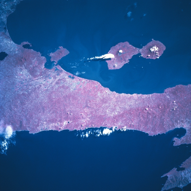
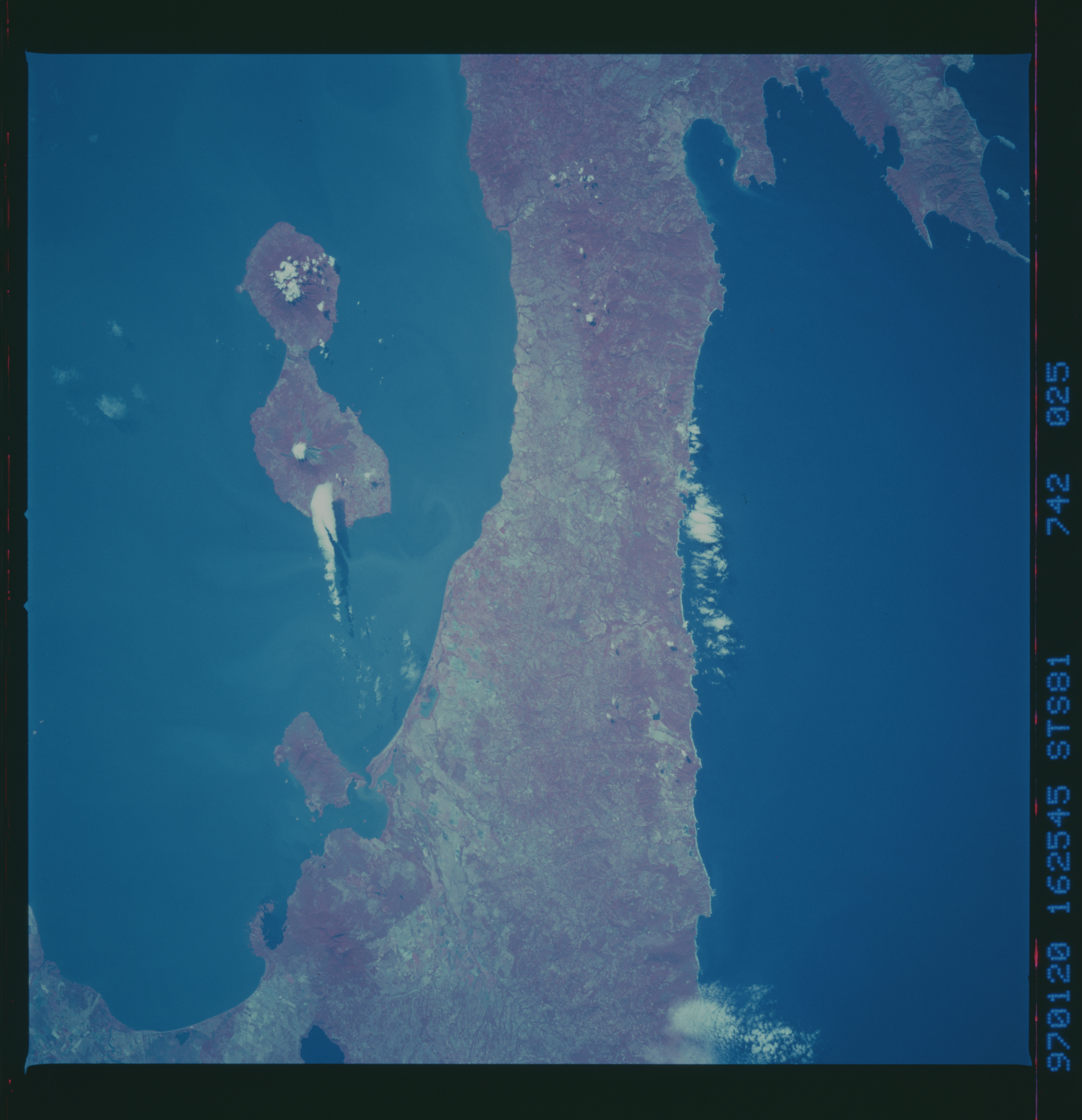
Image Caption: STS081-742-025 Ometepe Island, Nicaragua January 1997
Ometepe Island, formed by two volcanoes, is located along the west side of Lake Nicaragua. Conception Volcano, an active volcano, makes up the larger, northwest part of the island, while Maderas Volcano on the southeast side of the island is dormant. Their respective summit elevations are 5283 feet (1610 meters) and 4413 feet (1345 meters) above sea level. Several small towns are distributed around the island. The major economic activities include tourism, farming, and ranching, with tourism the major attraction. The color infrared image (records healthy green vegetation as various shades of red) helps to identify the distribution of the natural vegetation and also helps to delimit land-water boundaries. Most of the remaining tropical rainforest (darker reds) are found on the Maderas side of the island. The strip of land that separates Lake Nicaragua from the Pacific Ocean is about 12 miles (19 km) in width. The narrow corridor of land shows some agricultural activity (lighter colored areas) and a forested landscape (darker reds).
Ometepe Island, formed by two volcanoes, is located along the west side of Lake Nicaragua. Conception Volcano, an active volcano, makes up the larger, northwest part of the island, while Maderas Volcano on the southeast side of the island is dormant. Their respective summit elevations are 5283 feet (1610 meters) and 4413 feet (1345 meters) above sea level. Several small towns are distributed around the island. The major economic activities include tourism, farming, and ranching, with tourism the major attraction. The color infrared image (records healthy green vegetation as various shades of red) helps to identify the distribution of the natural vegetation and also helps to delimit land-water boundaries. Most of the remaining tropical rainforest (darker reds) are found on the Maderas side of the island. The strip of land that separates Lake Nicaragua from the Pacific Ocean is about 12 miles (19 km) in width. The narrow corridor of land shows some agricultural activity (lighter colored areas) and a forested landscape (darker reds).
