STS081-742-23
| NASA Photo ID | STS081-742-23 |
| Focal Length | 250mm |
| Date taken | 1997.01.20 |
| Time taken | 16:25:40 GMT |
Resolutions offered for this image:
4096 x 4096 pixels 640 x 640 pixels 5700 x 5900 pixels 483 x 500 pixels 518 x 509 pixels
4096 x 4096 pixels 640 x 640 pixels 5700 x 5900 pixels 483 x 500 pixels 518 x 509 pixels

Cloud masks available for this image:
Spacecraft nadir point: 9.7° N, 86.7° W
Photo center point: 12.0° N, 86.0° W
Photo center point by machine learning:
Photo center point: 12.0° N, 86.0° W
Photo center point by machine learning:
Nadir to Photo Center: North
Spacecraft Altitude: 193 nautical miles (357km)
Country or Geographic Name: | NICARAGUA |
Features: | LAKE MANAGUA |
| Features Found Using Machine Learning: | |
Cloud Cover Percentage: | 5 (1-10)% |
Sun Elevation Angle: | 53° |
Sun Azimuth: | 143° |
Camera: | Hasselblad |
Focal Length: | 250mm |
Camera Tilt: | 37 degrees |
Format: | 2443: Kodak Aerochrome 2443, color IR, thin base, EA-5 process thru June 1999, E-6 process afterward |
Film Exposure: | Normal |
| Additional Information | |
| Width | Height | Annotated | Cropped | Purpose | Links |
|---|---|---|---|---|---|
| 4096 pixels | 4096 pixels | No | No | Earth From Space collection | Download Image |
| 640 pixels | 640 pixels | No | No | Earth From Space collection | Download Image |
| 5700 pixels | 5900 pixels | No | No | Download Image | |
| 483 pixels | 500 pixels | No | No | Download Image | |
| 518 pixels | 509 pixels | No | No | Download Image |
Download Packaged File
Download a Google Earth KML for this Image
View photo footprint information
Download a GeoTIFF for this photo
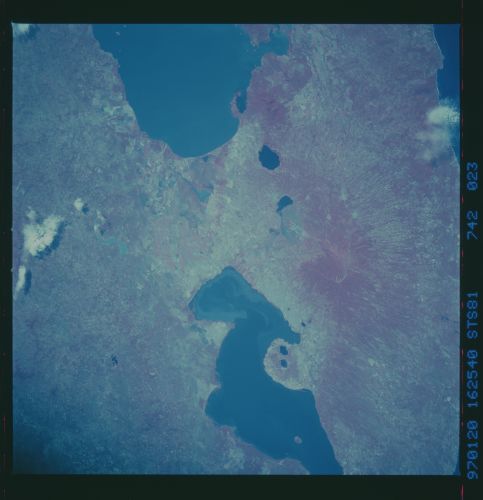
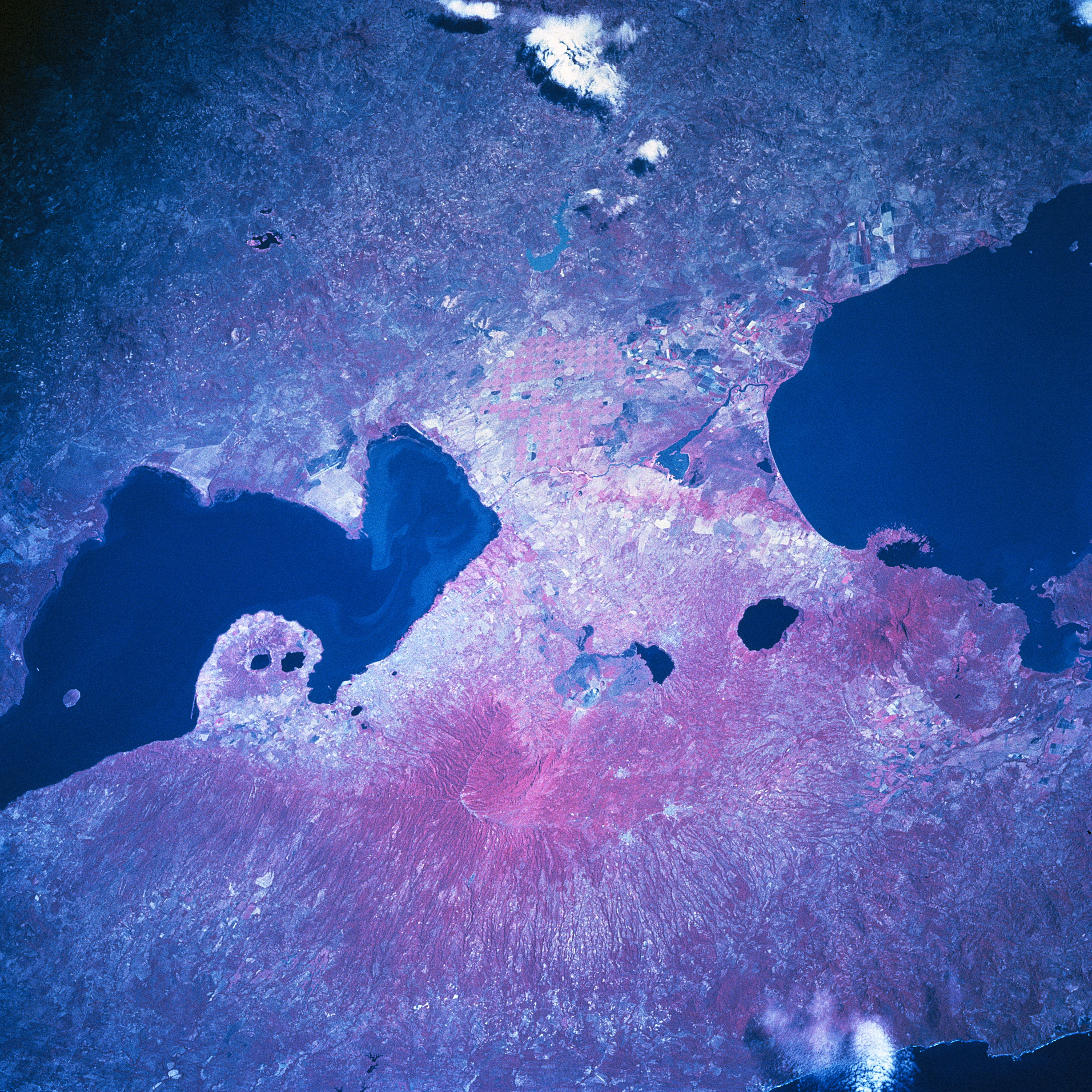
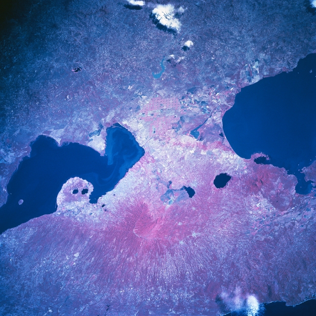
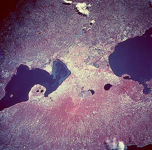
Image Caption: STS081-742-23 Lake Managua, Nicaragua January 1997
The dark-looking water of Lake Managua (left middle) and the northwest end of Lake Nicaragua (right middle) stand out in marked contrast with the volcanic landscape of western Nicaragua in this color infrared image. Most of the land between the two lakes is used for agriculture (note the cultivated field patterns). There is a light colored sediment plume in the water along the east shore of Lake Managua. The smaller dark features that are aligned northwest to southeast display the location of four craters/calderas that have been filled with water. These water-filled structures help to identify the active volcanic belt that borders and parallels the west coast of Central America. The capital of Nicaragua, Managua, is the highly reflective (lighter in color) area south of Lake Managua. Masaya Volcano, a composite twin volcano with multiple summit craters and a caldera lake along the east side of the volcano, is discernible southeast of the city of Managua (slightly below the center of the image). Notice how the color infrared picture (green vegetation is portrayed as reddish colors) helps to document the deeply eroded western flanks of the low mountains in the lower third of the picture.
The dark-looking water of Lake Managua (left middle) and the northwest end of Lake Nicaragua (right middle) stand out in marked contrast with the volcanic landscape of western Nicaragua in this color infrared image. Most of the land between the two lakes is used for agriculture (note the cultivated field patterns). There is a light colored sediment plume in the water along the east shore of Lake Managua. The smaller dark features that are aligned northwest to southeast display the location of four craters/calderas that have been filled with water. These water-filled structures help to identify the active volcanic belt that borders and parallels the west coast of Central America. The capital of Nicaragua, Managua, is the highly reflective (lighter in color) area south of Lake Managua. Masaya Volcano, a composite twin volcano with multiple summit craters and a caldera lake along the east side of the volcano, is discernible southeast of the city of Managua (slightly below the center of the image). Notice how the color infrared picture (green vegetation is portrayed as reddish colors) helps to document the deeply eroded western flanks of the low mountains in the lower third of the picture.
