STS081-728-57
| NASA Photo ID | STS081-728-57 |
| Focal Length | 250mm |
| Date taken | 1997.01.20 |
| Time taken | 16:24:41 GMT |
Resolutions offered for this image:
4066 x 4066 pixels 640 x 640 pixels 5700 x 5900 pixels 483 x 500 pixels 960 x 942 pixels 517 x 509 pixels
4066 x 4066 pixels 640 x 640 pixels 5700 x 5900 pixels 483 x 500 pixels 960 x 942 pixels 517 x 509 pixels

Cloud masks available for this image:
Spacecraft nadir point: 12.7° N, 88.9° W
Photo center point: 14.0° N, 89.0° W
Photo center point by machine learning:
Photo center point: 14.0° N, 89.0° W
Photo center point by machine learning:
Nadir to Photo Center: North
Spacecraft Altitude: 192 nautical miles (356km)
Country or Geographic Name: | EL SALVADOR |
Features: | SAN SALVADOR, VOLCANO |
| Features Found Using Machine Learning: | |
Cloud Cover Percentage: | 0 (no clouds present) |
Sun Elevation Angle: | 49° |
Sun Azimuth: | 142° |
Camera: | Hasselblad |
Focal Length: | 250mm |
Camera Tilt: | 22 degrees |
Format: | 5046: Kodak, natural color positive, Lumiere 100/5046, ASA 100, standard base |
Film Exposure: | Normal |
| Additional Information | |
| Width | Height | Annotated | Cropped | Purpose | Links |
|---|---|---|---|---|---|
| 4066 pixels | 4066 pixels | No | No | Earth From Space collection | Download Image |
| 640 pixels | 640 pixels | No | No | Earth From Space collection | Download Image |
| 5700 pixels | 5900 pixels | No | No | Download Image | |
| 483 pixels | 500 pixels | No | No | Download Image | |
| 960 pixels | 942 pixels | Yes | No | Download Image | |
| 517 pixels | 509 pixels | No | No | Download Image |
Download Packaged File
Download a Google Earth KML for this Image
View photo footprint information
Download a GeoTIFF for this photo
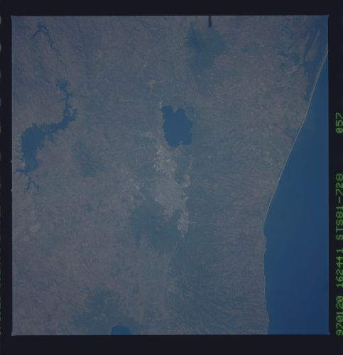
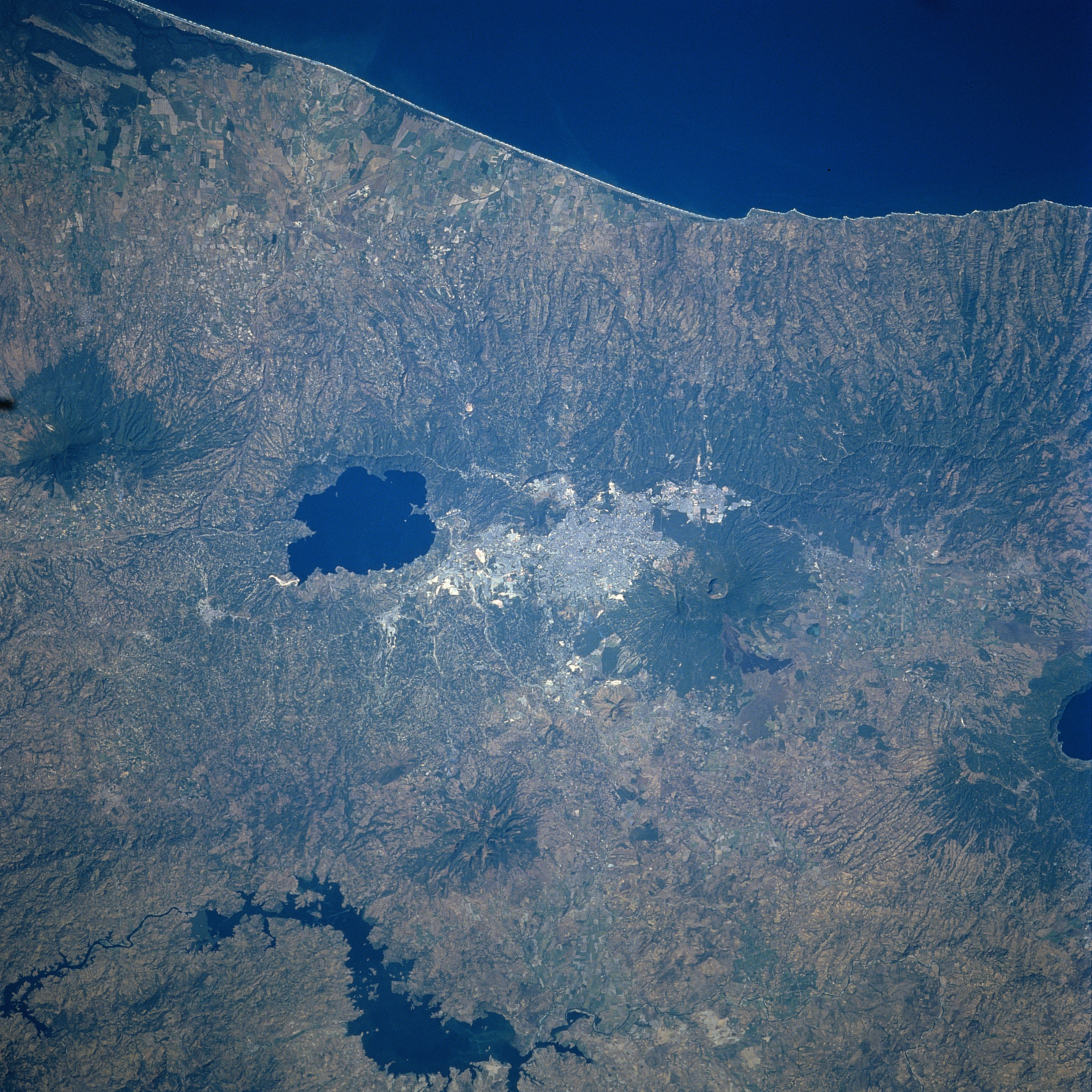
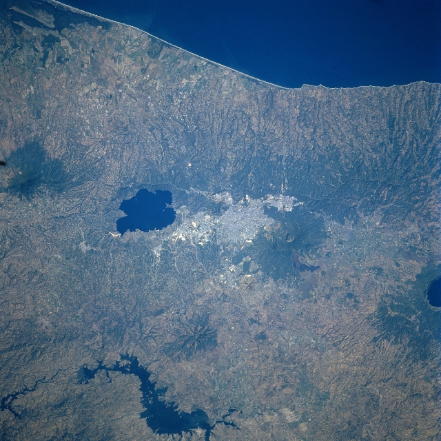
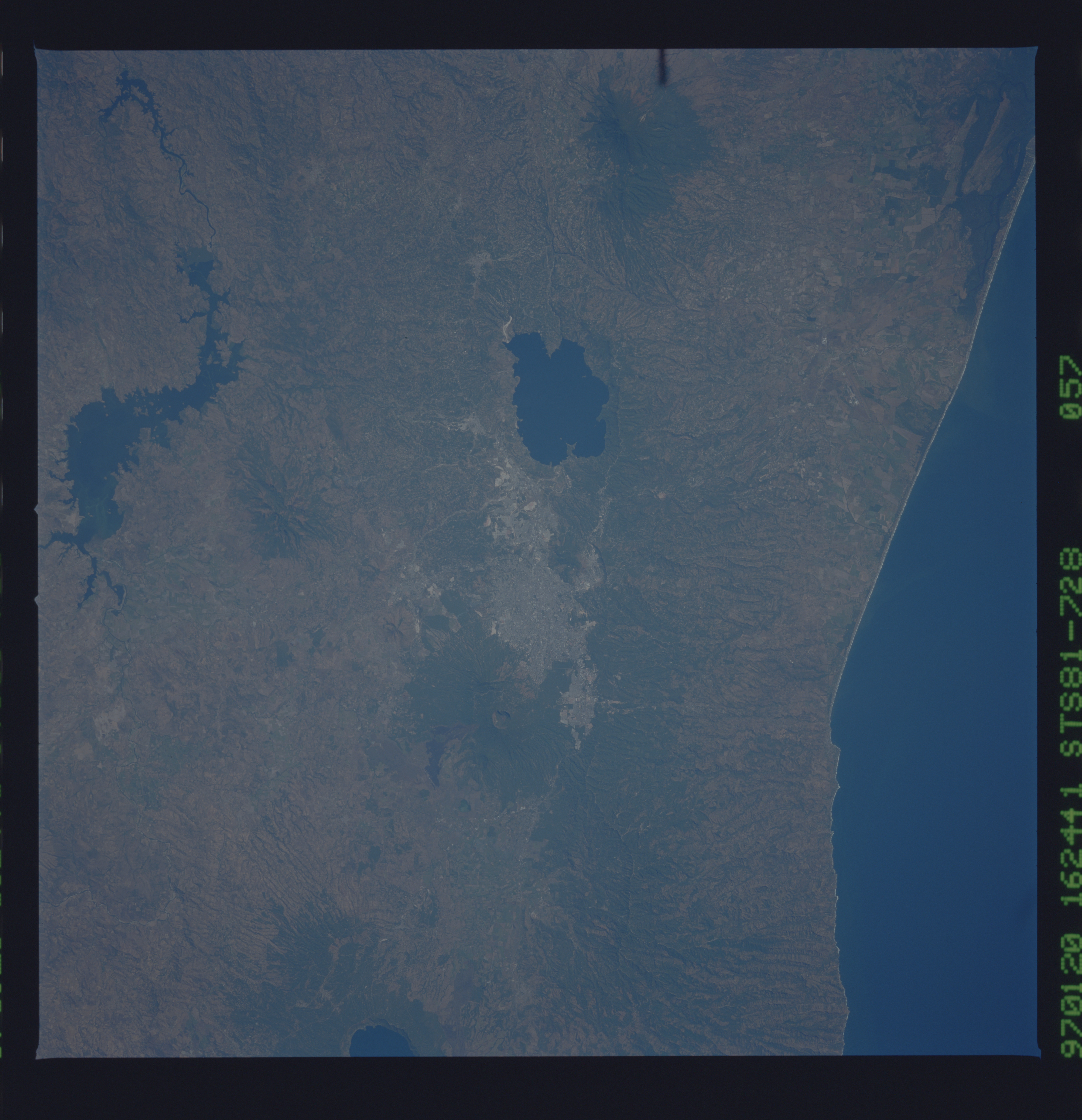
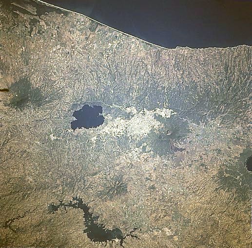
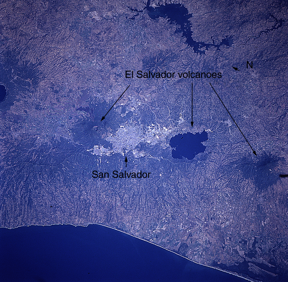
Image Caption: STS081-728-057 San Salvador, El Salvador January 1997
The capital city of El Salvador, San Salvador, can be seen near the center of the image in this south-looking view. San Salvador is located in a valley at 2100 feet (640 meters) on the eastern flank of San Salvador Volcano. Near the eastern end of the city and visible on the image is the caldera of the Ilopango Volcano, now a deep lake. The city of San Salvador is located 20 miles (32 km) north of the coast of the Pacific Ocean (top of image). An important industrial center, San Salvador has factories producing soap, silk, and cotton textiles, cigars, sugar, and beer. San Salvador also has the distinction of having the largest shopping mall in Central America. The city is built on a modified gridiron pattern with wide streets and many parks. Due to the threat of earthquakes, the city's houses tend to be low and surrounded by open areas. Earthquakes, ranging from 6.5 to 7.9 on the Richter scale, have struck San Salvador 13 times over the last 400 years all but destroying the city in 1854, 1873, 1917, and most recently in October of 1986. The 1986 earthquake killed 1400 people, injured 21,000, and left nearly 300,000 homeless. Of the volcanoes located within the metropolitan area, San Salvador Volcano last erupted in 1917 and Ilopango Volcano last erupted in 1879. Near the bottom center of the image, the new Cerron Grande Reservoir is visible. Near the right center of the image, the deep lake caldera of Coatepeque Volcano is visible.
The capital city of El Salvador, San Salvador, can be seen near the center of the image in this south-looking view. San Salvador is located in a valley at 2100 feet (640 meters) on the eastern flank of San Salvador Volcano. Near the eastern end of the city and visible on the image is the caldera of the Ilopango Volcano, now a deep lake. The city of San Salvador is located 20 miles (32 km) north of the coast of the Pacific Ocean (top of image). An important industrial center, San Salvador has factories producing soap, silk, and cotton textiles, cigars, sugar, and beer. San Salvador also has the distinction of having the largest shopping mall in Central America. The city is built on a modified gridiron pattern with wide streets and many parks. Due to the threat of earthquakes, the city's houses tend to be low and surrounded by open areas. Earthquakes, ranging from 6.5 to 7.9 on the Richter scale, have struck San Salvador 13 times over the last 400 years all but destroying the city in 1854, 1873, 1917, and most recently in October of 1986. The 1986 earthquake killed 1400 people, injured 21,000, and left nearly 300,000 homeless. Of the volcanoes located within the metropolitan area, San Salvador Volcano last erupted in 1917 and Ilopango Volcano last erupted in 1879. Near the bottom center of the image, the new Cerron Grande Reservoir is visible. Near the right center of the image, the deep lake caldera of Coatepeque Volcano is visible.
