STS081-727-89
| NASA Photo ID | STS081-727-89 |
| Focal Length | 250mm |
| Date taken | 1997.01.16 |
| Time taken | 07:44:33 GMT |
Resolutions offered for this image:
4072 x 4072 pixels 639 x 639 pixels 5700 x 5900 pixels 483 x 500 pixels 2533 x 2426 pixels
4072 x 4072 pixels 639 x 639 pixels 5700 x 5900 pixels 483 x 500 pixels 2533 x 2426 pixels


Cloud masks available for this image:
Spacecraft nadir point: 40.8° N, 34.8° E
Photo center point: 37.0° N, 31.0° E
Photo center point by machine learning:
Photo center point: 37.0° N, 31.0° E
Photo center point by machine learning:
Nadir to Photo Center: Southwest
Spacecraft Altitude: 209 nautical miles (387km)
Camera: | Hasselblad |
Focal Length: | 250mm |
Camera Tilt: | High Oblique |
Format: | 5046: Kodak, natural color positive, Lumiere 100/5046, ASA 100, standard base |
Film Exposure: | Normal |
| Additional Information | |
| Width | Height | Annotated | Cropped | Purpose | Links |
|---|---|---|---|---|---|
| 4072 pixels | 4072 pixels | No | No | Earth From Space collection | Download Image |
| 639 pixels | 639 pixels | No | No | Earth From Space collection | Download Image |
| 5700 pixels | 5900 pixels | No | No | Download Image | |
| 483 pixels | 500 pixels | No | No | Download Image | |
| 2533 pixels | 2426 pixels | Download Image |
Download Packaged File
Download a Google Earth KML for this Image
View photo footprint information
Download a GeoTIFF for this photo
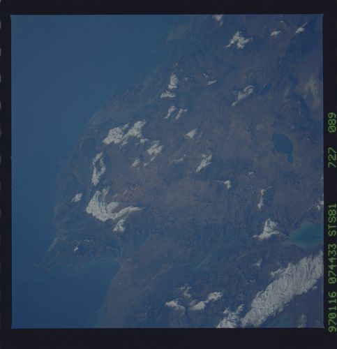
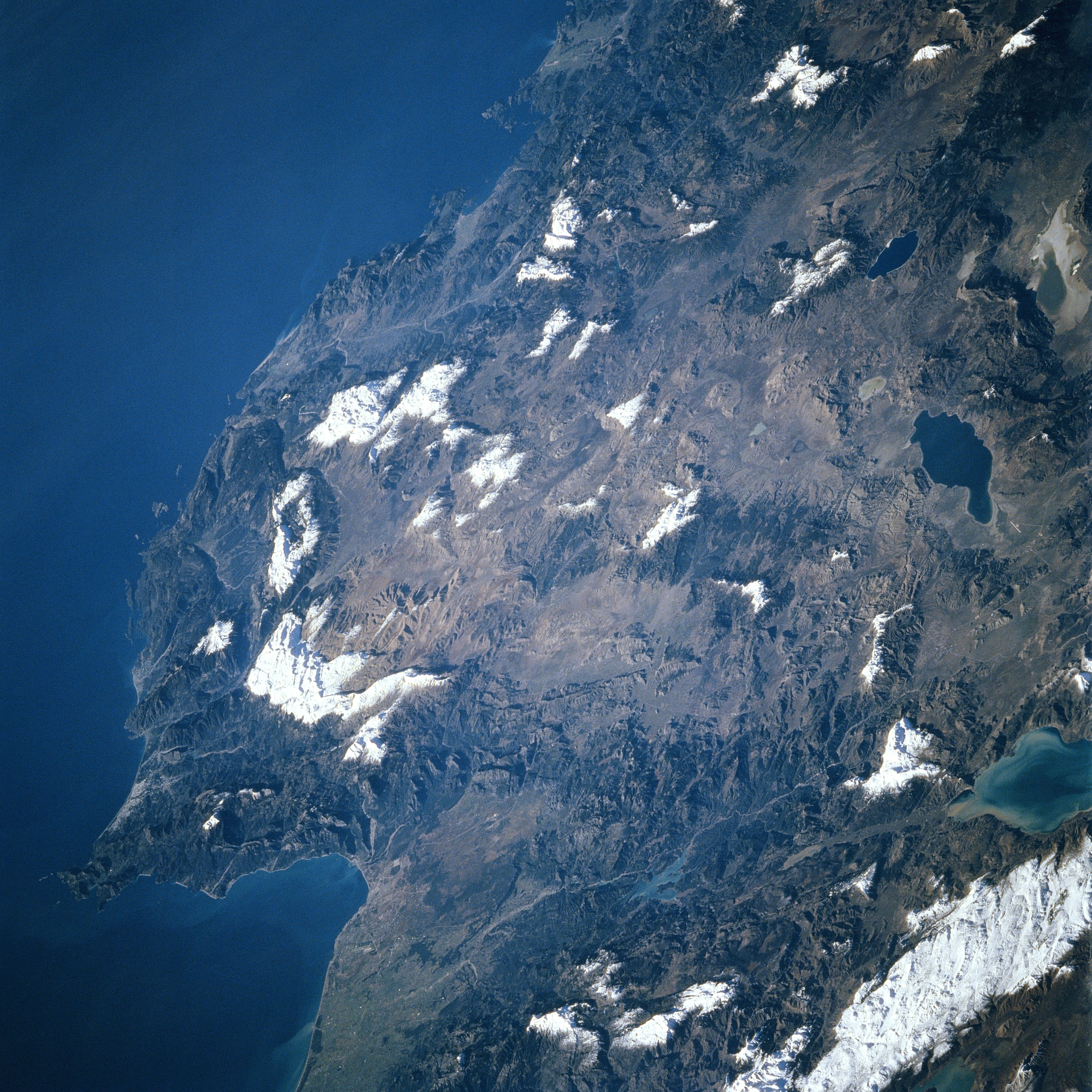
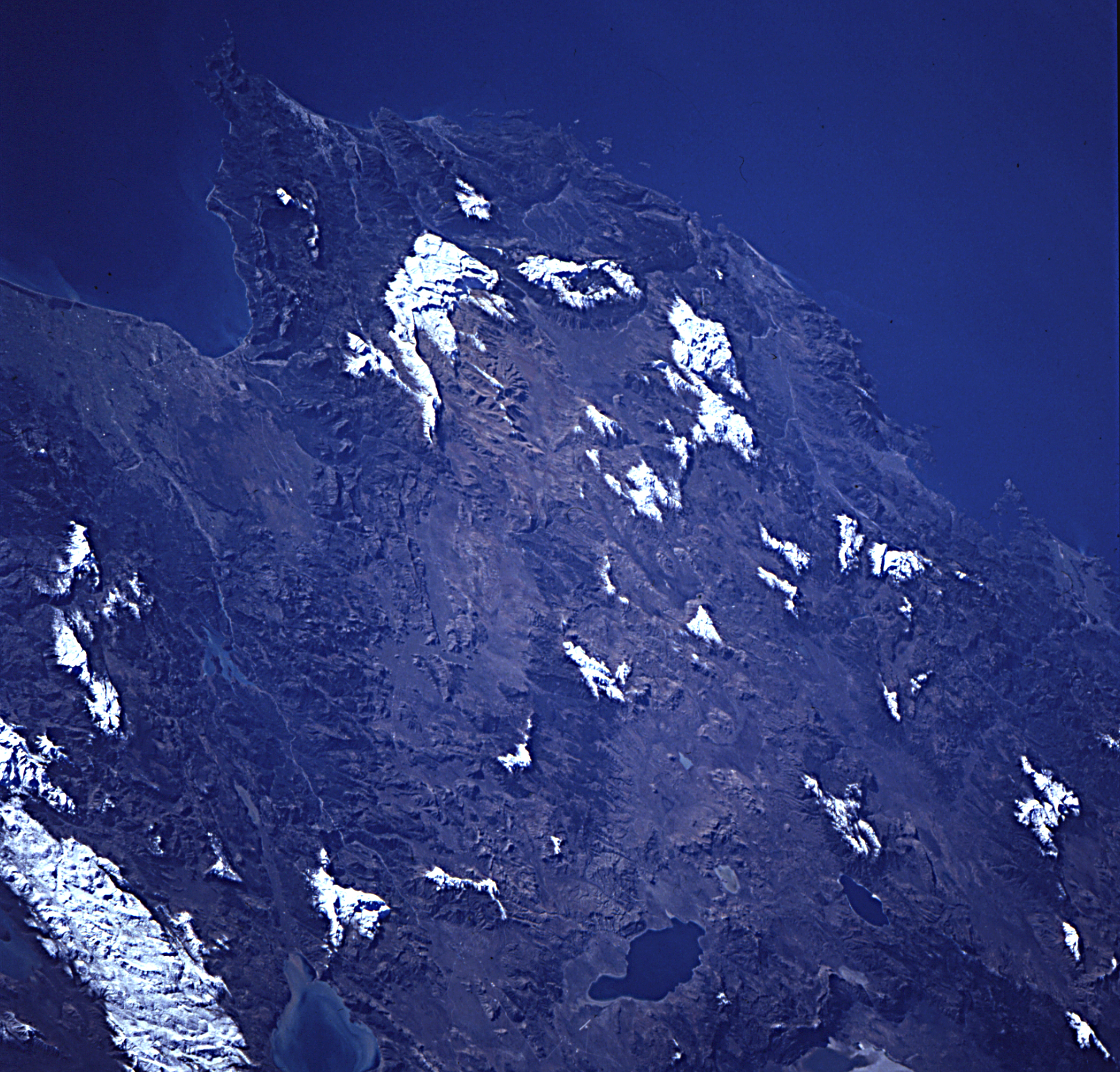
Image Caption: STS081-727-089 Bey Mountains, Antalya, Turkey January 1997
The rugged landscape of southwestern Turkey can be seen in this west-looking view. The ancient coastal city of Antalya, founded in 150 BC, is visible in the lower left portion of the image. Located on the Gulf of Antalya, an inlet of the Mediterranean Sea, Antalya is a seaport and a major commercial center for the southwestern part of Turkey. The city's industries include shipbuilding and repair, and textiles. West of Antalya are the rugged Bey Mountains. The mountains reach elevations exceeding 9000 feet (2745 meters). Chrome and Manganese are extracted from the Bey Mountains. Numerous lakes are visible along the right portion of the image. From top right to bottom right are Lake Salda, Lake Aci, Lake Burdur, and Lake Edridir.
The rugged landscape of southwestern Turkey can be seen in this west-looking view. The ancient coastal city of Antalya, founded in 150 BC, is visible in the lower left portion of the image. Located on the Gulf of Antalya, an inlet of the Mediterranean Sea, Antalya is a seaport and a major commercial center for the southwestern part of Turkey. The city's industries include shipbuilding and repair, and textiles. West of Antalya are the rugged Bey Mountains. The mountains reach elevations exceeding 9000 feet (2745 meters). Chrome and Manganese are extracted from the Bey Mountains. Numerous lakes are visible along the right portion of the image. From top right to bottom right are Lake Salda, Lake Aci, Lake Burdur, and Lake Edridir.
