STS081-724-83

| NASA Photo ID | STS081-724-83 |
| Focal Length | 250mm |
| Date taken | 1997.01.__ |
| Time taken | GMT |
Resolutions offered for this image:
4096 x 4096 pixels 640 x 640 pixels 5700 x 5900 pixels 483 x 500 pixels
4096 x 4096 pixels 640 x 640 pixels 5700 x 5900 pixels 483 x 500 pixels

Cloud masks available for this image:
Spacecraft nadir point:
Photo center point: 43.0° S, 73.0° W
Photo center point by machine learning:
Photo center point: 43.0° S, 73.0° W
Photo center point by machine learning:
Nadir to Photo Center:
Spacecraft Altitude: nautical miles (0km)
Country or Geographic Name: | CHILE |
Features: | GULF OF CORCOVADO |
| Features Found Using Machine Learning: | |
Cloud Cover Percentage: | 5 (1-10)% |
Sun Elevation Angle: | ° |
Sun Azimuth: | ° |
Camera: | Hasselblad |
Focal Length: | 250mm |
Camera Tilt: | |
Format: | 5046: Kodak, natural color positive, Lumiere 100/5046, ASA 100, standard base |
Film Exposure: | Normal |
| Additional Information | |
| Width | Height | Annotated | Cropped | Purpose | Links |
|---|---|---|---|---|---|
| 4096 pixels | 4096 pixels | No | No | Earth From Space collection | Download Image |
| 640 pixels | 640 pixels | No | No | Earth From Space collection | Download Image |
| 5700 pixels | 5900 pixels | No | No | Download Image | |
| 483 pixels | 500 pixels | No | No | Download Image |
Download Packaged File
Download a Google Earth KML for this Image
View photo footprint information
Download a GeoTIFF for this photo
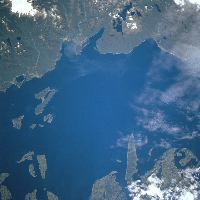
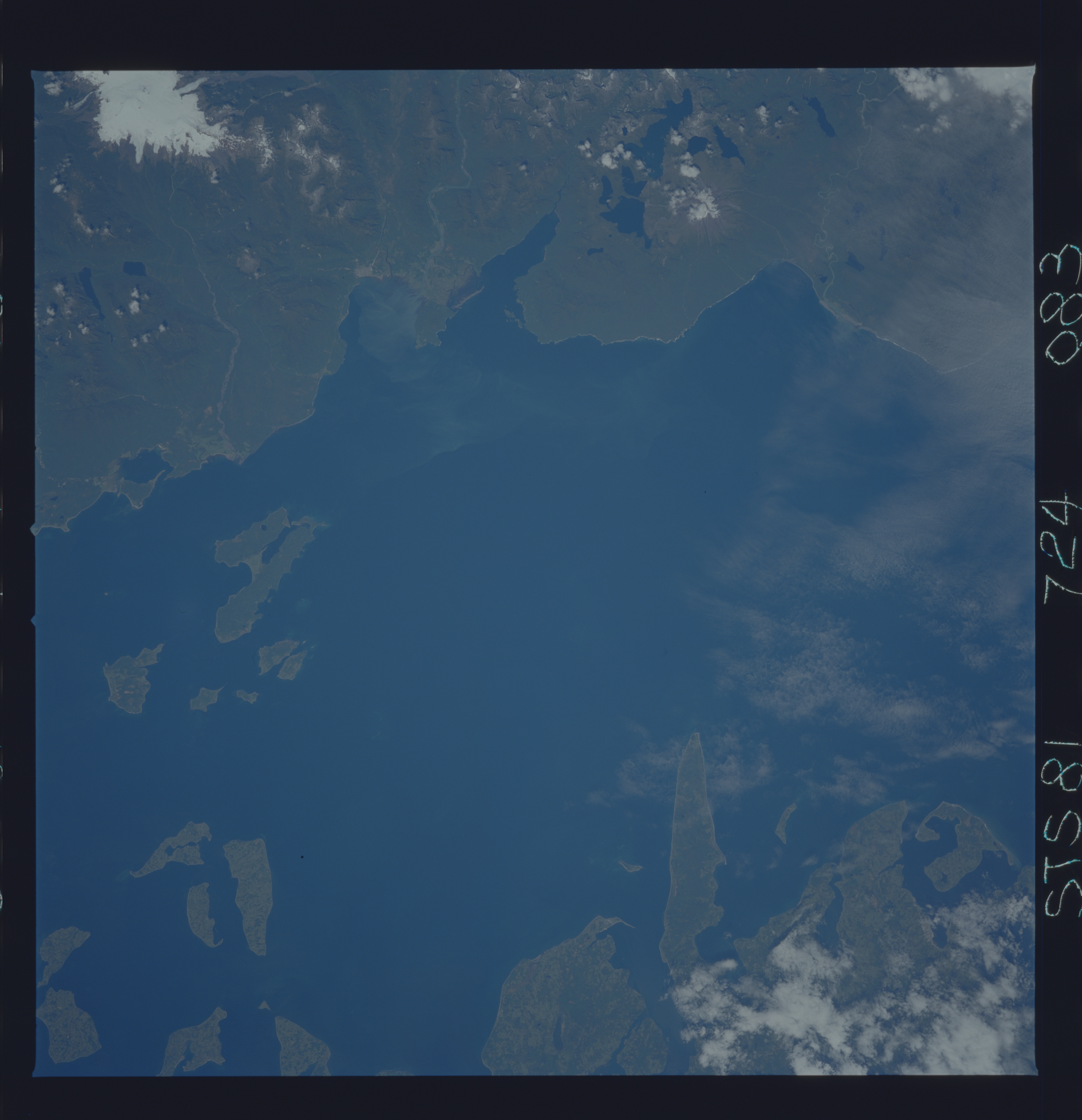
Image Caption: STS081-724-083 Gulf of Corcovado, Chile January 1997
The northern Gulf of Corcovado can be seen in this west-northwest-looking view. An inlet of the Pacific Ocean, the gulf separates the island of Chiloe (upper left), the largest of the Chilean Islands, from the Chilean mainland (bottom). Islands discernible along the right center and upper right separate the Gulf of Corcovado from the Gulf of Ancud (not visible). Lumbering, fishing, and tourism are the main industries of the small surrounding communities. The snow-capped mountain seen on the lower-left margin of the image, with three lakes on its north and northeast flanks, is the 7000 foot (2135 meter) Corcovado Volcano. The pointed island protruding into the gulf in the upper left portion of the image is Tranqui Island.
The northern Gulf of Corcovado can be seen in this west-northwest-looking view. An inlet of the Pacific Ocean, the gulf separates the island of Chiloe (upper left), the largest of the Chilean Islands, from the Chilean mainland (bottom). Islands discernible along the right center and upper right separate the Gulf of Corcovado from the Gulf of Ancud (not visible). Lumbering, fishing, and tourism are the main industries of the small surrounding communities. The snow-capped mountain seen on the lower-left margin of the image, with three lakes on its north and northeast flanks, is the 7000 foot (2135 meter) Corcovado Volcano. The pointed island protruding into the gulf in the upper left portion of the image is Tranqui Island.
