STS081-717-66
| NASA Photo ID | STS081-717-66 |
| Focal Length | 250mm |
| Date taken | 1997.01.14 |
| Time taken | 09:47:49 GMT |
Resolutions offered for this image:
4096 x 4096 pixels 640 x 640 pixels 5700 x 5900 pixels 483 x 500 pixels
4096 x 4096 pixels 640 x 640 pixels 5700 x 5900 pixels 483 x 500 pixels

Cloud masks available for this image:
Spacecraft nadir point: 43.6° N, 9.8° E
Photo center point: 45.5° N, 10.5° E
Photo center point by machine learning:
Photo center point: 45.5° N, 10.5° E
Photo center point by machine learning:
Nadir to Photo Center: North
Spacecraft Altitude: 193 nautical miles (357km)
Country or Geographic Name: | ITALY |
Features: | LAKE GARDA, MOUNTAINS |
| Features Found Using Machine Learning: | |
Cloud Cover Percentage: | 0 (no clouds present) |
Sun Elevation Angle: | 21° |
Sun Azimuth: | 155° |
Camera: | Hasselblad |
Focal Length: | 250mm |
Camera Tilt: | 32 degrees |
Format: | 5046: Kodak, natural color positive, Lumiere 100/5046, ASA 100, standard base |
Film Exposure: | Normal |
| Additional Information | |
| Width | Height | Annotated | Cropped | Purpose | Links |
|---|---|---|---|---|---|
| 4096 pixels | 4096 pixels | No | No | Earth From Space collection | Download Image |
| 640 pixels | 640 pixels | No | No | Earth From Space collection | Download Image |
| 5700 pixels | 5900 pixels | No | No | Download Image | |
| 483 pixels | 500 pixels | No | No | Download Image |
Download Packaged File
Download a Google Earth KML for this Image
View photo footprint information
Download a GeoTIFF for this photo
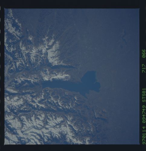
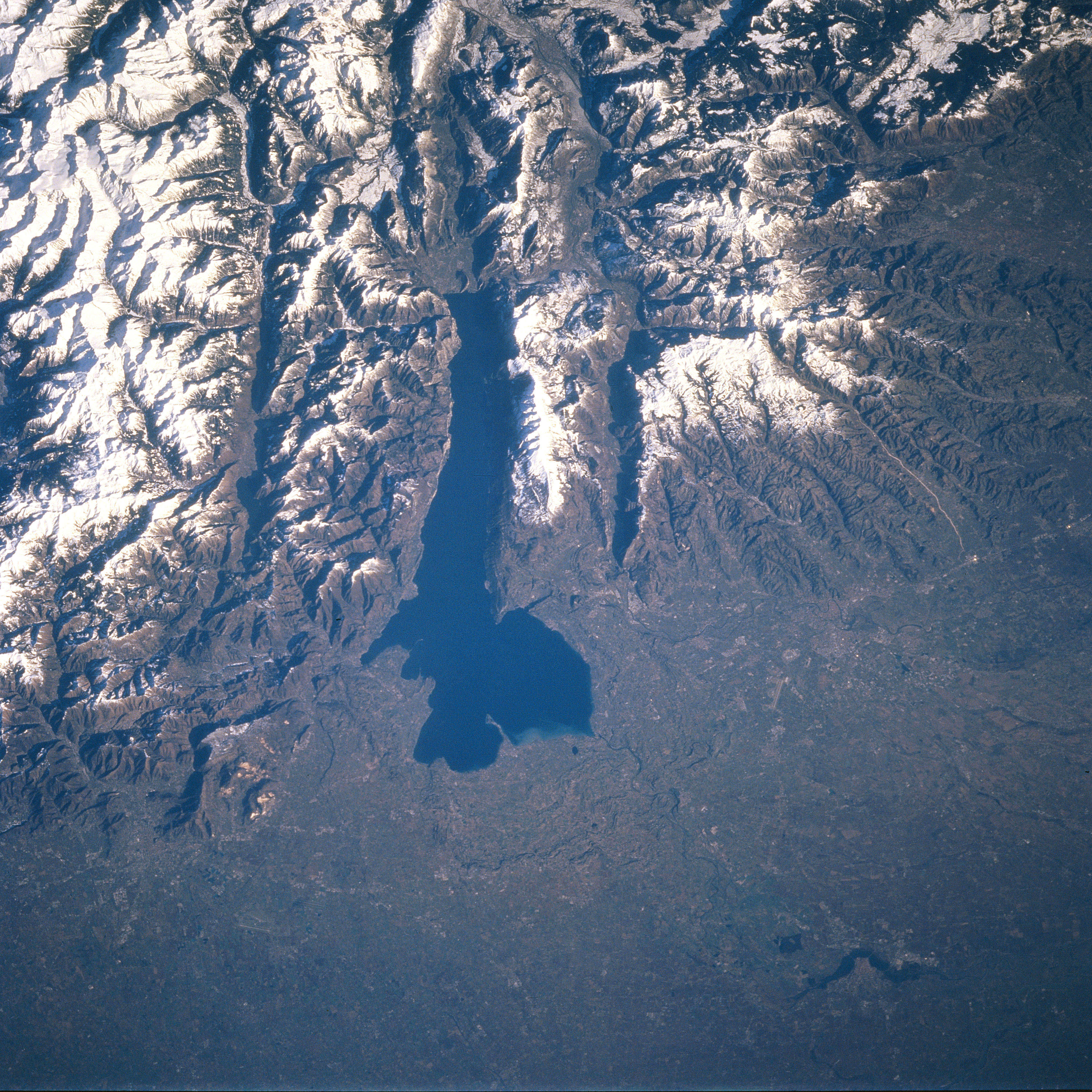
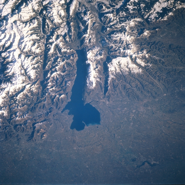
Image Caption: STS081-717-066 Lake Garda, Italy January 1997
Lake Garda, the elongated, dark feature near the center of the picture, is one of several glacially formed lakes in the Italian Alps of northern Italy. Lake Garda occupies a basin where the southern extent of an Alpine valley was deepened by glaciers and dammed by a large terminal moraine. The lake is 32 miles (51 km) long and has contrasting scenery that includes open, rolling plains at the southern end and rugged, precipitous mountains east and west of the lake. The paralleling valleys adjacent to Lake Garda show elongated, dark features, which are shadows caused by the high, snow covered mountains. There is, however, a small lake (dark feature) in the valley immediately west of Lake Garda. The Italian cities of Verona (southeast of the lake) and Brescia (southwest of the lake) are in this scene but cannot be identified because of the small scale of the image and the lack of contrast between the natural environment and the urban areas. The bottom third of the image shows a section of the broad alluvial plains of the Po River Valley.
Lake Garda, the elongated, dark feature near the center of the picture, is one of several glacially formed lakes in the Italian Alps of northern Italy. Lake Garda occupies a basin where the southern extent of an Alpine valley was deepened by glaciers and dammed by a large terminal moraine. The lake is 32 miles (51 km) long and has contrasting scenery that includes open, rolling plains at the southern end and rugged, precipitous mountains east and west of the lake. The paralleling valleys adjacent to Lake Garda show elongated, dark features, which are shadows caused by the high, snow covered mountains. There is, however, a small lake (dark feature) in the valley immediately west of Lake Garda. The Italian cities of Verona (southeast of the lake) and Brescia (southwest of the lake) are in this scene but cannot be identified because of the small scale of the image and the lack of contrast between the natural environment and the urban areas. The bottom third of the image shows a section of the broad alluvial plains of the Po River Valley.
