STS081-715-69

| NASA Photo ID | STS081-715-69 |
| Focal Length | 250mm |
| Date taken | 1997.01.13 |
| Time taken | 07:19:03 GMT |
Resolutions offered for this image:
4096 x 4096 pixels 640 x 640 pixels 5700 x 5900 pixels 483 x 500 pixels 636 x 644 pixels
4096 x 4096 pixels 640 x 640 pixels 5700 x 5900 pixels 483 x 500 pixels 636 x 644 pixels

Cloud masks available for this image:
Spacecraft nadir point: 42.7° S, 149.1° E
Photo center point: 43.0° S, 147.0° E
Photo center point by machine learning:
Photo center point: 43.0° S, 147.0° E
Photo center point by machine learning:
Nadir to Photo Center: West
Spacecraft Altitude: 161 nautical miles (298km)
Country or Geographic Name: | AUSTRALIA-T |
Features: | HOBART |
| Features Found Using Machine Learning: | |
Cloud Cover Percentage: | 0 (no clouds present) |
Sun Elevation Angle: | 24° |
Sun Azimuth: | 262° |
Camera: | Hasselblad |
Focal Length: | 250mm |
Camera Tilt: | 38 degrees |
Format: | 5046: Kodak, natural color positive, Lumiere 100/5046, ASA 100, standard base |
Film Exposure: | Normal |
| Additional Information | |
| Width | Height | Annotated | Cropped | Purpose | Links |
|---|---|---|---|---|---|
| 4096 pixels | 4096 pixels | No | No | Earth From Space collection | Download Image |
| 640 pixels | 640 pixels | No | No | Earth From Space collection | Download Image |
| 5700 pixels | 5900 pixels | No | No | Download Image | |
| 483 pixels | 500 pixels | No | No | Download Image | |
| 636 pixels | 644 pixels | No | No | Download Image |
Download Packaged File
Download a Google Earth KML for this Image
View photo footprint information
Download a GeoTIFF for this photo
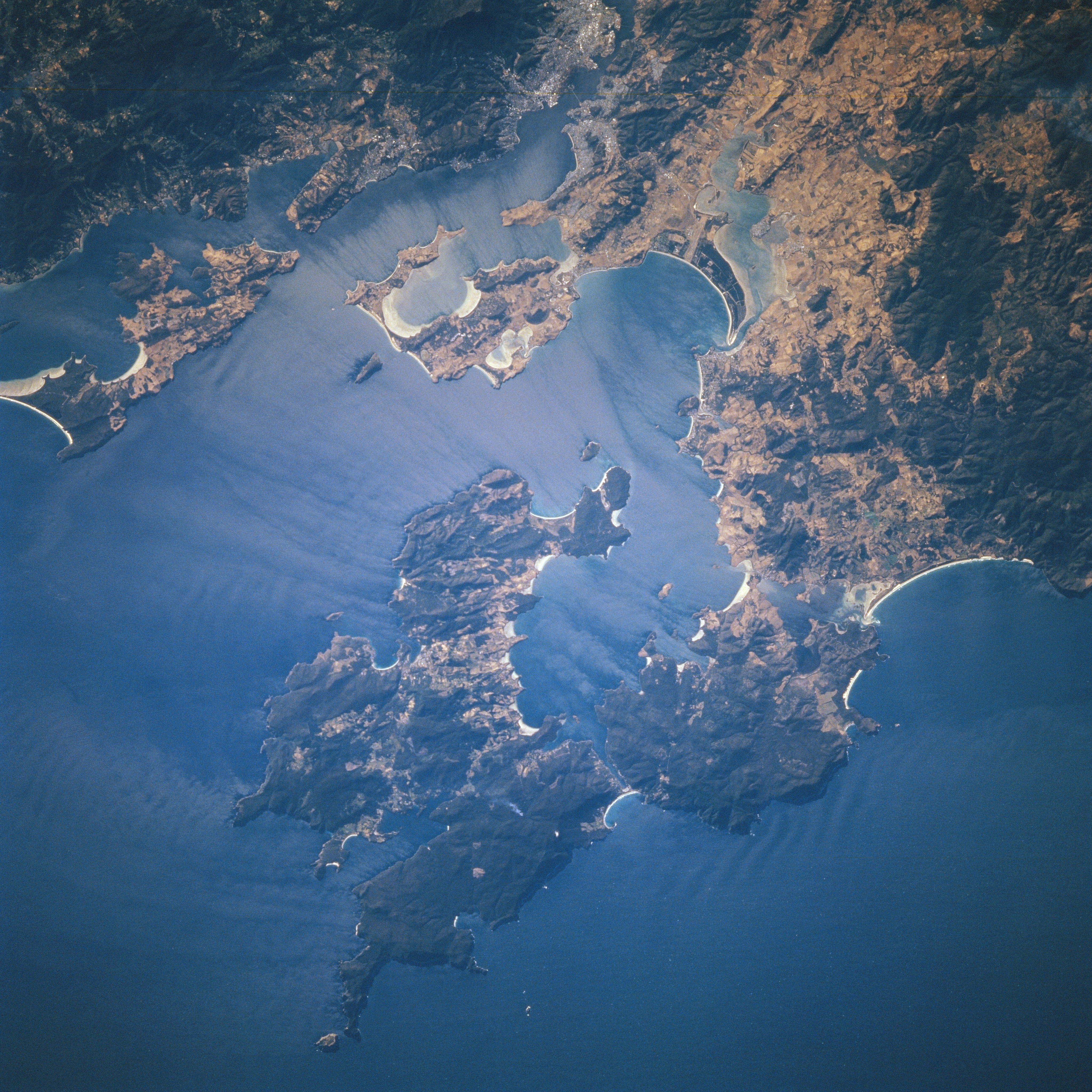
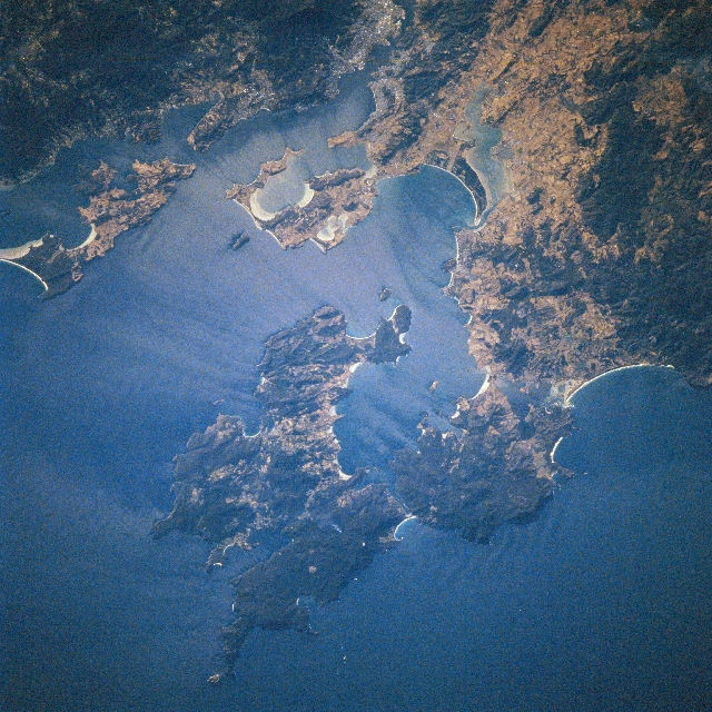
Image Caption: STS081-715-069 Storm Bay, Hobart, Tasmania January 1997
Storm Bay, an arm of the Pacific Ocean, and the capital city of Tasmania, Hobart (upper center) can be seen in this northwest-looking view. Hobart, with a population exceeding 50000, is located on the banks of the river Derwent 12 miles (20 km) from its mouth. The city is the industrial and commercial center of the island of Tasmania and has a modern deep-water port. The city is blocked from expanding on either side of the river by rugged, forested mountains (darker features). Agricultural lands (lighter colored areas) are visible to the east of the city (upper right). The Tasman Peninsula can be seen near the bottom center of the image. Numerous beaches (highly reflective white-colored areas) are discernible scattered along the many coastlines visible on the image.
Storm Bay, an arm of the Pacific Ocean, and the capital city of Tasmania, Hobart (upper center) can be seen in this northwest-looking view. Hobart, with a population exceeding 50000, is located on the banks of the river Derwent 12 miles (20 km) from its mouth. The city is the industrial and commercial center of the island of Tasmania and has a modern deep-water port. The city is blocked from expanding on either side of the river by rugged, forested mountains (darker features). Agricultural lands (lighter colored areas) are visible to the east of the city (upper right). The Tasman Peninsula can be seen near the bottom center of the image. Numerous beaches (highly reflective white-colored areas) are discernible scattered along the many coastlines visible on the image.
