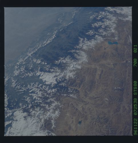
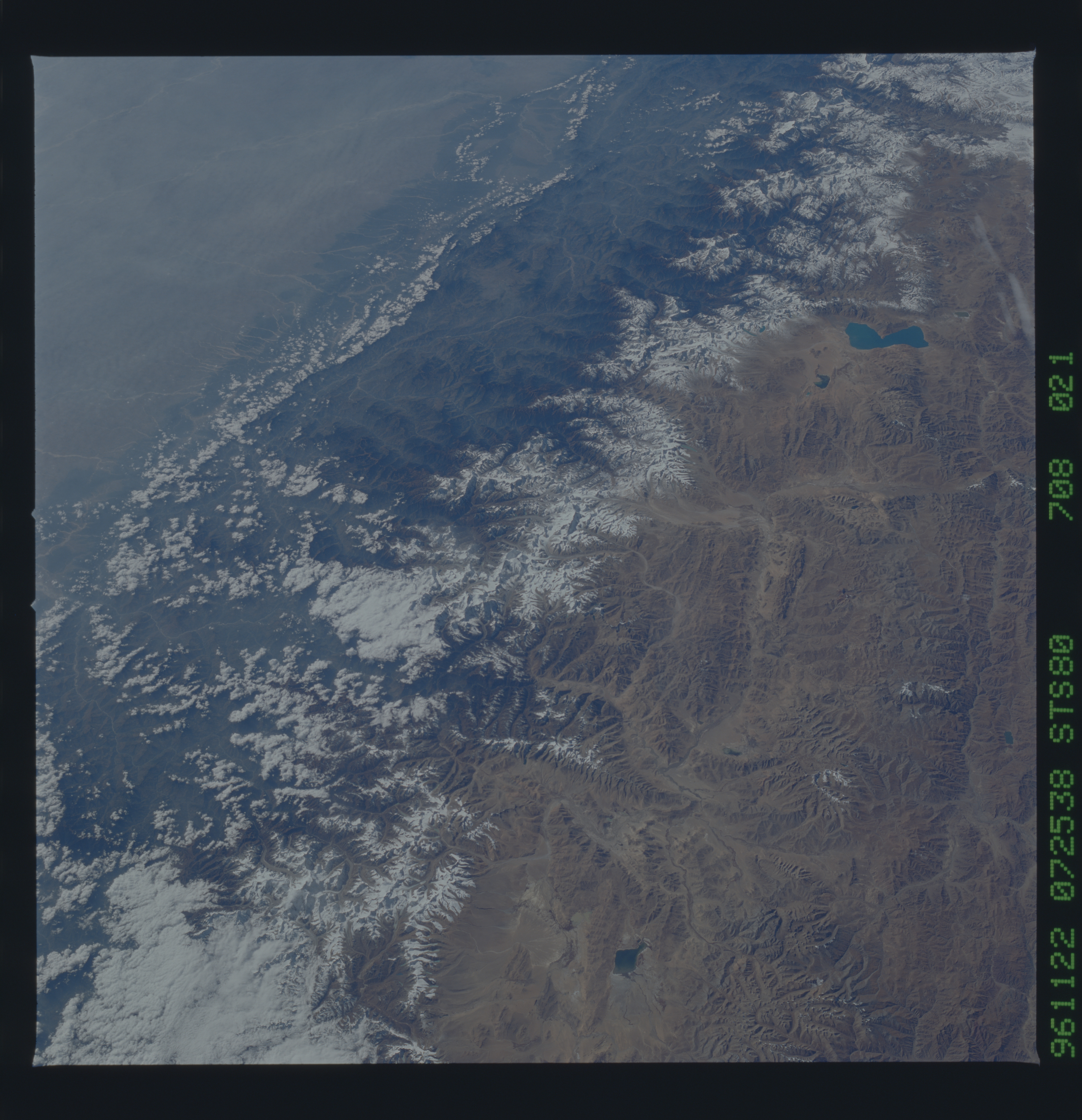
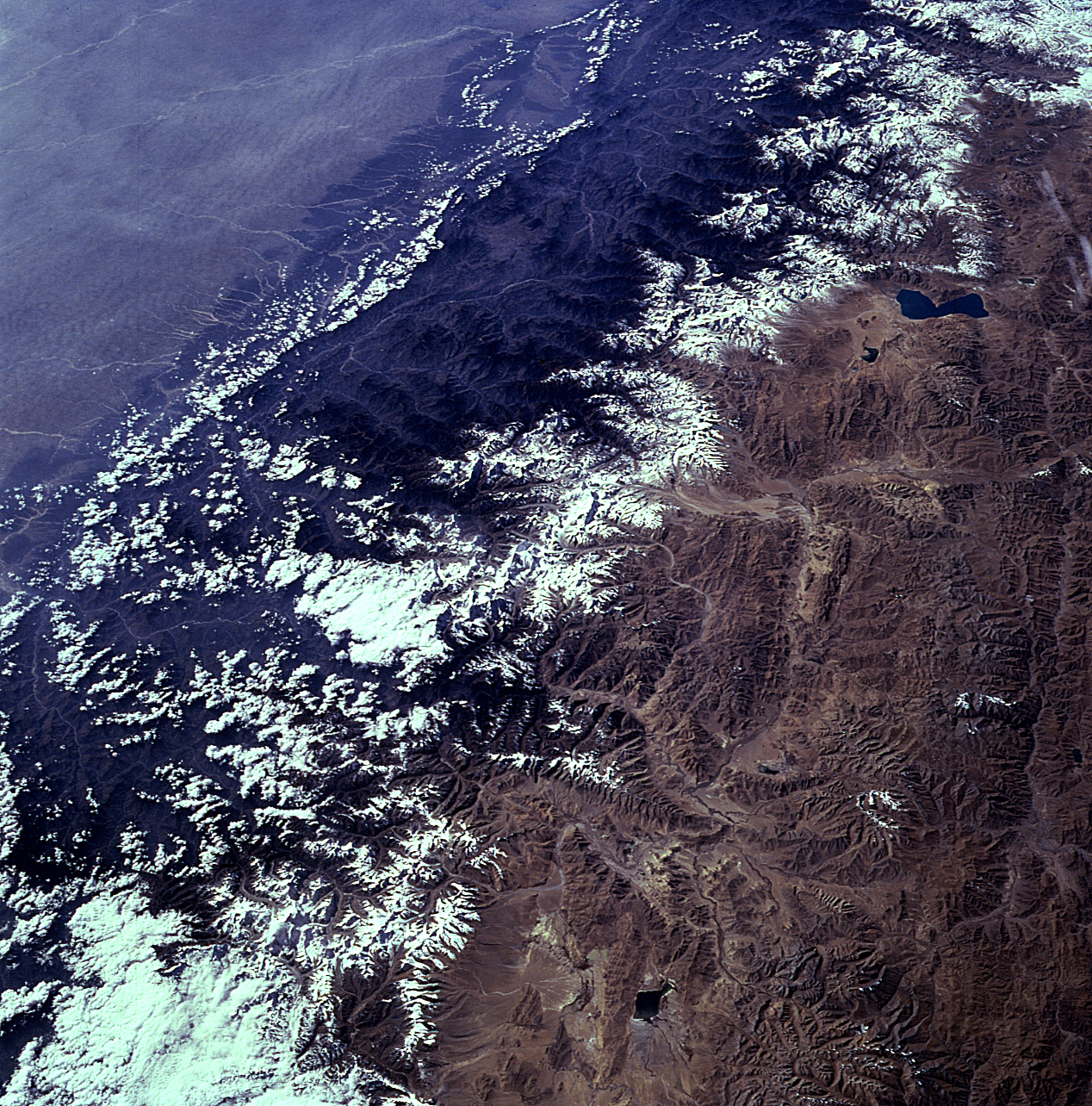
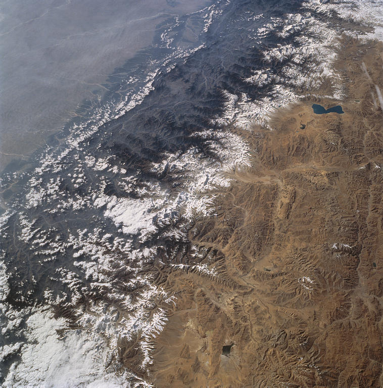
STS080-708-21
| NASA Photo ID | STS080-708-21 |
| Focal Length | 100mm |
| Date taken | 1996.11.22 |
| Time taken | 07:25:38 GMT |
Resolutions offered for this image:
5700 x 5900 pixels 483 x 500 pixels 1268 x 1284 pixels 3952 x 4000 pixels 758 x 768 pixels
5700 x 5900 pixels 483 x 500 pixels 1268 x 1284 pixels 3952 x 4000 pixels 758 x 768 pixels

Cloud masks available for this image:
Spacecraft nadir point: 28.6° N, 90.6° E
Photo center point: 28.0° N, 87.0° E
Photo center point by machine learning:
Photo center point: 28.0° N, 87.0° E
Photo center point by machine learning:
Nadir to Photo Center: West
Spacecraft Altitude: 190 nautical miles (352km)
Camera: | Hasselblad |
Focal Length: | 100mm |
Camera Tilt: | 49 degrees |
Format: | 5046: Kodak, natural color positive, Lumiere 100/5046, ASA 100, standard base |
Film Exposure: | Normal |
| Additional Information | |
| Width | Height | Annotated | Cropped | Purpose | Links |
|---|---|---|---|---|---|
| 5700 pixels | 5900 pixels | No | No | Download Image | |
| 483 pixels | 500 pixels | No | No | Download Image | |
| 1268 pixels | 1284 pixels | Download Image | |||
| 3952 pixels | 4000 pixels | No | No | Download Image | |
| 758 pixels | 768 pixels | No | Yes | Download Image |
Download Packaged File
Download a Google Earth KML for this Image
View photo footprint information
Download a GeoTIFF for this photo
Image Caption: none
