STS080-702-94
| NASA Photo ID | STS080-702-94 |
| Focal Length | 250mm |
| Date taken | 1996.11.21 |
| Time taken | 17:32:41 GMT |
Resolutions offered for this image:
4048 x 4048 pixels 639 x 639 pixels 5700 x 5900 pixels 483 x 500 pixels
4048 x 4048 pixels 639 x 639 pixels 5700 x 5900 pixels 483 x 500 pixels

Cloud masks available for this image:
Spacecraft nadir point: 22.2° N, 100.8° W
Photo center point: 22.0° N, 102.5° W
Photo center point by machine learning:
Photo center point: 22.0° N, 102.5° W
Photo center point by machine learning:
Nadir to Photo Center: West
Spacecraft Altitude: 189 nautical miles (350km)
Country or Geographic Name: | MEXICO |
Features: | AGUASCALIENTES, AGR., RES. |
| Features Found Using Machine Learning: | |
Cloud Cover Percentage: | 0 (no clouds present) |
Sun Elevation Angle: | 46° |
Sun Azimuth: | 161° |
Camera: | Hasselblad |
Focal Length: | 250mm |
Camera Tilt: | 29 degrees |
Format: | 5046: Kodak, natural color positive, Lumiere 100/5046, ASA 100, standard base |
Film Exposure: | Normal |
| Additional Information | |
| Width | Height | Annotated | Cropped | Purpose | Links |
|---|---|---|---|---|---|
| 4048 pixels | 4048 pixels | No | No | Earth From Space collection | Download Image |
| 639 pixels | 639 pixels | No | No | Earth From Space collection | Download Image |
| 5700 pixels | 5900 pixels | No | No | Download Image | |
| 483 pixels | 500 pixels | No | No | Download Image |
Download Packaged File
Download a Google Earth KML for this Image
View photo footprint information
Download a GeoTIFF for this photo
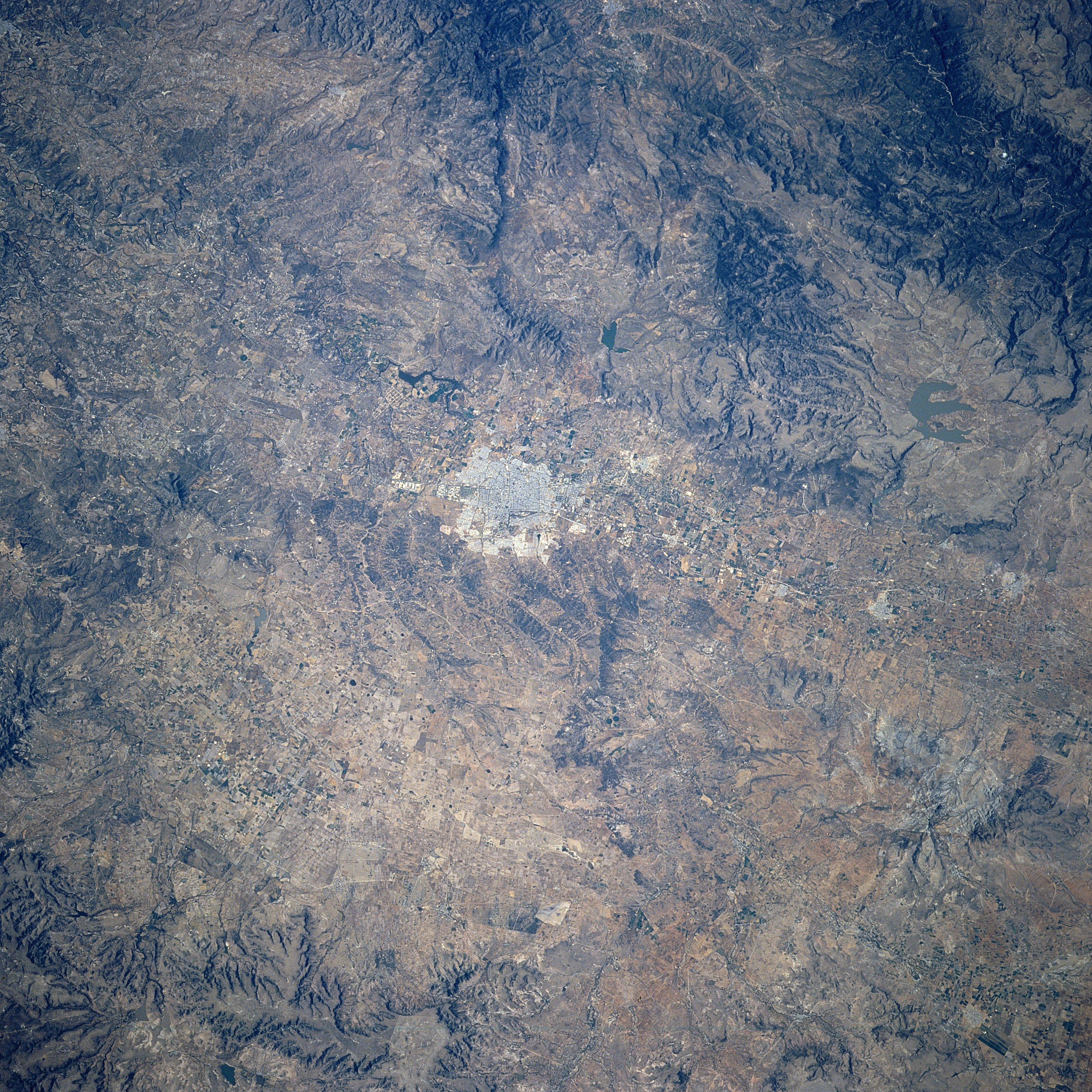
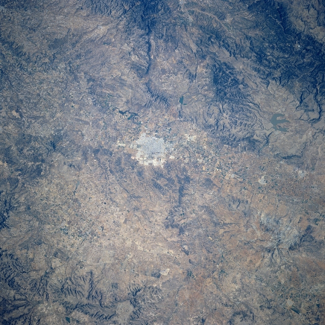
Image Caption: STS080-702-094 Aguascalientes Area, Mexico November 1996
Aguascalientes, the highly reflective area near the center of the image, is the capital of the state with the same name. Located approximately 110 miles (175 km) northeast of Guadalajara, this urban area located on the Mexican Plateau (6486 feet - 1977 meters above sea level) was named for the numerous thermal springs that are found in the area. This region of the semi-arid Mexican Plateau is characterized by rugged mountains (darker features west of the city) separated by basins. Some of the elevated landscape (slightly darker features) display evidence of recent volcanic activity. The meandering channel of the Rio Verde Grande de Balem (aligned north-south) can be seen as it passes along the west side of Aguascalientes. The Presidente Calles Reservoir is barely visible (shaped like letter E) north, northwest of the city.
Aguascalientes, the highly reflective area near the center of the image, is the capital of the state with the same name. Located approximately 110 miles (175 km) northeast of Guadalajara, this urban area located on the Mexican Plateau (6486 feet - 1977 meters above sea level) was named for the numerous thermal springs that are found in the area. This region of the semi-arid Mexican Plateau is characterized by rugged mountains (darker features west of the city) separated by basins. Some of the elevated landscape (slightly darker features) display evidence of recent volcanic activity. The meandering channel of the Rio Verde Grande de Balem (aligned north-south) can be seen as it passes along the west side of Aguascalientes. The Presidente Calles Reservoir is barely visible (shaped like letter E) north, northwest of the city.
