STS079-812-87
| NASA Photo ID | STS079-812-87 |
| Focal Length | 250mm |
| Date taken | 1996.09.23 |
| Time taken | 14:59:46 GMT |
Resolutions offered for this image:
3989 x 3989 pixels 640 x 640 pixels 5700 x 5900 pixels 483 x 500 pixels 513 x 509 pixels 480 x 479 pixels
3989 x 3989 pixels 640 x 640 pixels 5700 x 5900 pixels 483 x 500 pixels 513 x 509 pixels 480 x 479 pixels


Cloud masks available for this image:
Spacecraft nadir point: 33.2° N, 90.6° W
Photo center point: 34.0° N, 90.0° W
Photo center point by machine learning:
Photo center point: 34.0° N, 90.0° W
Photo center point by machine learning:
Nadir to Photo Center: Northeast
Spacecraft Altitude: 201 nautical miles (372km)
Country or Geographic Name: | USA-MISSISSIPPI |
Features: | GRENADA RES., ENID LAKE |
| Features Found Using Machine Learning: | |
Cloud Cover Percentage: | 0 (no clouds present) |
Sun Elevation Angle: | 37° |
Sun Azimuth: | 120° |
Camera: | Hasselblad |
Focal Length: | 250mm |
Camera Tilt: | 17 degrees |
Format: | 5046: Kodak, natural color positive, Lumiere 100/5046, ASA 100, standard base |
Film Exposure: | Normal |
| Additional Information | |
| Width | Height | Annotated | Cropped | Purpose | Links |
|---|---|---|---|---|---|
| 3989 pixels | 3989 pixels | No | No | Earth From Space collection | Download Image |
| 640 pixels | 640 pixels | No | No | Earth From Space collection | Download Image |
| 5700 pixels | 5900 pixels | No | No | Download Image | |
| 483 pixels | 500 pixels | No | No | Download Image | |
| 513 pixels | 509 pixels | No | No | Download Image | |
| 480 pixels | 479 pixels | Download Image |
Download Packaged File
Download a Google Earth KML for this Image
View photo footprint information
Download a GeoTIFF for this photo
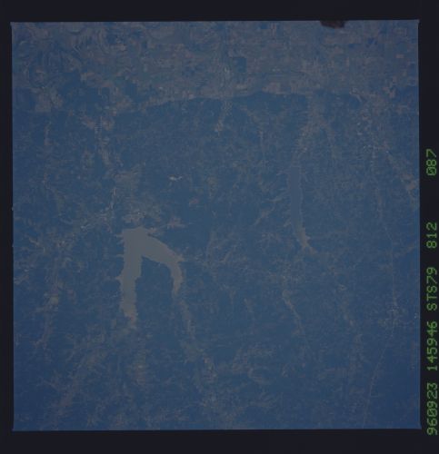
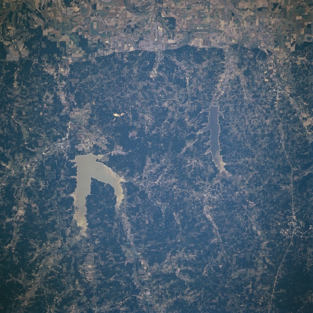
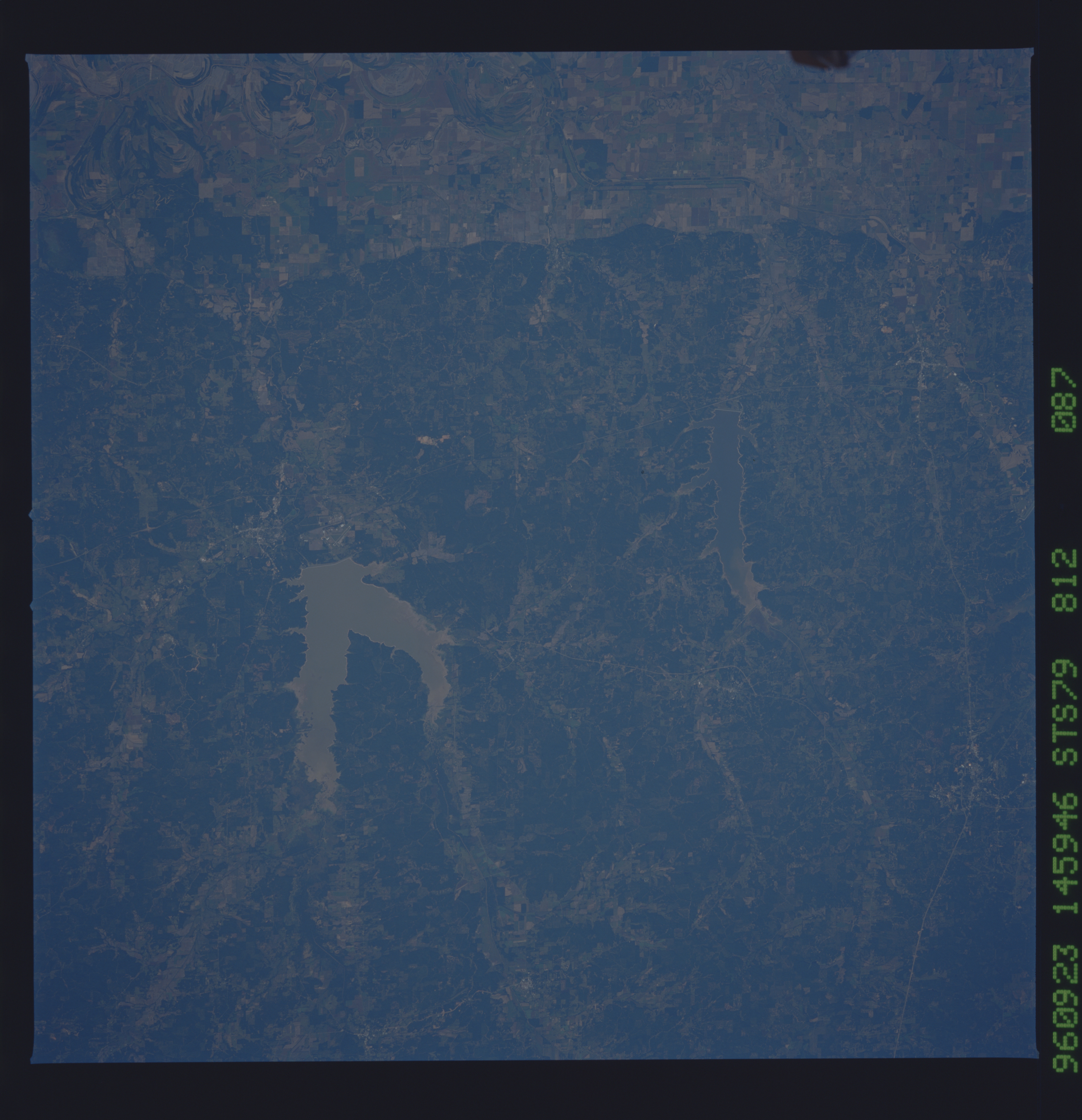
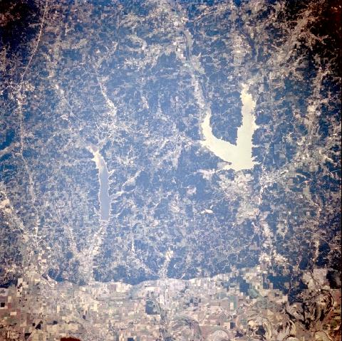
Image Caption: STS079-812-087 Grenada and Enid Lakes, Mississippi September, 1996
The larger of the two lakes shown in this scene, Grenada Lake shown in sun glint, and the smaller Enid Lake are visible in the east-looking low-oblique view. Both lakes are located in a cotton growing and timber-producing region of central Mississippi. Grenada Lake is fed by the Yalobusha and Skuna Rivers and has nearly 90380 acres (36604 hectares) of land and water combined for recreational purposes. The dams for both lakes control flooding, especially downstream for the Tallahatchie River floodplain, which is visible along the lower portion of the image. The dams of both lakes also provide hydroelectric power for the growing industrial base in the region.
The larger of the two lakes shown in this scene, Grenada Lake shown in sun glint, and the smaller Enid Lake are visible in the east-looking low-oblique view. Both lakes are located in a cotton growing and timber-producing region of central Mississippi. Grenada Lake is fed by the Yalobusha and Skuna Rivers and has nearly 90380 acres (36604 hectares) of land and water combined for recreational purposes. The dams for both lakes control flooding, especially downstream for the Tallahatchie River floodplain, which is visible along the lower portion of the image. The dams of both lakes also provide hydroelectric power for the growing industrial base in the region.
