STS079-812-85
| NASA Photo ID | STS079-812-85 |
| Focal Length | 250mm |
| Date taken | 1996.09.23 |
| Time taken | 14:59:32 GMT |
Resolutions offered for this image:
4019 x 4085 pixels 629 x 640 pixels 5700 x 5900 pixels 483 x 500 pixels 512 x 493 pixels 480 x 477 pixels
4019 x 4085 pixels 629 x 640 pixels 5700 x 5900 pixels 483 x 500 pixels 512 x 493 pixels 480 x 477 pixels


Cloud masks available for this image:
Spacecraft nadir point: 33.8° N, 91.4° W
Photo center point: 34.0° N, 91.0° W
Photo center point by machine learning:
Photo center point: 34.0° N, 91.0° W
Photo center point by machine learning:
Nadir to Photo Center: Northeast
Spacecraft Altitude: 201 nautical miles (372km)
Country or Geographic Name: | USA-MISSISSIPPI |
Features: | MISSISSIPPI R, CLARKSDALE |
| Features Found Using Machine Learning: | |
Cloud Cover Percentage: | 0 (no clouds present) |
Sun Elevation Angle: | 36° |
Sun Azimuth: | 120° |
Camera: | Hasselblad |
Focal Length: | 250mm |
Camera Tilt: | 8 degrees |
Format: | 5046: Kodak, natural color positive, Lumiere 100/5046, ASA 100, standard base |
Film Exposure: | Normal |
| Additional Information | |
| Width | Height | Annotated | Cropped | Purpose | Links |
|---|---|---|---|---|---|
| 4019 pixels | 4085 pixels | No | No | Earth From Space collection | Download Image |
| 629 pixels | 640 pixels | No | No | Earth From Space collection | Download Image |
| 5700 pixels | 5900 pixels | No | No | Download Image | |
| 483 pixels | 500 pixels | No | No | Download Image | |
| 512 pixels | 493 pixels | No | No | Download Image | |
| 480 pixels | 477 pixels | Download Image |
Download Packaged File
Download a Google Earth KML for this Image
View photo footprint information
Download a GeoTIFF for this photo
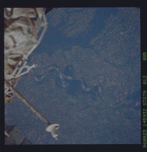
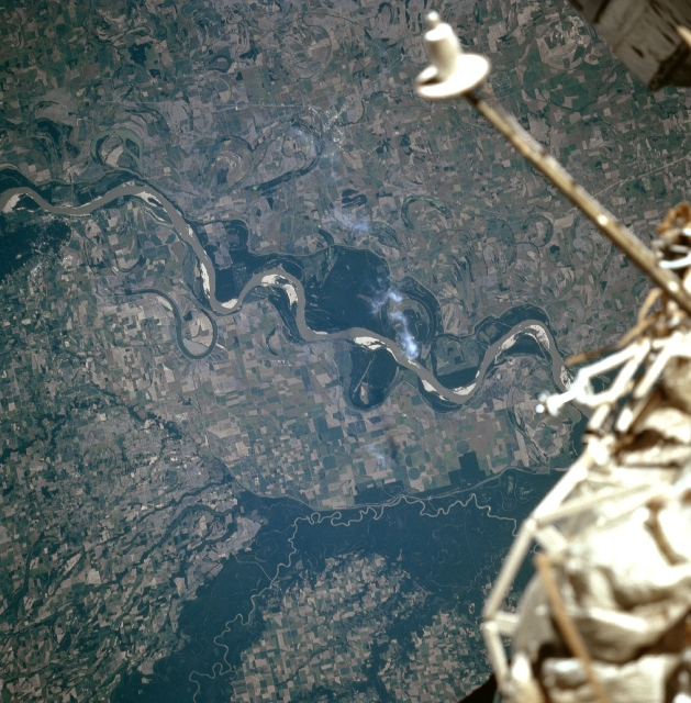
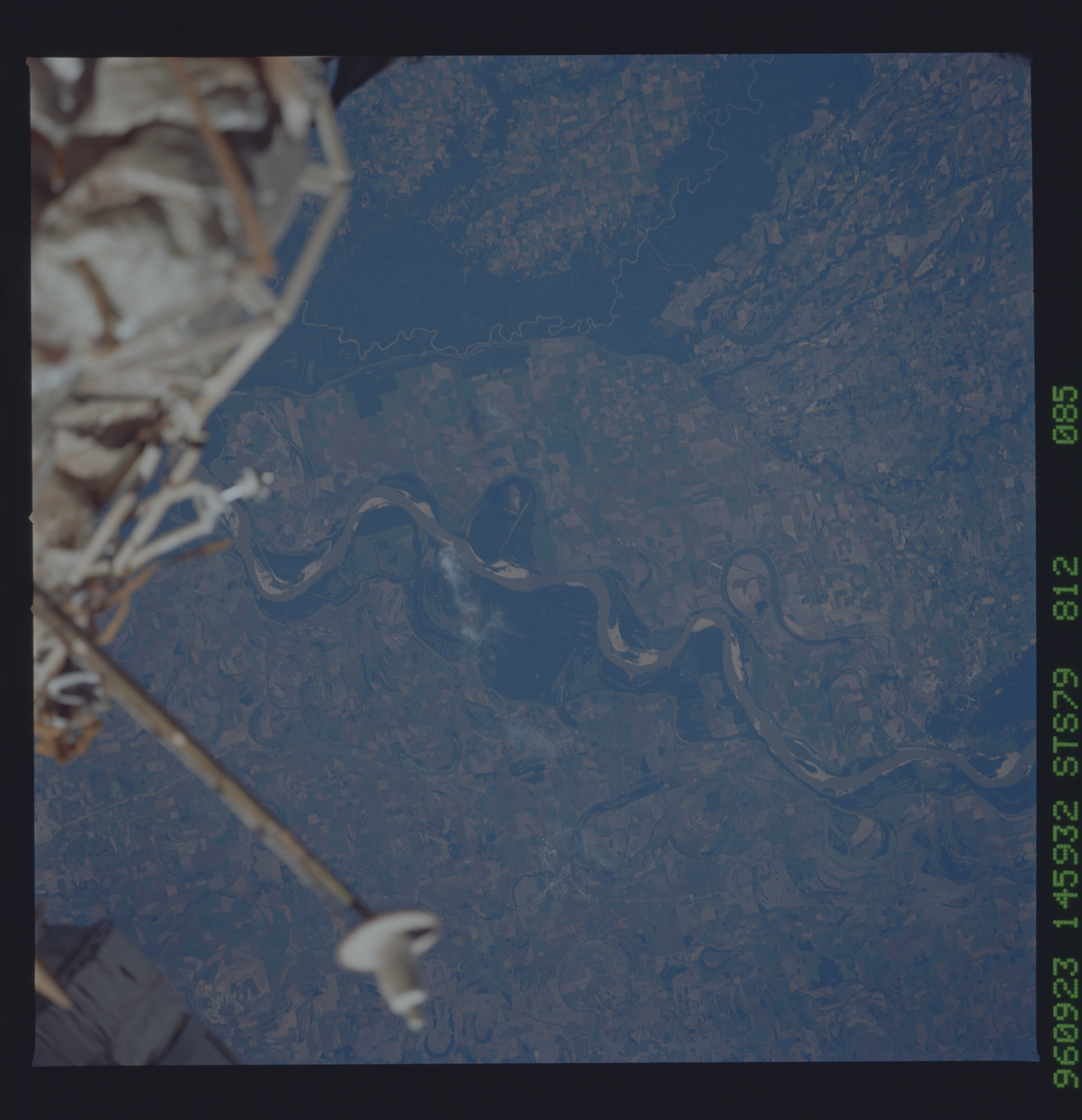
Image Caption: STS079-812-085 Mississippi and White Rivers, Arkansas September 1996
The Mississippi River is the largest river system in the United States draining nearly one-third of the country. Only the Nile River of Africa and the Amazon River of South America drain larger areas. Rich agricultural lands, created by thousands of years of river flooding and meandering, are visible on both sides of the river. Midway between the center and right center of the image, the small city of Clarksdale, Mississippi is discernible. Clarksdale is a processing and distribution center in a rich cotton producing area. To the west (left) of the Mississippi River, the meandering White River in Arkansas is visible. The river is forested on both sides and these forested lands have been set-aside as a National Wildlife Refuge area. The area outside the refuge is agricultural and is easily distinguished from the refuge. The White River, 690 miles (1110 km) long, rises in the Boston Mountains of northwestern Arkansas, and is navigable for shallow-draft vessels 300 miles (480 km) upstream from where the river enters the Mississippi River.
The Mississippi River is the largest river system in the United States draining nearly one-third of the country. Only the Nile River of Africa and the Amazon River of South America drain larger areas. Rich agricultural lands, created by thousands of years of river flooding and meandering, are visible on both sides of the river. Midway between the center and right center of the image, the small city of Clarksdale, Mississippi is discernible. Clarksdale is a processing and distribution center in a rich cotton producing area. To the west (left) of the Mississippi River, the meandering White River in Arkansas is visible. The river is forested on both sides and these forested lands have been set-aside as a National Wildlife Refuge area. The area outside the refuge is agricultural and is easily distinguished from the refuge. The White River, 690 miles (1110 km) long, rises in the Boston Mountains of northwestern Arkansas, and is navigable for shallow-draft vessels 300 miles (480 km) upstream from where the river enters the Mississippi River.
