STS079-811-19
| NASA Photo ID | STS079-811-19 |
| Focal Length | 40mm |
| Date taken | 1996.09.23 |
| Time taken | 14:54:49 GMT |
Resolutions offered for this image:
4073 x 4096 pixels 636 x 640 pixels 5700 x 5900 pixels 483 x 500 pixels 508 x 519 pixels 479 x 480 pixels
4073 x 4096 pixels 636 x 640 pixels 5700 x 5900 pixels 483 x 500 pixels 508 x 519 pixels 479 x 480 pixels


Cloud masks available for this image:
Spacecraft nadir point: 44.2° N, 108.3° W
Photo center point: 44.0° N, 109.5° W
Photo center point by machine learning:
Photo center point: 44.0° N, 109.5° W
Photo center point by machine learning:
Nadir to Photo Center: West
Spacecraft Altitude: 202 nautical miles (374km)
Country or Geographic Name: | USA-WYOMING |
Features: | YELLOWSTONE LAKE, MTS. |
| Features Found Using Machine Learning: | |
Cloud Cover Percentage: | 10 (1-10)% |
Sun Elevation Angle: | 19° |
Sun Azimuth: | 110° |
Camera: | Hasselblad |
Focal Length: | 40mm |
Camera Tilt: | 20 degrees |
Format: | 5046: Kodak, natural color positive, Lumiere 100/5046, ASA 100, standard base |
Film Exposure: | Normal |
| Additional Information | |
| Width | Height | Annotated | Cropped | Purpose | Links |
|---|---|---|---|---|---|
| 4073 pixels | 4096 pixels | No | No | Earth From Space collection | Download Image |
| 636 pixels | 640 pixels | No | No | Earth From Space collection | Download Image |
| 5700 pixels | 5900 pixels | No | No | Download Image | |
| 483 pixels | 500 pixels | No | No | Download Image | |
| 508 pixels | 519 pixels | No | No | Download Image | |
| 479 pixels | 480 pixels | Download Image |
Download Packaged File
Download a Google Earth KML for this Image
View photo footprint information
Download a GeoTIFF for this photo
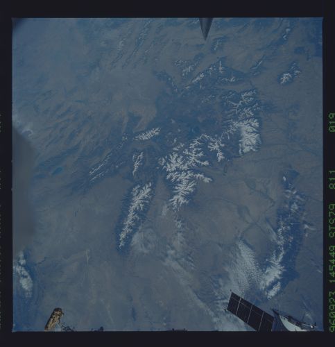
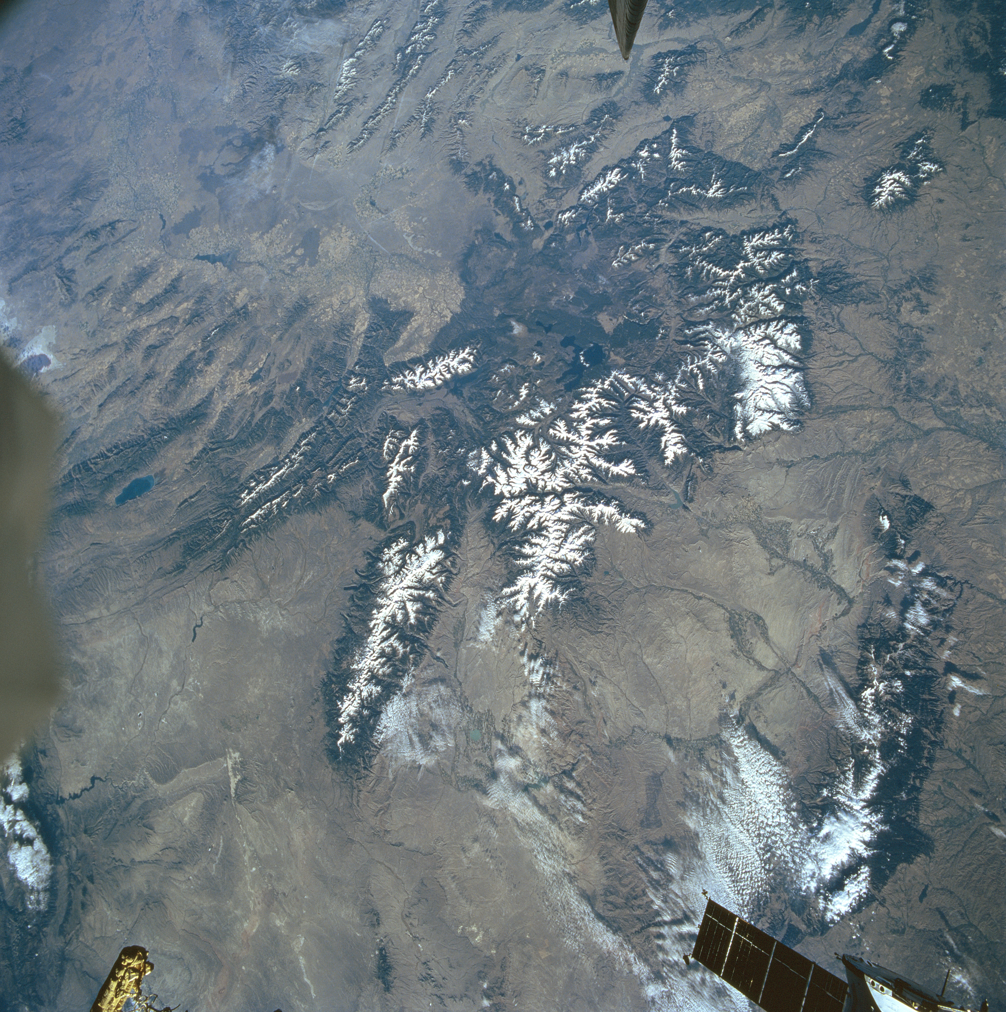
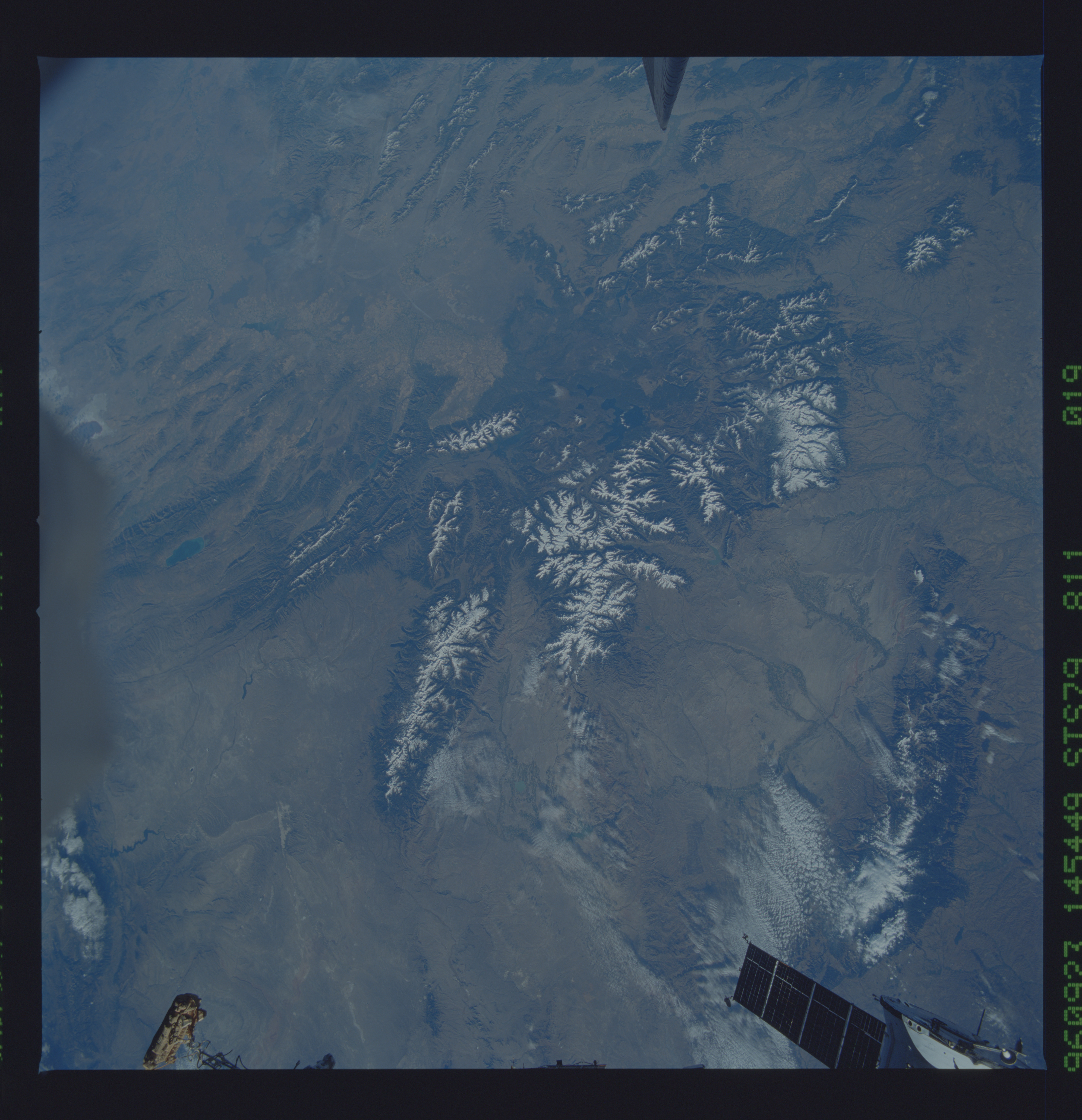
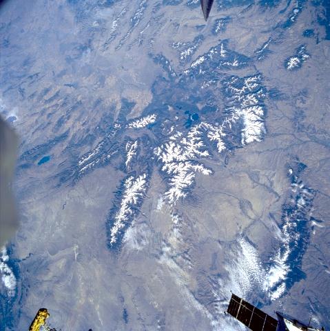
Image Caption: STS079-811-019 Yellowstone Area, Wyoming September, 1996
The Yellowstone area, one of the most geologically unique regions in the world, can be seen in this synoptic generally west-looking low-oblique view. The majority of the area is located atop a geothermal "hotspot" in the mantle of the earth, a geologic layer just below the earth's crust. This concentrated hotspot under the earth provides the heat necessary to drive the incredible hydrothermal features and volcanic activity. The world's greatest concentration of geysers and hot springs are situated here in the Yellowstone area. A large caldera, which is caused by a collapsed volcano, exists in the southern portion of Yellowstone and is the remnant of a major volcanic eruption that occurred about 1.2 million years ago. Yellowstone Lake, (small and very dark blue) just to the right and slightly above the center of the image, is the largest high mountain lake in North America and fills part of the huge caldera. Other features visible in this view include the Grand Tetons and Jackson Hole (to the left of Yellowstone Lake); the Absaroka Range (to the east or right of Yellowstone Lake); and the Wind River Range (extending southeastward or below the Grand Tetons and Jackson Hole). The Bighorn Mountains of north central Wyoming are discernible in the lower right portion of the image. Between the Bighorn Mountains and the Yellowstone area is the Bighorn Basin. Near the bottom center of the image is the Great Divide Basin. In the bottom left portion of the image are the Uinta Mountains of northern Utah. Bear Lake and the northern Wasatch Range are visible near the left center of the image. Just to the west of the Wasatch Range, the northern portion of the Great Salt Lake is discernible. Extending westward from the Yellowstone area toward the upper left of the image is the Snake River Plain of eastern Idaho.
The Yellowstone area, one of the most geologically unique regions in the world, can be seen in this synoptic generally west-looking low-oblique view. The majority of the area is located atop a geothermal "hotspot" in the mantle of the earth, a geologic layer just below the earth's crust. This concentrated hotspot under the earth provides the heat necessary to drive the incredible hydrothermal features and volcanic activity. The world's greatest concentration of geysers and hot springs are situated here in the Yellowstone area. A large caldera, which is caused by a collapsed volcano, exists in the southern portion of Yellowstone and is the remnant of a major volcanic eruption that occurred about 1.2 million years ago. Yellowstone Lake, (small and very dark blue) just to the right and slightly above the center of the image, is the largest high mountain lake in North America and fills part of the huge caldera. Other features visible in this view include the Grand Tetons and Jackson Hole (to the left of Yellowstone Lake); the Absaroka Range (to the east or right of Yellowstone Lake); and the Wind River Range (extending southeastward or below the Grand Tetons and Jackson Hole). The Bighorn Mountains of north central Wyoming are discernible in the lower right portion of the image. Between the Bighorn Mountains and the Yellowstone area is the Bighorn Basin. Near the bottom center of the image is the Great Divide Basin. In the bottom left portion of the image are the Uinta Mountains of northern Utah. Bear Lake and the northern Wasatch Range are visible near the left center of the image. Just to the west of the Wasatch Range, the northern portion of the Great Salt Lake is discernible. Extending westward from the Yellowstone area toward the upper left of the image is the Snake River Plain of eastern Idaho.
