STS079-810-48
| NASA Photo ID | STS079-810-48 |
| Focal Length | 250mm |
| Date taken | 1996.09.24 |
| Time taken | 06:20:31 GMT |
Resolutions offered for this image:
3987 x 3992 pixels 639 x 639 pixels 5700 x 5900 pixels 483 x 500 pixels 652 x 640 pixels
3987 x 3992 pixels 639 x 639 pixels 5700 x 5900 pixels 483 x 500 pixels 652 x 640 pixels


Cloud masks available for this image:
Spacecraft nadir point: 34.0° N, 34.2° E
Photo center point: 31.5° N, 35.0° E
Photo center point by machine learning:
Photo center point: 31.5° N, 35.0° E
Photo center point by machine learning:
Nadir to Photo Center: South
Spacecraft Altitude: 201 nautical miles (372km)
Country or Geographic Name: | ISRAEL |
Features: | TEL AVIV, GAZA STRIP |
| Features Found Using Machine Learning: | |
Cloud Cover Percentage: | 0 (no clouds present) |
Sun Elevation Angle: | 33° |
Sun Azimuth: | 117° |
Camera: | Hasselblad |
Focal Length: | 250mm |
Camera Tilt: | 38 degrees |
Format: | 5046: Kodak, natural color positive, Lumiere 100/5046, ASA 100, standard base |
Film Exposure: | Normal |
| Additional Information | |
| Width | Height | Annotated | Cropped | Purpose | Links |
|---|---|---|---|---|---|
| 3987 pixels | 3992 pixels | No | No | Earth From Space collection | Download Image |
| 639 pixels | 639 pixels | No | No | Earth From Space collection | Download Image |
| 5700 pixels | 5900 pixels | No | No | Download Image | |
| 483 pixels | 500 pixels | No | No | Download Image | |
| 652 pixels | 640 pixels | No | No | Download Image |
Download Packaged File
Download a Google Earth KML for this Image
View photo footprint information
Download a GeoTIFF for this photo
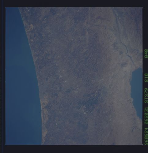
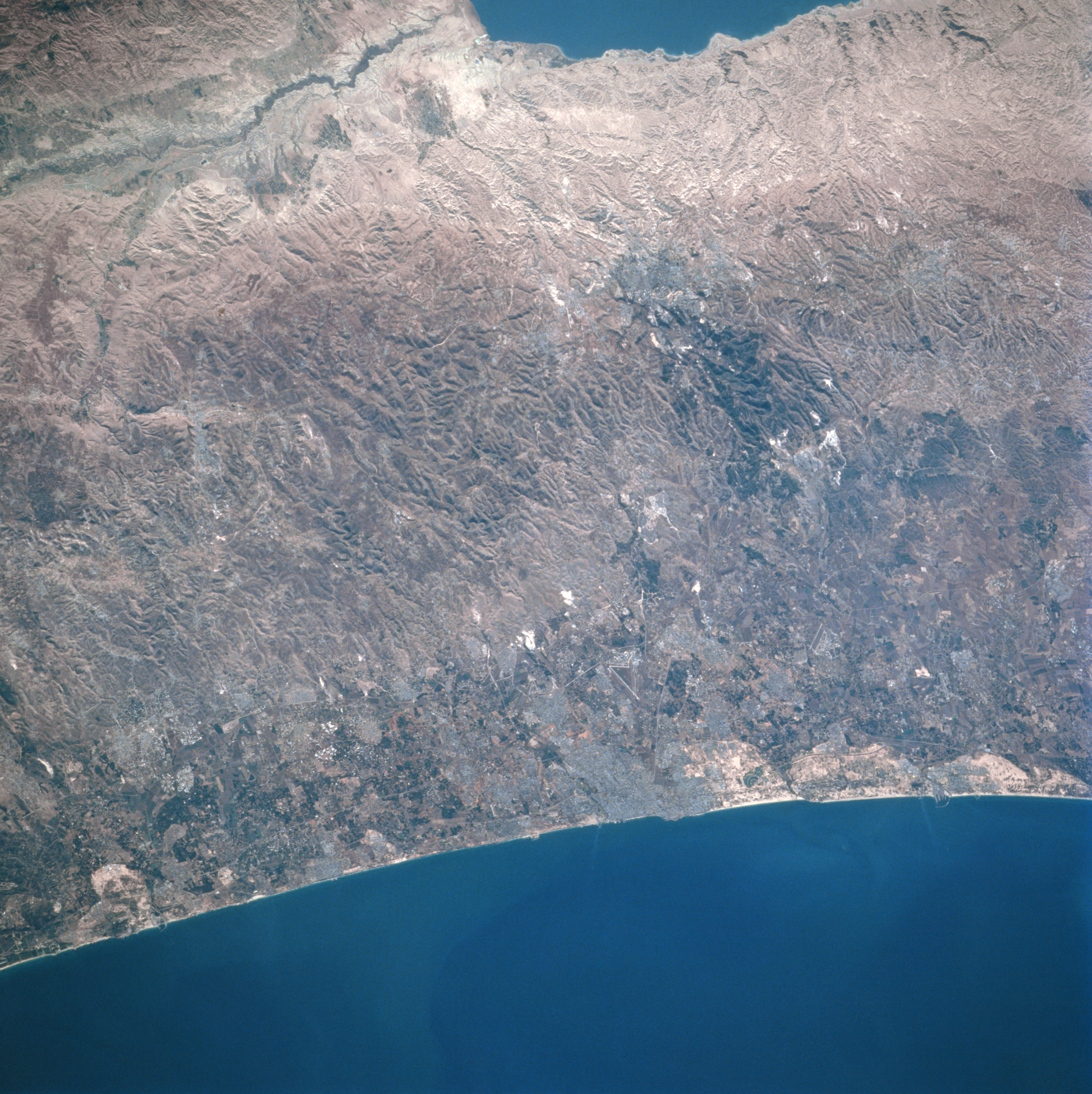
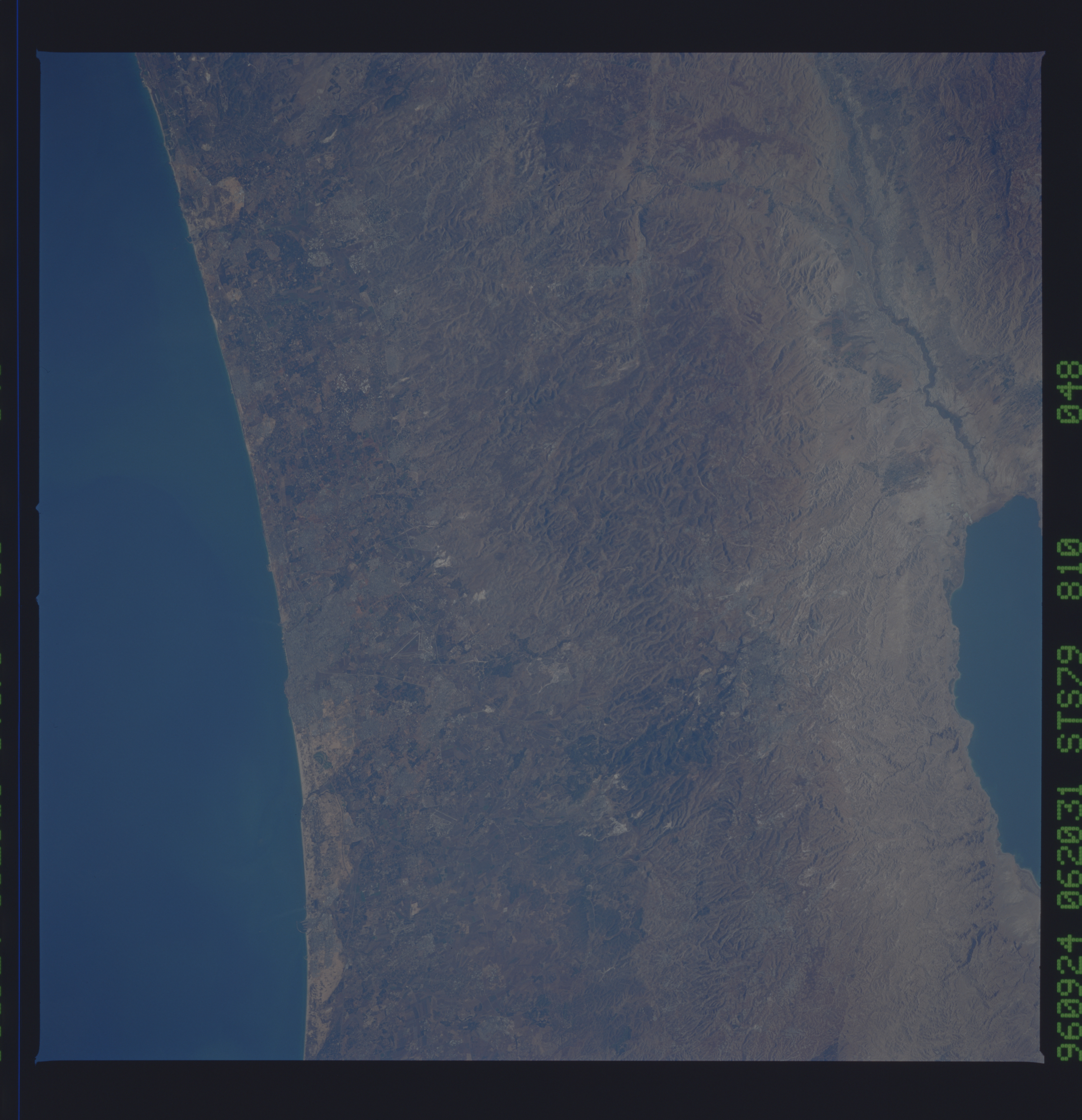
Image Caption: STS079-810-048 Central Highland Region, Tel Aviv, Israel September 1996
Situated on the narrow, but fertile coastal plain, the largest city of Israel, Tel Aviv, is located midway between the center and bottom center of the image in this east-looking view. Tel Aviv is the major commercial, financial, communications, industrial, and cultural center in Israel. Construction, textiles, clothing, pharmaceuticals, electrical and electronic appliances, and printed materials are the main industries. The city is also a popular tourist resort with wide, attractive beaches. Just to the east of Tel Aviv are the Central Highlands, an area of hills and several small valleys. In the upper left and upper center of the image, a portion of the Jordan River Rift Valley and the Dead Sea are visible.
Situated on the narrow, but fertile coastal plain, the largest city of Israel, Tel Aviv, is located midway between the center and bottom center of the image in this east-looking view. Tel Aviv is the major commercial, financial, communications, industrial, and cultural center in Israel. Construction, textiles, clothing, pharmaceuticals, electrical and electronic appliances, and printed materials are the main industries. The city is also a popular tourist resort with wide, attractive beaches. Just to the east of Tel Aviv are the Central Highlands, an area of hills and several small valleys. In the upper left and upper center of the image, a portion of the Jordan River Rift Valley and the Dead Sea are visible.
