STS079-809-54

| NASA Photo ID | STS079-809-54 |
| Focal Length | 250mm |
| Date taken | 1996.09.24 |
| Time taken | 14:02:29 GMT |
Resolutions offered for this image:
4061 x 4091 pixels 635 x 640 pixels 5700 x 5900 pixels 483 x 500 pixels 509 x 524 pixels 478 x 480 pixels
4061 x 4091 pixels 635 x 640 pixels 5700 x 5900 pixels 483 x 500 pixels 509 x 524 pixels 478 x 480 pixels


Cloud masks available for this image:
Spacecraft nadir point: 30.4° N, 78.6° W
Photo center point: 30.5° N, 81.0° W
Photo center point by machine learning:
Photo center point: 30.5° N, 81.0° W
Photo center point by machine learning:
Nadir to Photo Center: West
Spacecraft Altitude: 201 nautical miles (372km)
Country or Geographic Name: | USA-FLORIDA |
Features: | JACKSONVILLE, ST. JOHNS RIVER |
| Features Found Using Machine Learning: | |
Cloud Cover Percentage: | 0 (no clouds present) |
Sun Elevation Angle: | 36° |
Sun Azimuth: | 117° |
Camera: | Hasselblad |
Focal Length: | 250mm |
Camera Tilt: | 36 degrees |
Format: | 5046: Kodak, natural color positive, Lumiere 100/5046, ASA 100, standard base |
Film Exposure: | Normal |
| Additional Information | |
| Width | Height | Annotated | Cropped | Purpose | Links |
|---|---|---|---|---|---|
| 4061 pixels | 4091 pixels | No | No | Earth From Space collection | Download Image |
| 635 pixels | 640 pixels | No | No | Earth From Space collection | Download Image |
| 5700 pixels | 5900 pixels | No | No | Download Image | |
| 483 pixels | 500 pixels | No | No | Download Image | |
| 509 pixels | 524 pixels | No | No | Download Image | |
| 478 pixels | 480 pixels | Download Image |
Download Packaged File
Download a Google Earth KML for this Image
View photo footprint information
Download a GeoTIFF for this photo
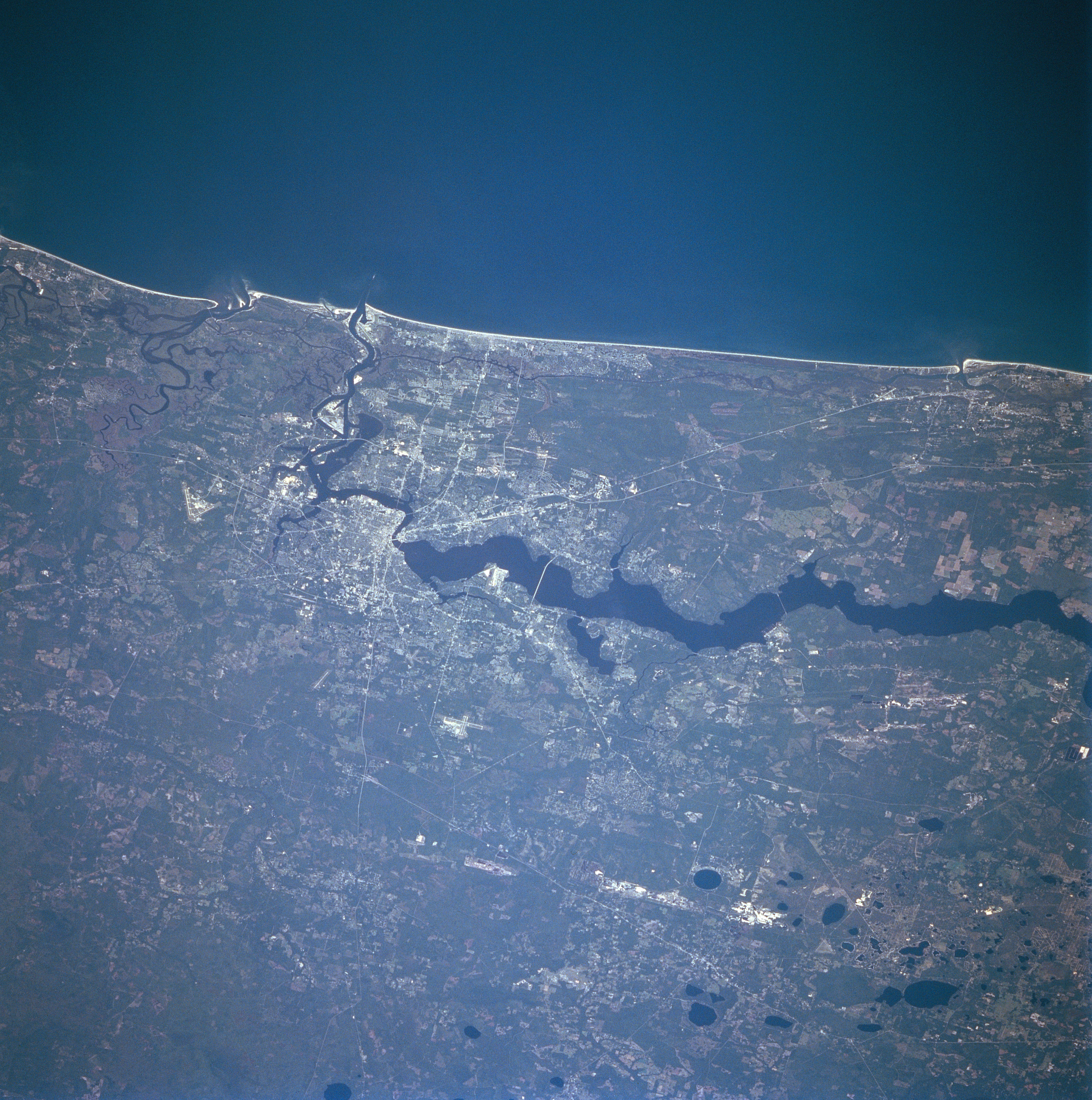
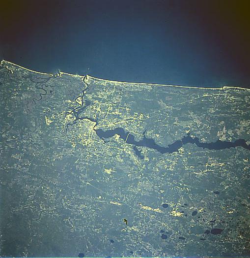
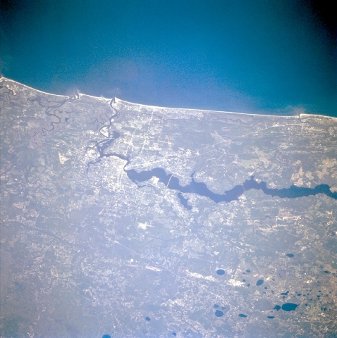
Image Caption: STS079-809-054 Jacksonville, Florida, USA September 1996
The physical setting of the largest city in northeast Florida, Jacksonville, is captured in this synoptic, northeast-looking view. The north flowing St. Johns River is the broad, dark feature south of the city. Notice how the river narrows and changes direction as it enters the downtown area of Jacksonville; in fact the St. Johns River makes several major direction changes before the river turns east and finally empties into the Atlantic Ocean. The blue water of the Atlantic Ocean contrasts with the narrow band of white sandy beaches that are found along the entire northeast coast of Florida. The oval shaped (dark features) are lakes (sink holes) that have been formed by the interaction of rain water and the limestone rocks (karst topography) that are found throughout most of the central section of the peninsula of Florida. Two major highways, U.S. 301 (interior) and U. S. 1 (near the coast) are visible as very straight, light colored, linear features. Runways of Jacksonville International Airport (north of city), Cecil Field Naval Air Station (southwest of city), and Jacksonville Naval Air Station (south of city along west coast of St. Johns River) can be discriminated. Most of landscape is heavily vegetated coastal plains.
The physical setting of the largest city in northeast Florida, Jacksonville, is captured in this synoptic, northeast-looking view. The north flowing St. Johns River is the broad, dark feature south of the city. Notice how the river narrows and changes direction as it enters the downtown area of Jacksonville; in fact the St. Johns River makes several major direction changes before the river turns east and finally empties into the Atlantic Ocean. The blue water of the Atlantic Ocean contrasts with the narrow band of white sandy beaches that are found along the entire northeast coast of Florida. The oval shaped (dark features) are lakes (sink holes) that have been formed by the interaction of rain water and the limestone rocks (karst topography) that are found throughout most of the central section of the peninsula of Florida. Two major highways, U.S. 301 (interior) and U. S. 1 (near the coast) are visible as very straight, light colored, linear features. Runways of Jacksonville International Airport (north of city), Cecil Field Naval Air Station (southwest of city), and Jacksonville Naval Air Station (south of city along west coast of St. Johns River) can be discriminated. Most of landscape is heavily vegetated coastal plains.
