STS079-809-28
| NASA Photo ID | STS079-809-28 |
| Focal Length | 250mm |
| Date taken | 1996.09.24 |
| Time taken | 12:25:38 GMT |
Resolutions offered for this image:
5700 x 5900 pixels 6726 x 6872 pixels 483 x 500 pixels 751 x 768 pixels
5700 x 5900 pixels 6726 x 6872 pixels 483 x 500 pixels 751 x 768 pixels

Cloud masks available for this image:
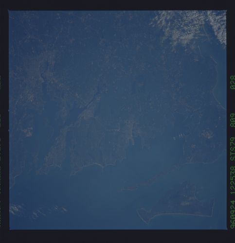
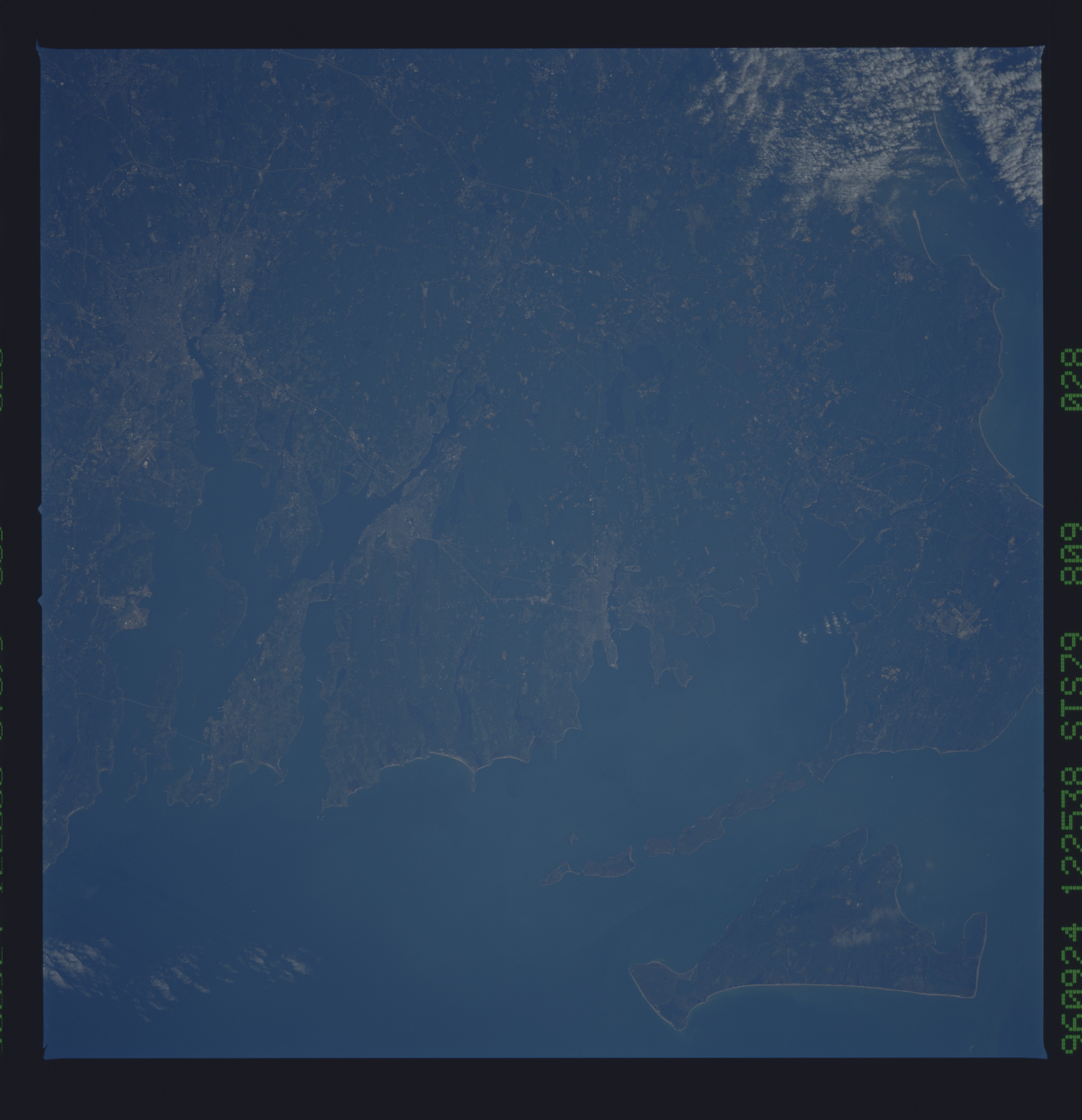
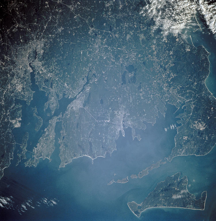
Spacecraft nadir point: 42.2° N, 72.0° W
Photo center point: 41.5° N, 71.0° W
Photo center point by machine learning:
Photo center point: 41.5° N, 71.0° W
Photo center point by machine learning:
Nadir to Photo Center: Southeast
Spacecraft Altitude: 201 nautical miles (372km)
Country or Geographic Name: | USA-RHODE ISLAND |
Features: | PROVIDENCE, NEW BEDFORD |
| Features Found Using Machine Learning: | |
Cloud Cover Percentage: | 5 (1-10)% |
Sun Elevation Angle: | 19° |
Sun Azimuth: | 109° |
Camera: | Hasselblad |
Focal Length: | 250mm |
Camera Tilt: | 20 degrees |
Format: | 5046: Kodak, natural color positive, Lumiere 100/5046, ASA 100, standard base |
Film Exposure: | Normal |
| Additional Information | |
| Width | Height | Annotated | Cropped | Purpose | Links |
|---|---|---|---|---|---|
| 5700 pixels | 5900 pixels | No | No | Download Image | |
| 6726 pixels | 6872 pixels | No | No | Scientist Request | Download Image |
| 483 pixels | 500 pixels | No | No | Download Image | |
| 751 pixels | 768 pixels | No | Yes | Scientist Request | Download Image |
Download Packaged File
Download a Google Earth KML for this Image
View photo footprint information
Download a GeoTIFF for this photo
Image Caption: none
