STS079-785-16

| NASA Photo ID | STS079-785-16 |
| Focal Length | 100mm |
| Date taken | 1996.09.24 |
| Time taken | 15:50:15 GMT |
Resolutions offered for this image:
4055 x 4055 pixels 639 x 639 pixels 5700 x 5900 pixels 483 x 500 pixels
4055 x 4055 pixels 639 x 639 pixels 5700 x 5900 pixels 483 x 500 pixels

Cloud masks available for this image:
Spacecraft nadir point: 16.8° S, 64.8° W
Photo center point: 20.0° S, 68.0° W
Photo center point by machine learning:
Photo center point: 20.0° S, 68.0° W
Photo center point by machine learning:
Nadir to Photo Center: Southwest
Spacecraft Altitude: 203 nautical miles (376km)
Country or Geographic Name: | BOLIVIA |
Features: | PAN-SALAR DE UYUNI, COAST |
| Features Found Using Machine Learning: | |
Cloud Cover Percentage: | 5 (1-10)% |
Sun Elevation Angle: | 73° |
Sun Azimuth: | 18° |
Camera: | Hasselblad |
Focal Length: | 100mm |
Camera Tilt: | High Oblique |
Format: | 5046: Kodak, natural color positive, Lumiere 100/5046, ASA 100, standard base |
Film Exposure: | Normal |
| Additional Information | |
| Width | Height | Annotated | Cropped | Purpose | Links |
|---|---|---|---|---|---|
| 4055 pixels | 4055 pixels | No | No | Earth From Space collection | Download Image |
| 639 pixels | 639 pixels | No | No | Earth From Space collection | Download Image |
| 5700 pixels | 5900 pixels | No | No | Download Image | |
| 483 pixels | 500 pixels | No | No | Download Image |
Download Packaged File
Download a Google Earth KML for this Image
View photo footprint information
Download a GeoTIFF for this photo
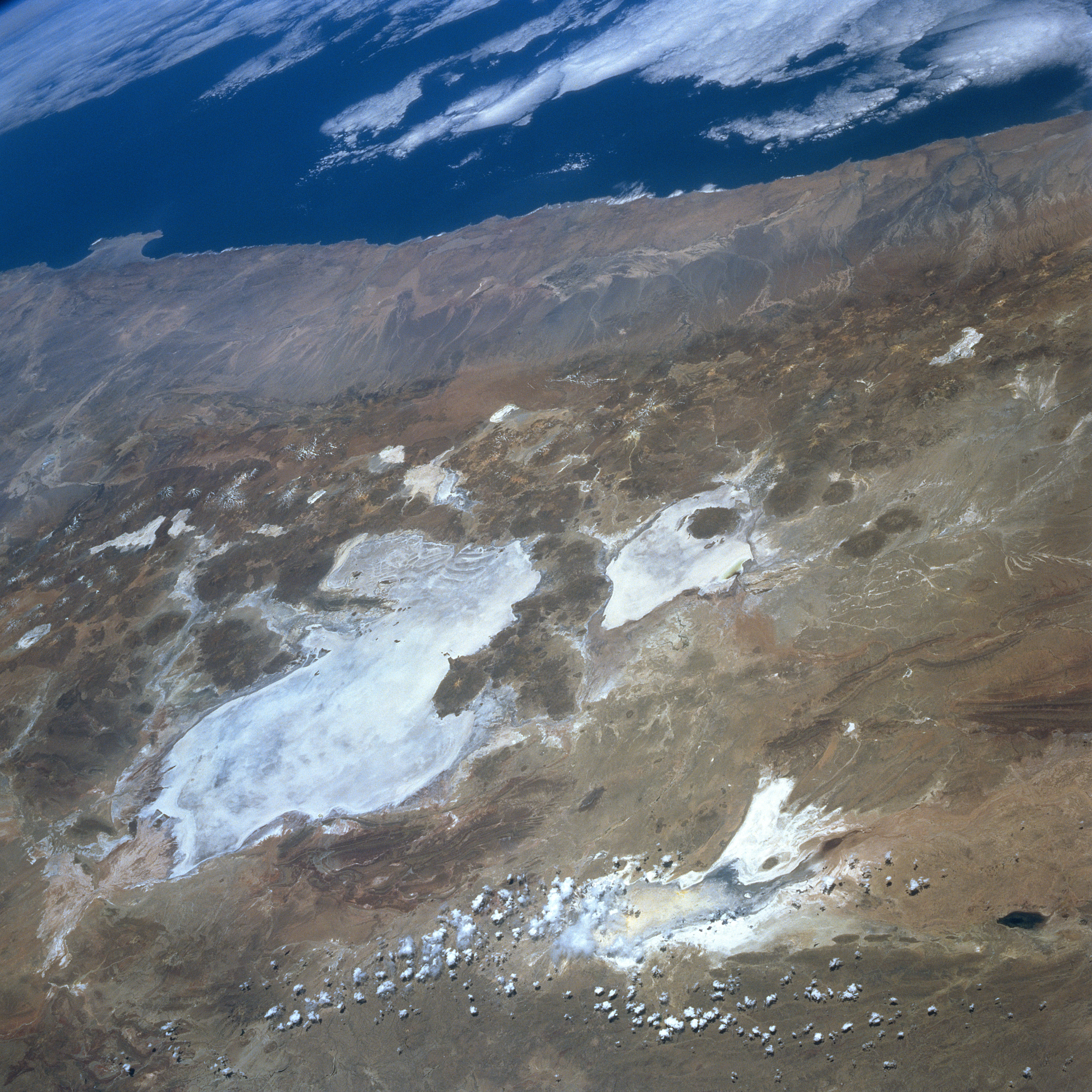
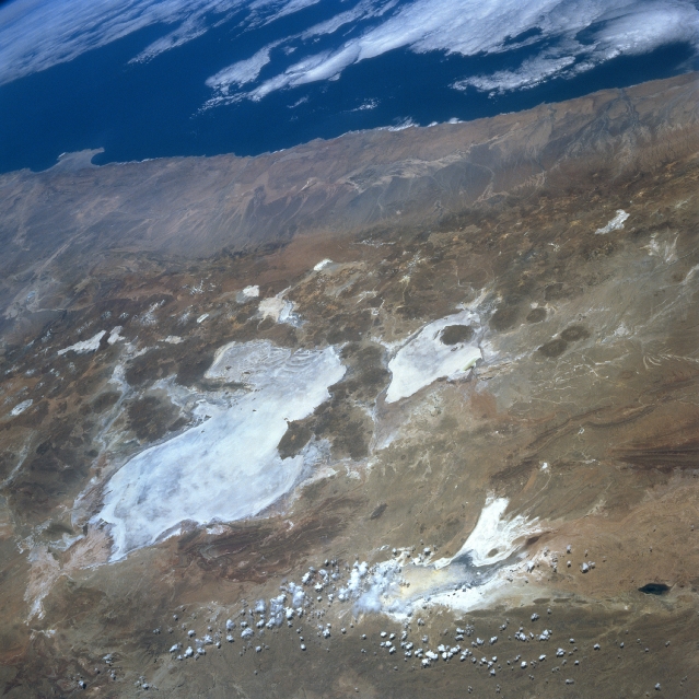
Image Caption: STS079-785-016 Lake Poopo, Salar de Uyuni, Bolivia September 1996
Numerous bright salars or salt flats are visible in this westerly view of the southwestern part of the Altiplano in Bolivia. Many volcanic cones (darker, roughly circular features) are visible, mainly along the western flanks of the two large salars, Uyuni (largest) and Coipasa. Lake Poopo, a light colored feature northeast of the two large salars, appears to be relatively devoid of standing water at the time this image was obtained. Some clouds partially obscure the southern end of intermittently water filled Lake Poopo. The Andes Mountains dramatically decrease in elevation in a relatively short horizontal distance along the western slopes of the mountains. Known as the Atacama Desert of northern Chile, this synoptic view shows a large section of one of the most arid regions on earth.
Numerous bright salars or salt flats are visible in this westerly view of the southwestern part of the Altiplano in Bolivia. Many volcanic cones (darker, roughly circular features) are visible, mainly along the western flanks of the two large salars, Uyuni (largest) and Coipasa. Lake Poopo, a light colored feature northeast of the two large salars, appears to be relatively devoid of standing water at the time this image was obtained. Some clouds partially obscure the southern end of intermittently water filled Lake Poopo. The Andes Mountains dramatically decrease in elevation in a relatively short horizontal distance along the western slopes of the mountains. Known as the Atacama Desert of northern Chile, this synoptic view shows a large section of one of the most arid regions on earth.
