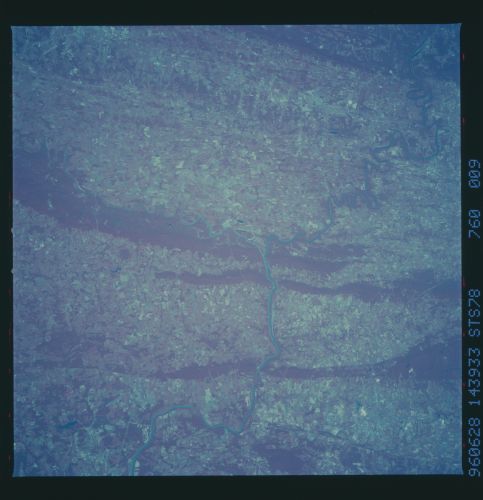
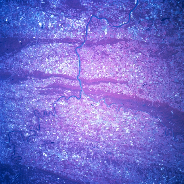
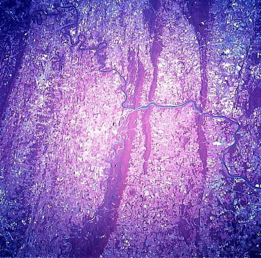
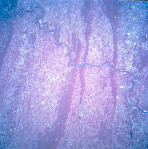
STS078-760-9
| NASA Photo ID | STS078-760-9 |
| Focal Length | 250mm |
| Date taken | 1996.06.28 |
| Time taken | 14:39:33 GMT |
Resolutions offered for this image:
4049 x 4049 pixels 640 x 640 pixels 5700 x 5900 pixels 483 x 500 pixels 512 x 505 pixels 474 x 479 pixels
4049 x 4049 pixels 640 x 640 pixels 5700 x 5900 pixels 483 x 500 pixels 512 x 505 pixels 474 x 479 pixels


Cloud masks available for this image:
Spacecraft nadir point: 38.4° N, 77.4° W
Photo center point: 39.5° N, 77.5° W
Photo center point by machine learning:
Photo center point: 39.5° N, 77.5° W
Photo center point by machine learning:
Nadir to Photo Center: North
Spacecraft Altitude: 143 nautical miles (265km)
Country or Geographic Name: | USA-MARYLAND |
Features: | POTOMAC RIVER, FREDERICK |
| Features Found Using Machine Learning: | |
Cloud Cover Percentage: | 0 (no clouds present) |
Sun Elevation Angle: | 54° |
Sun Azimuth: | 103° |
Camera: | Hasselblad |
Focal Length: | 250mm |
Camera Tilt: | 25 degrees |
Format: | 2443: Kodak Aerochrome 2443, color IR, thin base, EA-5 process thru June 1999, E-6 process afterward |
Film Exposure: | Normal |
| Additional Information | |
| Width | Height | Annotated | Cropped | Purpose | Links |
|---|---|---|---|---|---|
| 4049 pixels | 4049 pixels | No | No | Earth From Space collection | Download Image |
| 640 pixels | 640 pixels | No | No | Earth From Space collection | Download Image |
| 5700 pixels | 5900 pixels | No | No | Download Image | |
| 483 pixels | 500 pixels | No | No | Download Image | |
| 512 pixels | 505 pixels | No | No | Download Image | |
| 474 pixels | 479 pixels | Download Image |
Download Packaged File
Download a Google Earth KML for this Image
View photo footprint information
Download a GeoTIFF for this photo
Image Caption: STS078-760-009 Potomac River, Virginia, USA June 1996 The junction of the borders of three states (Virginia, West Virginia, and Maryland) is located near the center of this color infrared picture. At this junction the smaller, northeasterly flowing Shenandoah River merges with the larger, southeasterly flowing Potomac River. The color infrared image (green vegetation portrayed as shades of red) helps to identify the forested and widely spaced, parallel mountain ridges (northeast-southwest trending) of the Appalachian Mountains.
