STS078-758-96
| NASA Photo ID | STS078-758-96 |
| Focal Length | 250mm |
| Date taken | 1996.06.28 |
| Time taken | 14:37:11 GMT |
Resolutions offered for this image:
4042 x 4042 pixels 640 x 640 pixels 5700 x 5900 pixels 483 x 500 pixels 513 x 508 pixels 480 x 478 pixels
4042 x 4042 pixels 640 x 640 pixels 5700 x 5900 pixels 483 x 500 pixels 513 x 508 pixels 480 x 478 pixels

Cloud masks available for this image:
Spacecraft nadir point: 39.2° N, 88.5° W
Photo center point: 39.5° N, 88.0° W
Photo center point by machine learning:
Photo center point: 39.5° N, 88.0° W
Photo center point by machine learning:
Nadir to Photo Center: Northeast
Spacecraft Altitude: 142 nautical miles (263km)
Country or Geographic Name: | USA-ILLINOIS |
Features: | DECATUR, LAKE SHELBYVILLE |
| Features Found Using Machine Learning: | |
Cloud Cover Percentage: | 0 (no clouds present) |
Sun Elevation Angle: | 45° |
Sun Azimuth: | 95° |
Camera: | Hasselblad |
Focal Length: | 250mm |
Camera Tilt: | 14 degrees |
Format: | 2443: Kodak Aerochrome 2443, color IR, thin base, EA-5 process thru June 1999, E-6 process afterward |
Film Exposure: | Normal |
| Additional Information | |
| Width | Height | Annotated | Cropped | Purpose | Links |
|---|---|---|---|---|---|
| 4042 pixels | 4042 pixels | No | No | Earth From Space collection | Download Image |
| 640 pixels | 640 pixels | No | No | Earth From Space collection | Download Image |
| 5700 pixels | 5900 pixels | No | No | Download Image | |
| 483 pixels | 500 pixels | No | No | Download Image | |
| 513 pixels | 508 pixels | No | No | Download Image | |
| 480 pixels | 478 pixels | Download Image |
Download Packaged File
Download a Google Earth KML for this Image
View photo footprint information
Download a GeoTIFF for this photo
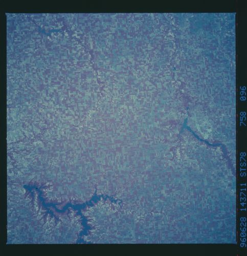
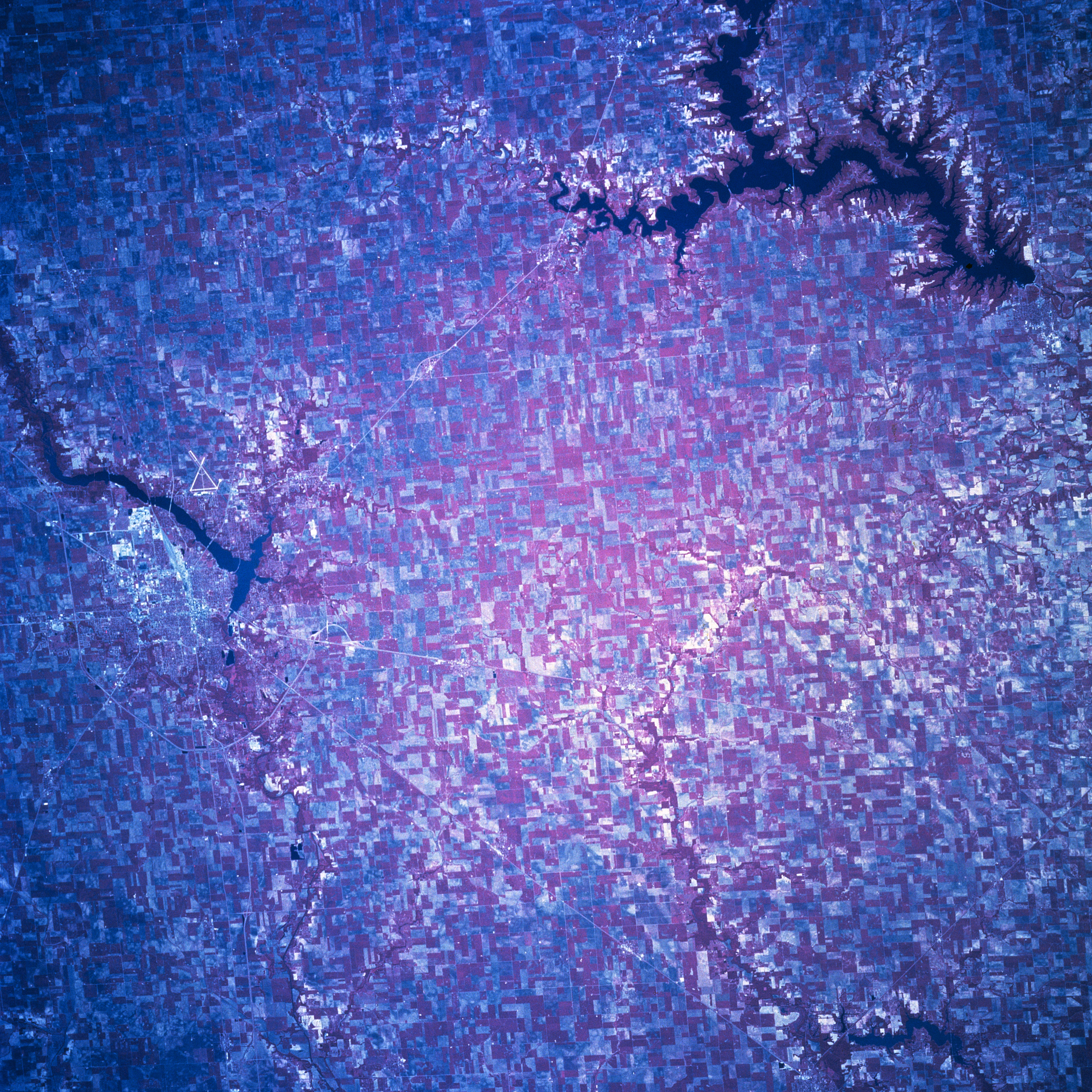
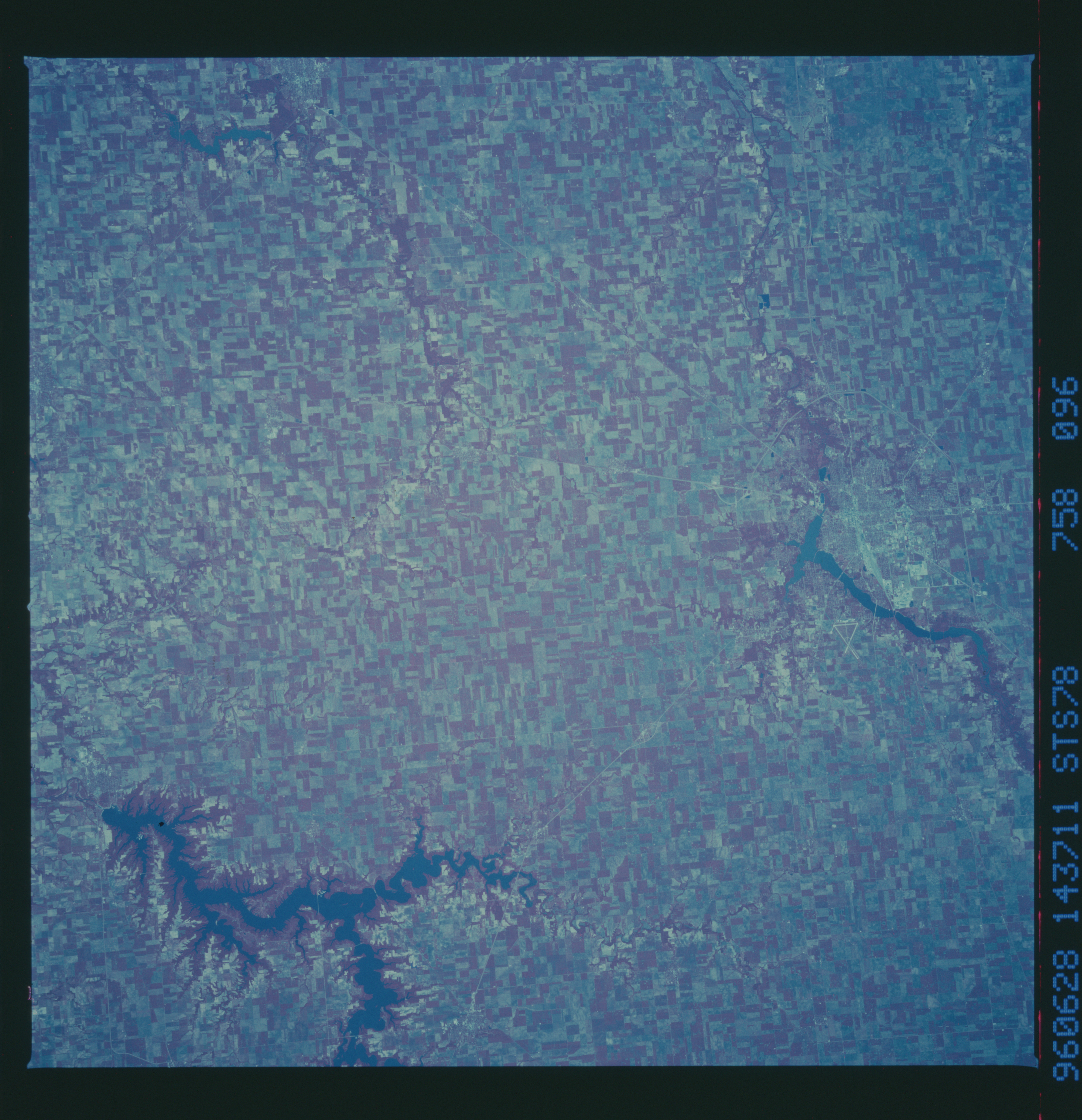
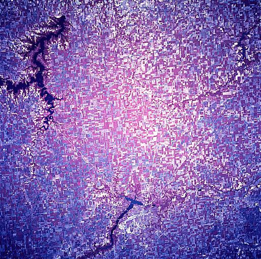
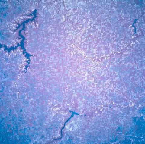
Image Caption: STS078-758-096 Lake Shelbyville, Illinois, USA June 1996
The plains of central Illinois, which is part of the great Corn Belt, are covered by an abundance of cultivated fields (represented by different shades of reds, grays, and lighter colors in this color infrared image) covering the entire view. The large, dark serpentine-shaped feature along the southeast corner of the picture is Lake Shelbyville. Lake Decatur is another sizable, elongated (dark) feature along the northern edge of the image. The much smaller dark feature in the southwest corner of the scene is Lake Taylorville. The urban, built up area of Decatur is visible immediately west of Lake Decatur and the intersecting runways of Decatur Municipal Airport are located east of the lake. Most of Interstate Highway 72 (thin, light line) is visible as it skirts around the north and west side of Decatur. Several state and U. S. highways are also visible as they radiate outward from the southern limits of Decatur.
The plains of central Illinois, which is part of the great Corn Belt, are covered by an abundance of cultivated fields (represented by different shades of reds, grays, and lighter colors in this color infrared image) covering the entire view. The large, dark serpentine-shaped feature along the southeast corner of the picture is Lake Shelbyville. Lake Decatur is another sizable, elongated (dark) feature along the northern edge of the image. The much smaller dark feature in the southwest corner of the scene is Lake Taylorville. The urban, built up area of Decatur is visible immediately west of Lake Decatur and the intersecting runways of Decatur Municipal Airport are located east of the lake. Most of Interstate Highway 72 (thin, light line) is visible as it skirts around the north and west side of Decatur. Several state and U. S. highways are also visible as they radiate outward from the southern limits of Decatur.
