STS078-758-94

| NASA Photo ID | STS078-758-94 |
| Focal Length | 250mm |
| Date taken | 1996.06.28 |
| Time taken | 14:37:02 GMT |
Resolutions offered for this image:
4096 x 4096 pixels 640 x 640 pixels 5700 x 5900 pixels 483 x 500 pixels 512 x 508 pixels 479 x 479 pixels
4096 x 4096 pixels 640 x 640 pixels 5700 x 5900 pixels 483 x 500 pixels 512 x 508 pixels 479 x 479 pixels

Cloud masks available for this image:
Spacecraft nadir point: 39.2° N, 89.2° W
Photo center point: 39.5° N, 90.5° W
Photo center point by machine learning:
Photo center point: 39.5° N, 90.5° W
Photo center point by machine learning:
Nadir to Photo Center: West
Spacecraft Altitude: 142 nautical miles (263km)
Country or Geographic Name: | USA-ILLINOIS |
Features: | ILLINOIS & MISSISSIPPI R |
| Features Found Using Machine Learning: | |
Cloud Cover Percentage: | 0 (no clouds present) |
Sun Elevation Angle: | 44° |
Sun Azimuth: | 95° |
Camera: | Hasselblad |
Focal Length: | 250mm |
Camera Tilt: | 29 degrees |
Format: | 2443: Kodak Aerochrome 2443, color IR, thin base, EA-5 process thru June 1999, E-6 process afterward |
Film Exposure: | Normal |
| Additional Information | |
| Width | Height | Annotated | Cropped | Purpose | Links |
|---|---|---|---|---|---|
| 4096 pixels | 4096 pixels | No | No | Earth From Space collection | Download Image |
| 640 pixels | 640 pixels | No | No | Earth From Space collection | Download Image |
| 5700 pixels | 5900 pixels | No | No | Download Image | |
| 483 pixels | 500 pixels | No | No | Download Image | |
| 512 pixels | 508 pixels | No | No | Download Image | |
| 479 pixels | 479 pixels | Download Image |
Download Packaged File
Download a Google Earth KML for this Image
View photo footprint information
Download a GeoTIFF for this photo
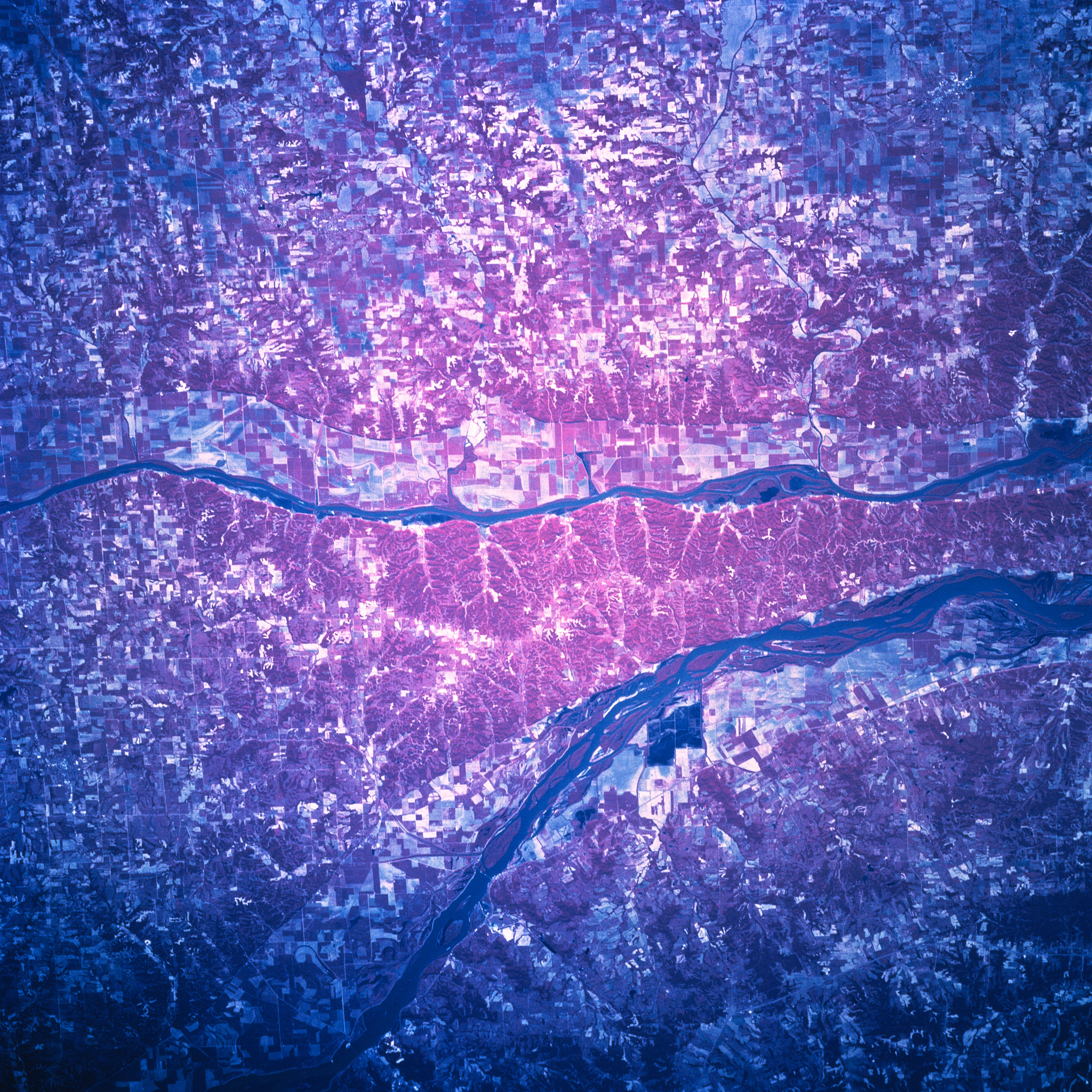
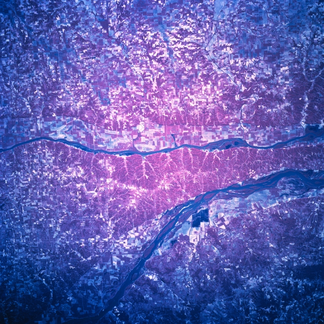
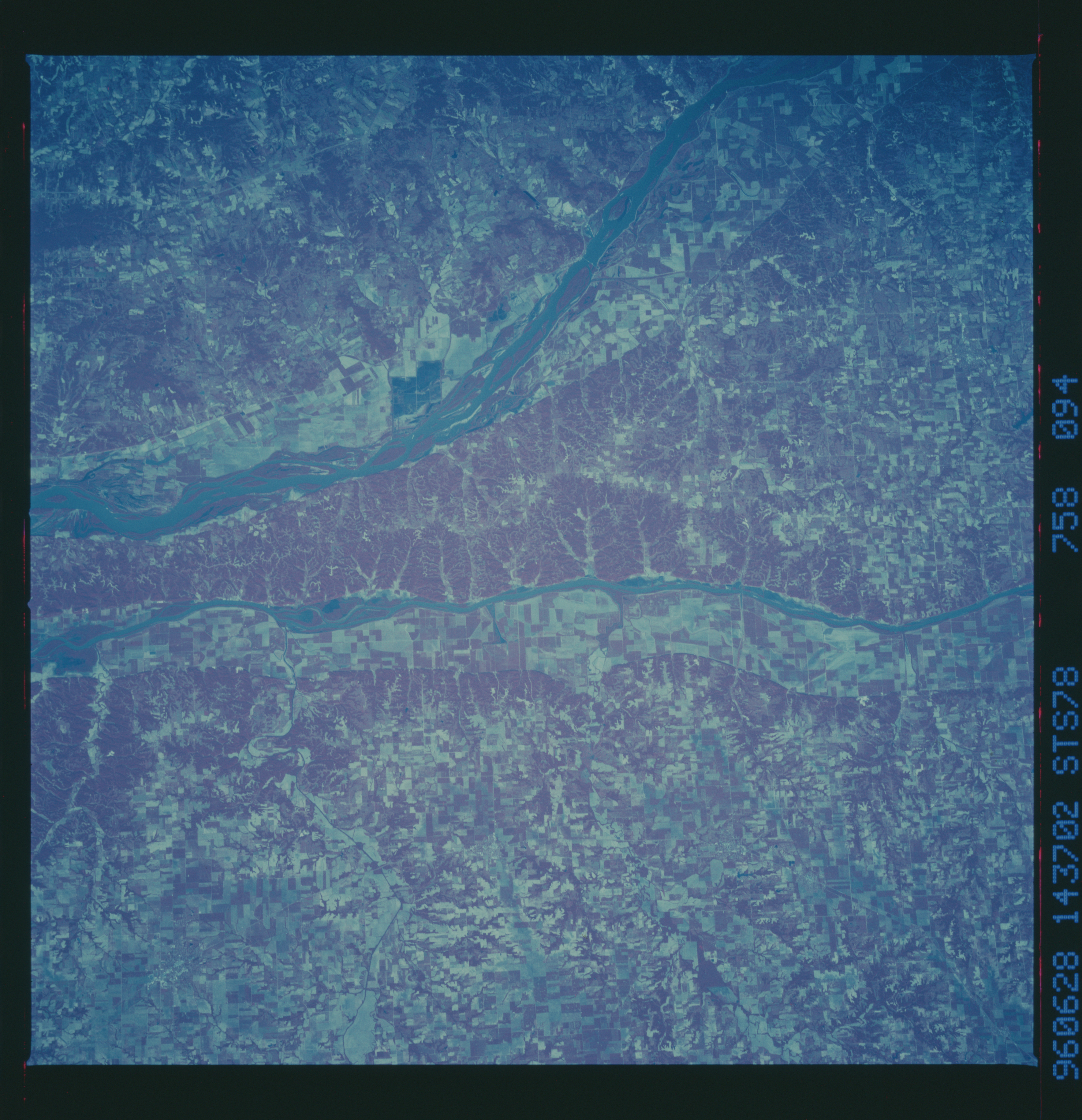
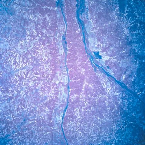
Image Caption: STS078-758-94 Illinois/Mississippi Rivers, Illinois, USA June 1996
The largest cultivated field patterns on this color infrared image are visible on the narrow floodplains of the Illinois River (narrower, straighter river in the center of the view) and the Mississippi River (broader and slightly curving river west of the Illinois River). Most of the picture shows smaller, angular agricultural field patterns (in red, pink, and white) concentrated within red-mauve areas that represent the green, forested lands on infrared film. The land between these two south flowing rivers tapers into a peninsula, just north of where the Illinois River joins the Mississippi River (slightly northwest of St. Louis--not in this image). The peninsula is more heavily forested (concentration of reds indicate green woodlands) and less broken up by fields, perhaps because it is more remote from cities and transport routes. Mark Twain Wildlife Refuge is also in the area. The stream channels for several west flowing tributary streams that feed the Illinois River can be traced across the landscape to their entry point into the Illinois River.
The largest cultivated field patterns on this color infrared image are visible on the narrow floodplains of the Illinois River (narrower, straighter river in the center of the view) and the Mississippi River (broader and slightly curving river west of the Illinois River). Most of the picture shows smaller, angular agricultural field patterns (in red, pink, and white) concentrated within red-mauve areas that represent the green, forested lands on infrared film. The land between these two south flowing rivers tapers into a peninsula, just north of where the Illinois River joins the Mississippi River (slightly northwest of St. Louis--not in this image). The peninsula is more heavily forested (concentration of reds indicate green woodlands) and less broken up by fields, perhaps because it is more remote from cities and transport routes. Mark Twain Wildlife Refuge is also in the area. The stream channels for several west flowing tributary streams that feed the Illinois River can be traced across the landscape to their entry point into the Illinois River.
