STS078-758-44
| NASA Photo ID | STS078-758-44 |
| Focal Length | 250mm |
| Date taken | 1996.06.27 |
| Time taken | 16:15:28 GMT |
Resolutions offered for this image:
4042 x 4042 pixels 640 x 640 pixels 5700 x 5900 pixels 483 x 500 pixels 510 x 516 pixels 640 x 606 pixels 479 x 480 pixels
4042 x 4042 pixels 640 x 640 pixels 5700 x 5900 pixels 483 x 500 pixels 510 x 516 pixels 640 x 606 pixels 479 x 480 pixels


Cloud masks available for this image:
Spacecraft nadir point: 36.8° N, 83.8° W
Photo center point: 36.5° N, 85.0° W
Photo center point by machine learning:
Photo center point: 36.5° N, 85.0° W
Photo center point by machine learning:
Nadir to Photo Center: West
Spacecraft Altitude: 144 nautical miles (267km)
Country or Geographic Name: | USA-TENNESSEE |
Features: | LAKE CUMBERLAND |
| Features Found Using Machine Learning: | |
Cloud Cover Percentage: | 0 (no clouds present) |
Sun Elevation Angle: | 68° |
Sun Azimuth: | 121° |
Camera: | Hasselblad |
Focal Length: | 250mm |
Camera Tilt: | 27 degrees |
Format: | 2443: Kodak Aerochrome 2443, color IR, thin base, EA-5 process thru June 1999, E-6 process afterward |
Film Exposure: | Normal |
| Additional Information | |
| Width | Height | Annotated | Cropped | Purpose | Links |
|---|---|---|---|---|---|
| 4042 pixels | 4042 pixels | No | No | Earth From Space collection | Download Image |
| 640 pixels | 640 pixels | No | No | Earth From Space collection | Download Image |
| 5700 pixels | 5900 pixels | No | No | Download Image | |
| 483 pixels | 500 pixels | No | No | Download Image | |
| 510 pixels | 516 pixels | No | No | Download Image | |
| 640 pixels | 606 pixels | No | No | Photographic Highlights | Download Image |
| 479 pixels | 480 pixels | Download Image |
Download Packaged File
Download a Google Earth KML for this Image
View photo footprint information
Download a GeoTIFF for this photo
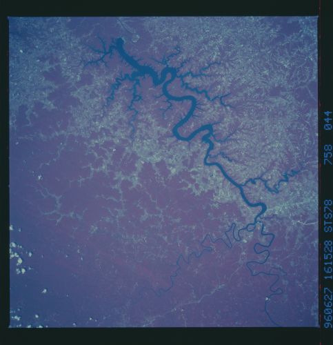
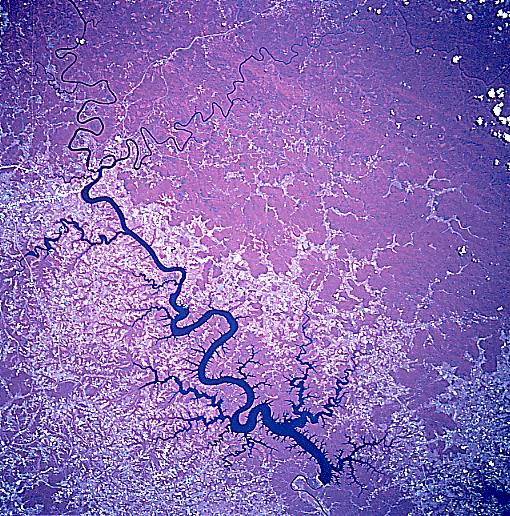
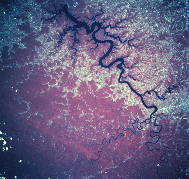
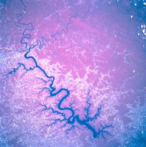
Image Caption: STS078-758-044 Lake Cumberland, Kentucky, USA June 1996 Lake Cumberland (dark, irregular-shaped feature) was created by building the Wolf Creek Dam on the Cumberland River in south-central Kentucky. The color infrared film helps to discriminate the land-water boundaries, even allowing the identification of many of the tributary streams that flow into the Cumberland River. The twisting and turning stream channels of the Fishing Creek and the South Fork of the Cumberland River are visible towards the eastern end of the lake. The heavily forested, deep red areas (representing green vegetation) are visible with the greatest concentration south of Lake Cumberland. The uniform-looking, reddish color that dominates the scene is a dense forested canopy, while the lighter-colored areas (irregular pattern) indicate a landscape where the forests have been removed. U. S. Highway 27 is the light-colored, linear feature (north-south orientation) that can be traced through the rural, wooded landscape in the northeastern quadrant of the image. Even a section of the Cumberland Parkway, an east-west toll road, is visible north of Lake Cumberland.
