STS078-751-76
| NASA Photo ID | STS078-751-76 |
| Focal Length | 100mm |
| Date taken | 1996.06.29 |
| Time taken | 16:09:42 GMT |
Resolutions offered for this image:
4096 x 4096 pixels 640 x 640 pixels 5700 x 5900 pixels 483 x 500 pixels 4033 x 4000 pixels 665 x 651 pixels 639 x 634 pixels 789 x 796 pixels 479 x 479 pixels
4096 x 4096 pixels 640 x 640 pixels 5700 x 5900 pixels 483 x 500 pixels 4033 x 4000 pixels 665 x 651 pixels 639 x 634 pixels 789 x 796 pixels 479 x 479 pixels

Cloud masks available for this image:
Spacecraft nadir point: 33.1° N, 84.4° W
Photo center point: 33.5° N, 84.5° W
Photo center point by machine learning:
Photo center point: 33.5° N, 84.5° W
Photo center point by machine learning:
Nadir to Photo Center: North
Spacecraft Altitude: 143 nautical miles (265km)
Camera: | Hasselblad |
Focal Length: | 100mm |
Camera Tilt: | 10 degrees |
Format: | 5046: Kodak, natural color positive, Lumiere 100/5046, ASA 100, standard base |
Film Exposure: | Normal |
| Additional Information | |
| Width | Height | Annotated | Cropped | Purpose | Links |
|---|---|---|---|---|---|
| 4096 pixels | 4096 pixels | No | No | Earth From Space collection | Download Image |
| 640 pixels | 640 pixels | No | No | Earth From Space collection | Download Image |
| 5700 pixels | 5900 pixels | No | No | Download Image | |
| 483 pixels | 500 pixels | No | No | Download Image | |
| 4033 pixels | 4000 pixels | Download Image | |||
| 665 pixels | 651 pixels | No | No | Download Image | |
| 639 pixels | 634 pixels | Download Image | |||
| 789 pixels | 796 pixels | No | No | Download Image | |
| 479 pixels | 479 pixels | Download Image |
Download Packaged File
Download a Google Earth KML for this Image
View photo footprint information
Download a GeoTIFF for this photo
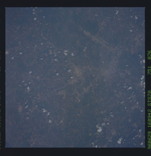
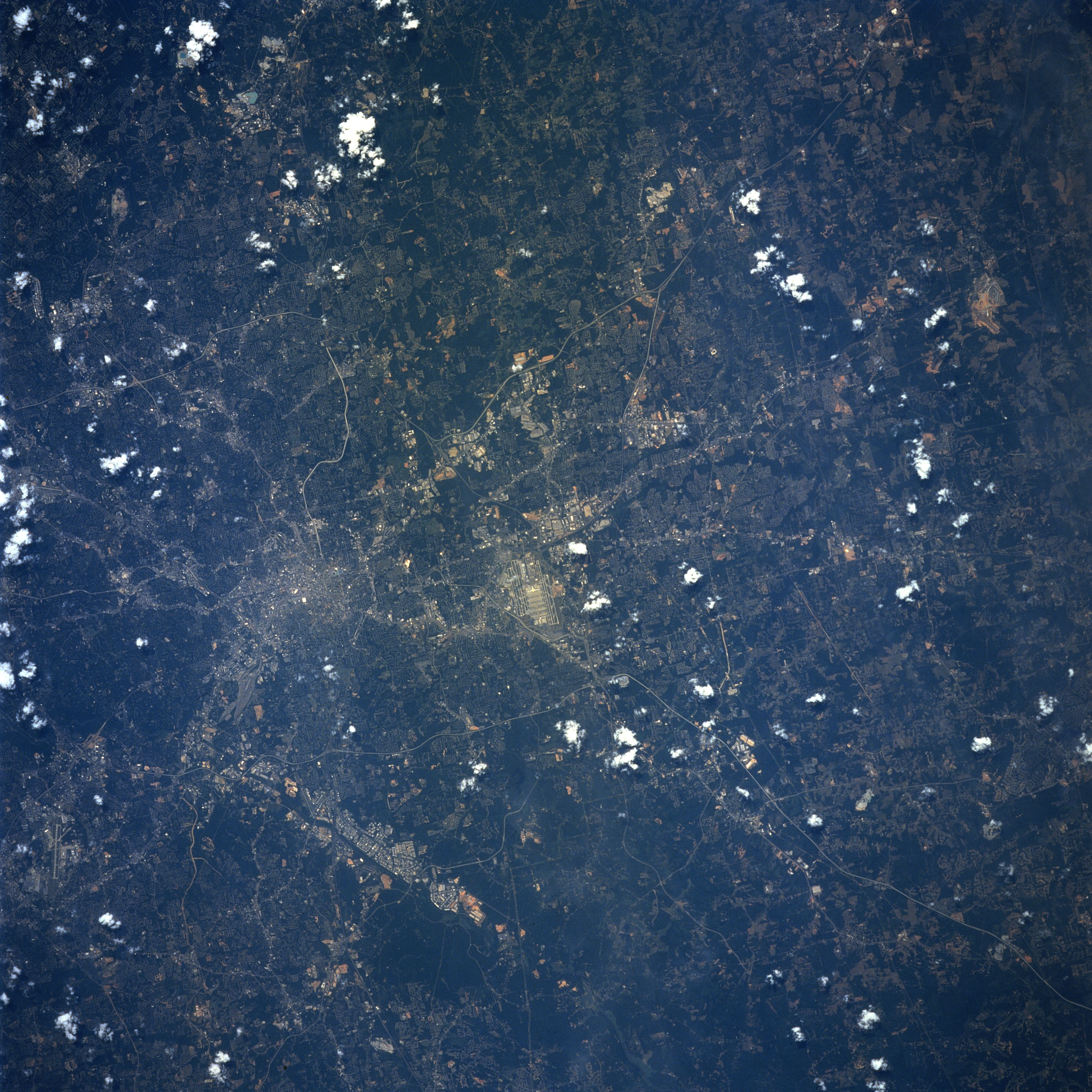
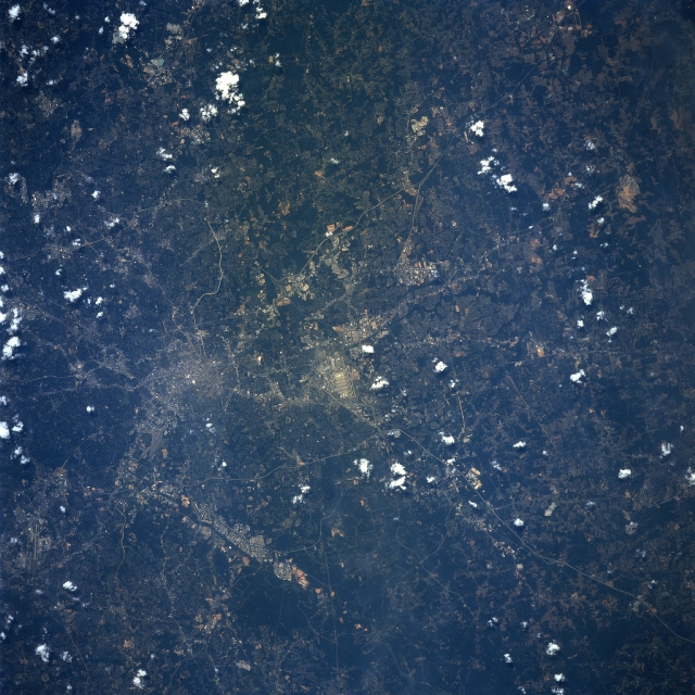
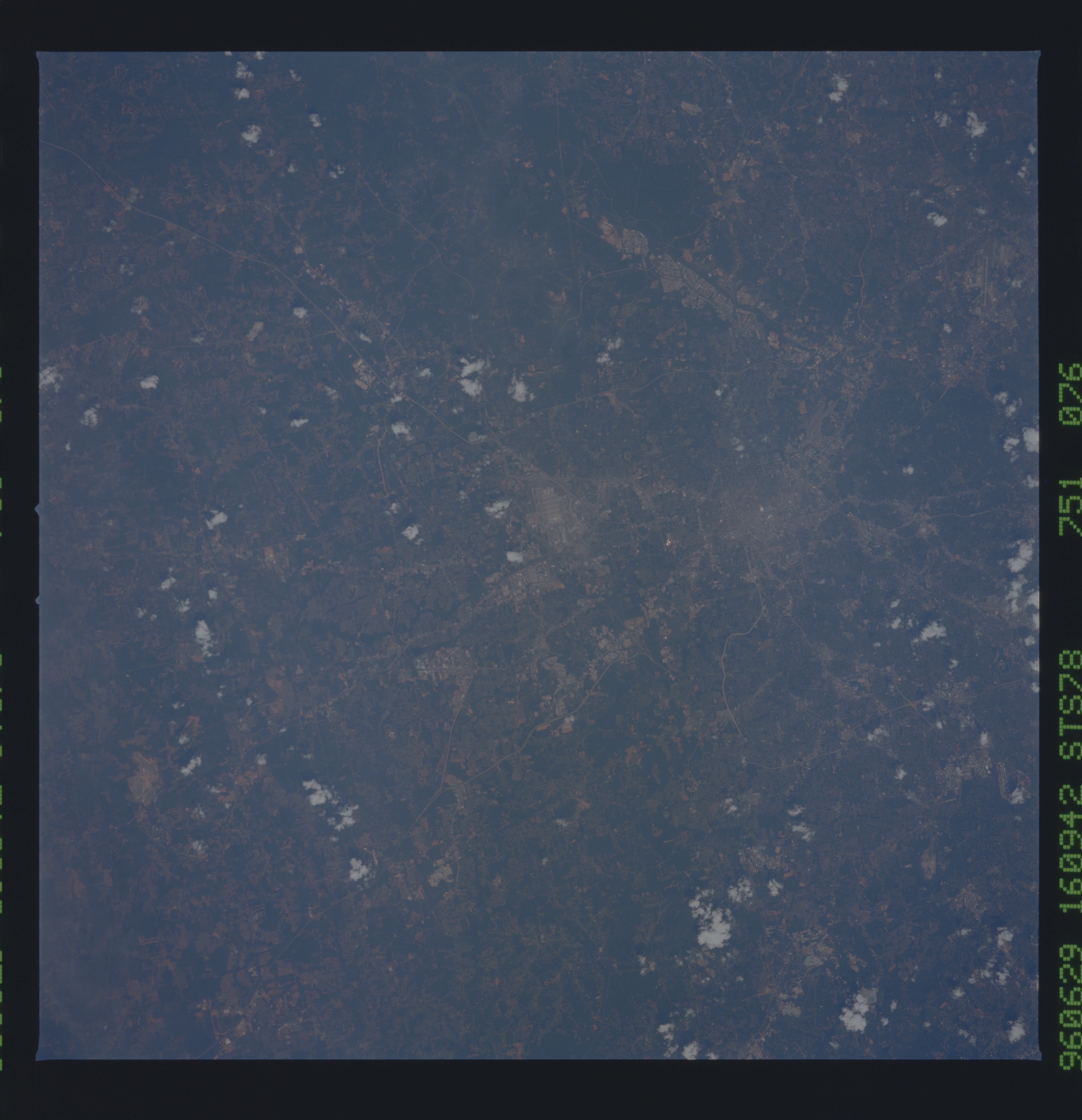
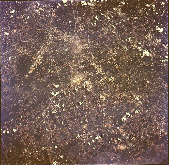
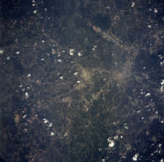
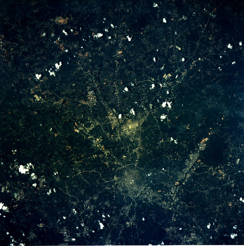
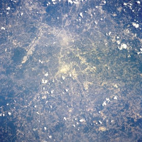
Image Caption: STS078-751-076 Atlanta, Georgia June, 1996
One of the leading cities of the southern United States, the city of Atlanta can be seen in this near-vertical view. One of the fastest growing U.S. cities, Atlanta is the largest city in Georgia. The city is the cultural, industrial, transportation, financial, and commercial center, not only for the state of Georgia, but for the whole southern region of the United States. Atlanta was host to the 1996 Summer Olympic Games. The runways of Hartsfield Atlanta International Airport, one of the ten busiest airports in the world, are visible near the center of the image. Numerous interstate highways are visible traversing through and around the city of Atlanta.
One of the leading cities of the southern United States, the city of Atlanta can be seen in this near-vertical view. One of the fastest growing U.S. cities, Atlanta is the largest city in Georgia. The city is the cultural, industrial, transportation, financial, and commercial center, not only for the state of Georgia, but for the whole southern region of the United States. Atlanta was host to the 1996 Summer Olympic Games. The runways of Hartsfield Atlanta International Airport, one of the ten busiest airports in the world, are visible near the center of the image. Numerous interstate highways are visible traversing through and around the city of Atlanta.
