STS078-750-13
| NASA Photo ID | STS078-750-13 |
| Focal Length | 250mm |
| Date taken | 1996.06.29 |
| Time taken | 07:28:43 GMT |
Resolutions offered for this image:
4096 x 4096 pixels 640 x 640 pixels 5700 x 5900 pixels 483 x 500 pixels 505 x 515 pixels
4096 x 4096 pixels 640 x 640 pixels 5700 x 5900 pixels 483 x 500 pixels 505 x 515 pixels

Cloud masks available for this image:
Spacecraft nadir point: 6.0° S, 109.3° E
Photo center point: 6.5° S, 108.5° E
Photo center point by machine learning:
Photo center point: 6.5° S, 108.5° E
Photo center point by machine learning:
Nadir to Photo Center: Southwest
Spacecraft Altitude: 146 nautical miles (270km)
Camera: | Hasselblad |
Focal Length: | 250mm |
Camera Tilt: | 21 degrees |
Format: | 5046: Kodak, natural color positive, Lumiere 100/5046, ASA 100, standard base |
Film Exposure: | Normal |
| Additional Information | |
| Width | Height | Annotated | Cropped | Purpose | Links |
|---|---|---|---|---|---|
| 4096 pixels | 4096 pixels | No | No | Earth From Space collection | Download Image |
| 640 pixels | 640 pixels | No | No | Earth From Space collection | Download Image |
| 5700 pixels | 5900 pixels | No | No | Download Image | |
| 483 pixels | 500 pixels | No | No | Download Image | |
| 505 pixels | 515 pixels | No | No | Download Image |
Download Packaged File
Download a Google Earth KML for this Image
View photo footprint information
Download a GeoTIFF for this photo
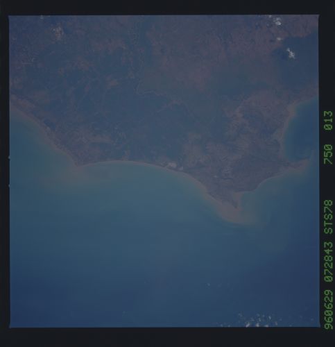
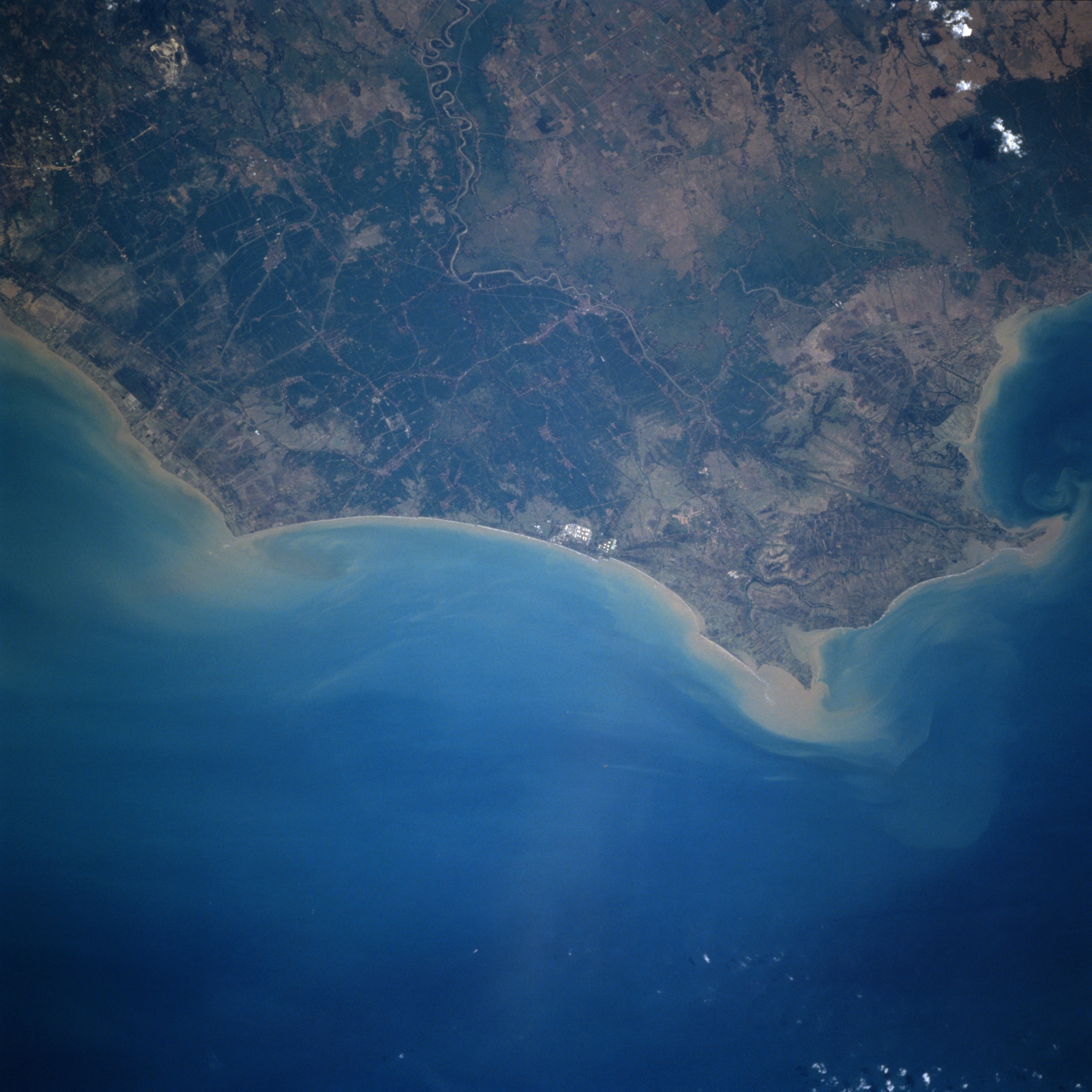
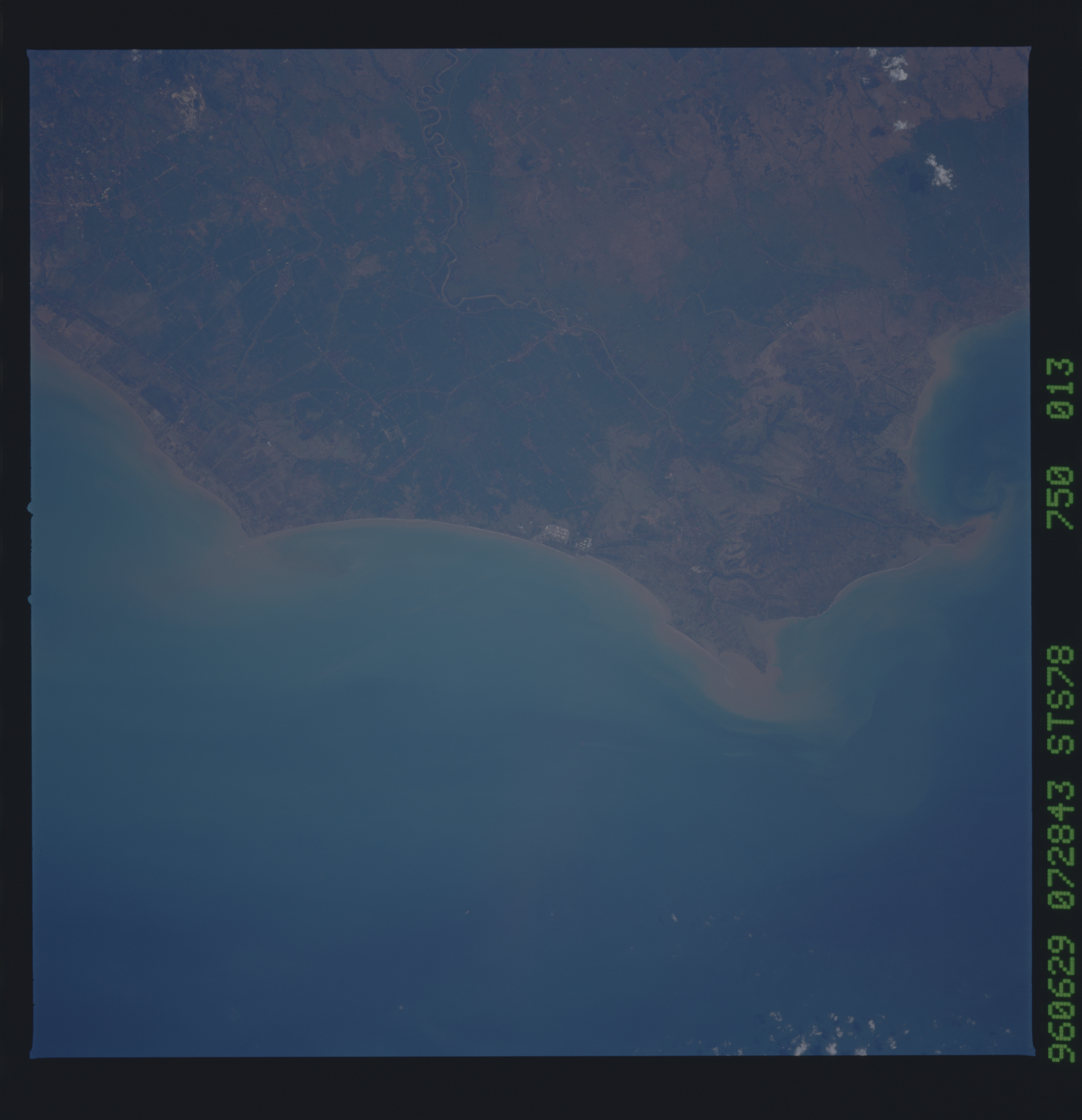
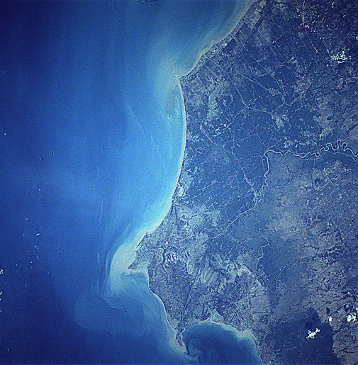
Image Caption: STS078-750-013 Manuk River Mouth, Java, Indonesia July 1996
The Manuk River enters the view near the upper center of the image and flows generally northward across a gently rolling coastal plain emptying into the Java Sea at the right center of the image. The Manuk rises in the volcanic mountains of central Java and is 75 miles (121 km) long. Forest clearing along the coastal plain and in the mountain lowlands has increased erosion and the sediment flow into the Java Sea. Not only is increased sediment a problem, the increasing use of pesticides and fertilizers, has increased the destruction of coral reefs along Java's northern coast. Rice is the major crop grown along the coastal plain.
The Manuk River enters the view near the upper center of the image and flows generally northward across a gently rolling coastal plain emptying into the Java Sea at the right center of the image. The Manuk rises in the volcanic mountains of central Java and is 75 miles (121 km) long. Forest clearing along the coastal plain and in the mountain lowlands has increased erosion and the sediment flow into the Java Sea. Not only is increased sediment a problem, the increasing use of pesticides and fertilizers, has increased the destruction of coral reefs along Java's northern coast. Rice is the major crop grown along the coastal plain.
