STS078-749-22
| NASA Photo ID | STS078-749-22 |
| Focal Length | 250mm |
| Date taken | 1996.06.26 |
| Time taken | 13:08:00 GMT |
Resolutions offered for this image:
4054 x 4054 pixels 640 x 640 pixels 5700 x 5900 pixels 483 x 500 pixels 664 x 641 pixels 479 x 479 pixels
4054 x 4054 pixels 640 x 640 pixels 5700 x 5900 pixels 483 x 500 pixels 664 x 641 pixels 479 x 479 pixels


Cloud masks available for this image:
Spacecraft nadir point: 33.7° N, 86.8° W
Photo center point: 34.5° N, 87.5° W
Photo center point by machine learning:
Photo center point: 34.5° N, 87.5° W
Photo center point by machine learning:
Nadir to Photo Center: Northwest
Spacecraft Altitude: 143 nautical miles (265km)
Country or Geographic Name: | USA-ALABAMA |
Features: | WHEELER LAKE, ROADS, DECATUR |
| Features Found Using Machine Learning: | |
Cloud Cover Percentage: | 0 (no clouds present) |
Sun Elevation Angle: | 28° |
Sun Azimuth: | 79° |
Camera: | Hasselblad |
Focal Length: | 250mm |
Camera Tilt: | 24 degrees |
Format: | 5046: Kodak, natural color positive, Lumiere 100/5046, ASA 100, standard base |
Film Exposure: | Normal |
| Additional Information | |
| Width | Height | Annotated | Cropped | Purpose | Links |
|---|---|---|---|---|---|
| 4054 pixels | 4054 pixels | No | No | Earth From Space collection | Download Image |
| 640 pixels | 640 pixels | No | No | Earth From Space collection | Download Image |
| 5700 pixels | 5900 pixels | No | No | Download Image | |
| 483 pixels | 500 pixels | No | No | Download Image | |
| 664 pixels | 641 pixels | No | No | Download Image | |
| 479 pixels | 479 pixels | Download Image |
Download Packaged File
Download a Google Earth KML for this Image
View photo footprint information
Download a GeoTIFF for this photo
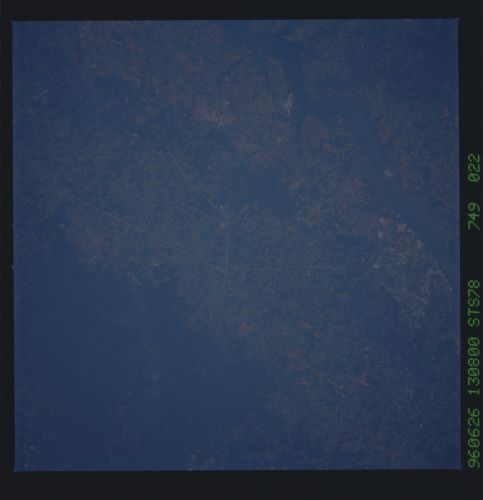
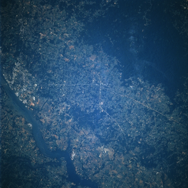
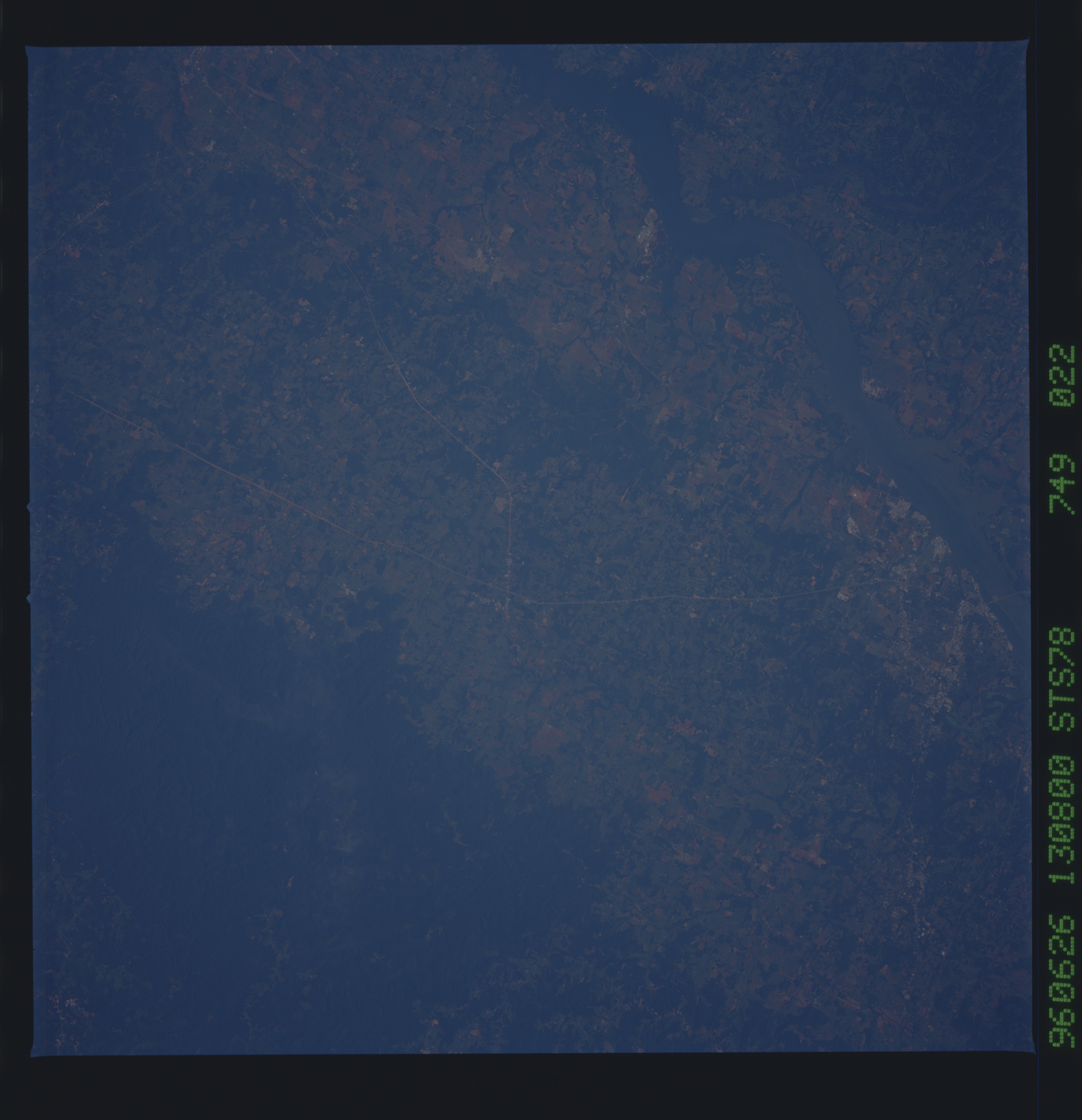
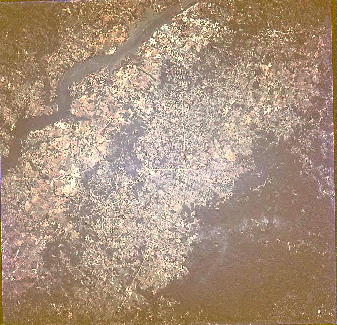
Image Caption: STS078-749-022 Wheeler Lake, Alabama June, 1996
A large portion of Wheeler Lake can be seen traversing the image from the left center to the bottom center in this near-vertical view. Wheeler Lake is a part of a chain of lakes and reservoirs built by the Tennessee Valley Authority to control flooding, increase river traffic, generate electric power, and provide water-oriented recreation. The Wheeler Lake Dam was constructed in 1936. The lake is nearly 74 miles (119 km) long. The land on either side of the lake is a cotton, corn, and poultry-farming area, with deposits of coal, limestone, and asphalt. The gently rolling hills and dense forest of the William B. Bankhead National Forest covers most of the lower right portion of the image. The city of Decater, Alabama is located at the left center of the image.
A large portion of Wheeler Lake can be seen traversing the image from the left center to the bottom center in this near-vertical view. Wheeler Lake is a part of a chain of lakes and reservoirs built by the Tennessee Valley Authority to control flooding, increase river traffic, generate electric power, and provide water-oriented recreation. The Wheeler Lake Dam was constructed in 1936. The lake is nearly 74 miles (119 km) long. The land on either side of the lake is a cotton, corn, and poultry-farming area, with deposits of coal, limestone, and asphalt. The gently rolling hills and dense forest of the William B. Bankhead National Forest covers most of the lower right portion of the image. The city of Decater, Alabama is located at the left center of the image.
