STS078-748-7
| NASA Photo ID | STS078-748-7 |
| Focal Length | 250mm |
| Date taken | 1996.06.25 |
| Time taken | 10:30:44 GMT |
Resolutions offered for this image:
4041 x 4028 pixels 639 x 637 pixels 5700 x 5900 pixels 483 x 500 pixels 2633 x 2553 pixels 2565 x 2511 pixels 515 x 508 pixels
4041 x 4028 pixels 639 x 637 pixels 5700 x 5900 pixels 483 x 500 pixels 2633 x 2553 pixels 2565 x 2511 pixels 515 x 508 pixels


Cloud masks available for this image:
Spacecraft nadir point: 26.2° N, 49.0° E
Photo center point: 27.0° N, 49.5° E
Photo center point by machine learning:
Photo center point: 27.0° N, 49.5° E
Photo center point by machine learning:
Nadir to Photo Center: Northeast
Spacecraft Altitude: 146 nautical miles (270km)
Camera: | Hasselblad |
Focal Length: | 250mm |
Camera Tilt: | 21 degrees |
Format: | 5046: Kodak, natural color positive, Lumiere 100/5046, ASA 100, standard base |
Film Exposure: | Normal |
| Additional Information | |
| Width | Height | Annotated | Cropped | Purpose | Links |
|---|---|---|---|---|---|
| 4041 pixels | 4028 pixels | No | No | Earth From Space collection | Download Image |
| 639 pixels | 637 pixels | No | No | Earth From Space collection | Download Image |
| 5700 pixels | 5900 pixels | No | No | Download Image | |
| 483 pixels | 500 pixels | No | No | Download Image | |
| 2633 pixels | 2553 pixels | No | Yes | ReefBase 1 | Download Image |
| 2565 pixels | 2511 pixels | No | No | ReefBase 1 | Download Image |
| 515 pixels | 508 pixels | No | No | Download Image |
Download Packaged File
Download a Google Earth KML for this Image
View photo footprint information
Download a GeoTIFF for this photo
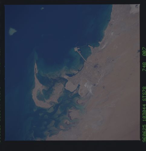
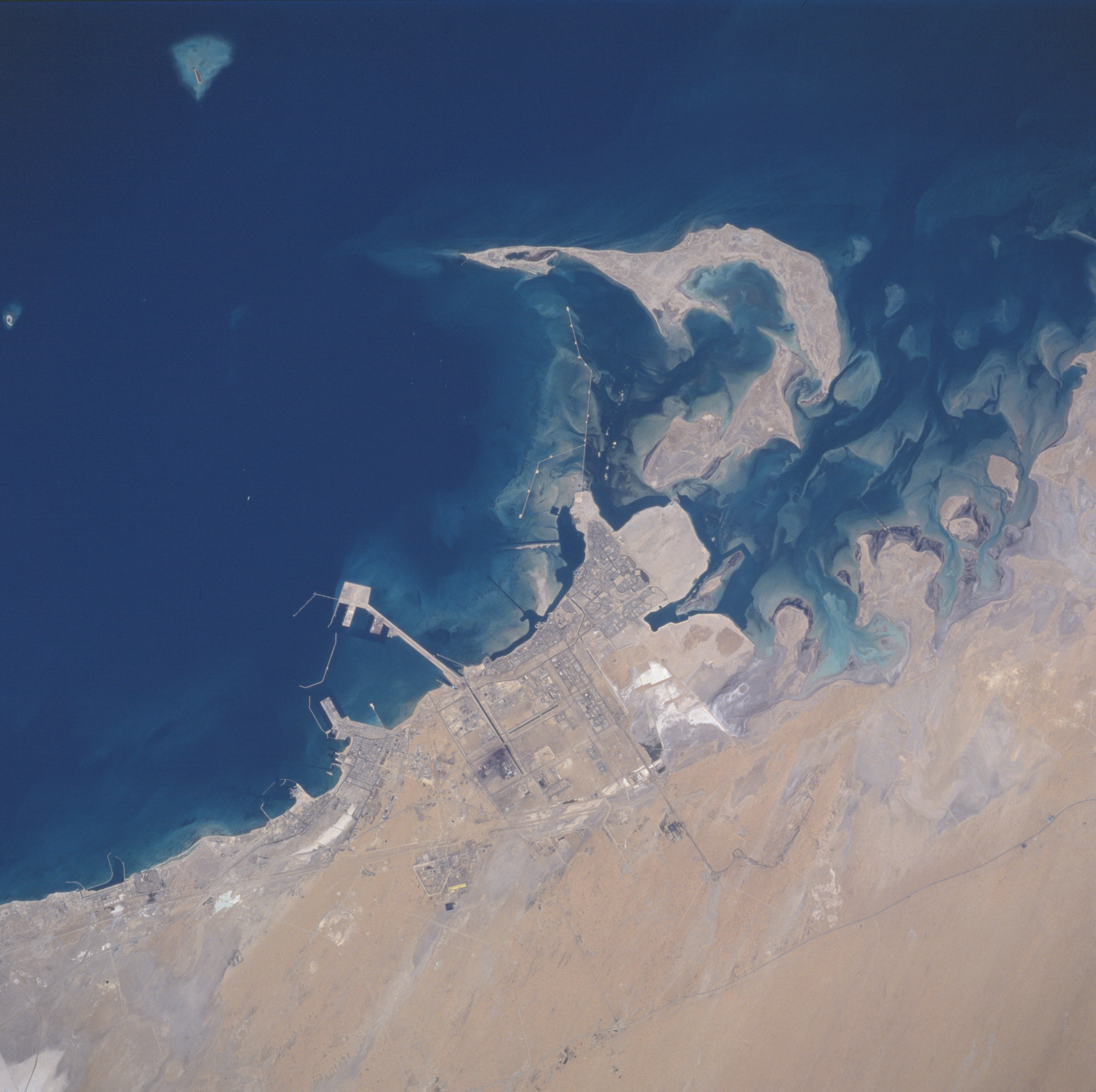
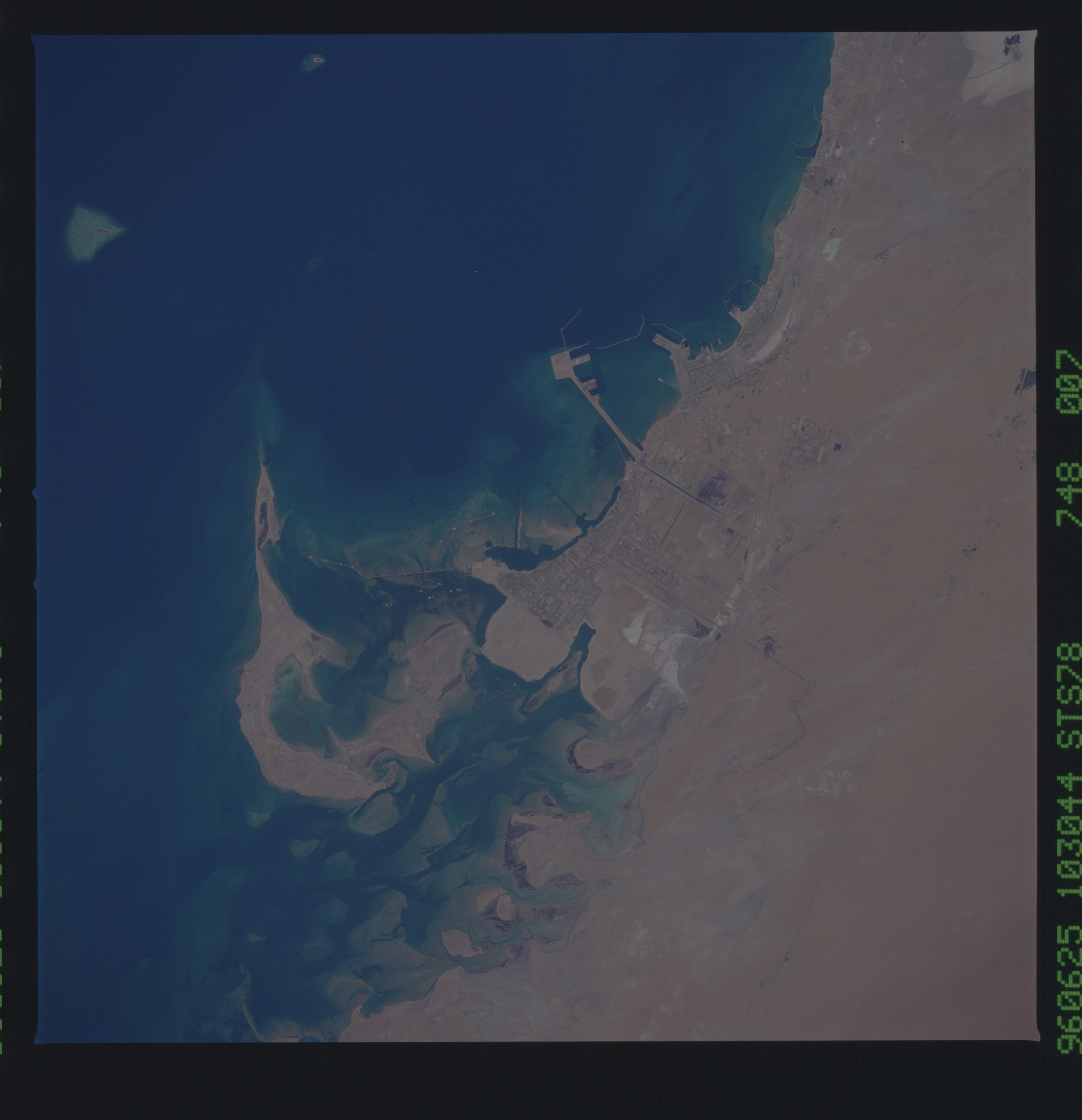
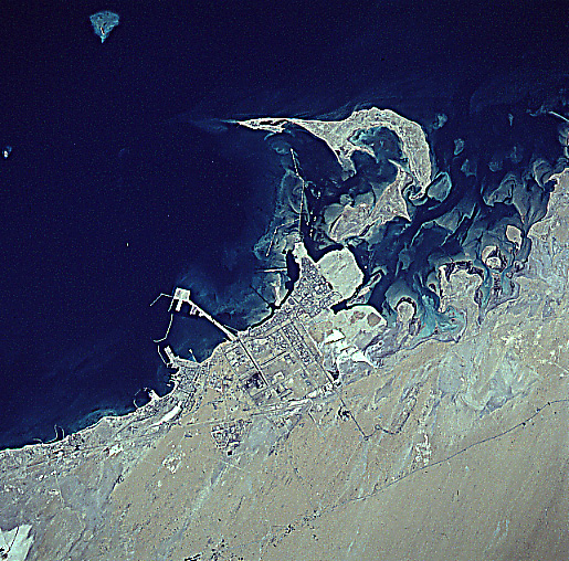
Image Caption: STS078-748-007 Al Jubayl (Jubail), Saudi Arabia June 1996
The water (dark area) of the Persian Gulf contrasts with the sandy, desert landscape of the northeast coast of Saudi Arabia. This newly created (development started in the 1980s) industrial center of Al Jabayl (also knows as Jubail), a city with modern infrastructure, is located in the middle of the image. The infrastructure includes modern residential areas, petrochemical plants, iron works, airport (southeast of the city), highways, railroad, and port facilities - plus the Royal Saudi Naval Base (located south of the industrial port facilities - see long piers and breakwater). The lighter colored, undeveloped areas scattered throughout the coastal region are dry lakebeds (salt flats). The thin dark line inland but parallel to the coast (upper right quadrant) is a combination highway and pipeline right of way.
The water (dark area) of the Persian Gulf contrasts with the sandy, desert landscape of the northeast coast of Saudi Arabia. This newly created (development started in the 1980s) industrial center of Al Jabayl (also knows as Jubail), a city with modern infrastructure, is located in the middle of the image. The infrastructure includes modern residential areas, petrochemical plants, iron works, airport (southeast of the city), highways, railroad, and port facilities - plus the Royal Saudi Naval Base (located south of the industrial port facilities - see long piers and breakwater). The lighter colored, undeveloped areas scattered throughout the coastal region are dry lakebeds (salt flats). The thin dark line inland but parallel to the coast (upper right quadrant) is a combination highway and pipeline right of way.
