STS078-740-83
| NASA Photo ID | STS078-740-83 |
| Focal Length | 250mm |
| Date taken | 1996.07.04 |
| Time taken | 05:13:37 GMT |
Resolutions offered for this image:
3986 x 4041 pixels 631 x 639 pixels 5700 x 5900 pixels 483 x 500 pixels 523 x 508 pixels
3986 x 4041 pixels 631 x 639 pixels 5700 x 5900 pixels 483 x 500 pixels 523 x 508 pixels

Cloud masks available for this image:
Spacecraft nadir point: 34.9° N, 38.9° E
Photo center point: 36.0° N, 38.5° E
Photo center point by machine learning:
Photo center point: 36.0° N, 38.5° E
Photo center point by machine learning:
Nadir to Photo Center: North
Spacecraft Altitude: 139 nautical miles (257km)
Country or Geographic Name: | SYRIA |
Features: | ASSAD RES., EUPHRATES, AGR |
| Features Found Using Machine Learning: | |
Cloud Cover Percentage: | 0 (no clouds present) |
Sun Elevation Angle: | 34° |
Sun Azimuth: | 84° |
Camera: | Hasselblad |
Focal Length: | 250mm |
Camera Tilt: | 27 degrees |
Format: | 5046: Kodak, natural color positive, Lumiere 100/5046, ASA 100, standard base |
Film Exposure: | Normal |
| Additional Information | |
| Width | Height | Annotated | Cropped | Purpose | Links |
|---|---|---|---|---|---|
| 3986 pixels | 4041 pixels | No | No | Earth From Space collection | Download Image |
| 631 pixels | 639 pixels | No | No | Earth From Space collection | Download Image |
| 5700 pixels | 5900 pixels | No | No | Download Image | |
| 483 pixels | 500 pixels | No | No | Download Image | |
| 523 pixels | 508 pixels | Download Image |
Download Packaged File
Download a Google Earth KML for this Image
View photo footprint information
Download a GeoTIFF for this photo
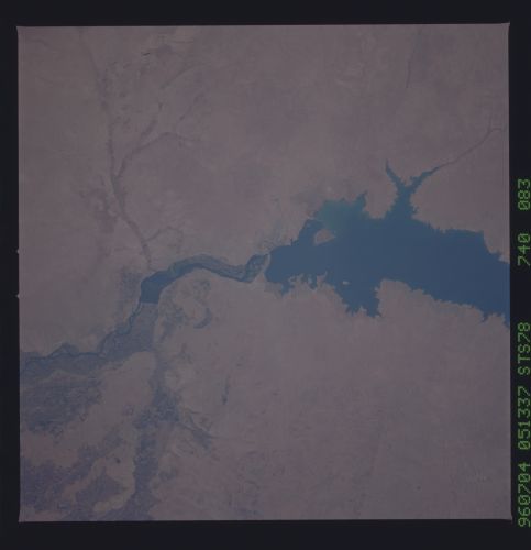
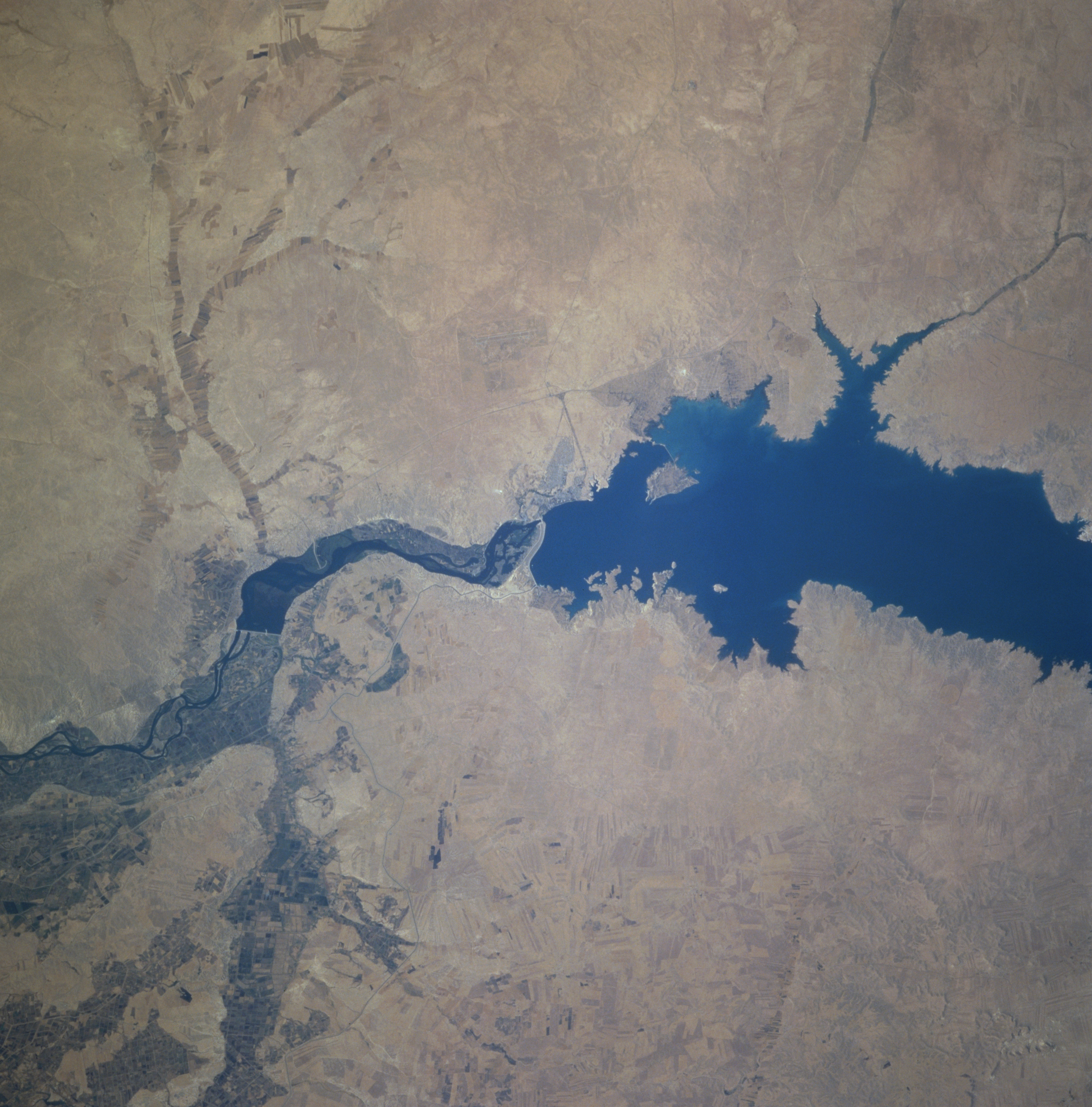
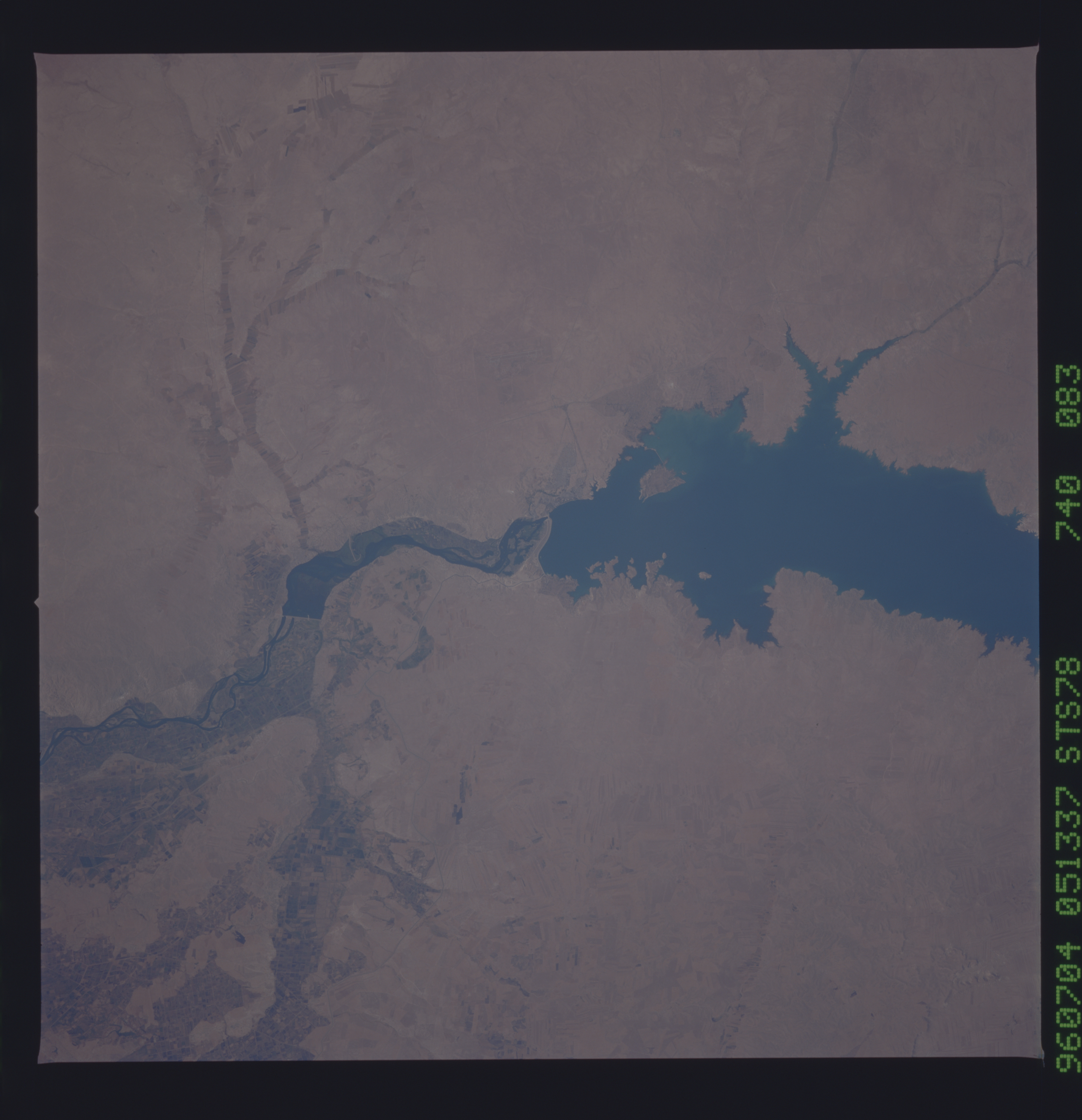
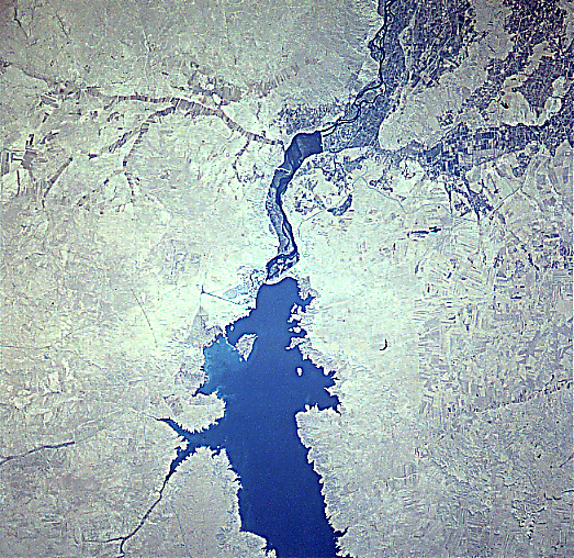
Image Caption: STS078-740-083 Tabaqah Dam, Lake Assad, Syria June 1996
Completed in 1973, the Tabaqah Dam (center of image) on the Euphrates River can be seen in this near-nadir view. The Tabaqah Dam is an earth filled dam nearly 197 feet (60 meters) high and 3 miles (5 km) long. The dam holds the waters of Lake Assad (center to left center of the image), a 50-mile (80 km) long and 5-mile (8 km) wide reservoir. Lake Assad and the Tabaqah Dam have not only provided increased hydroelectric power but the lake has doubled Syria's irrigated land. Actual crop production has not reached the goals set by the Syrian government due to a number of problems including the gypsum subsoil of the region, and whether or not farmers could be attracted back to this scarsely populated area from urban areas or more crowded agricultural areas in other parts of the country. Also the water levels within Lake Assad remain low due mostly in part to construction of the Keban and Ataturk Dams in Turkey, which have reduced the water flow of the Euphrates River in Syria.
Completed in 1973, the Tabaqah Dam (center of image) on the Euphrates River can be seen in this near-nadir view. The Tabaqah Dam is an earth filled dam nearly 197 feet (60 meters) high and 3 miles (5 km) long. The dam holds the waters of Lake Assad (center to left center of the image), a 50-mile (80 km) long and 5-mile (8 km) wide reservoir. Lake Assad and the Tabaqah Dam have not only provided increased hydroelectric power but the lake has doubled Syria's irrigated land. Actual crop production has not reached the goals set by the Syrian government due to a number of problems including the gypsum subsoil of the region, and whether or not farmers could be attracted back to this scarsely populated area from urban areas or more crowded agricultural areas in other parts of the country. Also the water levels within Lake Assad remain low due mostly in part to construction of the Keban and Ataturk Dams in Turkey, which have reduced the water flow of the Euphrates River in Syria.
