STS078-740-76
| NASA Photo ID | STS078-740-76 |
| Focal Length | 250mm |
| Date taken | 1996.07.04 |
| Time taken | 05:12:20 GMT |
Resolutions offered for this image:
4061 x 4061 pixels 639 x 639 pixels 5700 x 5900 pixels 483 x 500 pixels
4061 x 4061 pixels 639 x 639 pixels 5700 x 5900 pixels 483 x 500 pixels


Cloud masks available for this image:
Spacecraft nadir point: 36.4° N, 33.2° E
Photo center point: 36.5° N, 33.5° E
Photo center point by machine learning:
Photo center point: 36.5° N, 33.5° E
Photo center point by machine learning:
Nadir to Photo Center: East
Spacecraft Altitude: 139 nautical miles (257km)
Camera: | Hasselblad |
Focal Length: | 250mm |
Camera Tilt: | 8 degrees |
Format: | 5046: Kodak, natural color positive, Lumiere 100/5046, ASA 100, standard base |
Film Exposure: | Normal |
| Additional Information | |
| Width | Height | Annotated | Cropped | Purpose | Links |
|---|---|---|---|---|---|
| 4061 pixels | 4061 pixels | No | No | Earth From Space collection | Download Image |
| 639 pixels | 639 pixels | No | No | Earth From Space collection | Download Image |
| 5700 pixels | 5900 pixels | No | No | Download Image | |
| 483 pixels | 500 pixels | No | No | Download Image |
Download Packaged File
Download a Google Earth KML for this Image
View photo footprint information
Download a GeoTIFF for this photo
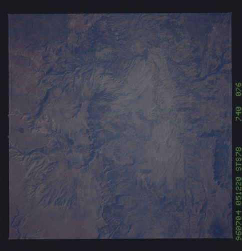
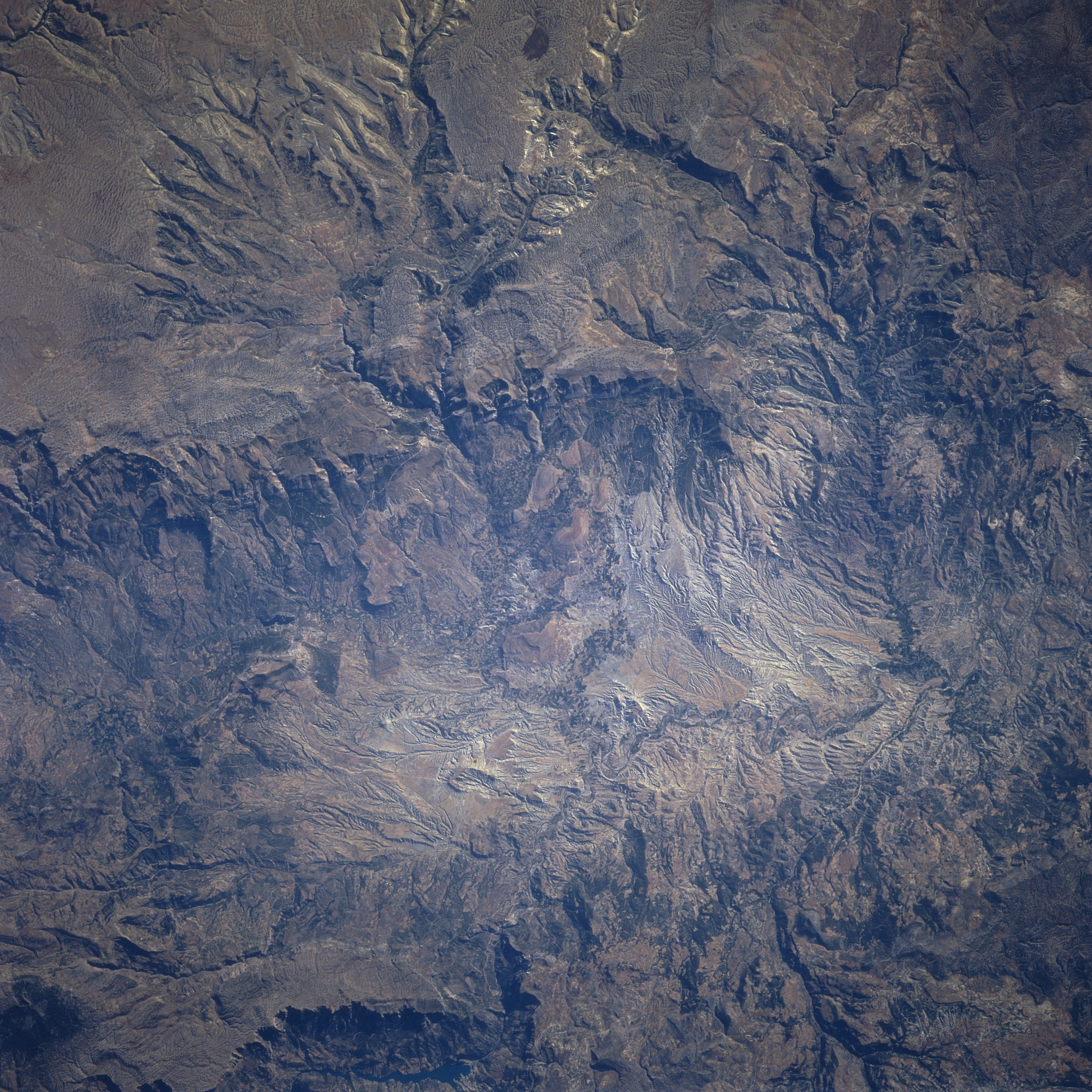
Image Caption: STS078-740-076 Taurus Mountains, Turkey June 1996
Stretching 350 miles (565 km) roughly paralleling the Mediterranean Coast of Southern Turkey, this nadir-looking view shows a small portion of the rugged Taurus Mountains. The Taurus Mountains form the southern border of the Anatolian Plateau. Karst (limestone) topography and deeply eroded surfaces are abundant in this particular area, with numerous underground channels, caves, sinkholes, and springs. Population is sparse in the area. Elevations in this particular scene range to over 7500 feet (2288 meters). The Taurus Mountains have important chromium deposits and other minerals.
Stretching 350 miles (565 km) roughly paralleling the Mediterranean Coast of Southern Turkey, this nadir-looking view shows a small portion of the rugged Taurus Mountains. The Taurus Mountains form the southern border of the Anatolian Plateau. Karst (limestone) topography and deeply eroded surfaces are abundant in this particular area, with numerous underground channels, caves, sinkholes, and springs. Population is sparse in the area. Elevations in this particular scene range to over 7500 feet (2288 meters). The Taurus Mountains have important chromium deposits and other minerals.
