STS078-736-68
| NASA Photo ID | STS078-736-68 |
| Focal Length | 250mm |
| Date taken | 1996.06.26 |
| Time taken | 17:49:05 GMT |
Resolutions offered for this image:
4096 x 4096 pixels 640 x 640 pixels 5700 x 5900 pixels 483 x 500 pixels 3355 x 3415 pixels 645 x 649 pixels 479 x 479 pixels
4096 x 4096 pixels 640 x 640 pixels 5700 x 5900 pixels 483 x 500 pixels 3355 x 3415 pixels 645 x 649 pixels 479 x 479 pixels

Cloud masks available for this image:
Spacecraft nadir point: 36.8° N, 100.3° W
Photo center point: 37.0° N, 101.0° W
Photo center point by machine learning:
Photo center point: 37.0° N, 101.0° W
Photo center point by machine learning:
Nadir to Photo Center: West
Spacecraft Altitude: 144 nautical miles (267km)
Country or Geographic Name: | USA-KANSAS |
Features: | LIBERAL, PIVOT & DRY AGR. |
| Features Found Using Machine Learning: | |
Cloud Cover Percentage: | 0 (no clouds present) |
Sun Elevation Angle: | 72° |
Sun Azimuth: | 135° |
Camera: | Hasselblad |
Focal Length: | 250mm |
Camera Tilt: | 17 degrees |
Format: | 5046: Kodak, natural color positive, Lumiere 100/5046, ASA 100, standard base |
Film Exposure: | Normal |
| Additional Information | |
| Width | Height | Annotated | Cropped | Purpose | Links |
|---|---|---|---|---|---|
| 4096 pixels | 4096 pixels | No | No | Earth From Space collection | Download Image |
| 640 pixels | 640 pixels | No | No | Earth From Space collection | Download Image |
| 5700 pixels | 5900 pixels | No | No | Download Image | |
| 483 pixels | 500 pixels | No | No | Download Image | |
| 3355 pixels | 3415 pixels | Download Image | |||
| 645 pixels | 649 pixels | No | No | Download Image | |
| 479 pixels | 479 pixels | Download Image |
Download Packaged File
Download a Google Earth KML for this Image
View photo footprint information
Download a GeoTIFF for this photo
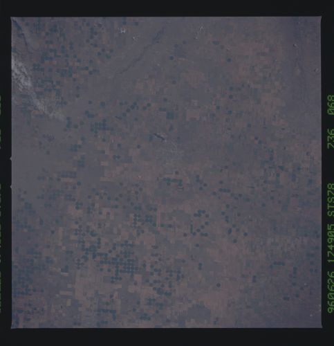
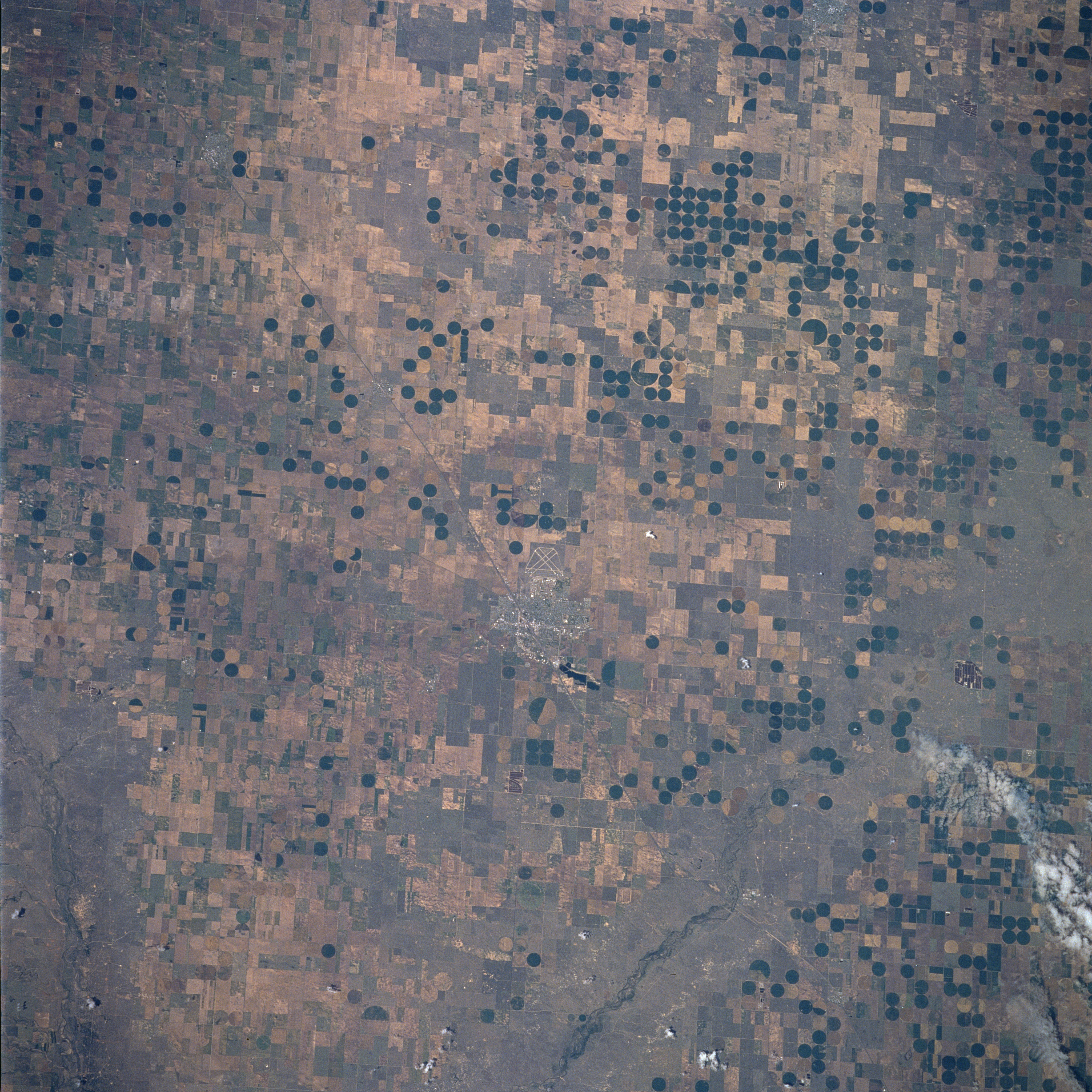
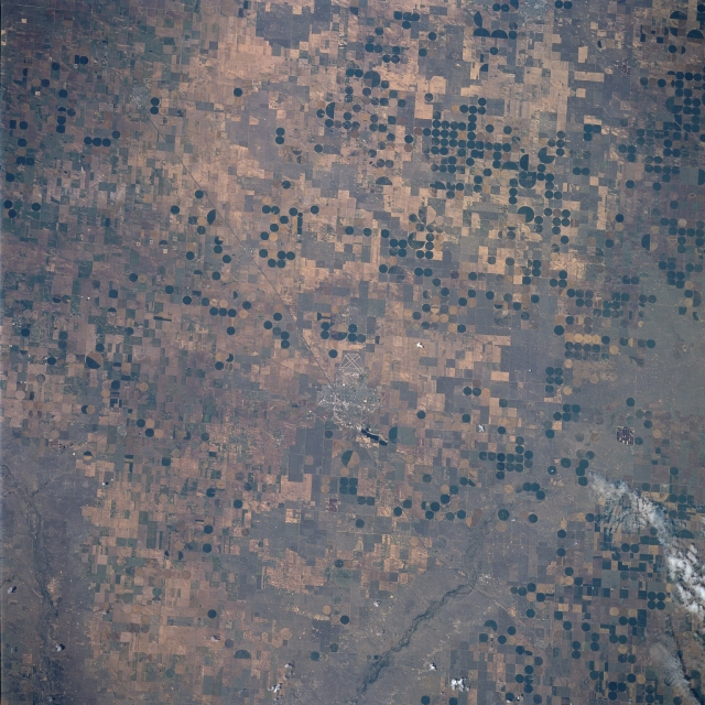
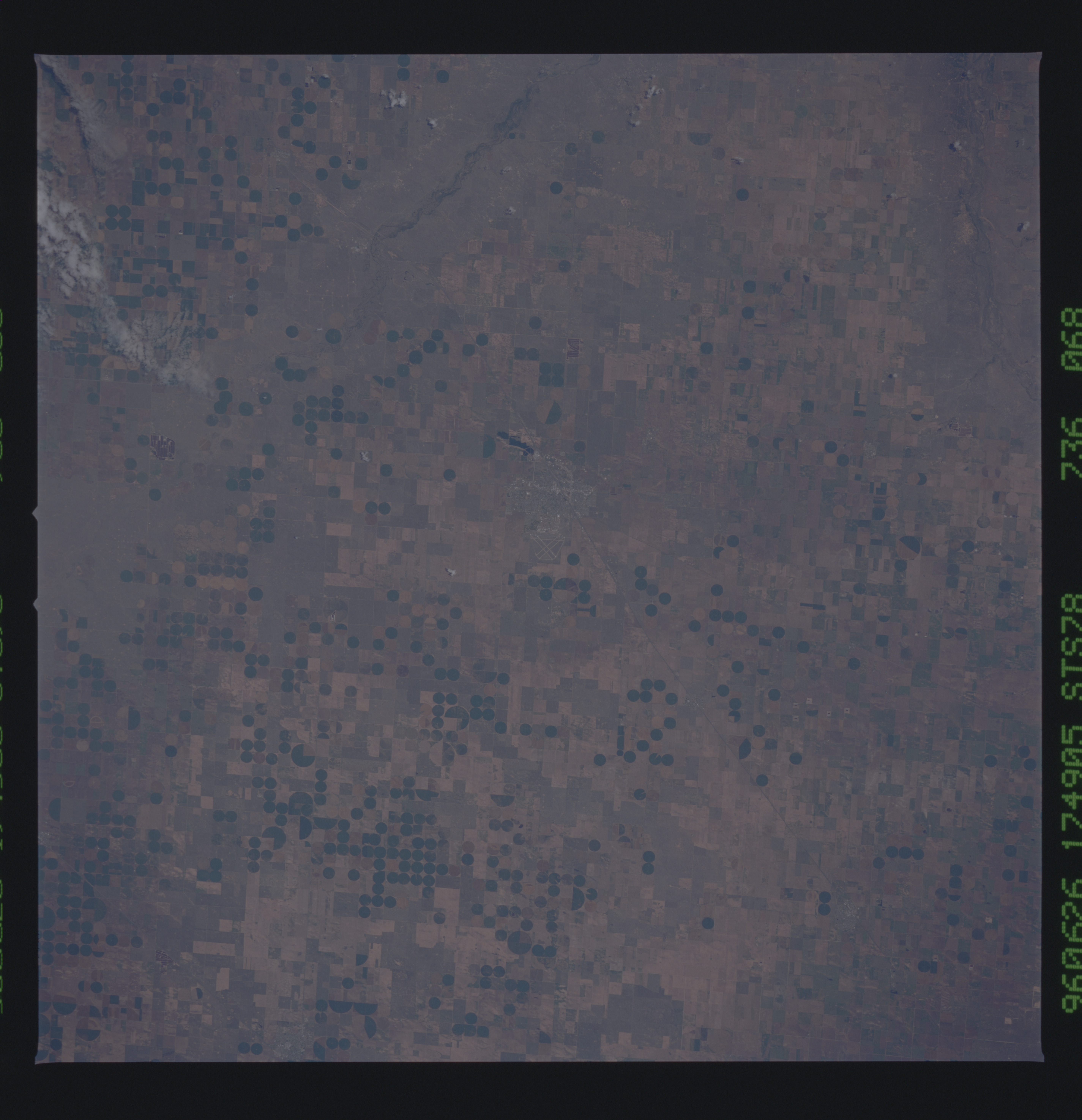
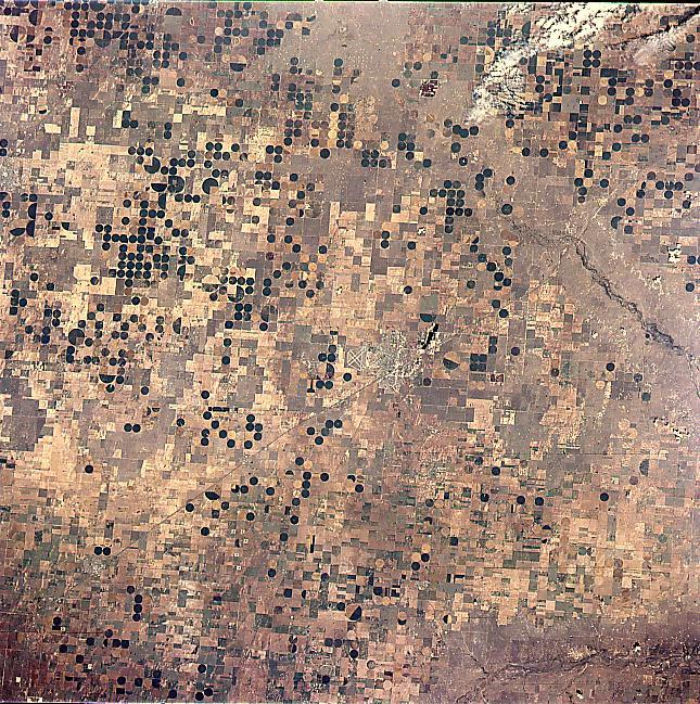
Image Caption: STS078-736-68 Liberal Area, Kansas June, 1996
Numerous central pivot irrigation operations can be seen in this near-vertical view taken over southwestern Kansas and the panhandle of western Oklahoma. The small city of Liberal, Kansas, near the Kansas/Oklahoma border, is just to the right of the center of the image. The runways of the Liberal Municipal Airport, located just to the northwest of the city, are also visible. Liberal is the trade center for this grain and livestock area. Oil and natural gas are also extracted in the region. Liberal and the surrounding agricultural regions are located on the Ogallala Aquifer, a vast underground water supply that stretches across the Great Plains from southern South Dakota to the panhandle of northern Texas. It is the largest underground water supply in the United States. The level of the water table is falling because irrigation systems, such as these visible throughout the image, are depleting the water system faster than natural processes can replenish it. Eventually this situation may well cause an economic hardship throughout this region of the Great Plains within the next decade or so.
Numerous central pivot irrigation operations can be seen in this near-vertical view taken over southwestern Kansas and the panhandle of western Oklahoma. The small city of Liberal, Kansas, near the Kansas/Oklahoma border, is just to the right of the center of the image. The runways of the Liberal Municipal Airport, located just to the northwest of the city, are also visible. Liberal is the trade center for this grain and livestock area. Oil and natural gas are also extracted in the region. Liberal and the surrounding agricultural regions are located on the Ogallala Aquifer, a vast underground water supply that stretches across the Great Plains from southern South Dakota to the panhandle of northern Texas. It is the largest underground water supply in the United States. The level of the water table is falling because irrigation systems, such as these visible throughout the image, are depleting the water system faster than natural processes can replenish it. Eventually this situation may well cause an economic hardship throughout this region of the Great Plains within the next decade or so.
