STS078-735-20
| NASA Photo ID | STS078-735-20 |
| Focal Length | 100mm |
| Date taken | 1996.07.04 |
| Time taken | 15:43:55 GMT |
Resolutions offered for this image:
4066 x 4066 pixels 640 x 640 pixels 5700 x 5900 pixels 483 x 500 pixels 519 x 503 pixels
4066 x 4066 pixels 640 x 640 pixels 5700 x 5900 pixels 483 x 500 pixels 519 x 503 pixels
Cloud masks available for this image:
Spacecraft nadir point: 30.4° N, 109.1° W
Photo center point: 30.5° N, 109.5° W
Photo center point by machine learning:
Photo center point: 30.5° N, 109.5° W
Photo center point by machine learning:
Nadir to Photo Center: West
Spacecraft Altitude: 139 nautical miles (257km)
Country or Geographic Name: | MEXICO |
Features: | SIERRA MADRE, MINE RUNOFF |
| Features Found Using Machine Learning: | |
Cloud Cover Percentage: | 0 (no clouds present) |
Sun Elevation Angle: | 41° |
Sun Azimuth: | 85° |
Camera: | Hasselblad |
Focal Length: | 100mm |
Camera Tilt: | 10 degrees |
Format: | 5046: Kodak, natural color positive, Lumiere 100/5046, ASA 100, standard base |
Film Exposure: | Normal |
| Additional Information | |
| Width | Height | Annotated | Cropped | Purpose | Links |
|---|---|---|---|---|---|
| 4066 pixels | 4066 pixels | No | No | Earth From Space collection | Download Image |
| 640 pixels | 640 pixels | No | No | Earth From Space collection | Download Image |
| 5700 pixels | 5900 pixels | No | No | Download Image | |
| 483 pixels | 500 pixels | No | No | Download Image | |
| 519 pixels | 503 pixels | No | No | Download Image |
Download Packaged File
Download a Google Earth KML for this Image
View photo footprint information
Download a GeoTIFF for this photo
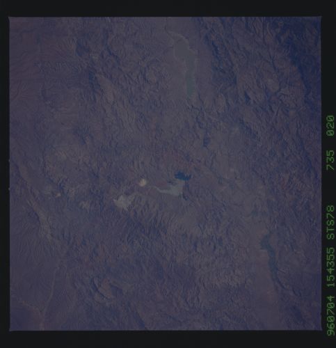
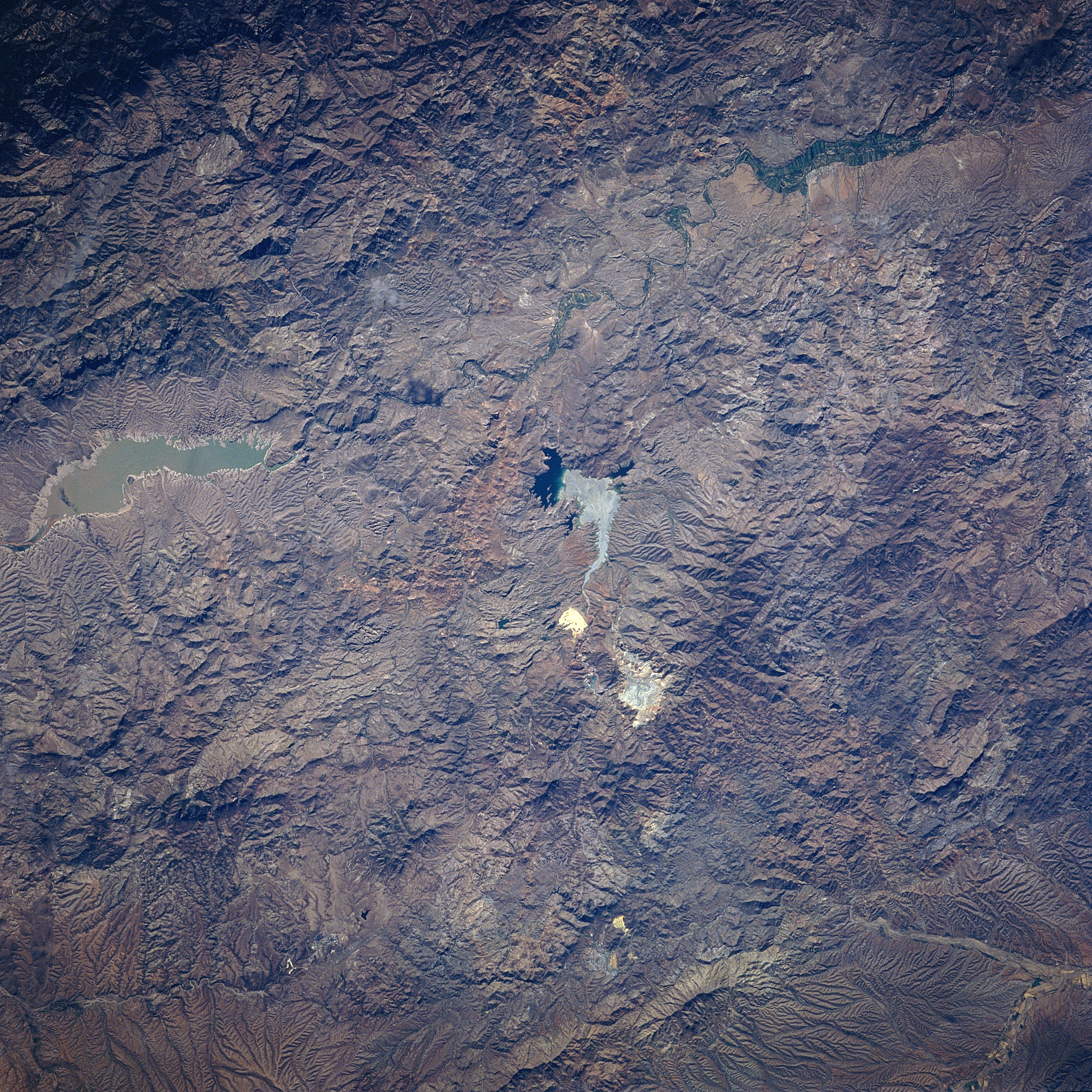
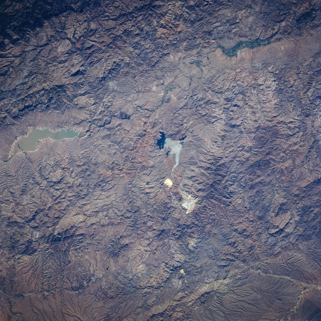
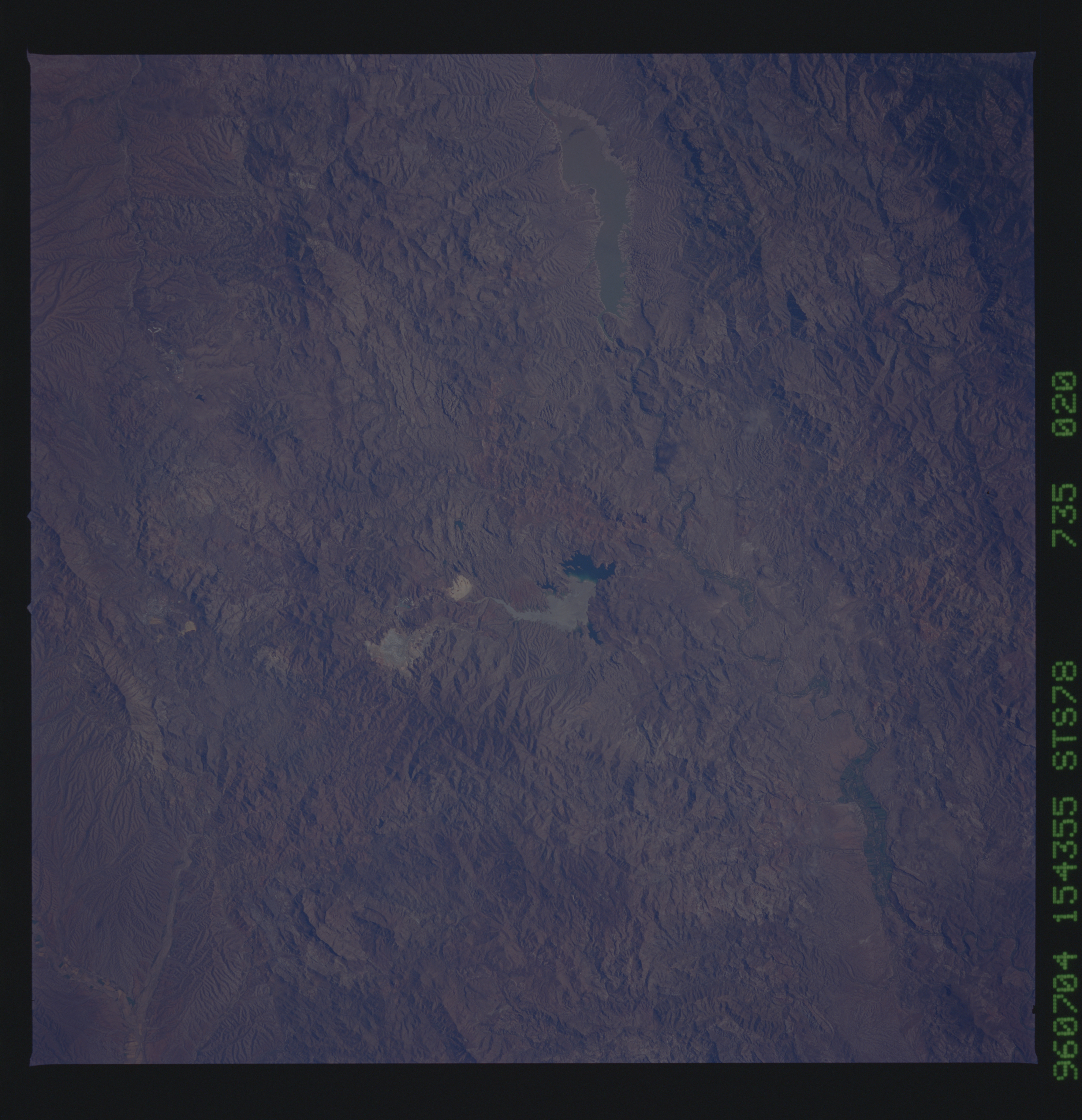
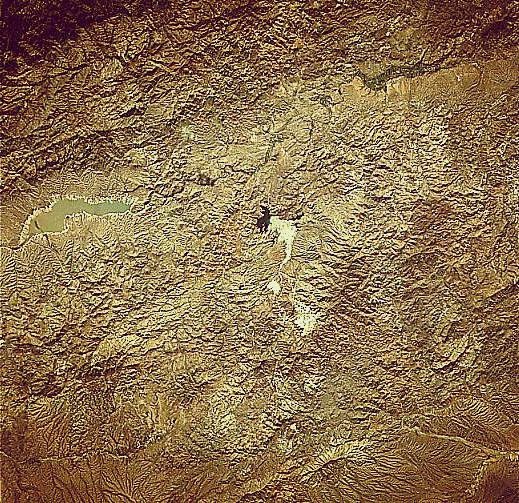
Image Caption: STS078-735-20 Open Pit (Copper) Mine, Sonora, Mexico June 1996
The rugged, mountainous terrain of the Sierra Madre Occidental is evident in this near-nadir image of a section of northeastern Sonora State. The only three identifiable features are a reservoir, a river valley, and a large open pit-mining site. The Angostura Reservoir (opaque, elongated feature near the northern side of the image) is located in the river valley (north-south orientation) that is a tributary of the Yaqui River system. The highly reflective areas in the center of the picture is the "La Cardidad" open pit mine, that is located east of the small town of Nacozari (not identifiable on this small scale image). This mining site is one of the largest copper and molybdenum operations in the northwest Mexico.
The rugged, mountainous terrain of the Sierra Madre Occidental is evident in this near-nadir image of a section of northeastern Sonora State. The only three identifiable features are a reservoir, a river valley, and a large open pit-mining site. The Angostura Reservoir (opaque, elongated feature near the northern side of the image) is located in the river valley (north-south orientation) that is a tributary of the Yaqui River system. The highly reflective areas in the center of the picture is the "La Cardidad" open pit mine, that is located east of the small town of Nacozari (not identifiable on this small scale image). This mining site is one of the largest copper and molybdenum operations in the northwest Mexico.
