STS078-734-54
| NASA Photo ID | STS078-734-54 |
| Focal Length | 250mm |
| Date taken | 1996.06.25 |
| Time taken | 16:18:01 GMT |
Resolutions offered for this image:
4042 x 4048 pixels 639 x 639 pixels 5700 x 5900 pixels 483 x 500 pixels 660 x 653 pixels 479 x 479 pixels
4042 x 4048 pixels 639 x 639 pixels 5700 x 5900 pixels 483 x 500 pixels 660 x 653 pixels 479 x 479 pixels


Cloud masks available for this image:
Spacecraft nadir point: 39.2° N, 94.5° W
Photo center point: 40.0° N, 95.0° W
Photo center point by machine learning:
Photo center point: 40.0° N, 95.0° W
Photo center point by machine learning:
Nadir to Photo Center: Northwest
Spacecraft Altitude: 144 nautical miles (267km)
Country or Geographic Name: | USA-MISSOURI |
Features: | ST. JOSEPH, MISSOURI R. |
| Features Found Using Machine Learning: | |
Cloud Cover Percentage: | 5 (1-10)% |
Sun Elevation Angle: | 60° |
Sun Azimuth: | 112° |
Camera: | Hasselblad |
Focal Length: | 250mm |
Camera Tilt: | 21 degrees |
Format: | 5046: Kodak, natural color positive, Lumiere 100/5046, ASA 100, standard base |
Film Exposure: | Normal |
| Additional Information | |
| Width | Height | Annotated | Cropped | Purpose | Links |
|---|---|---|---|---|---|
| 4042 pixels | 4048 pixels | No | No | Earth From Space collection | Download Image |
| 639 pixels | 639 pixels | No | No | Earth From Space collection | Download Image |
| 5700 pixels | 5900 pixels | No | No | Download Image | |
| 483 pixels | 500 pixels | No | No | Download Image | |
| 660 pixels | 653 pixels | No | No | Download Image | |
| 479 pixels | 479 pixels | Download Image |
Download Packaged File
Download a Google Earth KML for this Image
View photo footprint information
Download a GeoTIFF for this photo
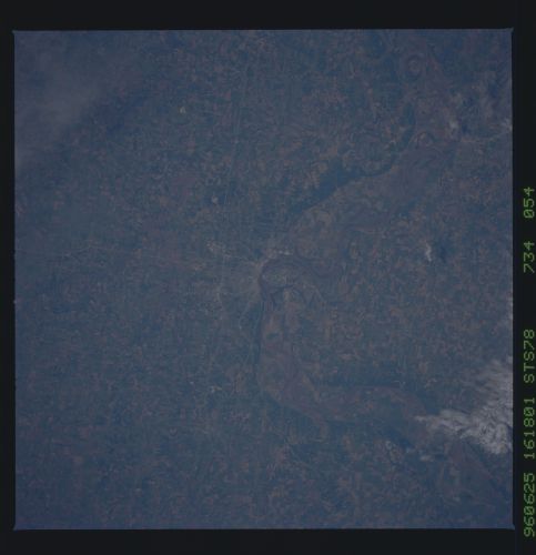
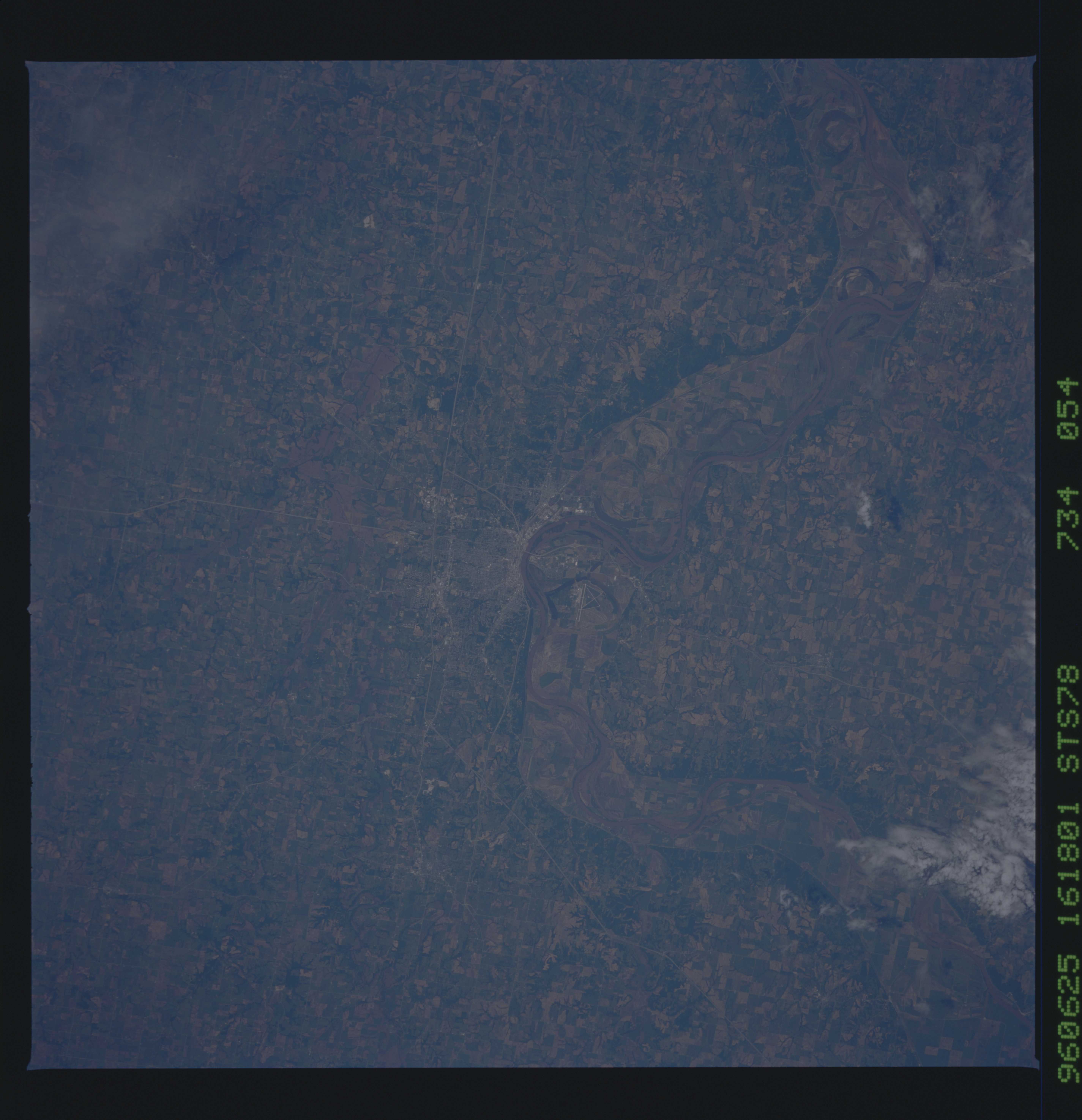
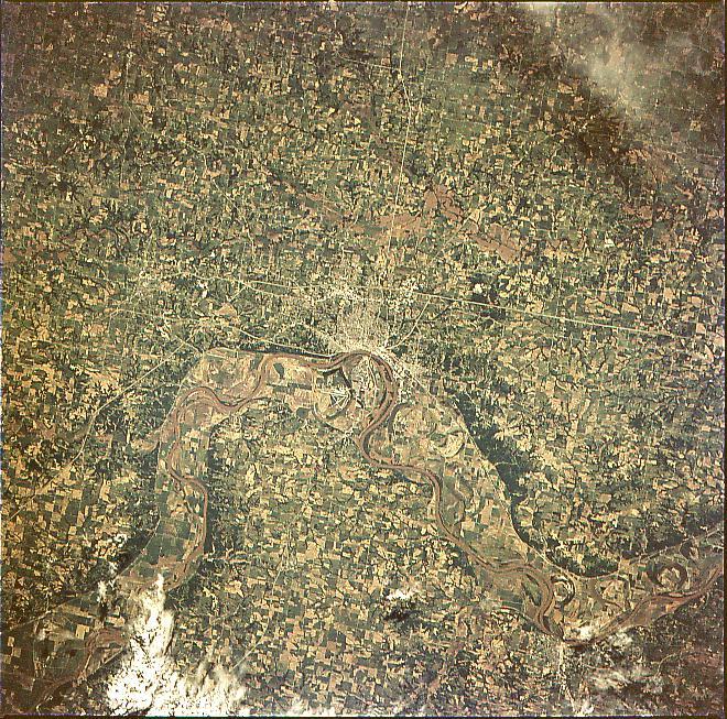
Image Caption: STS078-734-54 St. Joseph, Missouri, USA June 1996
Although this image shows a landscape that is intensively cultivated, the wooded escarpment (darker fringe of land along both sides of the floodplain) helps to frame the boundary of the floodplain of the Missouri River. Some of the gridded street pattern of St. Joseph is visible along the east bank of the Missouri River. The major highways in the St. Joseph area can be traced across the cultivated plain, especially Interstate Highways 29 and 229 and U. S. Highway 36. It is interesting to note that Rosecrans Memorial Airport, located due west of St. Joseph and west of the main channel of the Missouri River, is located in the state of Missouri. The small city of Atchison, Kansas is barely visible near the southwest edge of the picture along the west bank of the Missouri River.
Although this image shows a landscape that is intensively cultivated, the wooded escarpment (darker fringe of land along both sides of the floodplain) helps to frame the boundary of the floodplain of the Missouri River. Some of the gridded street pattern of St. Joseph is visible along the east bank of the Missouri River. The major highways in the St. Joseph area can be traced across the cultivated plain, especially Interstate Highways 29 and 229 and U. S. Highway 36. It is interesting to note that Rosecrans Memorial Airport, located due west of St. Joseph and west of the main channel of the Missouri River, is located in the state of Missouri. The small city of Atchison, Kansas is barely visible near the southwest edge of the picture along the west bank of the Missouri River.
