STS077-740-69
| NASA Photo ID | STS077-740-69 |
| Focal Length | 250mm |
| Date taken | 1996.05.27 |
| Time taken | 03:39:37 GMT |
Cloud masks available for this image:
Spacecraft nadir point: 7.4° N, 93.0° E
Photo center point: 8.0° N, 93.5° E
Photo center point by machine learning:
Photo center point: 8.0° N, 93.5° E
Photo center point by machine learning:
Nadir to Photo Center: Northeast
Spacecraft Altitude: 153 nautical miles (283km)
Country or Geographic Name: | NICOBAR ISLANDS |
Features: | SUNGLINT, WAVE REFRACTION |
| Features Found Using Machine Learning: | |
Cloud Cover Percentage: | 5 (1-10)% |
Sun Elevation Angle: | 57° |
Sun Azimuth: | 62° |
Camera: | Hasselblad |
Focal Length: | 250mm |
Camera Tilt: | 17 degrees |
Format: | 5046: Kodak, natural color positive, Lumiere 100/5046, ASA 100, standard base |
Film Exposure: | Normal |
| Additional Information | |
| Width | Height | Annotated | Cropped | Purpose | Links |
|---|---|---|---|---|---|
| 5700 pixels | 5900 pixels | No | No | Download Image | |
| 500 pixels | 518 pixels | No | No | Download Image | |
| 640 pixels | 480 pixels | No | No | Download Image |
Download Packaged File
Download a Google Earth KML for this Image
View photo footprint information
Download a GeoTIFF for this photo
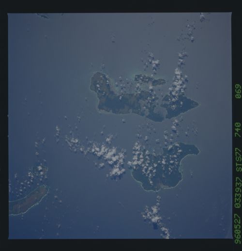
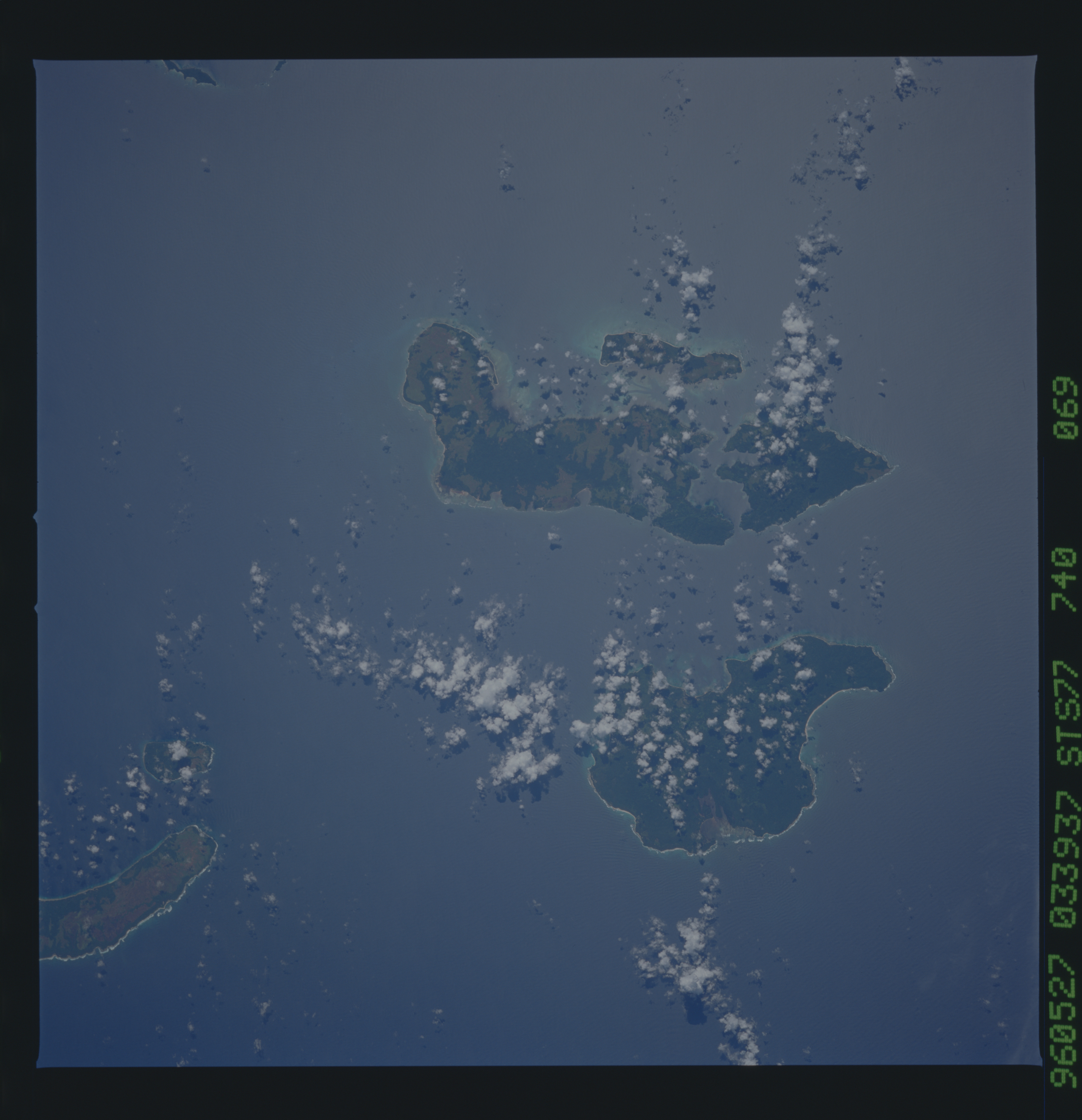
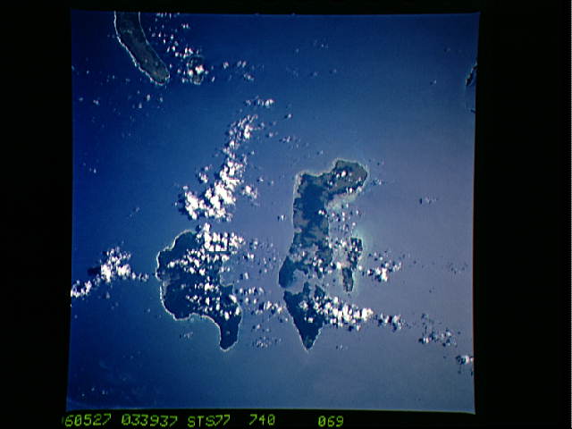
Image Caption: Nicobar Islands in the Andaman Sea
Color photography depicts reefs and land use patterns as seen on
these islands. Sea swell is seen making a variety of patterns as
they approach and refract of the islands. The individual island
names are Katchall (the smaller hooked finger island to the west),
Camorta ( the northern portion of the grouping to the east) and
Nancowry. (the southern portion of the grouping).
(nadir 8.7N 91.4E)
