STS077-709-48

| NASA Photo ID | STS077-709-48 |
| Focal Length | 50mm |
| Date taken | 1996.05.22 |
| Time taken | 17:02:26 GMT |
Resolutions offered for this image:
5700 x 5900 pixels 500 x 518 pixels 640 x 480 pixels 2516 x 2515 pixels
5700 x 5900 pixels 500 x 518 pixels 640 x 480 pixels 2516 x 2515 pixels
Cloud masks available for this image:
Spacecraft nadir point: 20.0° N, 91.1° W
Photo center point: 21.0° N, 88.5° W
Photo center point by machine learning:
Photo center point: 21.0° N, 88.5° W
Photo center point by machine learning:
Nadir to Photo Center: East
Spacecraft Altitude: 154 nautical miles (285km)
Country or Geographic Name: | MEXICO |
Features: | YUCATAN, ALACRAN REEF |
| Features Found Using Machine Learning: | |
Cloud Cover Percentage: | 25 (11-25)% |
Sun Elevation Angle: | 76° |
Sun Azimuth: | 85° |
Camera: | Hasselblad |
Focal Length: | 50mm |
Camera Tilt: | 47 degrees |
Format: | 5046: Kodak, natural color positive, Lumiere 100/5046, ASA 100, standard base |
Film Exposure: | Normal |
| Additional Information | |
| Width | Height | Annotated | Cropped | Purpose | Links |
|---|---|---|---|---|---|
| 5700 pixels | 5900 pixels | No | No | Download Image | |
| 500 pixels | 518 pixels | No | No | Download Image | |
| 640 pixels | 480 pixels | No | No | Download Image | |
| 2516 pixels | 2515 pixels | Download Image |
Download Packaged File
Download a Google Earth KML for this Image
View photo footprint information
Download a GeoTIFF for this photo
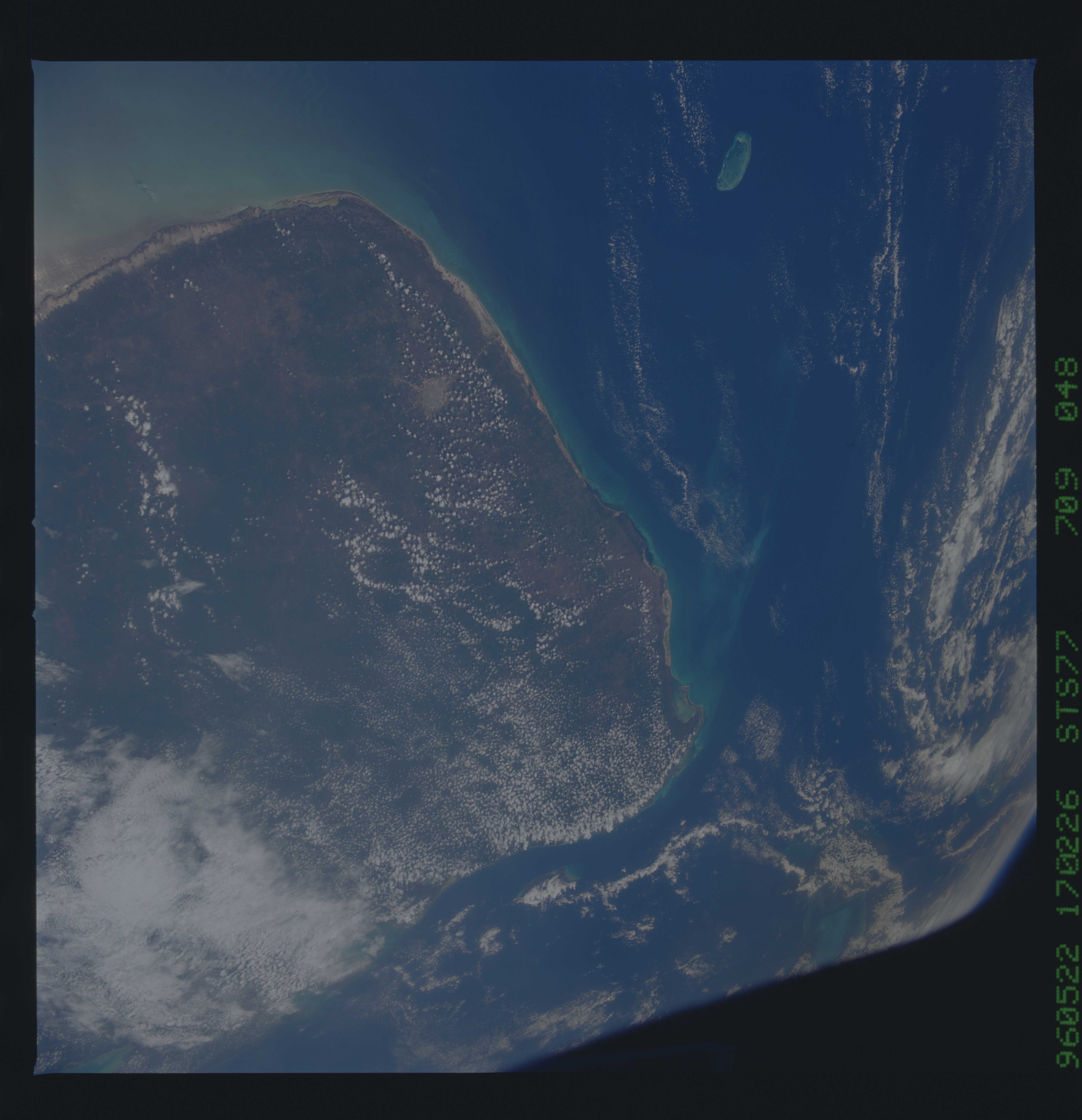
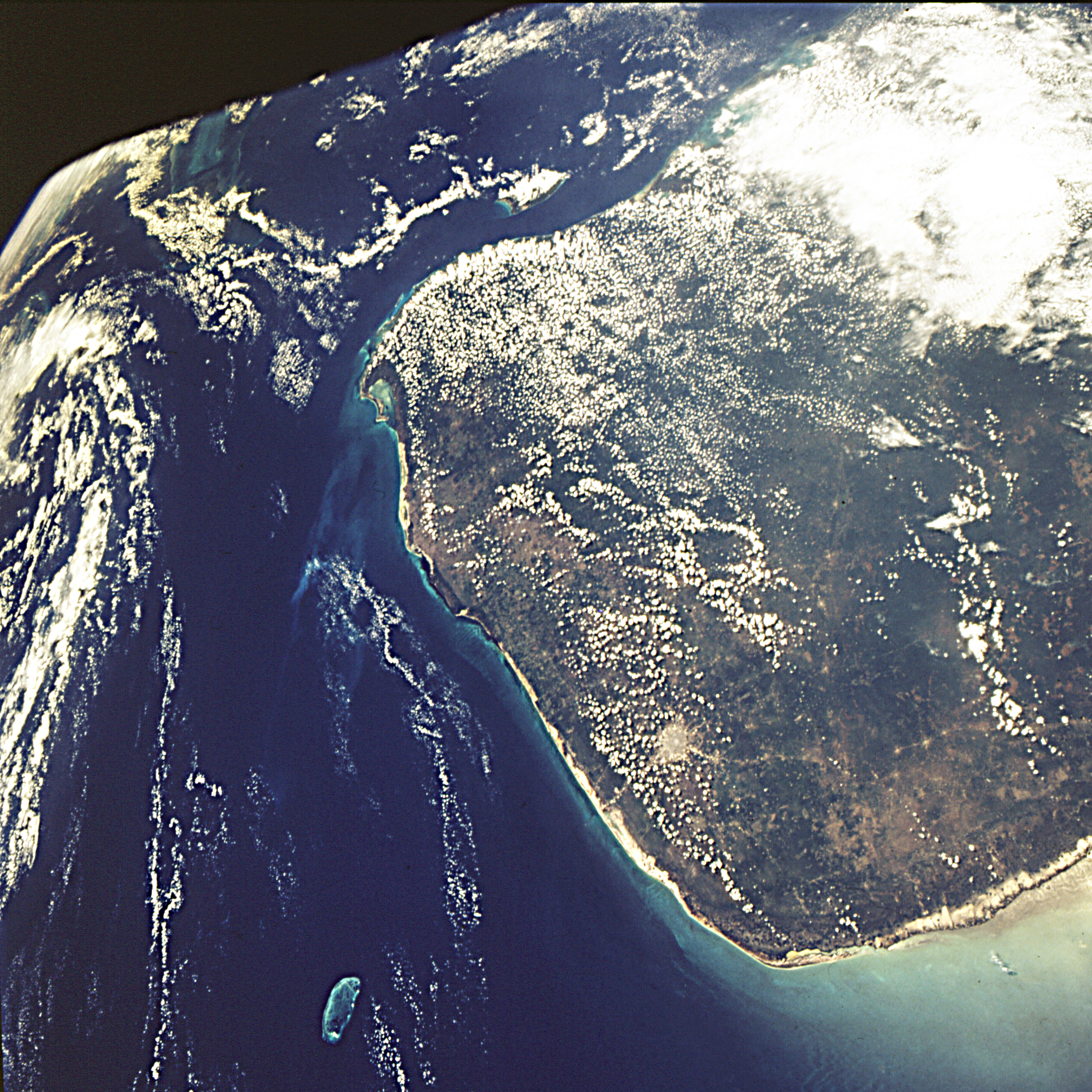
Image Caption: Northern end of the Yucatan Peninsula, Mexico. The city of
Merida appears as a large gray dot near the coast. The city of
Progresso on the coast and north of Merida is near the center of
of the Chicxulub impact crater. Chicxulub has been eroded and is
no longer readily visible, however this crater is estimated to have
originally been 6 to 12 miles (10 to 20 kilometers) in diameter. It
has been theorized that this impact contributed to the extinction
of the dinosaurs at the end of the Cretaceous.
