STS075-733-95
| NASA Photo ID | STS075-733-95 |
| Focal Length | 250mm |
| Date taken | 1996.03.01 |
| Time taken | 09:11:22 GMT |
Resolutions offered for this image:
4096 x 4096 pixels 640 x 640 pixels 5700 x 5900 pixels 500 x 518 pixels 640 x 480 pixels 524 x 515 pixels
4096 x 4096 pixels 640 x 640 pixels 5700 x 5900 pixels 500 x 518 pixels 640 x 480 pixels 524 x 515 pixels
Cloud masks available for this image:
Spacecraft nadir point: 5.7° N, 102.7° E
Photo center point: 6.0° N, 102.0° E
Photo center point by machine learning:
Photo center point: 6.0° N, 102.0° E
Photo center point by machine learning:
Nadir to Photo Center: West
Spacecraft Altitude: 158 nautical miles (293km)
Country or Geographic Name: | MALAYSIA |
Features: | KELANTAN R., COAST, TAIL |
| Features Found Using Machine Learning: | |
Cloud Cover Percentage: | 5 (1-10)% |
Sun Elevation Angle: | 31° |
Sun Azimuth: | 258° |
Camera: | Hasselblad |
Focal Length: | 250mm |
Camera Tilt: | 16 degrees |
Format: | 5046: Kodak, natural color positive, Lumiere 100/5046, ASA 100, standard base |
Film Exposure: | Normal |
| Additional Information | |
| Width | Height | Annotated | Cropped | Purpose | Links |
|---|---|---|---|---|---|
| 4096 pixels | 4096 pixels | No | No | Earth From Space collection | Download Image |
| 640 pixels | 640 pixels | No | No | Earth From Space collection | Download Image |
| 5700 pixels | 5900 pixels | No | No | Download Image | |
| 500 pixels | 518 pixels | No | No | Download Image | |
| 640 pixels | 480 pixels | No | No | Download Image | |
| 524 pixels | 515 pixels | Download Image |
Download Packaged File
Download a Google Earth KML for this Image
View photo footprint information
Download a GeoTIFF for this photo
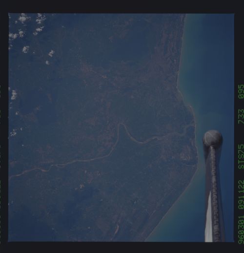
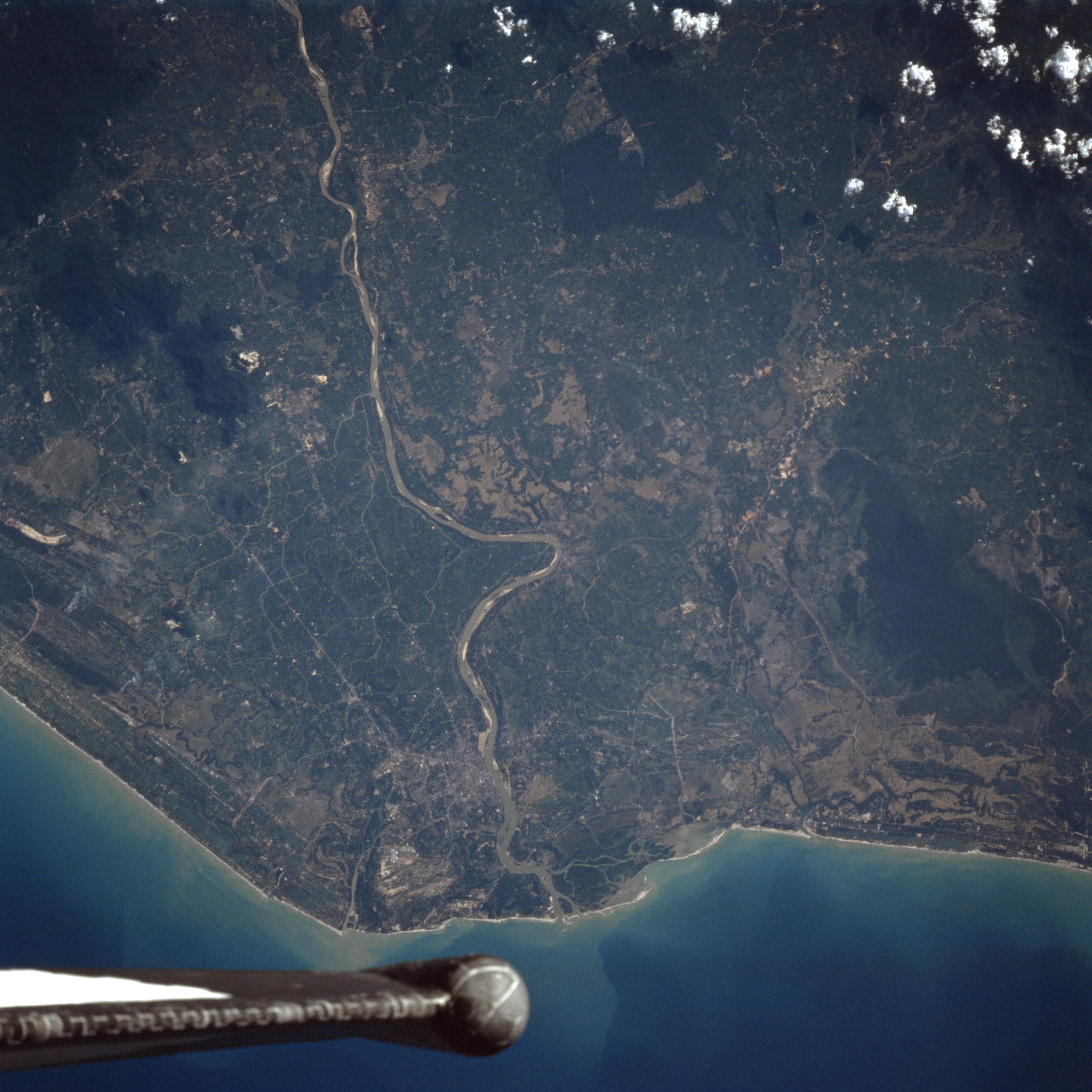
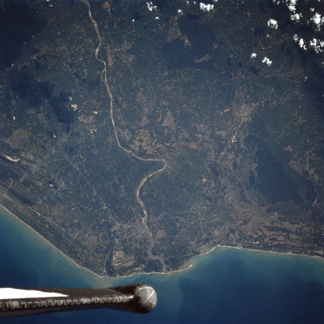
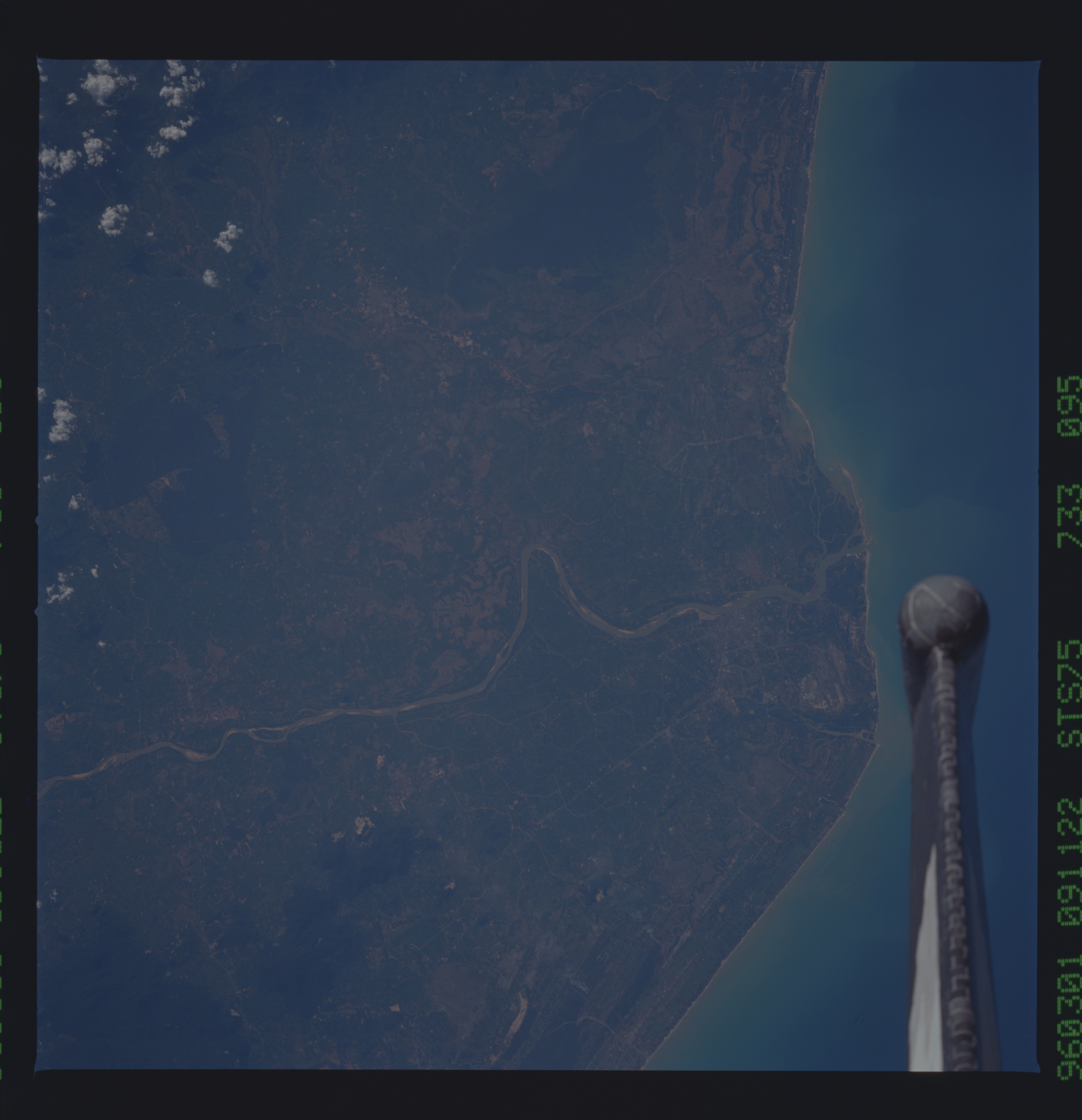
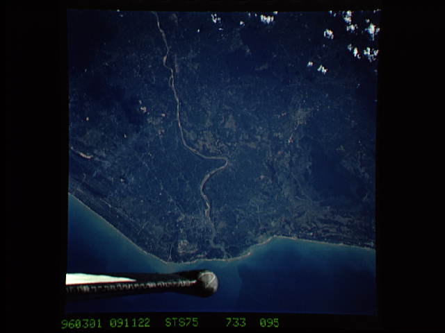
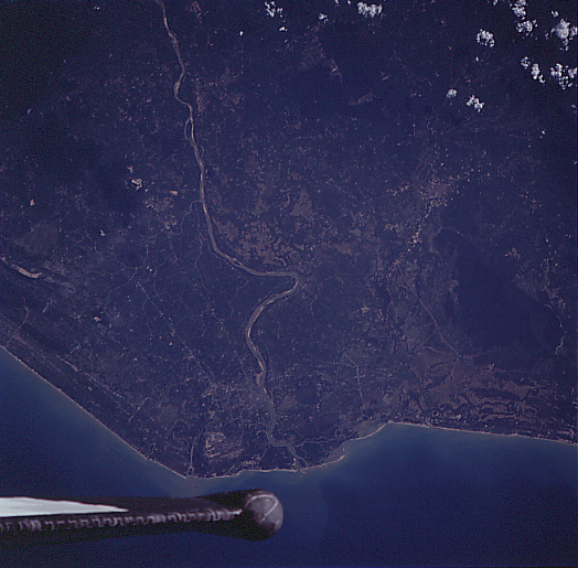
Image Caption: STS075-733-095 Kelantan River, Malaysia March 1996
Located near the border of Thailand (extreme right), the Kelantan River and its delta are visible in this southwest-looking view. Over 150 miles (242 km) long, the Kelantan rises in the interior mountains of the Malaysian Peninisula and flows generally north-northeast before emptying into the South China Sea (bottom of the image). The river has numerous tributaries and is navigable for much of its course. Much clearing (center of the image) of the fertile coastal plain is underway, with rice fields and rubber and coconut plantations taking over. Barely discernible on the east (left) bank of the Kelantan River (midway between the bottom center and center of the image) is the modern commercial city of Kota Baharu.
Located near the border of Thailand (extreme right), the Kelantan River and its delta are visible in this southwest-looking view. Over 150 miles (242 km) long, the Kelantan rises in the interior mountains of the Malaysian Peninisula and flows generally north-northeast before emptying into the South China Sea (bottom of the image). The river has numerous tributaries and is navigable for much of its course. Much clearing (center of the image) of the fertile coastal plain is underway, with rice fields and rubber and coconut plantations taking over. Barely discernible on the east (left) bank of the Kelantan River (midway between the bottom center and center of the image) is the modern commercial city of Kota Baharu.
