STS075-732-18
| NASA Photo ID | STS075-732-18 |
| Focal Length | 250mm |
| Date taken | 1996.03.02 |
| Time taken | 07:40:30 GMT |
Resolutions offered for this image:
5700 x 5900 pixels 500 x 518 pixels 640 x 480 pixels 5104 x 5123 pixels
5700 x 5900 pixels 500 x 518 pixels 640 x 480 pixels 5104 x 5123 pixels

Cloud masks available for this image:
Spacecraft nadir point: 11.2° N, 106.7° E
Photo center point: 10.0° N, 106.5° E
Photo center point by machine learning:
Photo center point: 10.0° N, 106.5° E
Photo center point by machine learning:
Nadir to Photo Center: South
Spacecraft Altitude: 157 nautical miles (291km)
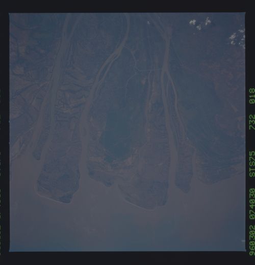
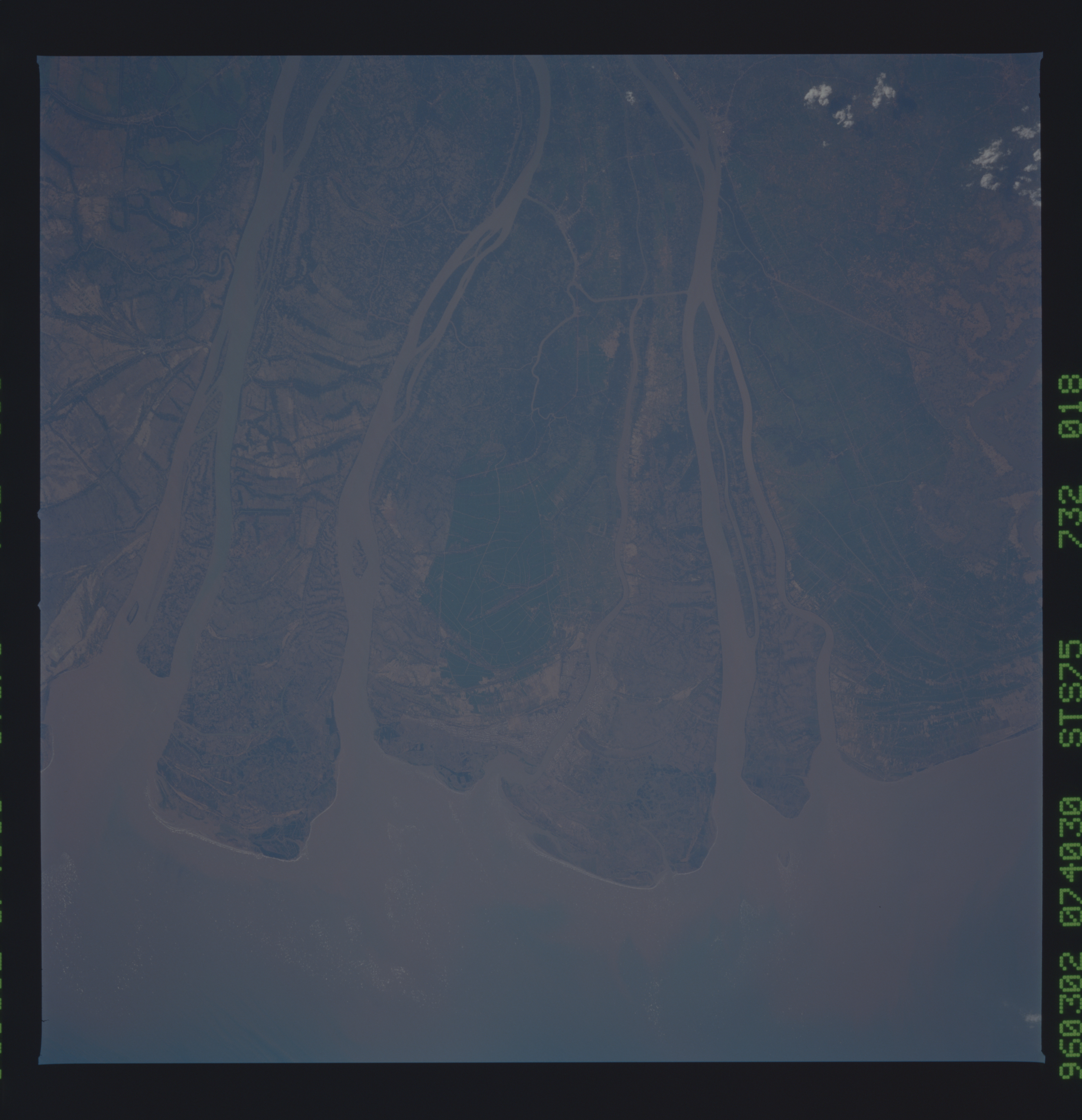
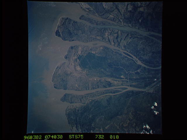
Country or Geographic Name: | VIETNAM |
Features: | MOUTHS OF THE MEKONG |
| Features Found Using Machine Learning: | |
Cloud Cover Percentage: | 5 (1-10)% |
Sun Elevation Angle: | 47° |
Sun Azimuth: | 247° |
Camera: | Hasselblad |
Focal Length: | 250mm |
Camera Tilt: | 25 degrees |
Format: | 5046: Kodak, natural color positive, Lumiere 100/5046, ASA 100, standard base |
Film Exposure: | Normal |
| Additional Information | |
| Width | Height | Annotated | Cropped | Purpose | Links |
|---|---|---|---|---|---|
| 5700 pixels | 5900 pixels | No | No | Download Image | |
| 500 pixels | 518 pixels | No | No | Download Image | |
| 640 pixels | 480 pixels | No | No | Download Image | |
| 5104 pixels | 5123 pixels | Download Image |
Download Packaged File
Download a Google Earth KML for this Image
View photo footprint information
Download a GeoTIFF for this photo
Image Caption: The Mekong Delta. Coastal delta photos without sunglint
show sediment distributions and deposition patterns of different
sediments being carried by the river (nadir 11.4N 106.3E).
show sediment distributions and deposition patterns of different
sediments being carried by the river (nadir 11.4N 106.3E).
