STS074-736-49
| NASA Photo ID | STS074-736-49 |
| Focal Length | 100mm |
| Date taken | 1995.11.15 |
| Time taken | 15:55:46 GMT |

Cloud masks available for this image:
Spacecraft nadir point: 11.6° N, 3.5° W
Photo center point: 16.0° N, 4.0° W
Photo center point by machine learning:
Photo center point: 16.0° N, 4.0° W
Photo center point by machine learning:
Nadir to Photo Center: North
Spacecraft Altitude: 213 nautical miles (394km)
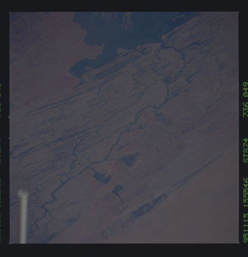
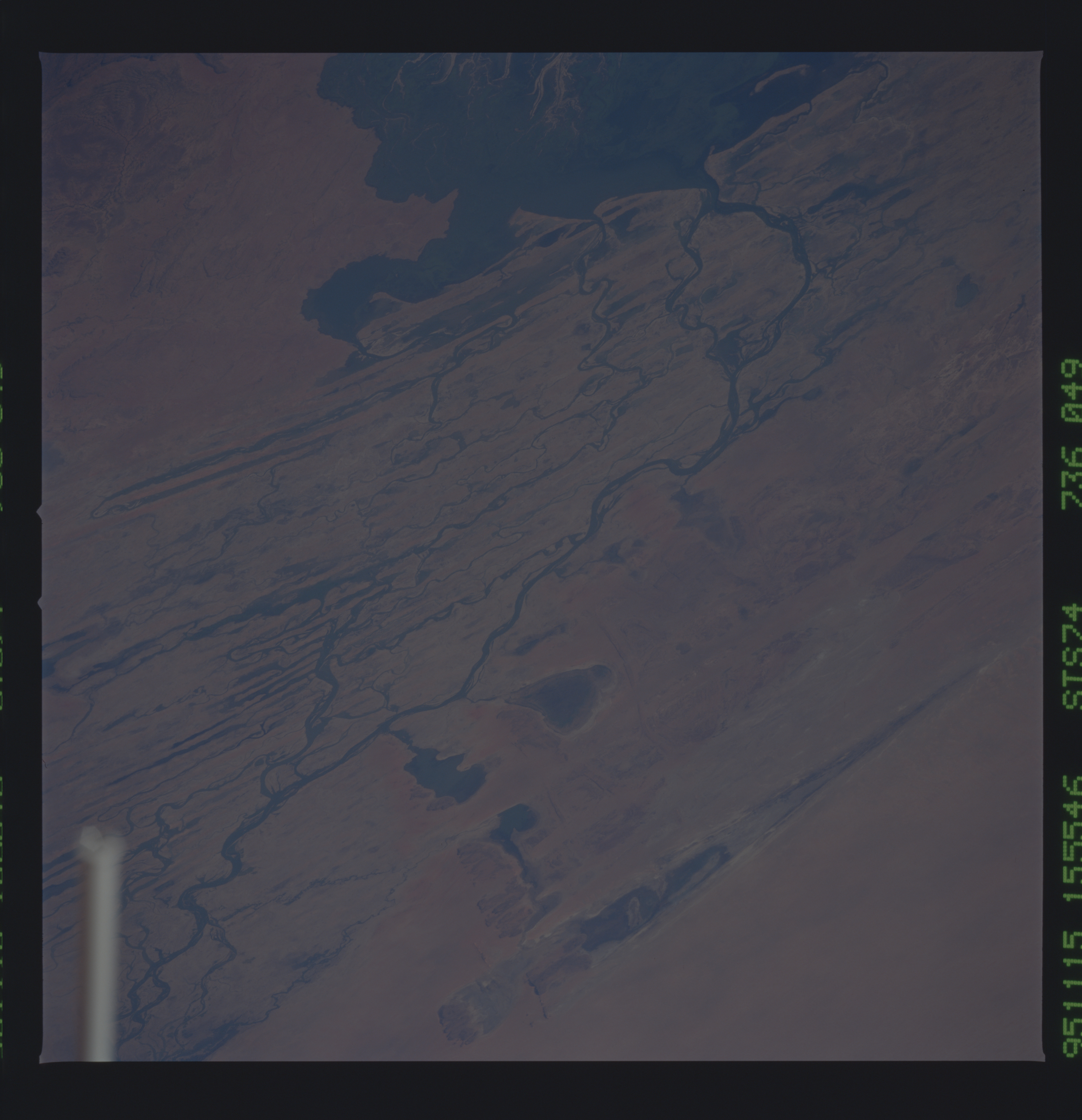
Country or Geographic Name: | MALI |
Features: | NIGER RIVER INLAND DELTA |
| Features Found Using Machine Learning: | |
Cloud Cover Percentage: | 0 (no clouds present) |
Sun Elevation Angle: | 24° |
Sun Azimuth: | 243° |
Camera: | Hasselblad |
Focal Length: | 100mm |
Camera Tilt: | 51 degrees |
Format: | 5046: Kodak, natural color positive, Lumiere 100/5046, ASA 100, standard base |
Film Exposure: | Normal |
| Additional Information | |
| Width | Height | Annotated | Cropped | Purpose | Links |
|---|---|---|---|---|---|
| 5700 pixels | 5900 pixels | No | No | Download Image | |
| 500 pixels | 518 pixels | No | No | Download Image | |
| 640 pixels | 480 pixels | No | No | Download Image |
Download Packaged File
Download a Google Earth KML for this Image
View photo footprint information
Download a GeoTIFF for this photo
Image Caption: The inland delta of the Niger river is located in Mali.
The city of Timbuktu is under the robot arm. The long lake in the
photographs is Faguibine. The Niger River is 2600 miles long and flows
eastward. It and the Senegal are the two major rivers in the Sahel
region.
The city of Timbuktu is under the robot arm. The long lake in the
photographs is Faguibine. The Niger River is 2600 miles long and flows
eastward. It and the Senegal are the two major rivers in the Sahel
region.
