STS074-711-18
| NASA Photo ID | STS074-711-18 |
| Focal Length | 250mm |
| Date taken | 1995.11.14 |
| Time taken | 21:18:05 GMT |
Resolutions offered for this image:
3872 x 3875 pixels 639 x 640 pixels 5700 x 5900 pixels 500 x 518 pixels 640 x 480 pixels
3872 x 3875 pixels 639 x 640 pixels 5700 x 5900 pixels 500 x 518 pixels 640 x 480 pixels

Cloud masks available for this image:
Spacecraft nadir point: 41.3° N, 113.8° W
Photo center point: 41.5° N, 112.5° W
Photo center point by machine learning:
Photo center point: 41.5° N, 112.5° W
Photo center point by machine learning:
Nadir to Photo Center: East
Spacecraft Altitude: 210 nautical miles (389km)
Country or Geographic Name: | USA-UTAH |
Features: | GREAT SALT LAKE, DESERT |
| Features Found Using Machine Learning: | |
Cloud Cover Percentage: | 5 (1-10)% |
Sun Elevation Angle: | 25° |
Sun Azimuth: | 211° |
Camera: | Hasselblad |
Focal Length: | 250mm |
Camera Tilt: | 21 degrees |
Format: | 5046: Kodak, natural color positive, Lumiere 100/5046, ASA 100, standard base |
Film Exposure: | Normal |
| Additional Information | |
| Width | Height | Annotated | Cropped | Purpose | Links |
|---|---|---|---|---|---|
| 3872 pixels | 3875 pixels | No | No | Earth From Space collection | Download Image |
| 639 pixels | 640 pixels | No | No | Earth From Space collection | Download Image |
| 5700 pixels | 5900 pixels | No | No | Download Image | |
| 500 pixels | 518 pixels | No | No | Download Image | |
| 640 pixels | 480 pixels | No | No | Download Image |
Download Packaged File
Download a Google Earth KML for this Image
View photo footprint information
Download a GeoTIFF for this photo
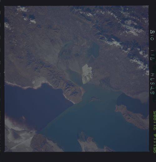
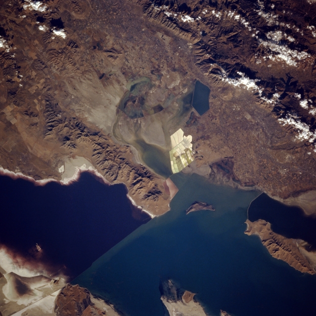
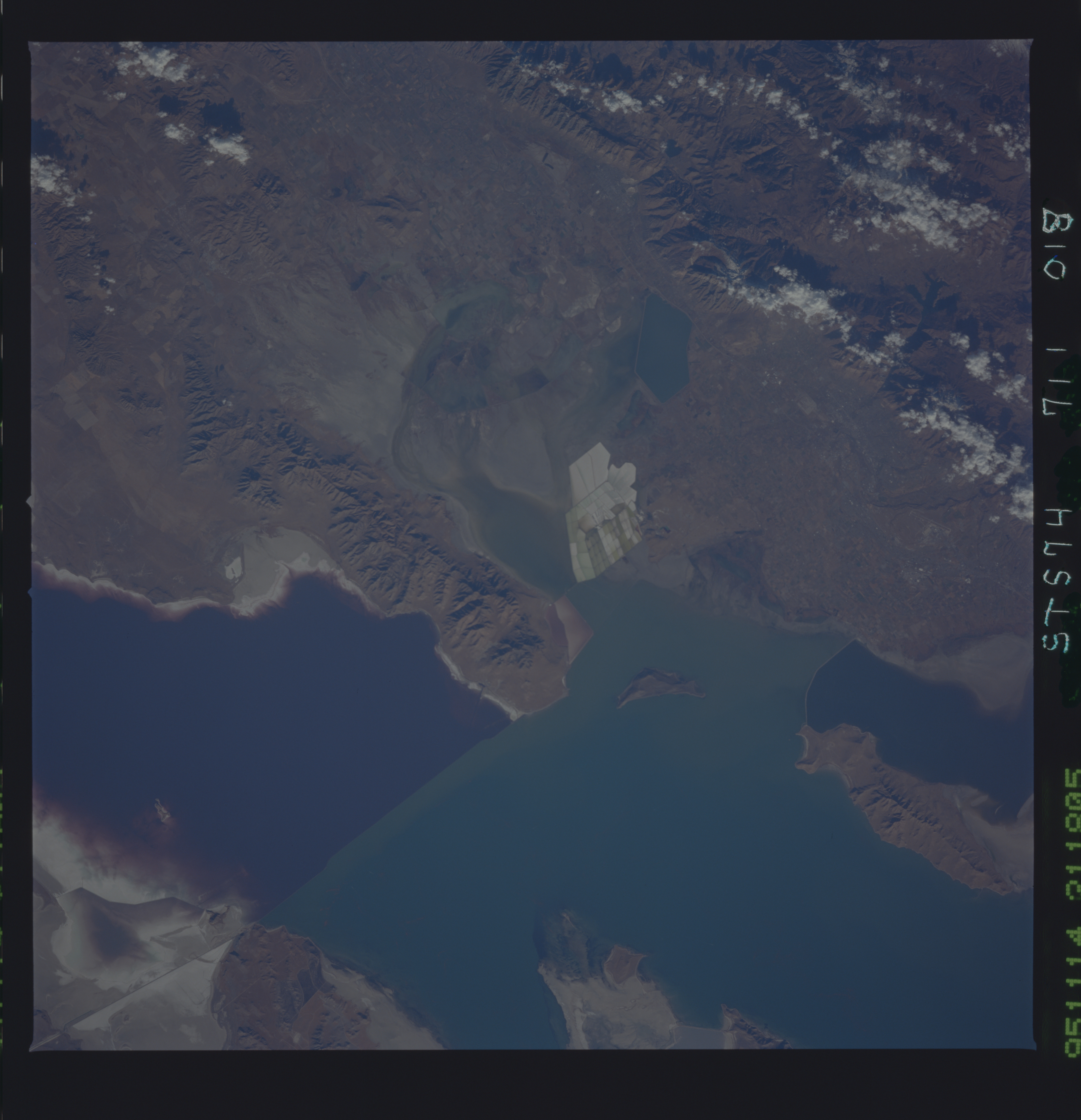
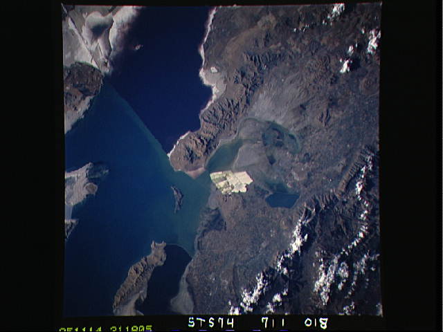
Image Caption: STS074-711-018 Great Salt Lake, Willard Bay, and Bear River Bay, Utah, U.S.A. November 1995
A railroad causeway through the middle of the Great Salt Lake and color variations of the lake caused by differences in salt concentration in the two halves are discernible in this northeast-looking, low-oblique photograph. The bluer northern half of the lake has a higher salt concentration, and the more sediment-filled southern half receives more runoff from neighboring mountains, thereby making it less salty. To the east of the north-south-trending Promontory Mountains are Willard Bay, Willard Reservoir, and Bear River Bay. Desiccation ponds and large evaporite pans are visible east of Willard Bay. The rugged peaks of the cloud-covered Wasatch Range lie east of the Hansels Mountains (lower left).
A railroad causeway through the middle of the Great Salt Lake and color variations of the lake caused by differences in salt concentration in the two halves are discernible in this northeast-looking, low-oblique photograph. The bluer northern half of the lake has a higher salt concentration, and the more sediment-filled southern half receives more runoff from neighboring mountains, thereby making it less salty. To the east of the north-south-trending Promontory Mountains are Willard Bay, Willard Reservoir, and Bear River Bay. Desiccation ponds and large evaporite pans are visible east of Willard Bay. The rugged peaks of the cloud-covered Wasatch Range lie east of the Hansels Mountains (lower left).
