STS074-709-58
| NASA Photo ID | STS074-709-58 |
| Focal Length | mm |
| Date taken | 1995.11.__ |
| Time taken | GMT |

Cloud masks available for this image:
Spacecraft nadir point:
Photo center point:
Photo center point by machine learning:
Photo center point:
Photo center point by machine learning:
Nadir to Photo Center:
Spacecraft Altitude: nautical miles (0km)
Country or Geographic Name: | |
Features: | NON EARTHOBS |
| Features Found Using Machine Learning: | |
Cloud Cover Percentage: | |
Sun Elevation Angle: | ° |
Sun Azimuth: | ° |
Camera: | Hasselblad |
Focal Length: | mm |
Camera Tilt: | |
Format: | 5046: Kodak, natural color positive, Lumiere 100/5046, ASA 100, standard base |
Film Exposure: | |
| Additional Information | |
| Width | Height | Annotated | Cropped | Purpose | Links |
|---|---|---|---|---|---|
| 5700 pixels | 5900 pixels | No | No | Download Image | |
| 500 pixels | 518 pixels | No | No | Download Image | |
| 640 pixels | 480 pixels | No | No | Download Image |
Download Packaged File
Download a Google Earth KML for this Image
View photo footprint information
Download a GeoTIFF for this photo
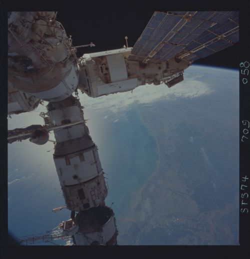
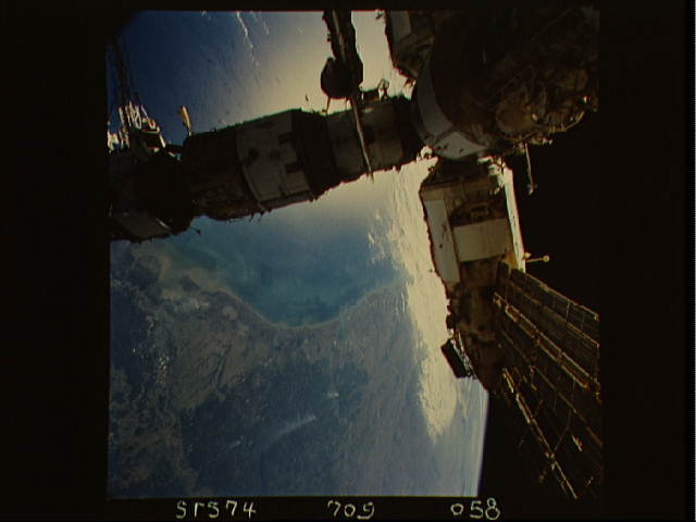
Image Caption: The Gulf of Mexico from the Atchafalaya Bay to
Matagorda Bay with the MIR. Sunglint shows patches of oil away for the
coast. These can be either ship bilge dumps or natural oil seeps. The
color along the coast shows the sediment distribution from river
discharge.
Matagorda Bay with the MIR. Sunglint shows patches of oil away for the
coast. These can be either ship bilge dumps or natural oil seeps. The
color along the coast shows the sediment distribution from river
discharge.
