STS073-E-5286

| NASA Photo ID | STS073-E-5286 |
| Focal Length | mm |
| Date taken | 1995.10.30 |
| Time taken | 15:40:39 GMT |
Cloud masks available for this image:
Spacecraft nadir point: 38.0° S, 28.2° E
Photo center point:
Photo center point by machine learning:
Photo center point:
Photo center point by machine learning:
Nadir to Photo Center:
Spacecraft Altitude: 144 nautical miles (267km)
Camera: | Kodak DCS460 Electronic Still Camera |
Focal Length: | mm |
Camera Tilt: | |
Format: | 3060E: 3060 x 2036 pixel CCD, RGBG array |
Film Exposure: | |
| Additional Information | |
| Width | Height | Annotated | Cropped | Purpose | Links |
|---|---|---|---|---|---|
| 1536 pixels | 1052 pixels | No | No | Download Image | |
| 3060 pixels | 2036 pixels | No | No | Download Image | |
| 640 pixels | 425 pixels | No | No | Download Image |
Download Packaged File
Download a Google Earth KML for this Image
View photo footprint information
Download a GeoTIFF for this photo
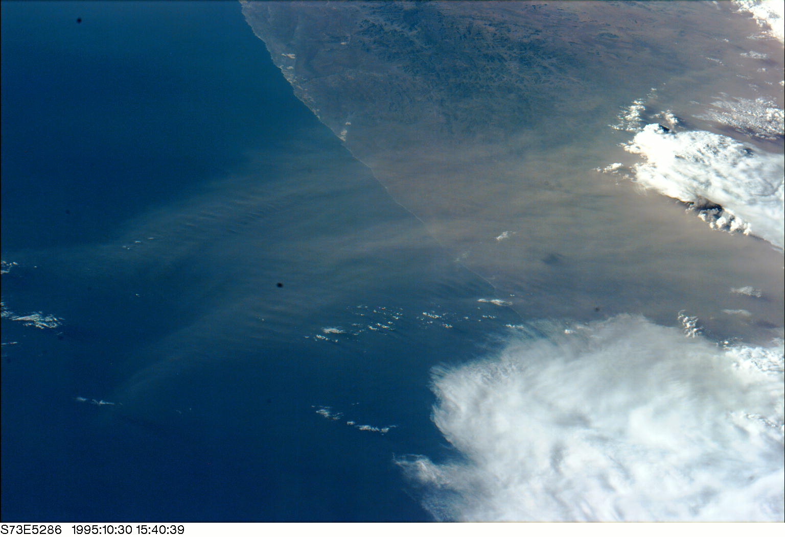
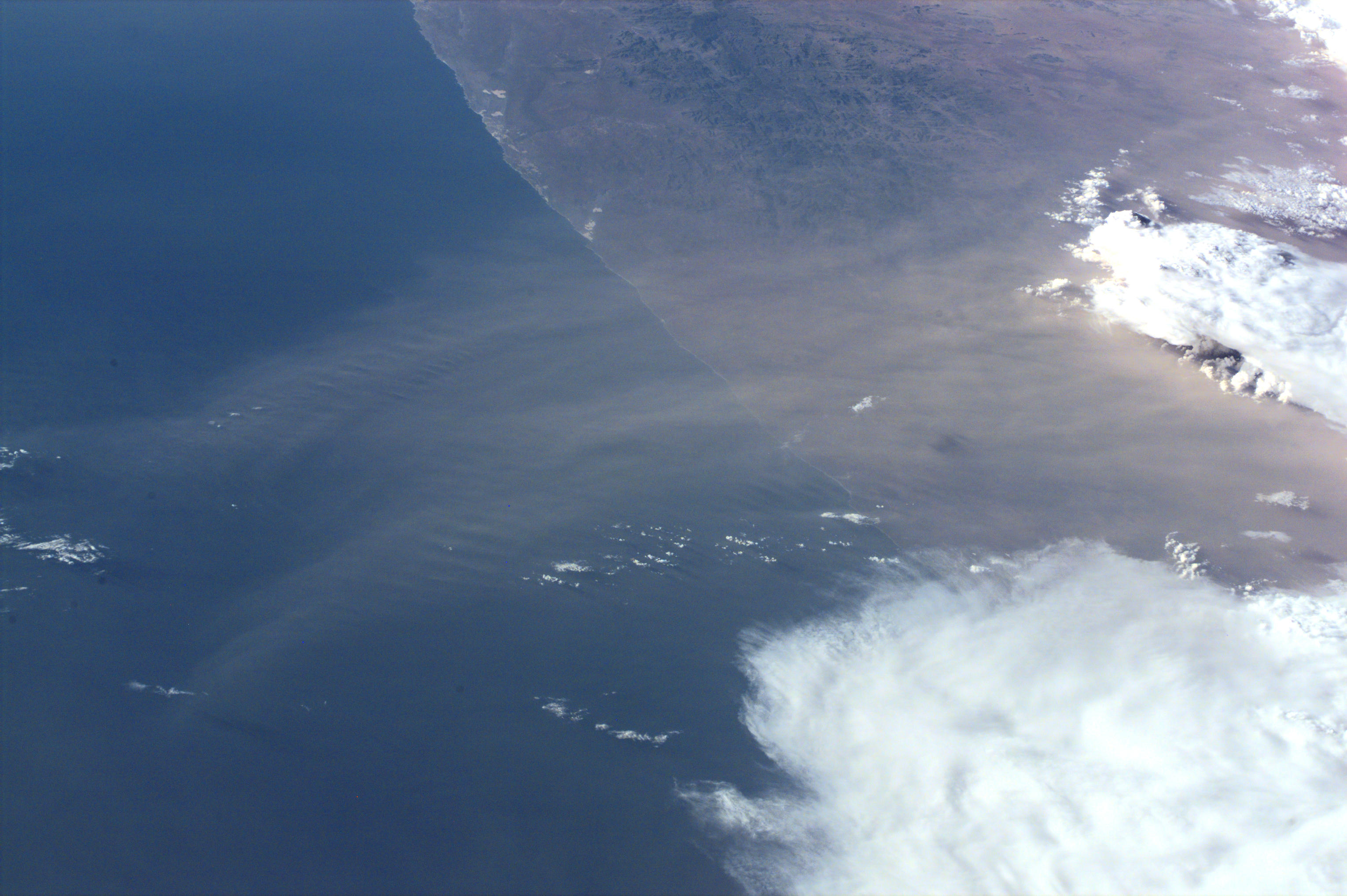
Image Caption: Namib dust, South Africa. The Namib coast in South Africa is
the most southerly point from which dust clouds have been recorded.
Small plumes have been seen three times prior on Shuttle photograpy,
but from the Namib sand sea (hundreds of miles to the north of this
shot).Dust supply to sea floor sediments increases during dry periods,
and is evidence for climate change.
