STS073-750-29
| NASA Photo ID | STS073-750-29 |
| Focal Length | 250mm |
| Date taken | 1995.10.25 |
| Time taken | 16:58:17 GMT |
Resolutions offered for this image:
3872 x 3904 pixels 634 x 639 pixels 5700 x 5900 pixels 500 x 518 pixels 640 x 480 pixels
3872 x 3904 pixels 634 x 639 pixels 5700 x 5900 pixels 500 x 518 pixels 640 x 480 pixels
Cloud masks available for this image:
Spacecraft nadir point: 33.9° N, 82.7° W
Photo center point: 34.5° N, 84.0° W
Photo center point by machine learning:
Photo center point: 34.5° N, 84.0° W
Photo center point by machine learning:
Nadir to Photo Center: West
Spacecraft Altitude: 145 nautical miles (269km)
Country or Geographic Name: | USA-GEORGIA |
Features: | L. SIDNEY LANIER, AGR., CY. |
| Features Found Using Machine Learning: | |
Cloud Cover Percentage: | 0 (no clouds present) |
Sun Elevation Angle: | 44° |
Sun Azimuth: | 174° |
Camera: | Hasselblad |
Focal Length: | 250mm |
Camera Tilt: | 31 degrees |
Format: | 2443: Kodak Aerochrome 2443, color IR, thin base, EA-5 process thru June 1999, E-6 process afterward |
Film Exposure: | Normal |
| Additional Information | |
| Width | Height | Annotated | Cropped | Purpose | Links |
|---|---|---|---|---|---|
| 3872 pixels | 3904 pixels | No | No | Earth From Space collection | Download Image |
| 634 pixels | 639 pixels | No | No | Earth From Space collection | Download Image |
| 5700 pixels | 5900 pixels | No | No | Download Image | |
| 500 pixels | 518 pixels | No | No | Download Image | |
| 640 pixels | 480 pixels | No | No | Download Image |
Download Packaged File
Download a Google Earth KML for this Image
View photo footprint information
Download a GeoTIFF for this photo
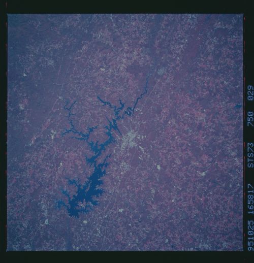
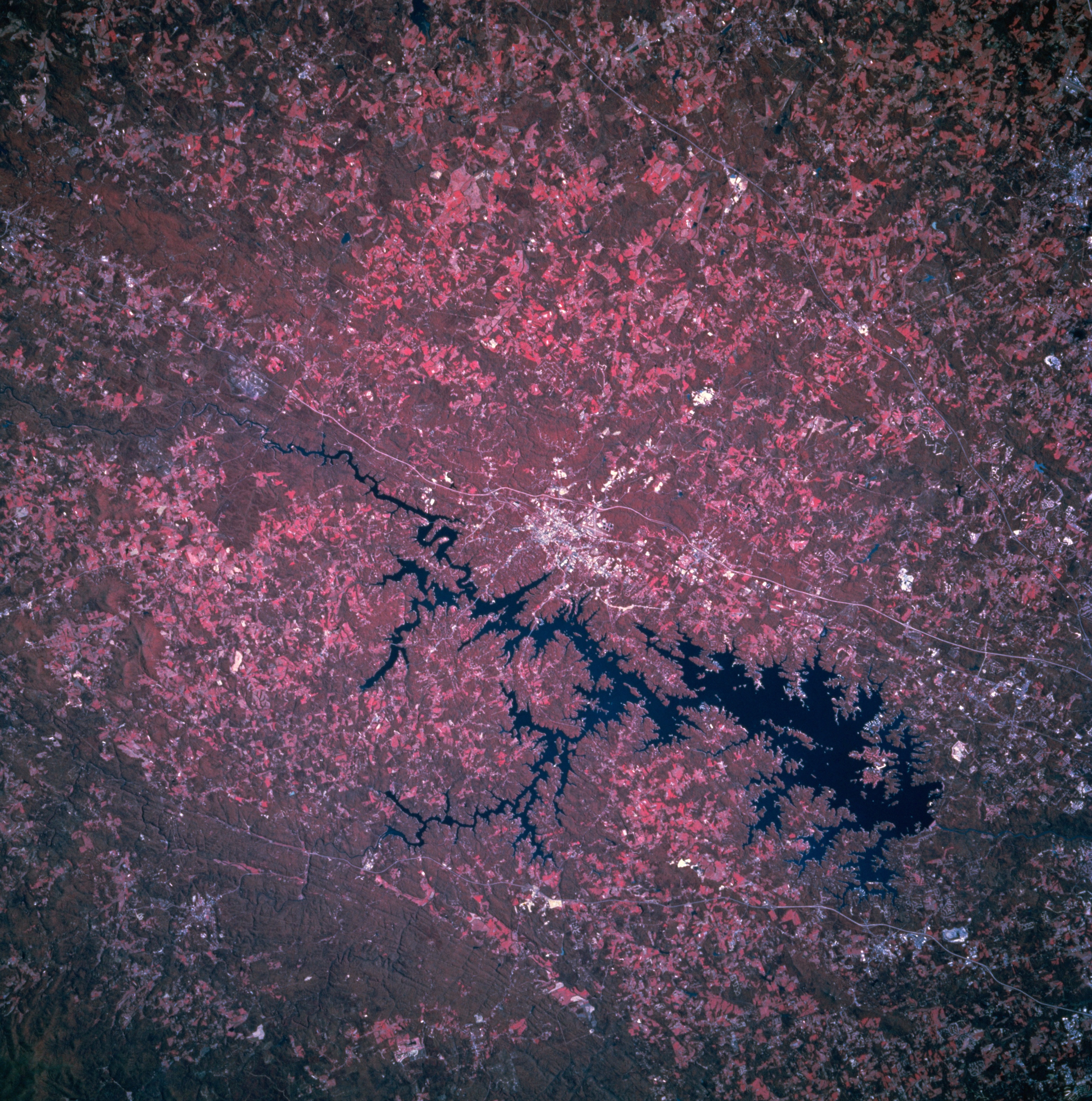
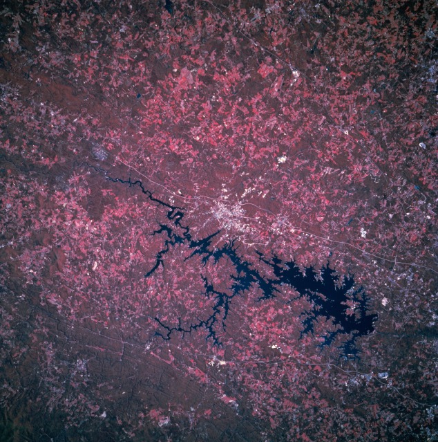
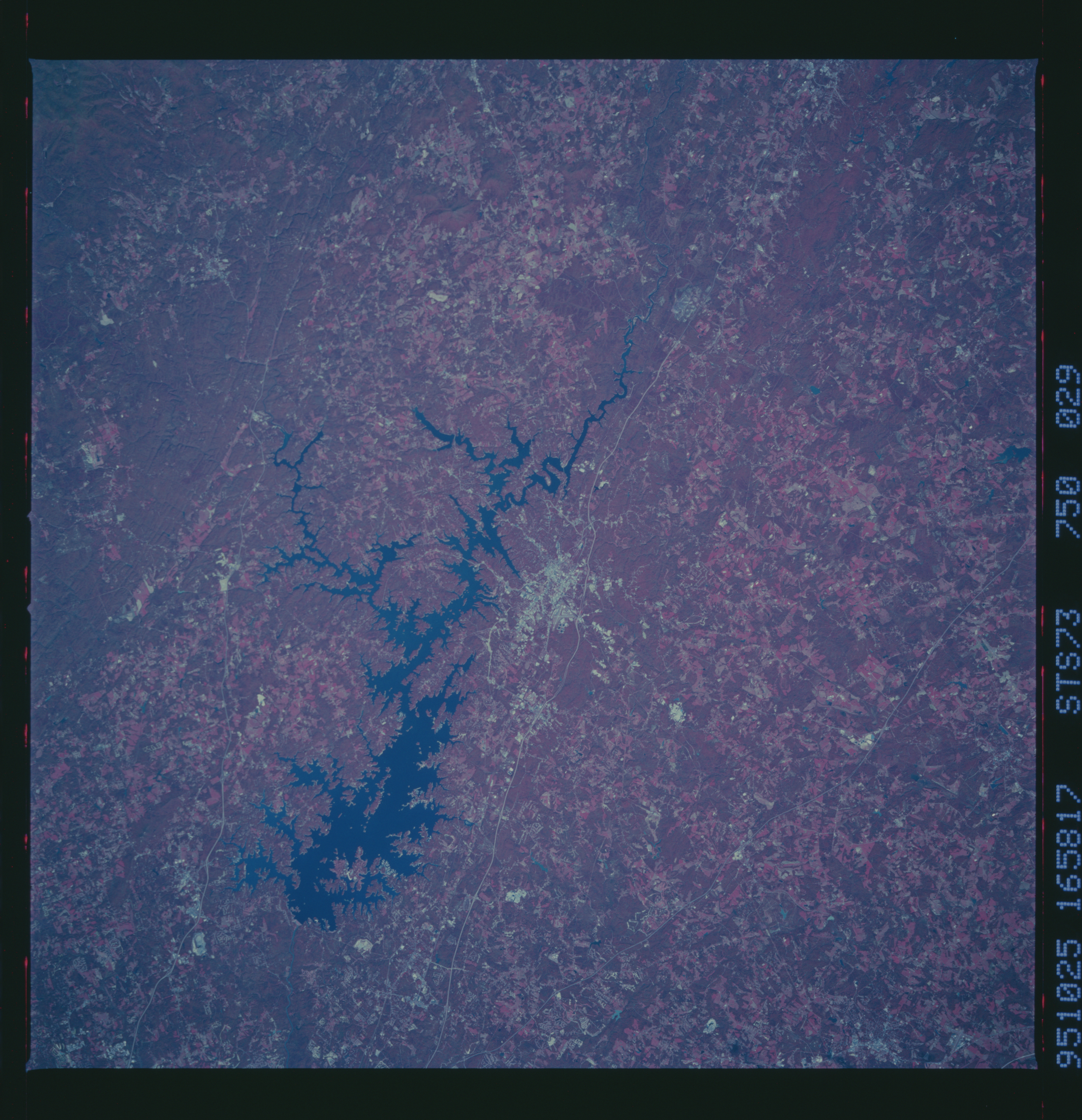
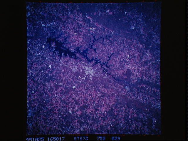
Image Caption: STS073-750-029 Gainesville, Georgia, U.S.A. October 1995
Featured in this color infrared photograph are Lake Sidney Lanier and Gainesville, which lie approximately 50 miles (80 kilometers) northeast of Atlanta. Color infrared film (showing green vegetation as red hues) helps to discriminate land-water boundaries; e.g., using color infrared film in this photograph the extensiveness of surface water is much easier to discern than in photograph STS073-708-014, a noninfrared color film product of the same general geographic area. Forested lands (darker red) and agricultural field patterns (lighter red) are also easier to discriminate using color infrared film. Several manmade features are visible--Interstate Highway 985 east of Gainesville; U. S. Highway 23, which parallels Interstate Highway 985 in some areas; and a thin, linear power line right-of-way through the southern Chattahoochee National Forest (lower left).
Featured in this color infrared photograph are Lake Sidney Lanier and Gainesville, which lie approximately 50 miles (80 kilometers) northeast of Atlanta. Color infrared film (showing green vegetation as red hues) helps to discriminate land-water boundaries; e.g., using color infrared film in this photograph the extensiveness of surface water is much easier to discern than in photograph STS073-708-014, a noninfrared color film product of the same general geographic area. Forested lands (darker red) and agricultural field patterns (lighter red) are also easier to discriminate using color infrared film. Several manmade features are visible--Interstate Highway 985 east of Gainesville; U. S. Highway 23, which parallels Interstate Highway 985 in some areas; and a thin, linear power line right-of-way through the southern Chattahoochee National Forest (lower left).
