STS073-744-60
| NASA Photo ID | STS073-744-60 |
| Focal Length | 250mm |
| Date taken | 1995.10.27 |
| Time taken | 18:20:31 GMT |
Resolutions offered for this image:
3936 x 3872 pixels 639 x 629 pixels 5700 x 5900 pixels 500 x 518 pixels 640 x 480 pixels
3936 x 3872 pixels 639 x 629 pixels 5700 x 5900 pixels 500 x 518 pixels 640 x 480 pixels


Cloud masks available for this image:
Spacecraft nadir point: 32.5° N, 115.0° W
Photo center point: 33.0° N, 115.5° W
Photo center point by machine learning:
Photo center point: 33.0° N, 115.5° W
Photo center point by machine learning:
Nadir to Photo Center: Northwest
Spacecraft Altitude: 144 nautical miles (267km)
Country or Geographic Name: | USA-CALIFORNIA |
Features: | AGR., MEXICO BORDER, DES. |
| Features Found Using Machine Learning: | |
Cloud Cover Percentage: | 0 (no clouds present) |
Sun Elevation Angle: | 42° |
Sun Azimuth: | 159° |
Camera: | Hasselblad |
Focal Length: | 250mm |
Camera Tilt: | 16 degrees |
Format: | 2443: Kodak Aerochrome 2443, color IR, thin base, EA-5 process thru June 1999, E-6 process afterward |
Film Exposure: | Normal |
| Additional Information | |
| Width | Height | Annotated | Cropped | Purpose | Links |
|---|---|---|---|---|---|
| 3936 pixels | 3872 pixels | No | No | Earth From Space collection | Download Image |
| 639 pixels | 629 pixels | No | No | Earth From Space collection | Download Image |
| 5700 pixels | 5900 pixels | No | No | Download Image | |
| 500 pixels | 518 pixels | No | No | Download Image | |
| 640 pixels | 480 pixels | No | No | Download Image |
Download Packaged File
Download a Google Earth KML for this Image
View photo footprint information
Download a GeoTIFF for this photo
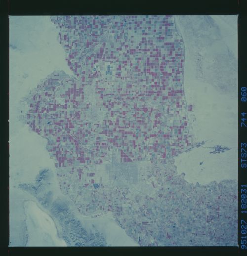
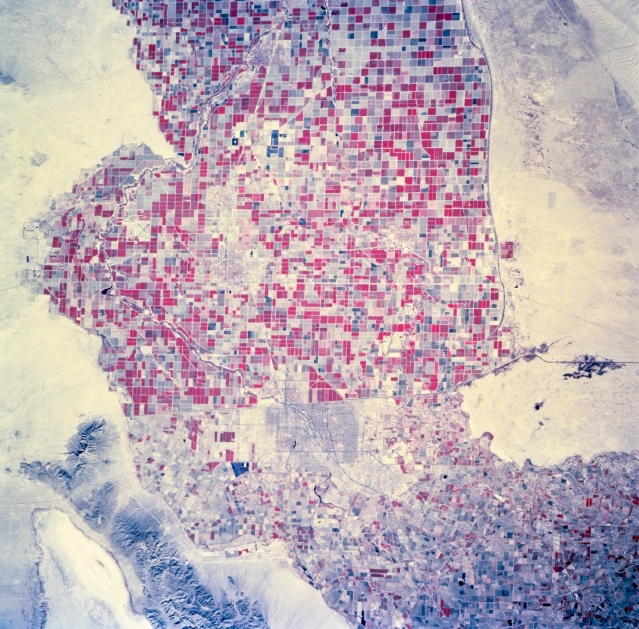
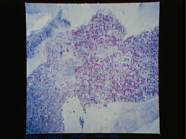
Image Caption: STS073-744-060 Imperial Valley, California, U.S.A., and U.S.-Mexico Border October 1995
This photograph, with vegetation recorded as reds on the color infrared film, features the cultivated, irrigated field patterns at the southern end of the Imperial Valley. The landscapes of the United States and Mexico delineate the differences in agricultural management practices--patterns south of the border become smaller and more irregular. The general outline of Mexicali, surrounded by agricultural field patterns, is discernible immediately south of the border.
This photograph, with vegetation recorded as reds on the color infrared film, features the cultivated, irrigated field patterns at the southern end of the Imperial Valley. The landscapes of the United States and Mexico delineate the differences in agricultural management practices--patterns south of the border become smaller and more irregular. The general outline of Mexicali, surrounded by agricultural field patterns, is discernible immediately south of the border.
