STS073-744-57
| NASA Photo ID | STS073-744-57 |
| Focal Length | 250mm |
| Date taken | 1995.10.27 |
| Time taken | 18:20:16 GMT |
Resolutions offered for this image:
3904 x 3936 pixels 634 x 639 pixels 5700 x 5900 pixels 500 x 518 pixels 640 x 480 pixels
3904 x 3936 pixels 634 x 639 pixels 5700 x 5900 pixels 500 x 518 pixels 640 x 480 pixels


Cloud masks available for this image:
Spacecraft nadir point: 32.9° N, 116.1° W
Photo center point: 32.5° N, 116.5° W
Photo center point by machine learning:
Photo center point: 32.5° N, 116.5° W
Photo center point by machine learning:
Nadir to Photo Center: Southwest
Spacecraft Altitude: 144 nautical miles (267km)
Country or Geographic Name: | MEXICO |
Features: | USA BORDER, MTS., RES. |
| Features Found Using Machine Learning: | |
Cloud Cover Percentage: | 0 (no clouds present) |
Sun Elevation Angle: | 42° |
Sun Azimuth: | 158° |
Camera: | Hasselblad |
Focal Length: | 250mm |
Camera Tilt: | 13 degrees |
Format: | 2443: Kodak Aerochrome 2443, color IR, thin base, EA-5 process thru June 1999, E-6 process afterward |
Film Exposure: | Normal |
| Additional Information | |
| Width | Height | Annotated | Cropped | Purpose | Links |
|---|---|---|---|---|---|
| 3904 pixels | 3936 pixels | No | No | Earth From Space collection | Download Image |
| 634 pixels | 639 pixels | No | No | Earth From Space collection | Download Image |
| 5700 pixels | 5900 pixels | No | No | Download Image | |
| 500 pixels | 518 pixels | No | No | Download Image | |
| 640 pixels | 480 pixels | No | No | Download Image |
Download Packaged File
Download a Google Earth KML for this Image
View photo footprint information
Download a GeoTIFF for this photo
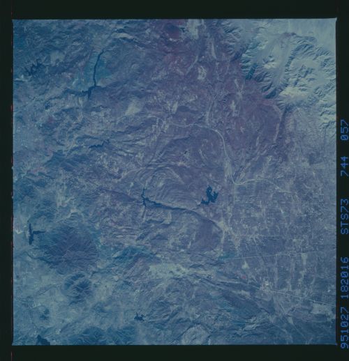
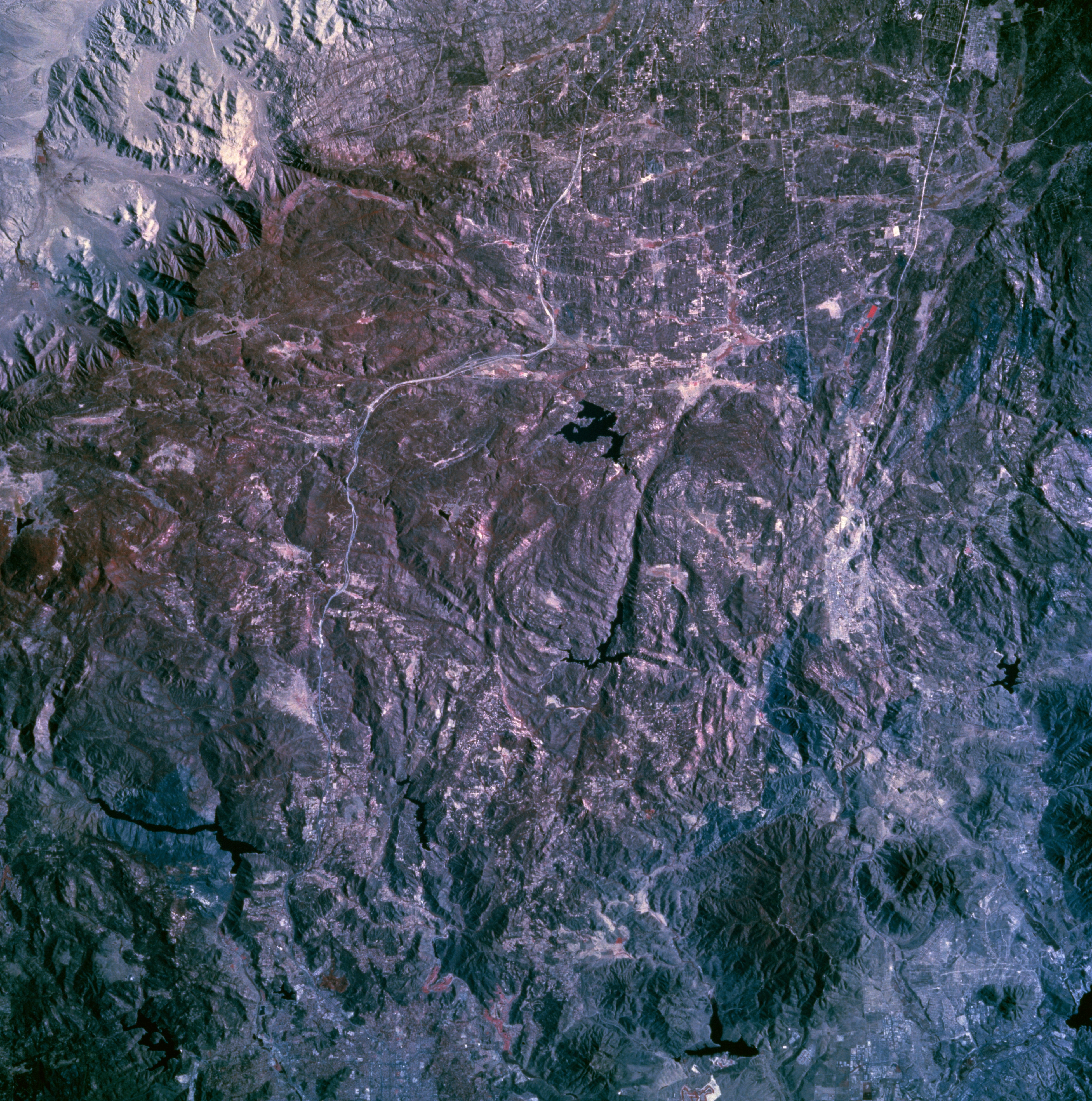
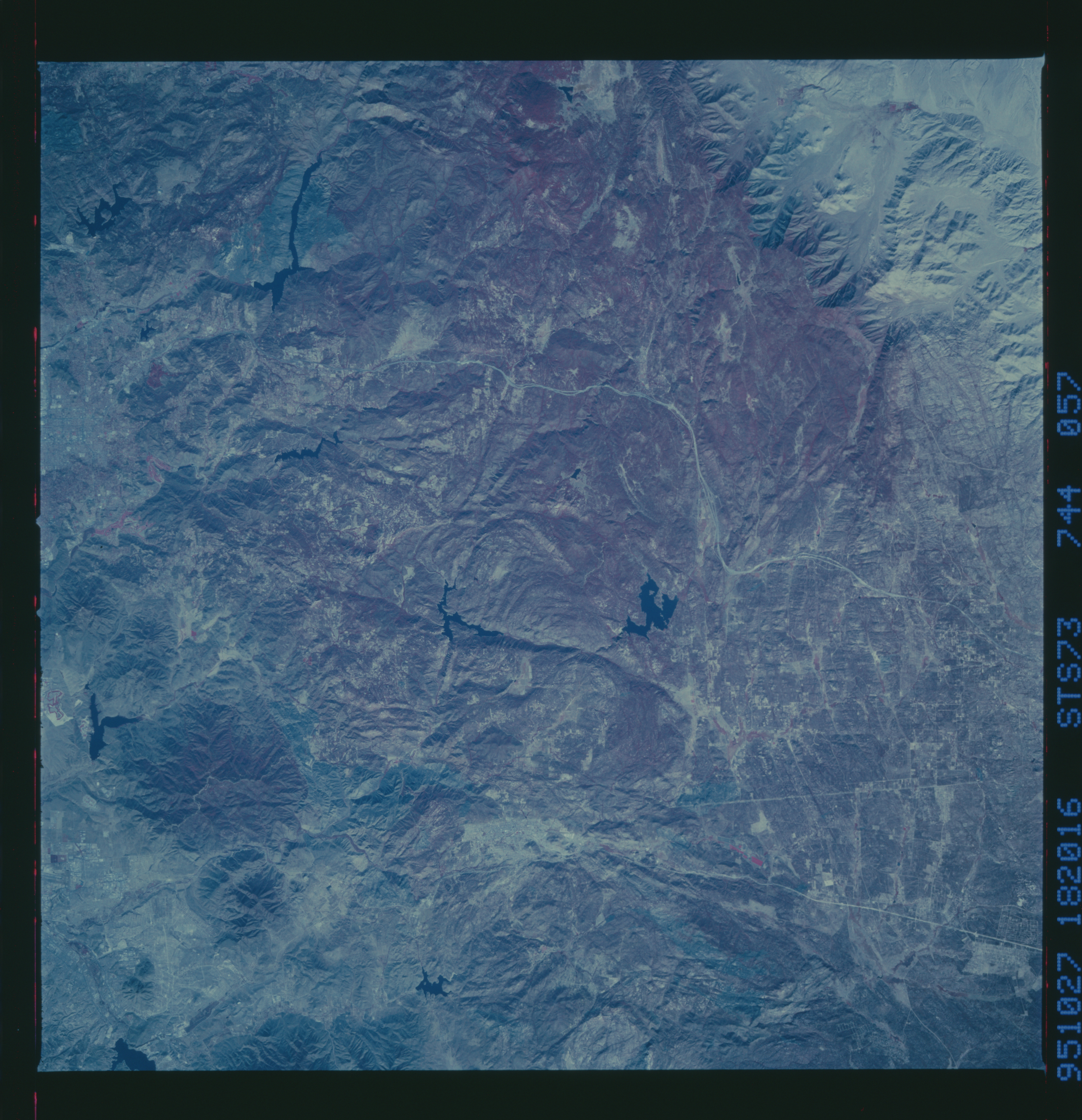
Image Caption: STS073-744-057 Cleveland National Forest, Southern California, U.S.A. October 1995
This photograph presents several manmade features--highly reflective, east-west-oriented Interstate Highway 8, near the center of the photograph, which connects the Imperial Valley of southern California with San Diego; the east-west-oriented linear feature south of Interstate Highway 8, which is part of the U.S.-Mexico border; the black Y-shaped reservoir south of Interstate Highway 8 near the 90-degree curve; and part of Mexican Highway 2 south of the border. The darker area with a hint of red (vegetation is recorded as shades of red on color infrared film) shows some of the forested, rugged mountain terrain. Several dark, faulted valleys are discernible.
This photograph presents several manmade features--highly reflective, east-west-oriented Interstate Highway 8, near the center of the photograph, which connects the Imperial Valley of southern California with San Diego; the east-west-oriented linear feature south of Interstate Highway 8, which is part of the U.S.-Mexico border; the black Y-shaped reservoir south of Interstate Highway 8 near the 90-degree curve; and part of Mexican Highway 2 south of the border. The darker area with a hint of red (vegetation is recorded as shades of red on color infrared film) shows some of the forested, rugged mountain terrain. Several dark, faulted valleys are discernible.
