STS073-744-48
| NASA Photo ID | STS073-744-48 |
| Focal Length | 250mm |
| Date taken | 1995.10.27 |
| Time taken | 18:19:41 GMT |
Resolutions offered for this image:
3872 x 3936 pixels 629 x 639 pixels 5700 x 5900 pixels 500 x 518 pixels 640 x 480 pixels
3872 x 3936 pixels 629 x 639 pixels 5700 x 5900 pixels 500 x 518 pixels 640 x 480 pixels


Cloud masks available for this image:
Spacecraft nadir point: 33.8° N, 118.5° W
Photo center point: 34.0° N, 118.5° W
Photo center point by machine learning:
Photo center point: 34.0° N, 118.5° W
Photo center point by machine learning:
Nadir to Photo Center: North
Spacecraft Altitude: 144 nautical miles (267km)
Country or Geographic Name: | USA-CALIFORNIA |
Features: | SAN FERNANDO VALLEY, CITY |
| Features Found Using Machine Learning: | |
Cloud Cover Percentage: | 0 (no clouds present) |
Sun Elevation Angle: | 40° |
Sun Azimuth: | 155° |
Camera: | Hasselblad |
Focal Length: | 250mm |
Camera Tilt: | 5 degrees |
Format: | 2443: Kodak Aerochrome 2443, color IR, thin base, EA-5 process thru June 1999, E-6 process afterward |
Film Exposure: | Normal |
| Additional Information | |
| Width | Height | Annotated | Cropped | Purpose | Links |
|---|---|---|---|---|---|
| 3872 pixels | 3936 pixels | No | No | Earth From Space collection | Download Image |
| 629 pixels | 639 pixels | No | No | Earth From Space collection | Download Image |
| 5700 pixels | 5900 pixels | No | No | Download Image | |
| 500 pixels | 518 pixels | No | No | Download Image | |
| 640 pixels | 480 pixels | No | No | Download Image |
Download Packaged File
Download a Google Earth KML for this Image
View photo footprint information
Download a GeoTIFF for this photo
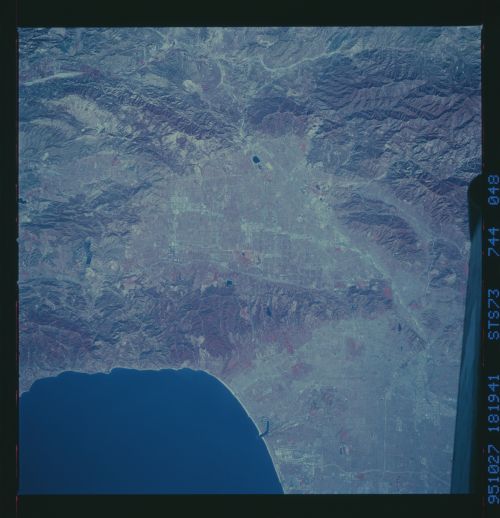
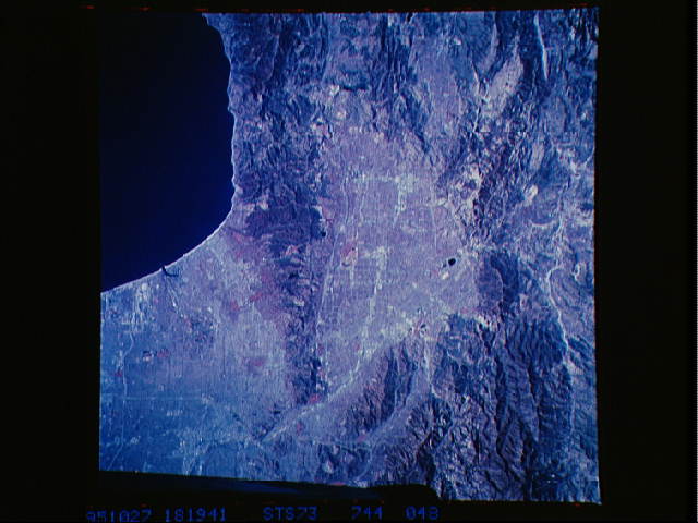
Image Caption: STS073-744-048 Northwestern Los Angeles Basin, California, U.S.A. November 1995
Four mountain ranges are discernible in this color infrared, near-vertical photograph of the northwest part of the greater Los Angeles metropolitan area--the Santa Monica Mountains that form the southern boundary of the San Fernando Valley and lie west of Los Angeles; the Santa Susana Mountains on the northwest side of the valley; the San Gabriel Mountains east of the Santa Susanas; and the Verdugo Mountains, a much smaller range sandwiched between the eastern end of the Santa Monica Mountains and the San Gabriel Mountains. Apparent are the ground transportation corridors--U.S. Highway 101, Interstate Highway 5, and Interstate Highway 210 that connect the San Fernando Valley with the much larger Los Angeles Basin. Visible are Van Norman Reservoir west of Interstate Highway 5; the east-west runways of the Los Angeles International Airport; Marina del Rey northwest of the airport; and some of the gridded street network of downtown Los Angeles near the junction of Interstate Highway 5, U.S. Highway 101, and the Los Angeles River. The large red areas of vegetation are probably parks or golf courses.
Four mountain ranges are discernible in this color infrared, near-vertical photograph of the northwest part of the greater Los Angeles metropolitan area--the Santa Monica Mountains that form the southern boundary of the San Fernando Valley and lie west of Los Angeles; the Santa Susana Mountains on the northwest side of the valley; the San Gabriel Mountains east of the Santa Susanas; and the Verdugo Mountains, a much smaller range sandwiched between the eastern end of the Santa Monica Mountains and the San Gabriel Mountains. Apparent are the ground transportation corridors--U.S. Highway 101, Interstate Highway 5, and Interstate Highway 210 that connect the San Fernando Valley with the much larger Los Angeles Basin. Visible are Van Norman Reservoir west of Interstate Highway 5; the east-west runways of the Los Angeles International Airport; Marina del Rey northwest of the airport; and some of the gridded street network of downtown Los Angeles near the junction of Interstate Highway 5, U.S. Highway 101, and the Los Angeles River. The large red areas of vegetation are probably parks or golf courses.
