STS073-744-46
| NASA Photo ID | STS073-744-46 |
| Focal Length | 250mm |
| Date taken | 1995.10.27 |
| Time taken | 18:19:27 GMT |
Resolutions offered for this image:
3936 x 3872 pixels 639 x 629 pixels 5700 x 5900 pixels 500 x 518 pixels 640 x 480 pixels
3936 x 3872 pixels 639 x 629 pixels 5700 x 5900 pixels 500 x 518 pixels 640 x 480 pixels


Cloud masks available for this image:
Spacecraft nadir point: 34.1° N, 119.5° W
Photo center point: 34.5° N, 119.5° W
Photo center point by machine learning:
Photo center point: 34.5° N, 119.5° W
Photo center point by machine learning:
Nadir to Photo Center: North
Spacecraft Altitude: 144 nautical miles (267km)
Country or Geographic Name: | USA-CALIFORNIA |
Features: | MTS., RES., SANTA BARBARA |
| Features Found Using Machine Learning: | |
Cloud Cover Percentage: | 0 (no clouds present) |
Sun Elevation Angle: | 39° |
Sun Azimuth: | 154° |
Camera: | Hasselblad |
Focal Length: | 250mm |
Camera Tilt: | 9 degrees |
Format: | 2443: Kodak Aerochrome 2443, color IR, thin base, EA-5 process thru June 1999, E-6 process afterward |
Film Exposure: | Normal |
| Additional Information | |
| Width | Height | Annotated | Cropped | Purpose | Links |
|---|---|---|---|---|---|
| 3936 pixels | 3872 pixels | No | No | Earth From Space collection | Download Image |
| 639 pixels | 629 pixels | No | No | Earth From Space collection | Download Image |
| 5700 pixels | 5900 pixels | No | No | Download Image | |
| 500 pixels | 518 pixels | No | No | Download Image | |
| 640 pixels | 480 pixels | No | No | Download Image |
Download Packaged File
Download a Google Earth KML for this Image
View photo footprint information
Download a GeoTIFF for this photo
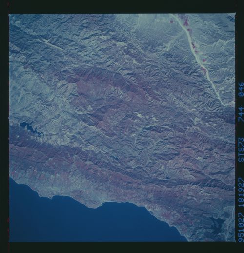
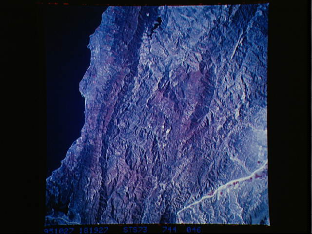
Image Caption: STS073-744-046 Santa Barbara, California, U.S.A. November 1995
The low Santa Ynez Mountains, a linear concentration of reds (an indication of dense vegetation), parallel this part of the California coastline. The higher elevations of the San Rafael Mountains farther north reflect more dense vegetation than some of the lower elevation valley areas. The east-west-trending white line is a road that follows the main ridgeline of the Santa Ynez Mountains. Lake Cachuma is the black irregular feature near the western edge of the photograph. Although the infrastructure for Santa Barbara is not discernible, the city and Goleta are included in this photograph. The highly reflective, linear feature to the northeast is part of a dry lakebed along a narrow valley.
The low Santa Ynez Mountains, a linear concentration of reds (an indication of dense vegetation), parallel this part of the California coastline. The higher elevations of the San Rafael Mountains farther north reflect more dense vegetation than some of the lower elevation valley areas. The east-west-trending white line is a road that follows the main ridgeline of the Santa Ynez Mountains. Lake Cachuma is the black irregular feature near the western edge of the photograph. Although the infrastructure for Santa Barbara is not discernible, the city and Goleta are included in this photograph. The highly reflective, linear feature to the northeast is part of a dry lakebed along a narrow valley.
