STS073-744-44
| NASA Photo ID | STS073-744-44 |
| Focal Length | 250mm |
| Date taken | 1995.10.27 |
| Time taken | 18:19:15 GMT |
Resolutions offered for this image:
3872 x 3936 pixels 629 x 639 pixels 5700 x 5900 pixels 500 x 518 pixels 640 x 480 pixels
3872 x 3936 pixels 629 x 639 pixels 5700 x 5900 pixels 500 x 518 pixels 640 x 480 pixels
Cloud masks available for this image:
Spacecraft nadir point: 34.4° N, 120.4° W
Photo center point: 34.5° N, 120.5° W
Photo center point by machine learning:
Photo center point: 34.5° N, 120.5° W
Photo center point by machine learning:
Nadir to Photo Center: Northwest
Spacecraft Altitude: 144 nautical miles (267km)
Country or Geographic Name: | USA-CALIFORNIA |
Features: | POINT ARGUELLO, CITIES |
| Features Found Using Machine Learning: | |
Cloud Cover Percentage: | 5 (1-10)% |
Sun Elevation Angle: | 39° |
Sun Azimuth: | 153° |
Camera: | Hasselblad |
Focal Length: | 250mm |
Camera Tilt: | 3 degrees |
Format: | 2443: Kodak Aerochrome 2443, color IR, thin base, EA-5 process thru June 1999, E-6 process afterward |
Film Exposure: | Normal |
| Additional Information | |
| Width | Height | Annotated | Cropped | Purpose | Links |
|---|---|---|---|---|---|
| 3872 pixels | 3936 pixels | No | No | Earth From Space collection | Download Image |
| 629 pixels | 639 pixels | No | No | Earth From Space collection | Download Image |
| 5700 pixels | 5900 pixels | No | No | Download Image | |
| 500 pixels | 518 pixels | No | No | Download Image | |
| 640 pixels | 480 pixels | No | No | Download Image |
Download Packaged File
Download a Google Earth KML for this Image
View photo footprint information
Download a GeoTIFF for this photo
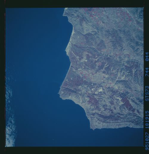
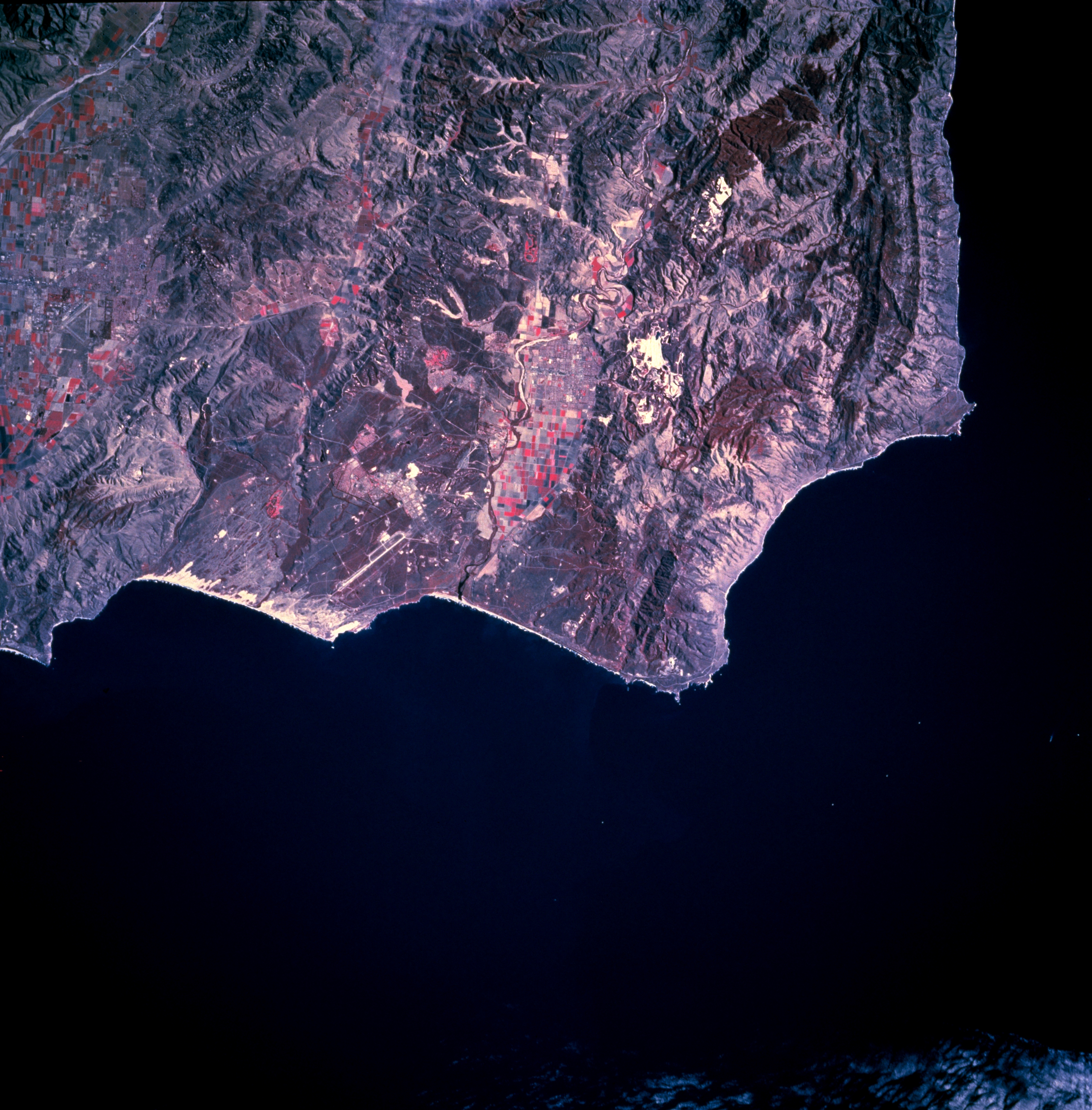
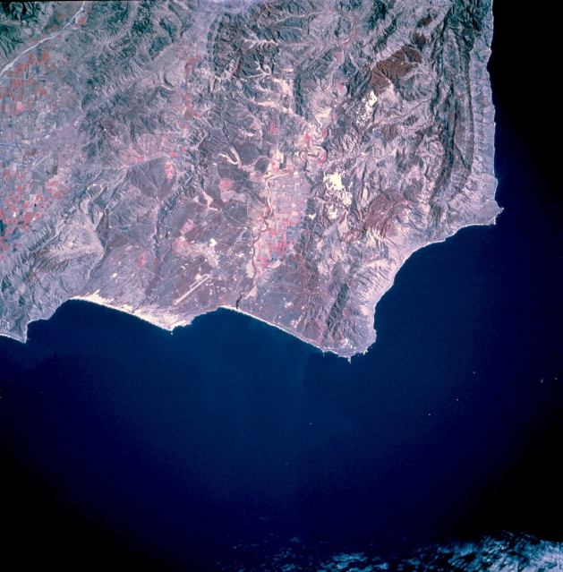
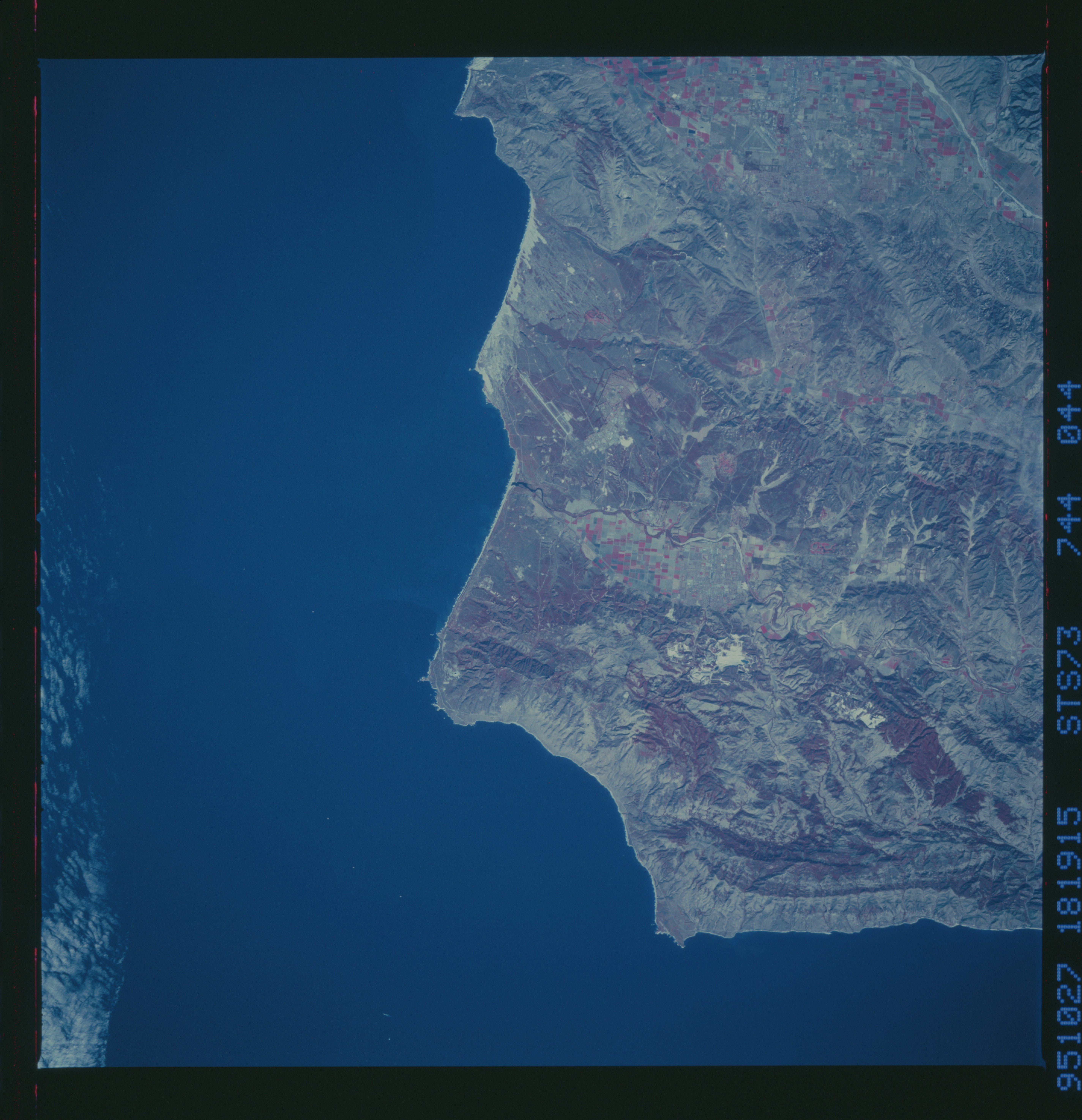
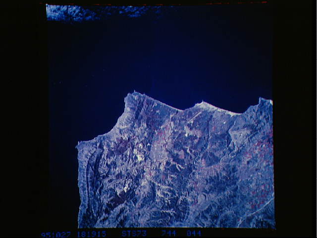
Image Caption: STS073-744-044 Coast Mountains and Point Arguello, California, U.S.A. November 1995
The color infrared film used in this photograph accentuates the rugged topography of coastal southwestern California near Point Arguello, the large promontory in the Pacific Ocean. Discernible are cultivated field patterns around Santa Maria and the western end of the Santa Ynez Mountains that parallel the California coastline. A small cluster of irrigated agriculture fields appears immediately west of Lompoc near the mouth of the Santa Ynez River. The brighter reds show irrigated crops, and deeper reds show native or natural vegetation. Two runways are visible--the long northwest-southeast-oriented runway of Vandenberg Air Force Base near the coast northwest of Lompoc and a V-shaped runway just south of Santa Maria.
The color infrared film used in this photograph accentuates the rugged topography of coastal southwestern California near Point Arguello, the large promontory in the Pacific Ocean. Discernible are cultivated field patterns around Santa Maria and the western end of the Santa Ynez Mountains that parallel the California coastline. A small cluster of irrigated agriculture fields appears immediately west of Lompoc near the mouth of the Santa Ynez River. The brighter reds show irrigated crops, and deeper reds show native or natural vegetation. Two runways are visible--the long northwest-southeast-oriented runway of Vandenberg Air Force Base near the coast northwest of Lompoc and a V-shaped runway just south of Santa Maria.
