STS073-743-5
| NASA Photo ID | STS073-743-5 |
| Focal Length | 250mm |
| Date taken | 1995.10.23 |
| Time taken | 15:26:54 GMT |
Resolutions offered for this image:
3904 x 3872 pixels 639 x 634 pixels 5700 x 5900 pixels 500 x 518 pixels 640 x 480 pixels
3904 x 3872 pixels 639 x 634 pixels 5700 x 5900 pixels 500 x 518 pixels 640 x 480 pixels
Cloud masks available for this image:
Spacecraft nadir point: 38.7° N, 88.8° W
Photo center point: 38.5° N, 90.5° W
Photo center point by machine learning:
Photo center point: 38.5° N, 90.5° W
Photo center point by machine learning:
Nadir to Photo Center: West
Spacecraft Altitude: 145 nautical miles (269km)
Country or Geographic Name: | USA-MISSOURI |
Features: | ST. LOUIS, MS & MO RIVERS |
| Features Found Using Machine Learning: | |
Cloud Cover Percentage: | 0 (no clouds present) |
Sun Elevation Angle: | 31° |
Sun Azimuth: | 141° |
Camera: | Hasselblad |
Focal Length: | 250mm |
Camera Tilt: | 35 degrees |
Format: | 2443: Kodak Aerochrome 2443, color IR, thin base, EA-5 process thru June 1999, E-6 process afterward |
Film Exposure: | Normal |
| Additional Information | |
| Width | Height | Annotated | Cropped | Purpose | Links |
|---|---|---|---|---|---|
| 3904 pixels | 3872 pixels | No | No | Earth From Space collection | Download Image |
| 639 pixels | 634 pixels | No | No | Earth From Space collection | Download Image |
| 5700 pixels | 5900 pixels | No | No | Download Image | |
| 500 pixels | 518 pixels | No | No | Download Image | |
| 640 pixels | 480 pixels | No | No | Download Image |
Download Packaged File
Download a Google Earth KML for this Image
View photo footprint information
Download a GeoTIFF for this photo
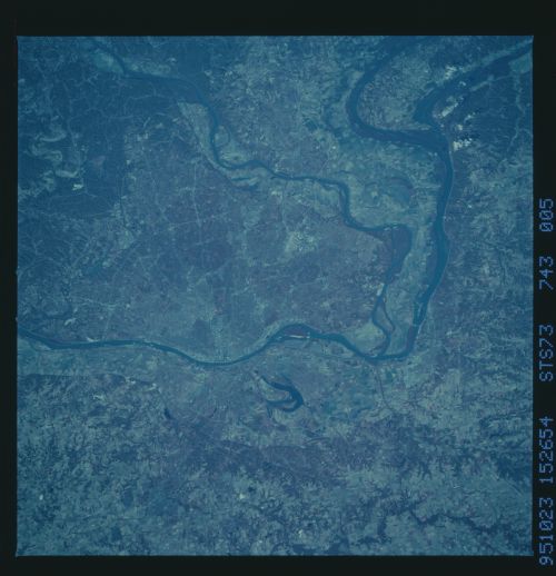
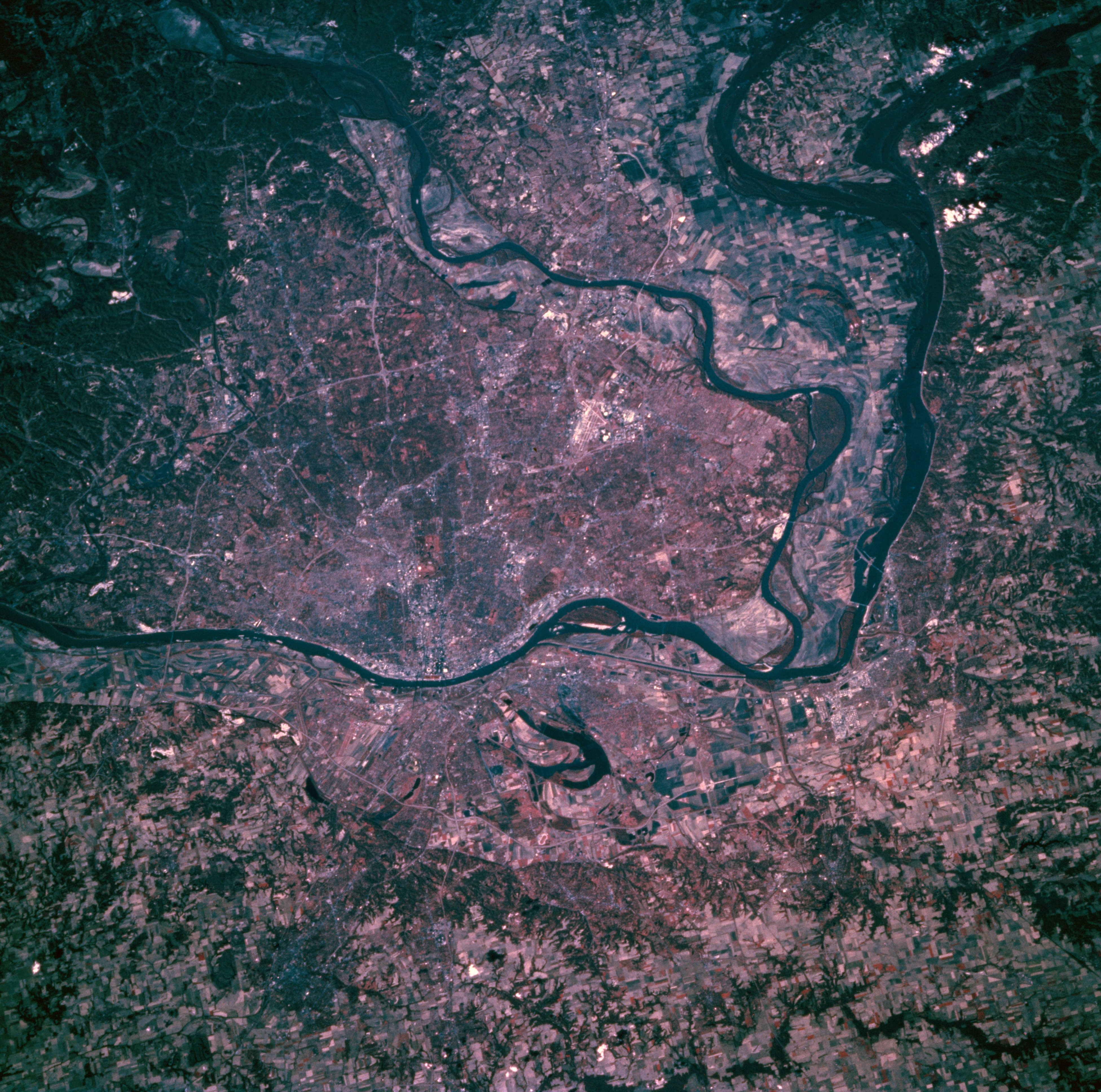
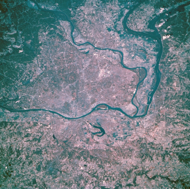
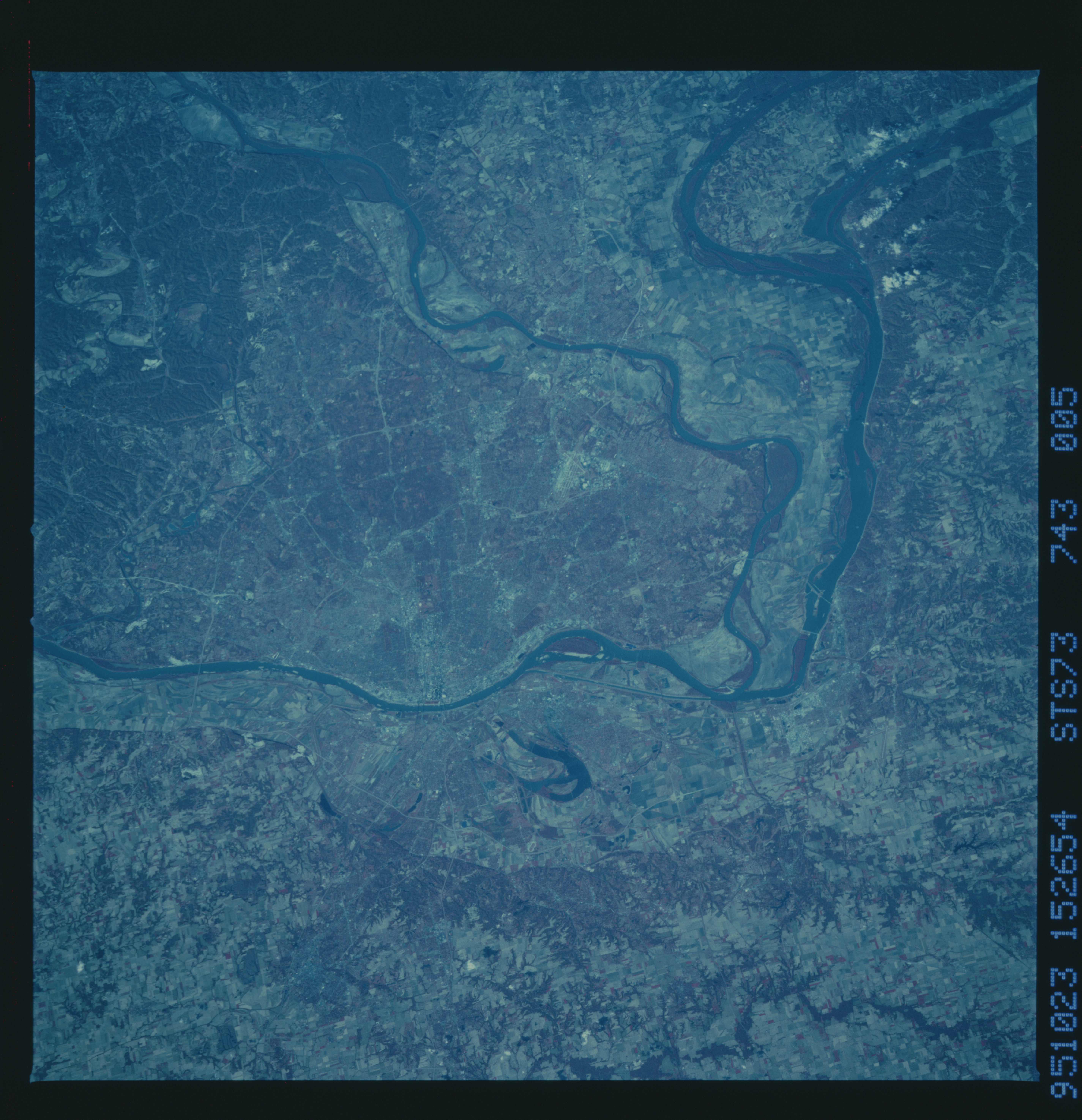
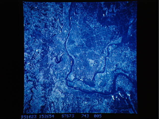
Image Caption: STS073-743-005 Saint Louis, Missouri, U.S.A. October 1995
This color infrared photograph features metropolitan Saint Louis, the "Gateway to the West," the starting point for early explorers and settlers to the western United States. Saint Louis, the largest city in Missouri, is a great river freight handling center; a major rail center; and a wholesale, banking, financial, and industrial center. The Missouri River flows east-northeast and joins the Mississippi River north of Saint Louis, which lies south of the confluence of the Illinois and Mississippi Rivers. East of the Mississippi River and north of East Saint Louis is Horseshoe Lake. The runways of Lambert-Saint Louis International Airport are discernible northwest of downtown.
This color infrared photograph features metropolitan Saint Louis, the "Gateway to the West," the starting point for early explorers and settlers to the western United States. Saint Louis, the largest city in Missouri, is a great river freight handling center; a major rail center; and a wholesale, banking, financial, and industrial center. The Missouri River flows east-northeast and joins the Mississippi River north of Saint Louis, which lies south of the confluence of the Illinois and Mississippi Rivers. East of the Mississippi River and north of East Saint Louis is Horseshoe Lake. The runways of Lambert-Saint Louis International Airport are discernible northwest of downtown.
