STS073-741-63
| NASA Photo ID | STS073-741-63 |
| Focal Length | 250mm |
| Date taken | 1995.10.24 |
| Time taken | 13:52:59 GMT |
Resolutions offered for this image:
3904 x 3904 pixels 639 x 639 pixels 5700 x 5900 pixels 500 x 518 pixels 640 x 480 pixels
3904 x 3904 pixels 639 x 639 pixels 5700 x 5900 pixels 500 x 518 pixels 640 x 480 pixels

Cloud masks available for this image:
Spacecraft nadir point: 38.4° N, 75.4° W
Photo center point: 39.0° N, 76.5° W
Photo center point by machine learning:
Photo center point: 39.0° N, 76.5° W
Photo center point by machine learning:
Nadir to Photo Center: Northwest
Spacecraft Altitude: 144 nautical miles (267km)
Country or Geographic Name: | USA-MARYLAND |
Features: | CHESAPEAKE BAY, BALTIMORE |
| Features Found Using Machine Learning: | |
Cloud Cover Percentage: | 0 (no clouds present) |
Sun Elevation Angle: | 26° |
Sun Azimuth: | 132° |
Camera: | Hasselblad |
Focal Length: | 250mm |
Camera Tilt: | 28 degrees |
Format: | 2443: Kodak Aerochrome 2443, color IR, thin base, EA-5 process thru June 1999, E-6 process afterward |
Film Exposure: | Normal |
| Additional Information | |
| Width | Height | Annotated | Cropped | Purpose | Links |
|---|---|---|---|---|---|
| 3904 pixels | 3904 pixels | No | No | Earth From Space collection | Download Image |
| 639 pixels | 639 pixels | No | No | Earth From Space collection | Download Image |
| 5700 pixels | 5900 pixels | No | No | Download Image | |
| 500 pixels | 518 pixels | No | No | Download Image | |
| 640 pixels | 480 pixels | No | No | Download Image |
Download Packaged File
Download a Google Earth KML for this Image
View photo footprint information
Download a GeoTIFF for this photo
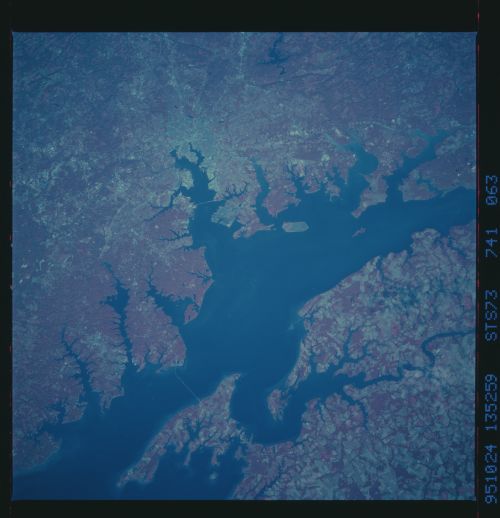
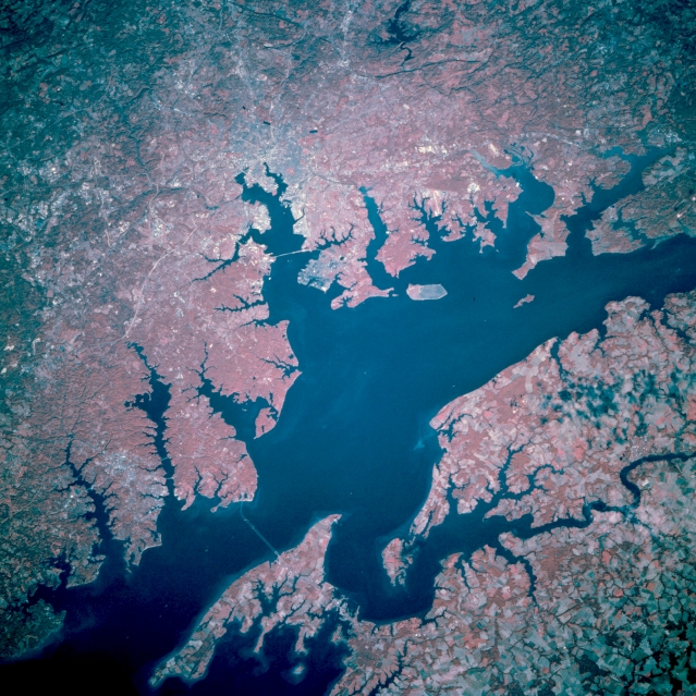
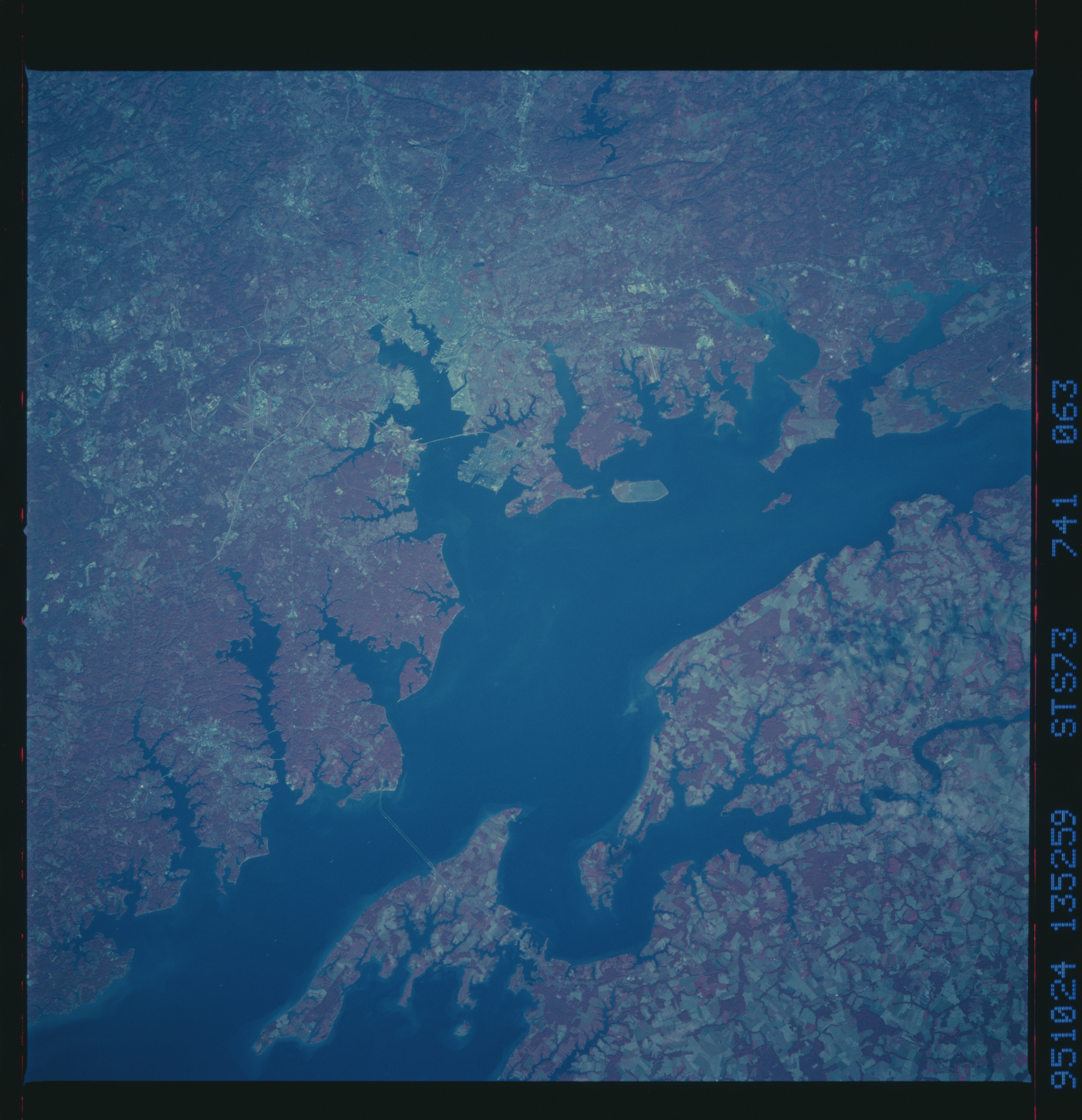
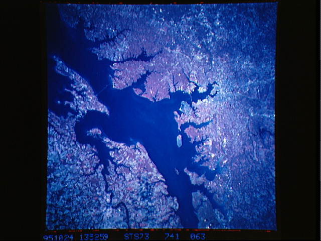
Image Caption: STS073-741-063 Chesapeake Bay; Baltimore, Maryland, U.S.A. October 1995
The largest city in Maryland, Baltimore, is near the center of this north-northwest-looking, low-oblique, color-infrared view. Chesapeake Bay extends from right center (northeast) to bottom-left (south). The gently rolling, forested terrain west of Chesapeake Bay (dark red) contrasts with the flatter, mostly agricultural lands of the Delmarva Peninsula (paler shades of red, lower right), east of Chesapeake Bay. Situated on the Patapsco River estuary, Baltimore is a major shipping and receiving center for coal, grain, iron steel, and copper. Principal industries include steel mills, shipbuilding, oil refining, chemical production, and manufacture of aerospace equipment. Baltimore is the home of Johns Hopkins University, one of the leading medical and public health universities in the world. In the War of 1812 against the British, the gallant defense of Fort McHenry inspired Francis Scott Key to write the Star Spangled Banner, which became the national anthem for the United States. The ship USS Constellation, a national historic shrine, is also docked here.
The largest city in Maryland, Baltimore, is near the center of this north-northwest-looking, low-oblique, color-infrared view. Chesapeake Bay extends from right center (northeast) to bottom-left (south). The gently rolling, forested terrain west of Chesapeake Bay (dark red) contrasts with the flatter, mostly agricultural lands of the Delmarva Peninsula (paler shades of red, lower right), east of Chesapeake Bay. Situated on the Patapsco River estuary, Baltimore is a major shipping and receiving center for coal, grain, iron steel, and copper. Principal industries include steel mills, shipbuilding, oil refining, chemical production, and manufacture of aerospace equipment. Baltimore is the home of Johns Hopkins University, one of the leading medical and public health universities in the world. In the War of 1812 against the British, the gallant defense of Fort McHenry inspired Francis Scott Key to write the Star Spangled Banner, which became the national anthem for the United States. The ship USS Constellation, a national historic shrine, is also docked here.
