STS073-740-25
| NASA Photo ID | STS073-740-25 |
| Focal Length | 250mm |
| Date taken | 1995.10.23 |
| Time taken | 18:32:44 GMT |
Resolutions offered for this image:
3936 x 3904 pixels 639 x 634 pixels 5700 x 5900 pixels 500 x 518 pixels 640 x 480 pixels
3936 x 3904 pixels 639 x 634 pixels 5700 x 5900 pixels 500 x 518 pixels 640 x 480 pixels


Cloud masks available for this image:
Spacecraft nadir point: 37.1° N, 104.2° W
Photo center point: 37.5° N, 105.5° W
Photo center point by machine learning:
Photo center point: 37.5° N, 105.5° W
Photo center point by machine learning:
Nadir to Photo Center: West
Spacecraft Altitude: 146 nautical miles (270km)
Country or Geographic Name: | USA-COLORADO |
Features: | AGR., MTS., RIO GRANDE |
| Features Found Using Machine Learning: | |
Cloud Cover Percentage: | 0 (no clouds present) |
Sun Elevation Angle: | 42° |
Sun Azimuth: | 177° |
Camera: | Hasselblad |
Focal Length: | 250mm |
Camera Tilt: | 29 degrees |
Format: | 5046: Kodak, natural color positive, Lumiere 100/5046, ASA 100, standard base |
Film Exposure: | Normal |
| Additional Information | |
| Width | Height | Annotated | Cropped | Purpose | Links |
|---|---|---|---|---|---|
| 3936 pixels | 3904 pixels | No | No | Earth From Space collection | Download Image |
| 639 pixels | 634 pixels | No | No | Earth From Space collection | Download Image |
| 5700 pixels | 5900 pixels | No | No | Download Image | |
| 500 pixels | 518 pixels | No | No | Download Image | |
| 640 pixels | 480 pixels | No | No | Download Image |
Download Packaged File
Download a Google Earth KML for this Image
View photo footprint information
Download a GeoTIFF for this photo
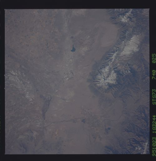
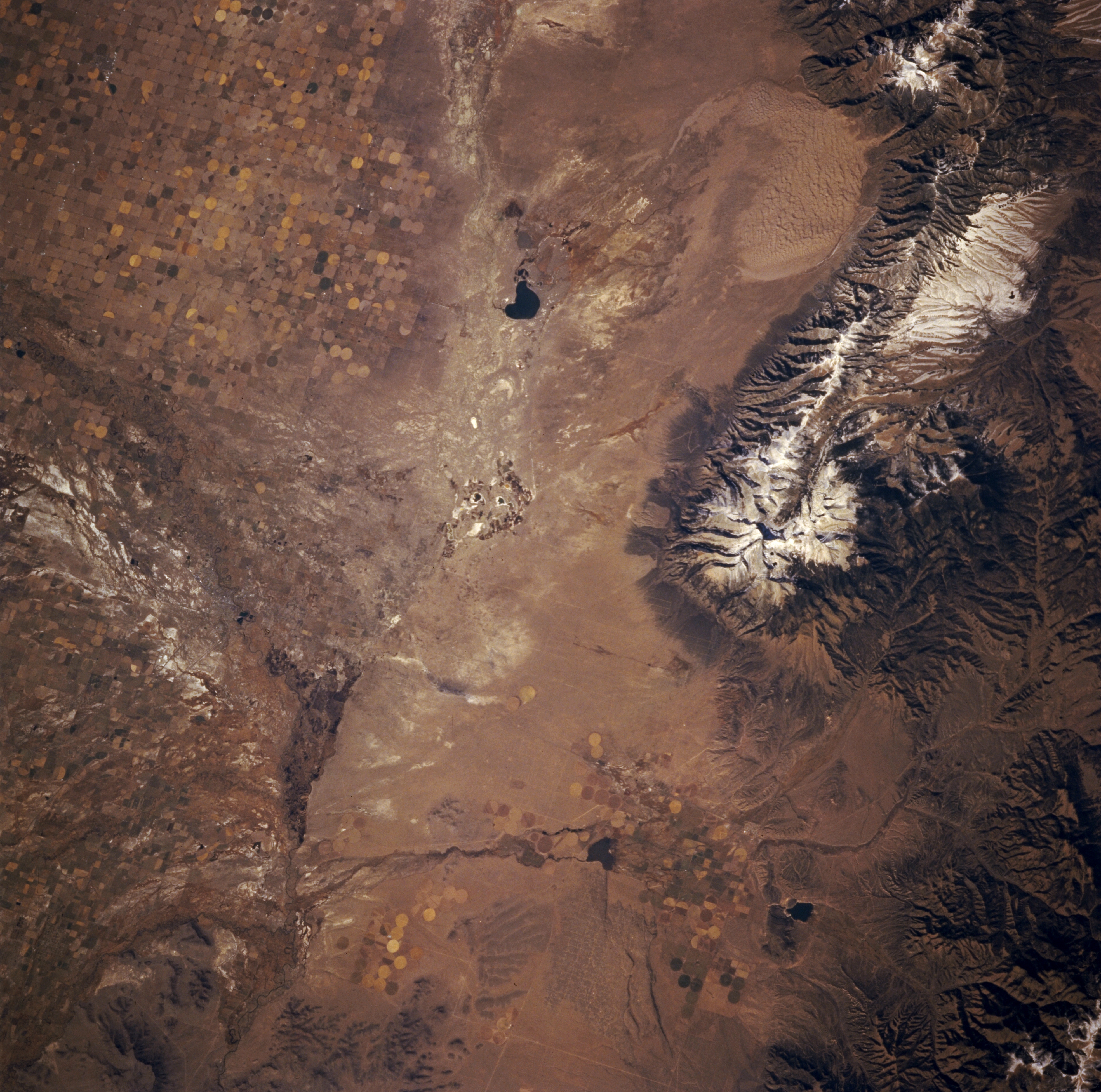
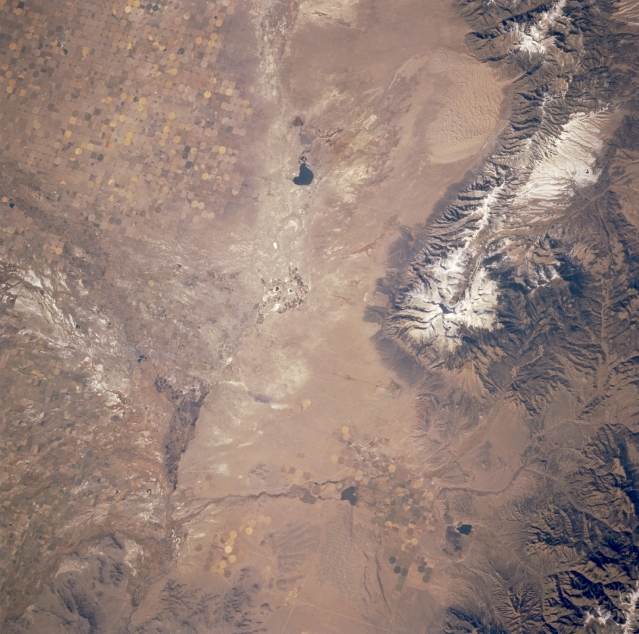
Image Caption: STS073-740-025 San Luis Valley, Colorado, U.S.A. October 1995
Part of the San Luis Valley of south-central Colorado is featured in this north-looking, low-oblique photograph. Visible in the valley are circular patterns produced by center-pivot irrigation; snowcapped Blanca Peak [14 345 feet (4372 meters) above sea level], north of which is Great Sand Dunes National Monument; and part of the Sangre de Cristo Mountains. Apparent are intermittently flowing San Luis Creek that travels south across the valley; dark San Luis Lake; and intermittently flowing water channels of the Rio Grande that merge with San Luis Creek near Alamosa (not discernible in this photograph). West of the Rio Grande is a light saline surface caused by the repetitive deposition and evaporation process in this desertlike landscape.
Part of the San Luis Valley of south-central Colorado is featured in this north-looking, low-oblique photograph. Visible in the valley are circular patterns produced by center-pivot irrigation; snowcapped Blanca Peak [14 345 feet (4372 meters) above sea level], north of which is Great Sand Dunes National Monument; and part of the Sangre de Cristo Mountains. Apparent are intermittently flowing San Luis Creek that travels south across the valley; dark San Luis Lake; and intermittently flowing water channels of the Rio Grande that merge with San Luis Creek near Alamosa (not discernible in this photograph). West of the Rio Grande is a light saline surface caused by the repetitive deposition and evaporation process in this desertlike landscape.
