STS073-736-43

| NASA Photo ID | STS073-736-43 |
| Focal Length | 250mm |
| Date taken | 1995.10.30 |
| Time taken | 00:06:33 GMT |
Resolutions offered for this image:
4072 x 4095 pixels 800 x 794 pixels 5700 x 5900 pixels 4095 x 4072 pixels 500 x 518 pixels 640 x 480 pixels
4072 x 4095 pixels 800 x 794 pixels 5700 x 5900 pixels 4095 x 4072 pixels 500 x 518 pixels 640 x 480 pixels

Cloud masks available for this image:
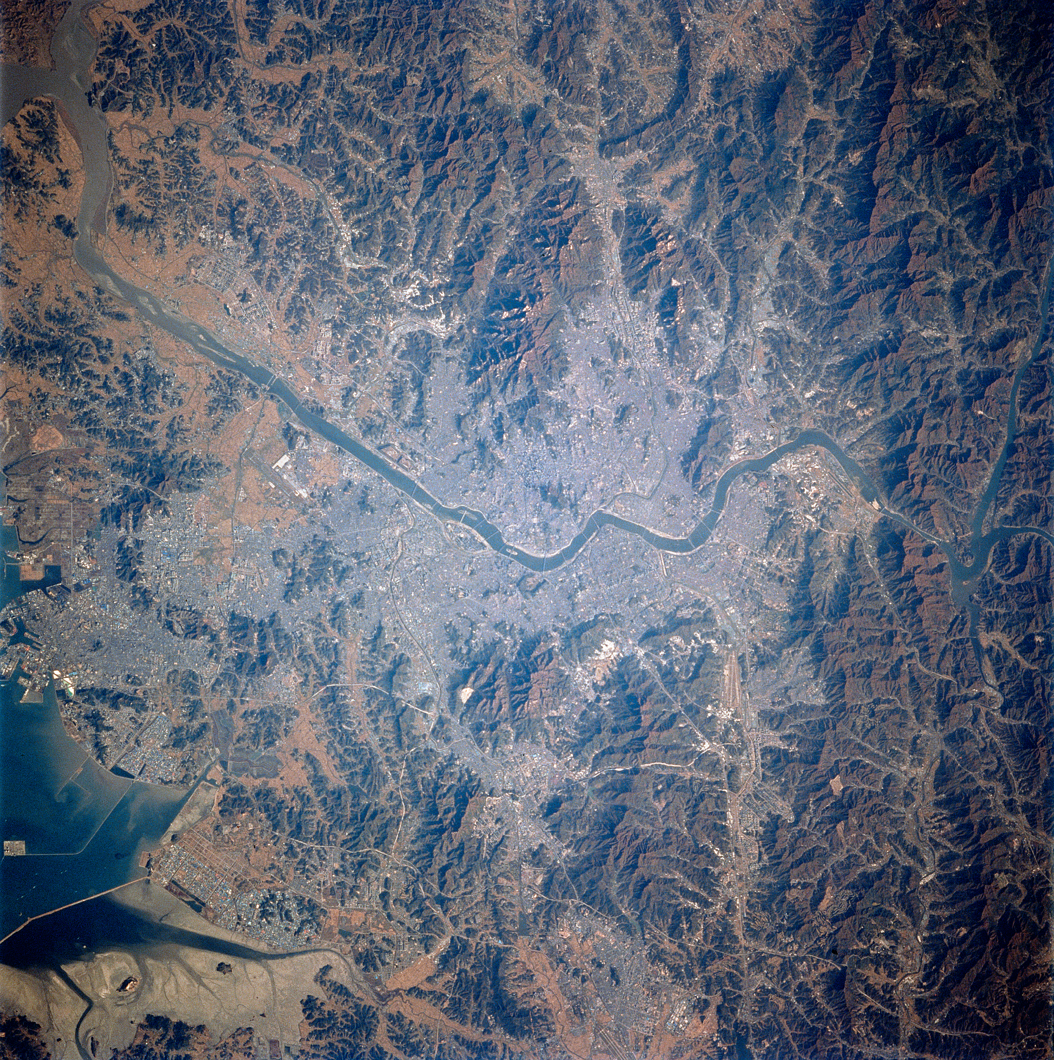
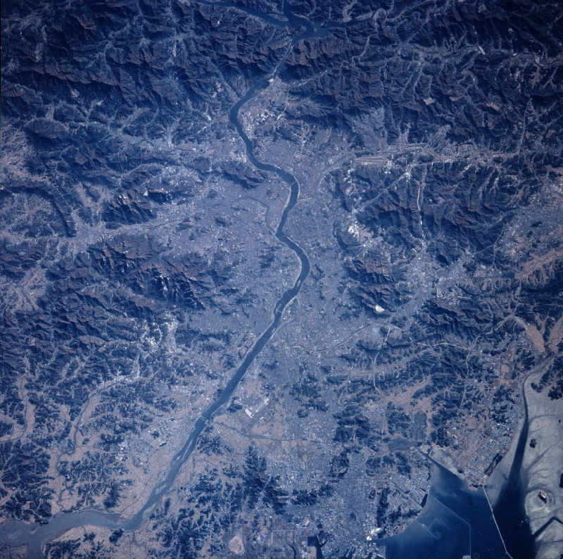
Spacecraft nadir point: 36.8° N, 125.9° E
Photo center point: 37.5° N, 127.0° E
Photo center point by machine learning:
Photo center point: 37.5° N, 127.0° E
Photo center point by machine learning:
Nadir to Photo Center: Northeast
Spacecraft Altitude: 142 nautical miles (263km)
Country or Geographic Name: | SOUTH KOREA |
Features: | SEOUL, NAMHAN RIVER, MTS. |
| Features Found Using Machine Learning: | |
Cloud Cover Percentage: | 0 (no clouds present) |
Sun Elevation Angle: | 22° |
Sun Azimuth: | 128° |
Camera: | Hasselblad |
Focal Length: | 250mm |
Camera Tilt: | 29 degrees |
Format: | 5046: Kodak, natural color positive, Lumiere 100/5046, ASA 100, standard base |
Film Exposure: | Normal |
| Additional Information | |
| Width | Height | Annotated | Cropped | Purpose | Links |
|---|---|---|---|---|---|
| 4072 pixels | 4095 pixels | Cities collection | Download Image | ||
| 800 pixels | 794 pixels | No | No | Cities collection | Download Image |
| 5700 pixels | 5900 pixels | No | No | Download Image | |
| 4095 pixels | 4072 pixels | No | No | Download Image | |
| 500 pixels | 518 pixels | No | No | Download Image | |
| 640 pixels | 480 pixels | No | No | Download Image |
Download Packaged File
Download a Google Earth KML for this Image
View photo footprint information
Download a GeoTIFF for this photo
Image Caption: none
