STS073-735-83
| NASA Photo ID | STS073-735-83 |
| Focal Length | 100mm |
| Date taken | 1995.11.04 |
| Time taken | 04:34:35 GMT |
Resolutions offered for this image:
3936 x 3904 pixels 639 x 634 pixels 5700 x 5900 pixels 500 x 518 pixels 640 x 480 pixels
3936 x 3904 pixels 639 x 634 pixels 5700 x 5900 pixels 500 x 518 pixels 640 x 480 pixels

Cloud masks available for this image:
Spacecraft nadir point: 22.3° S, 115.9° E
Photo center point: 26.0° S, 114.0° E
Photo center point by machine learning:
Photo center point: 26.0° S, 114.0° E
Photo center point by machine learning:
Nadir to Photo Center: Southwest
Spacecraft Altitude: 145 nautical miles (269km)
Country or Geographic Name: | AUSTRALIA-WA |
Features: | PAN-SHARK B., WOORAMEL R. |
| Features Found Using Machine Learning: | |
Cloud Cover Percentage: | 5 (1-10)% |
Sun Elevation Angle: | 79° |
Sun Azimuth: | 309° |
Camera: | Hasselblad |
Focal Length: | 100mm |
Camera Tilt: | High Oblique |
Format: | 5046: Kodak, natural color positive, Lumiere 100/5046, ASA 100, standard base |
Film Exposure: | Normal |
| Additional Information | |
| Width | Height | Annotated | Cropped | Purpose | Links |
|---|---|---|---|---|---|
| 3936 pixels | 3904 pixels | No | No | Earth From Space collection | Download Image |
| 639 pixels | 634 pixels | No | No | Earth From Space collection | Download Image |
| 5700 pixels | 5900 pixels | No | No | Download Image | |
| 500 pixels | 518 pixels | No | No | Download Image | |
| 640 pixels | 480 pixels | No | No | Download Image |
Download Packaged File
Download a Google Earth KML for this Image
View photo footprint information
Download a GeoTIFF for this photo
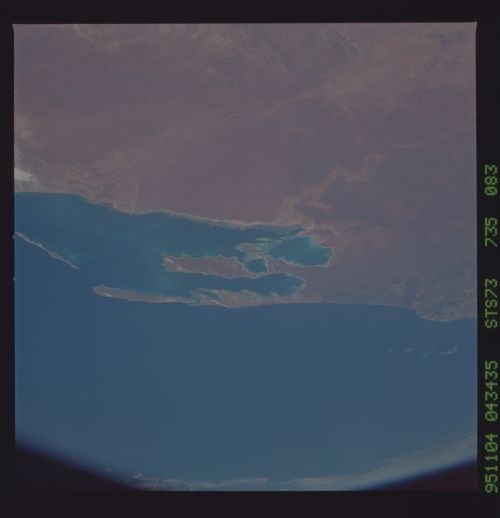
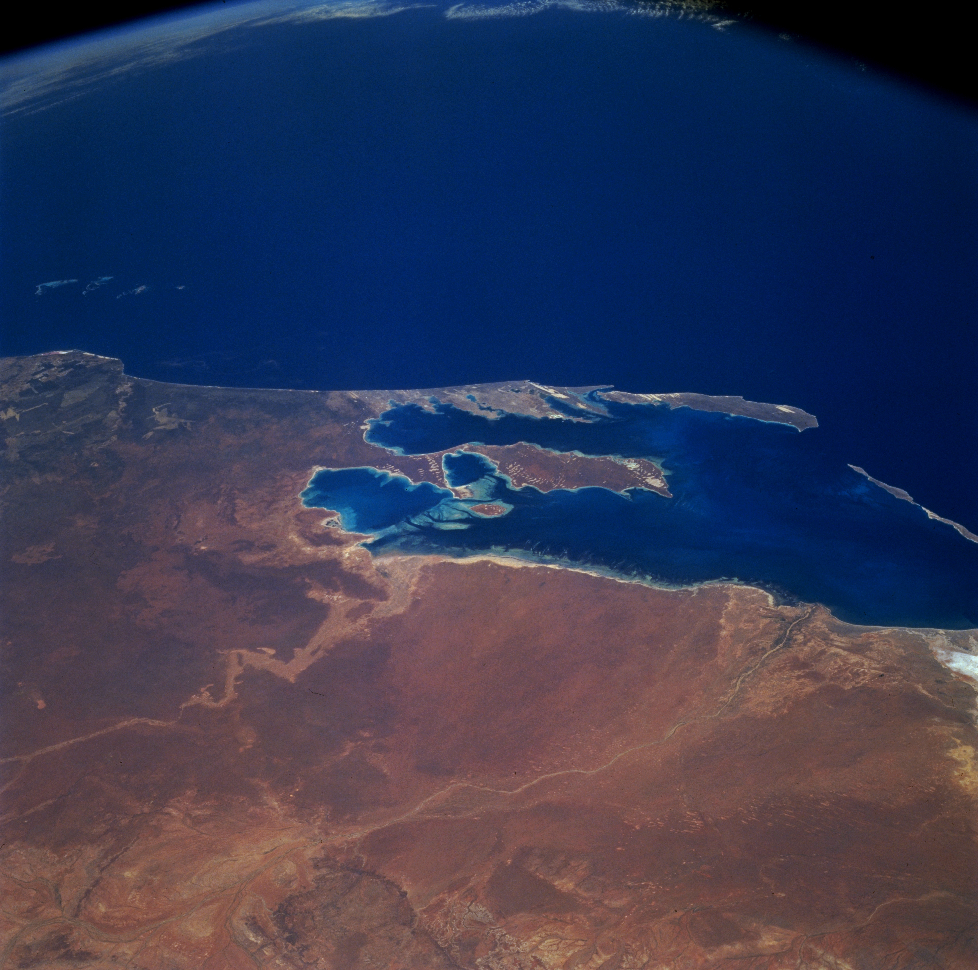
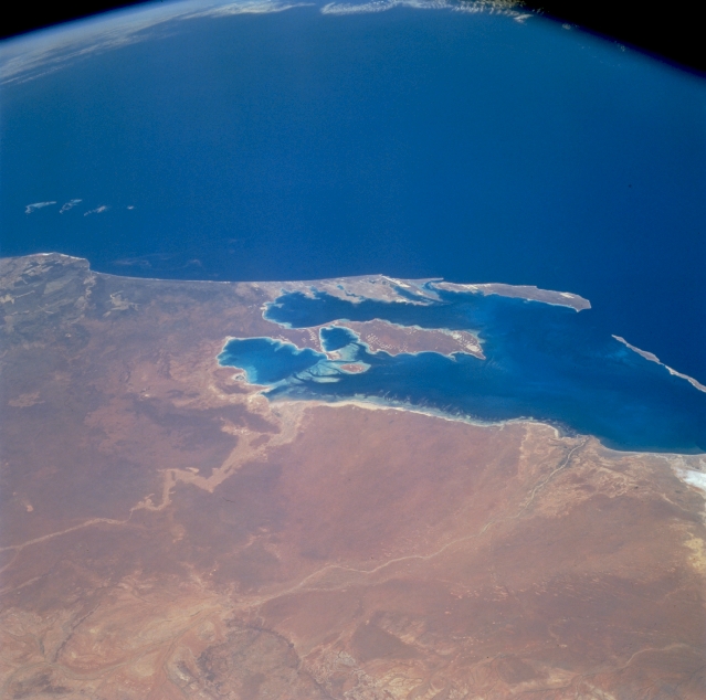
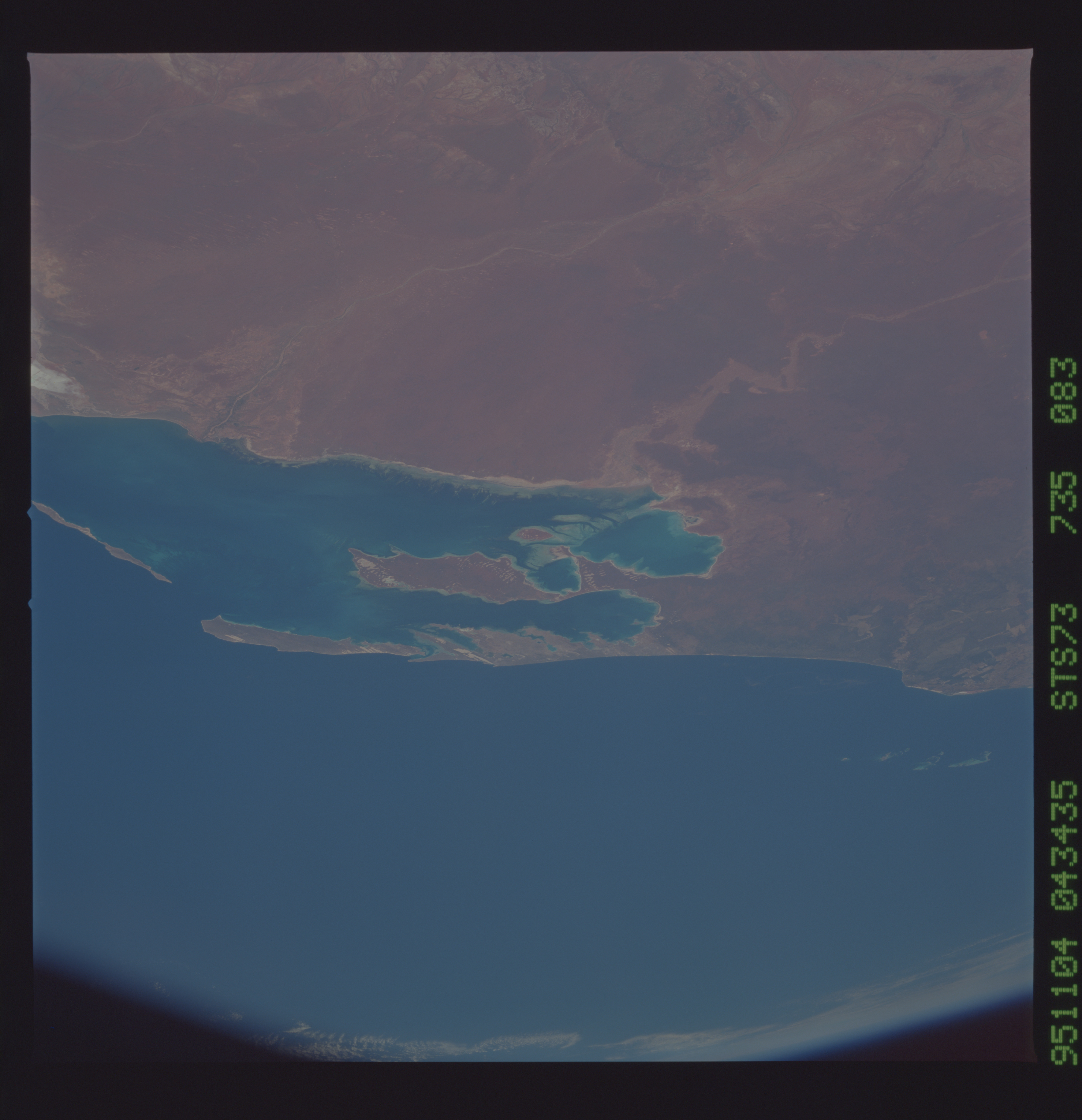
Image Caption: STS073-735-083 Shark Bay, Western Australia, Australia October 1995
This is a wide, southwest-looking view toward Australia's west coast. The prominent bay is Shark Bay. Shark Bay is a frequently photographed site by astronauts because of its distinctive shape. It is a World Heritage Site and is noted for its plant and animal populations, including dolphins, dugongs and stromatolites. Two distinct, ephemeral drainage systems, Gascoyne River (north) and Wooramel River (south), are visible on the mainland (eastern) side of Shark Bay. The city of Carnarvon is located along the southern shore of the Gascoyne River at its mouth and delta.
This is a wide, southwest-looking view toward Australia's west coast. The prominent bay is Shark Bay. Shark Bay is a frequently photographed site by astronauts because of its distinctive shape. It is a World Heritage Site and is noted for its plant and animal populations, including dolphins, dugongs and stromatolites. Two distinct, ephemeral drainage systems, Gascoyne River (north) and Wooramel River (south), are visible on the mainland (eastern) side of Shark Bay. The city of Carnarvon is located along the southern shore of the Gascoyne River at its mouth and delta.
