STS073-729-34
| NASA Photo ID | STS073-729-34 |
| Focal Length | 250mm |
| Date taken | 1995.10.21 |
| Time taken | 13:55:56 GMT |

Cloud masks available for this image:
Spacecraft nadir point: 30.1° N, 84.4° W
Photo center point: 30.0° N, 85.5° W
Photo center point by machine learning:
Photo center point: 30.0° N, 85.5° W
Photo center point by machine learning:
Nadir to Photo Center: West
Spacecraft Altitude: 146 nautical miles (270km)
Country or Geographic Name: | USA-FLORIDA |
Features: | CAPE SAN BLAS, SEDIMENT |
| Features Found Using Machine Learning: | |
Cloud Cover Percentage: | 0 (no clouds present) |
Sun Elevation Angle: | 26° |
Sun Azimuth: | 121° |
Camera: | Hasselblad |
Focal Length: | 250mm |
Camera Tilt: | 24 degrees |
Format: | 5046: Kodak, natural color positive, Lumiere 100/5046, ASA 100, standard base |
Film Exposure: | Normal |
| Additional Information | |
| Width | Height | Annotated | Cropped | Purpose | Links |
|---|---|---|---|---|---|
| 5700 pixels | 5900 pixels | No | No | Download Image | |
| 500 pixels | 518 pixels | No | No | Download Image | |
| 640 pixels | 480 pixels | No | No | Download Image |
Download Packaged File
Download a Google Earth KML for this Image
View photo footprint information
Download a GeoTIFF for this photo
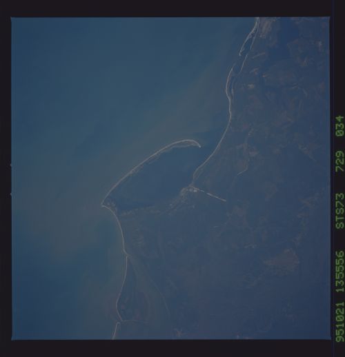
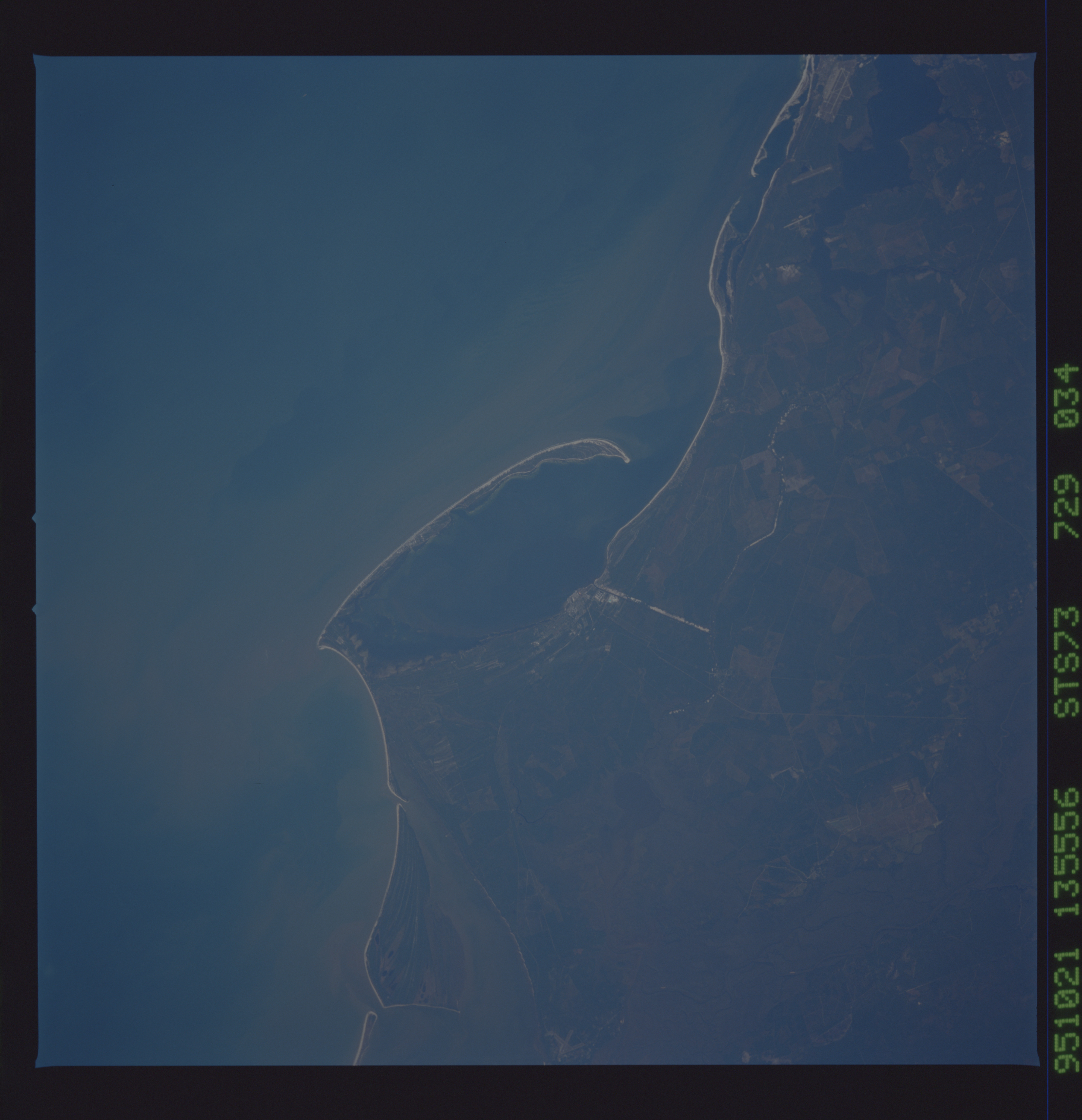
Image Caption: Cape San Blas Florida and Port St. Joe This 250mm view
shows many of the coastal features of this region Tyndal AFB is
visible on the edge of the frame and the intracoastal waterway is
plainly visible. The intracoastal waterway has a 97 mile stretch of
open water starting just to the East of the cape across the coastal
bend. Port St. Joe has one of the largest paper mills. The town was
built by the Duponts for the paper mill.
