STS073-725-84
| NASA Photo ID | STS073-725-84 |
| Focal Length | 250mm |
| Date taken | 1995.10.24 |
| Time taken | 20:01:47 GMT |
Resolutions offered for this image:
3904 x 3904 pixels 639 x 639 pixels 5700 x 5900 pixels 500 x 518 pixels 640 x 480 pixels
3904 x 3904 pixels 639 x 639 pixels 5700 x 5900 pixels 500 x 518 pixels 640 x 480 pixels


Cloud masks available for this image:
Spacecraft nadir point: 33.6° N, 121.1° W
Photo center point: 35.5° N, 121.0° W
Photo center point by machine learning:
Photo center point: 35.5° N, 121.0° W
Photo center point by machine learning:
Nadir to Photo Center: North
Spacecraft Altitude: 145 nautical miles (269km)
Country or Geographic Name: | USA-CALIFORNIA |
Features: | COAST RANGES, RESERVOIRS |
| Features Found Using Machine Learning: | |
Cloud Cover Percentage: | 0 (no clouds present) |
Sun Elevation Angle: | 45° |
Sun Azimuth: | 185° |
Camera: | Hasselblad |
Focal Length: | 250mm |
Camera Tilt: | 38 degrees |
Format: | 5046: Kodak, natural color positive, Lumiere 100/5046, ASA 100, standard base |
Film Exposure: | Normal |
| Additional Information | |
| Width | Height | Annotated | Cropped | Purpose | Links |
|---|---|---|---|---|---|
| 3904 pixels | 3904 pixels | No | No | Earth From Space collection | Download Image |
| 639 pixels | 639 pixels | No | No | Earth From Space collection | Download Image |
| 5700 pixels | 5900 pixels | No | No | Download Image | |
| 500 pixels | 518 pixels | No | No | Download Image | |
| 640 pixels | 480 pixels | No | No | Download Image |
Download Packaged File
Download a Google Earth KML for this Image
View photo footprint information
Download a GeoTIFF for this photo
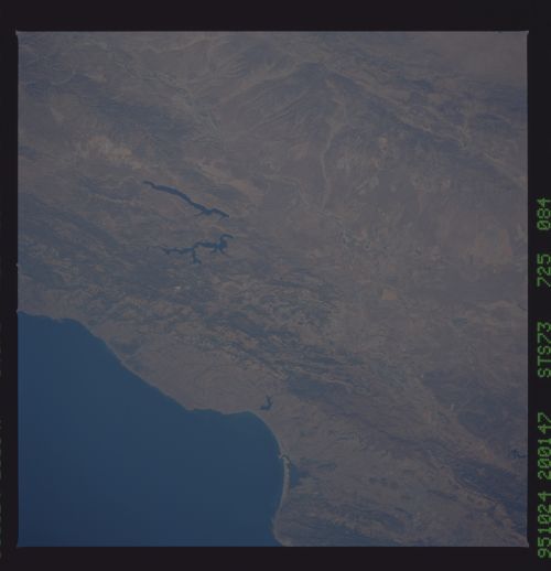
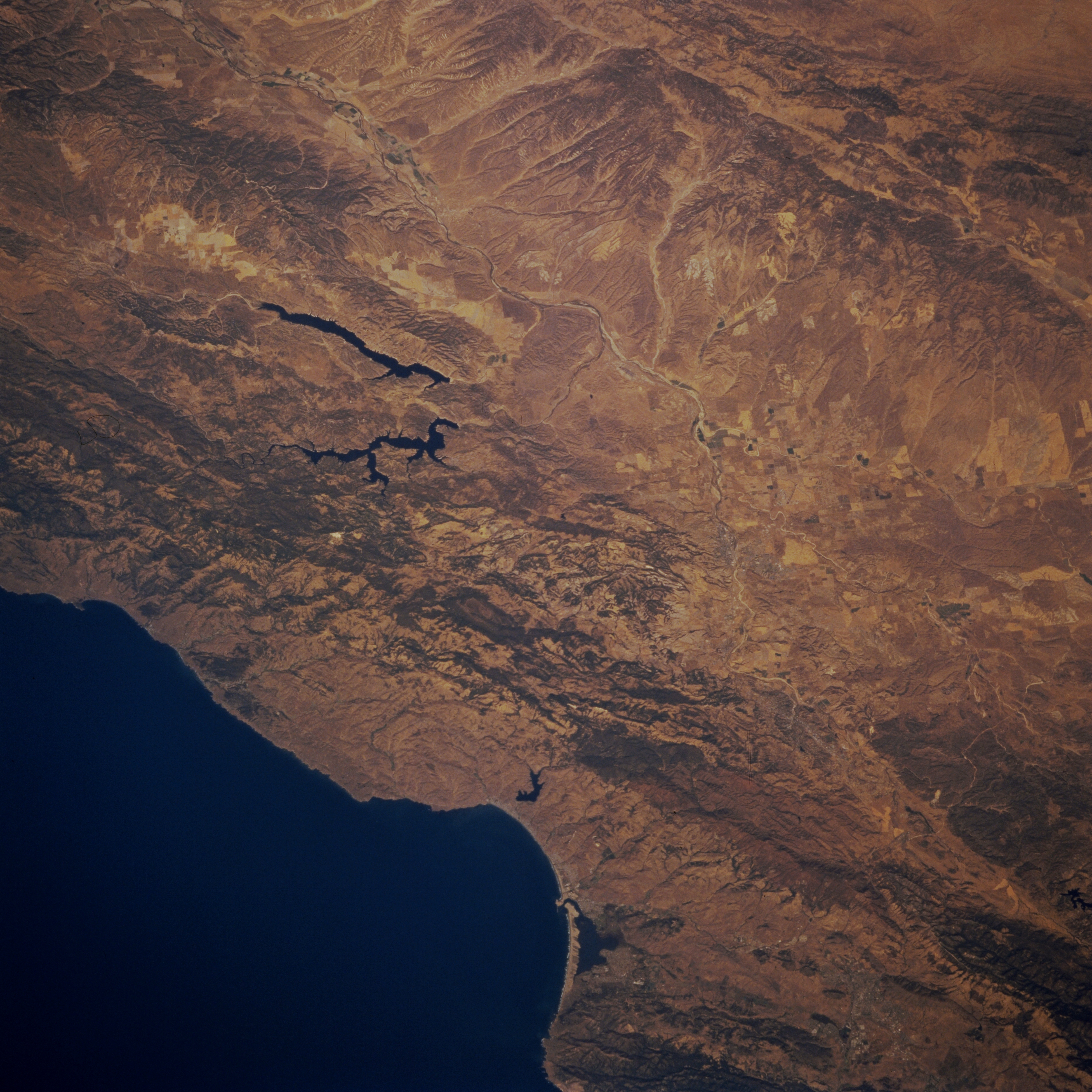
Image Caption: STS073-725-084 Santa Lucia Range, San Antonio Lake, and Nacimiento Lake, California, U.S.A. September 1995
Elongated Lake San Antonio and irregular Lake Nacimiento, both of which drain into the Salinas River, are featured in this low-oblique, north-looking photograph. Both lakes provide recreation and drinking water for many coastal communities. West of the lakes is the tree-covered Santa Lucia Range. Visible are Estero Bay and smaller Morro Bay, a California State Park. The rugged northern San Rafael Mountains lie to the south. Apparent in the upper right of the photograph is the San Andreas Fault with the Diablo Range to the west. The Salinas River Valley lies west of the Diablo Range.
Elongated Lake San Antonio and irregular Lake Nacimiento, both of which drain into the Salinas River, are featured in this low-oblique, north-looking photograph. Both lakes provide recreation and drinking water for many coastal communities. West of the lakes is the tree-covered Santa Lucia Range. Visible are Estero Bay and smaller Morro Bay, a California State Park. The rugged northern San Rafael Mountains lie to the south. Apparent in the upper right of the photograph is the San Andreas Fault with the Diablo Range to the west. The Salinas River Valley lies west of the Diablo Range.
